
WORDS:
LISA DREWE
PHOTOS:
LISA DREWE

Bio
Lisa is an award-winning outdoor writer, paddler and guidebook author, best known for her Paddleboarding book series published by Wild Things Publishing. She has explored hundreds of routes across Britain by paddleboard and kayak and writes regularly for outdoor and paddlesports publications.
https://www.islandeering.com
Read Lisa’s prior post on ten of the best paddling routes in London and thr South East at:https://paddlerezine.com/10-best-paddling-routes-in-the-se/
Five spring city paddles
From a floating harbour and London’s oldest canal to industrial Midlands waterways, an Olympic stadium loop and a Scottish canal linking sea lochs to city parks, these five urban paddles reveal a different side of Britain’s waterways.
City paddling offers a fascinating way to experience places that are usually seen only from streets and bridges. Slip quietly past converted dockyards, graffiti-lined canals, Olympic architecture and revived industrial basins where city life changes with the flow of water. Perfect for an early Spring paddle, these routes combine sheltered water with strong stories – engineering feats of the Industrial Revolution, maritime heritage, ambitious regeneration projects and creative urban spaces. Along the way, you’ll find waterside cafés, historic pubs and plenty of easy access points, making them ideal for relaxed day trips or exploratory half-day adventures.
Let’s explore these routes in detail, starting with Bristol.
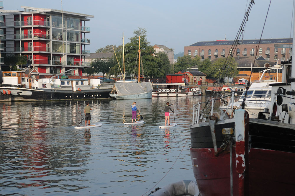
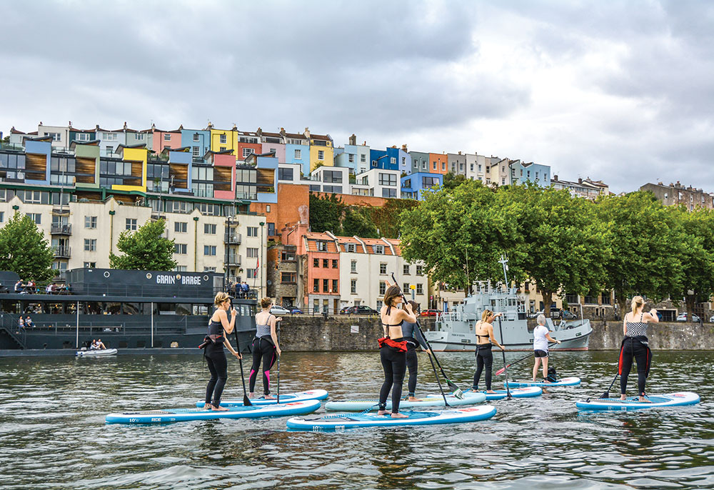
1. Bristol Floating Harbour
See the best of Bristol’s harbourside at a relaxed pace, with options to explore feeder waterways. The Floating Harbour, kept at a constant level by locks and pumps since 1809, protects this stretch from tidal changes. Historic wharf buildings and engineering sites now host attractions.
Launch at Baltic Wharf slipway. Paddle past Underfall Yard – the old pumping station turned museum and café – and several museums and galleries along the water. Spot historic vessels like the Mayflower, Pyronaut, John King, John Cabot’s Matthew replica, and the centrepiece SS Great Britain at the Great Western Dockyard.
To extend the trip, the Bristol Harbour Licence allows you to continue upstream on the River Avon as far as Hanham Lock.
With your Bristol adventure complete, discover what awaits in London.
Access restrictions: Bristol Harbour Licence required, £11.70/day from Harbour Office at Underfall Yard (0117 903 1484).
Parking: SS Great Britain Car Park (charges), Great Western Dockyard, Gas Ferry Road, Bristol BS1 6UN. The car park is 800 metres from the launch point. Alternatively, drop off kit by the Cottage Inn, adjacent to the launch site, before parking.
Launch: Baltic Wharf Slipway, Bristol BS1 6XG. Grid ST 5726 7216; Lat/long 51.4468, -2.6163.
Pitstops: The Orchard Inn Huge range of local ciders and doorstep sarnies www.orchardinn.co.uk.
The Grain Barge Great harbour views and craft beers https://grainbarge.com.
Nova Scotia Hearty pub food and dockside seating https://novascotiabristol.com.
The Cottage Post-paddle pie and pint right on the slipway (0117 9215256).
Special points: Busy harbour traffic – keep right and give way to larger vessels. BA and leash required; night paddling requires two paddlers and white lights. Launch only from Baltic Wharf; carry your licence. Full regulations www.bristol.gov.uk/bristol-harbour/safety/water-safety-codes-of-practice/paddle-boarding-safety-code-of-practice.
Getting there: By car from the west, leave M5 J18 and take the A4 to Bristol, following brown signs to SS Great Britain. From the east, leave M4 J19, take M32 into the city and follow brown signs. By public transport, Bristol Ferry runs weekend winter services (full timetable in summer) between Bristol Temple Meads and Baltic Wharf: www.bristolferry.com/ferry.
Full route map: www.islandeering.com/paddleboarding-bristol-floating-harbour
")

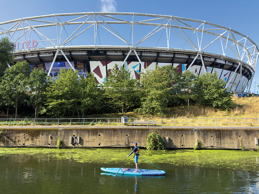
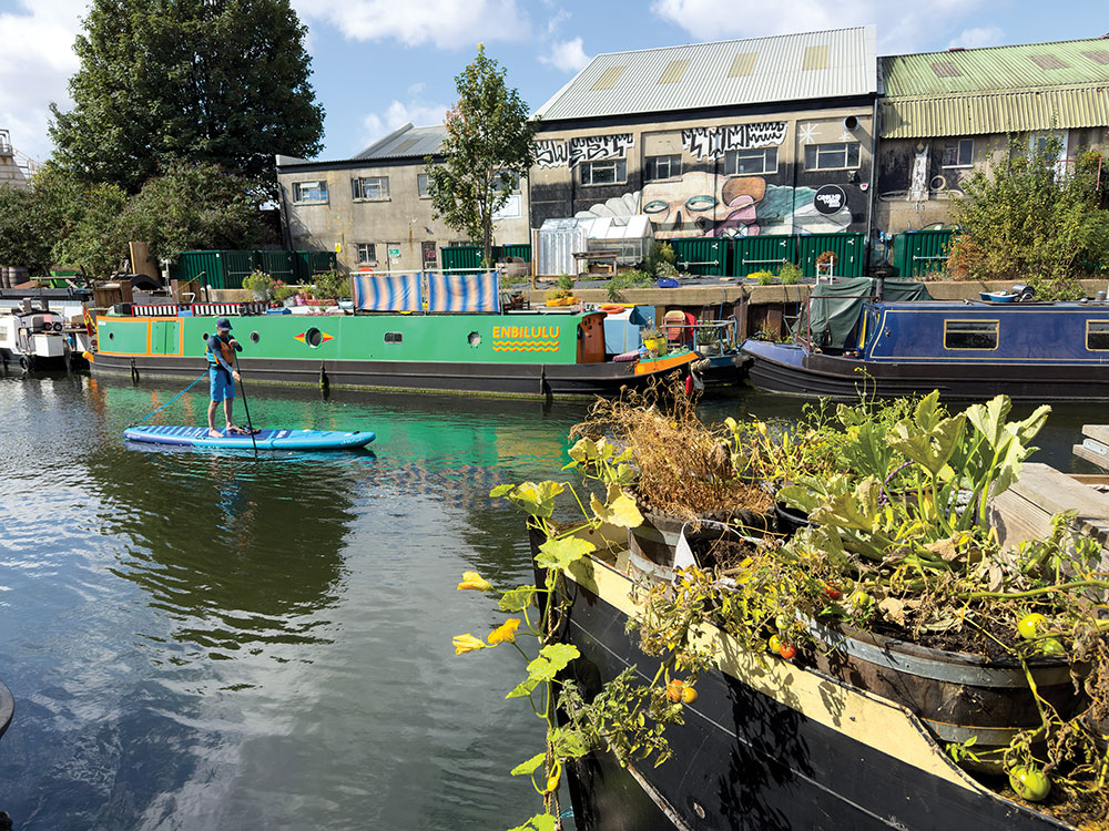
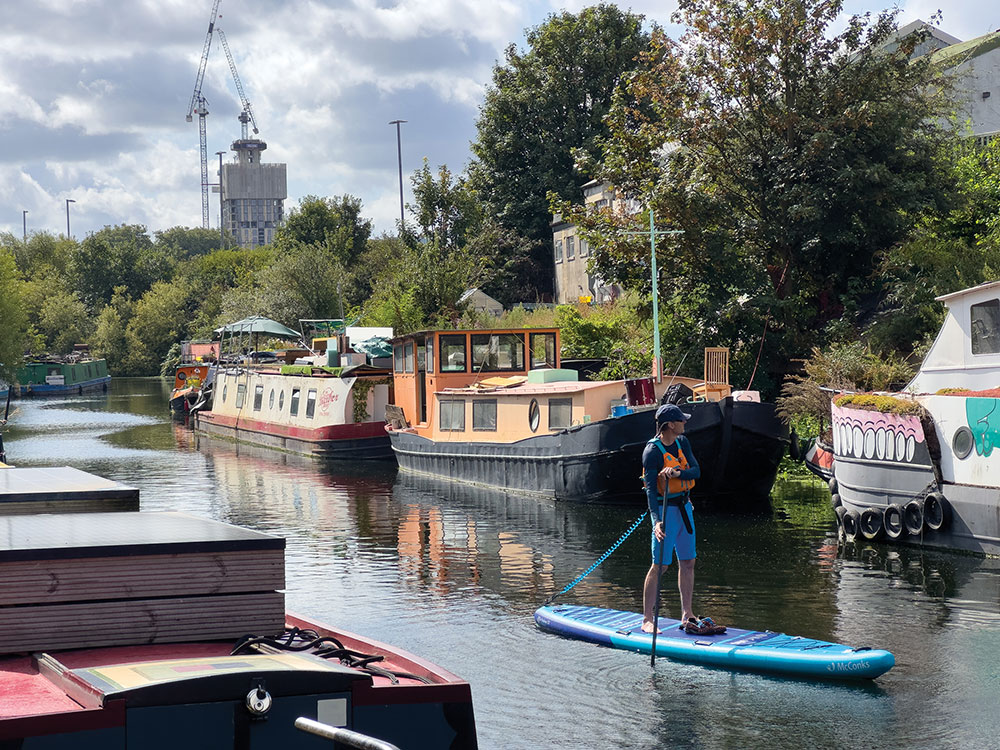
2. London, Limehouse Cut and Olympic Stadium (10.5km return)
A loop through East London’s waterways linking the Limehouse Cut with the Bow Back Rivers around the Olympic Stadium. Historic canals, industrial relics and Olympic landmarks combine on this distinctive urban paddle.
This route begins on the Limehouse Cut – London’s oldest canal – before threading into the Bow Back Rivers, a network of channels revitalised for the 2012 Olympics within Queen Elizabeth Olympic Park.
Start at Limehouse Basin, joining the Limehouse Cut. Pass Ropemakers Field on the right before going under a railway bridge and Kings Wharf Park. Continue straight, flanked by apartments, warehouses, and bridges, heading toward the A12.
At the canal’s bend, stay left at Bow Locks, avoiding the locks and entering the River Lea Navigation under road and rail bridges. Pass Bow Free Wharf. Before Old Ford Lock, turn right under the footbridge to follow City Mill River around the London Stadium. Look for the ArcelorMittal Orbit and London Aquatics Centre, then pass City Mill Lock into the Bow Back Rivers.
After St Thomas Creek footbridge, turn sharply left under the A118 to rejoin the River Lea and follow your route back via Limehouse Cut.
After exploring London’s waterways, head north to the industrial heart of Birmingham.
Licence: Required, included in Paddle UK membership.
Starting point: Limehouse Basin, Pinnacle Way, E14 7PB (TQ 363 810; 51.51193, -0.03651).
Launch: From the north side, off the concrete platform by the lock, into Regent’s Canal.
Pitstops: Quirky café Great atmosphere and food. The Yurt Café. Short walk from Limehouse Basin www.rfsk.org.uk/yurt-cafe.
Special points: In summer, invasive weeds can slow progress. Always wash gear thoroughly before entering other waterways to prevent the spread of invasive species.
Note: There are no locks to portage.
Getting there: From Limehouse DLR, exit Branch Road, turn left, and follow the arches 250m to the canal launch.
Full route map: www.islandeering.com/paddleboarding-limehouse-cut-and-olympic-stadium/

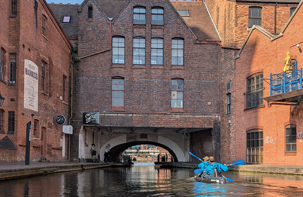
3. Birmingham (17km; or shorter option via rail return)
Cruise between chocolate heaven and this city’s industrial heart along the Worcester & Birmingham Canal and BCN Old Main Line, where brick wharves and the soot-darkened warehouses of the Industrial Revolution are now splashed with colour from cafés, bars and bustling canal-side terraces.
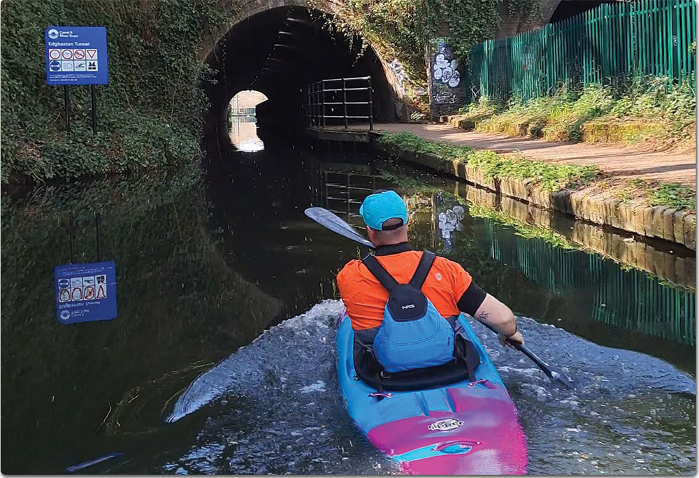
Launch at Junction House, Kings Norton and head north to Bournville and Cadbury’s World, looking out for the café boat Lola often moored nearby. A further 2.5km leads to the reed fringes, anglers and university boathouses of Edgbaston before entering the 96-metre Edgbaston tunnel.
Approaching The Mailbox, now BBC studios and waterside cafés, you enter a more urban stretch. Pass Love Lock Bridge and stay left onto BCN Old Main Line.
Gas Street Basin marks the first gas-lit freight interchange where coal, iron and finished goods were shifted between rival companies. Cast-iron signposts to ‘London’, ‘Worcester’ and ‘Stratford’ still point the way amongst narrowboats that idle beside bar terraces and familiar Peaky Blinders backdrops.
Regency Wharf’s old coal drops lead to clear canal water before Broad Street Tunnel – forming Black Sabbath Bridge – and Brindley Place, named for pioneer James Brindley.
Head to Old Turn Junction – the canal’s ‘Spaghetti Junction’ – circle the island and return via the same route (or rail return via Five Ways Station). Once back at Junction House, detour 700 metres east on Stratford-upon-Avon Canal to the rare Guillotine Lock.
Access: Licence required, included in Paddle UK membership.
Parking: Norton Playing Fields Car Park, Kings Norton B30 3HB. Grid SP 05049 79157; Lat/long 52.410, -1.927.
Launch: Canal-side access by Junction House (Grid ref. SP 053 793), 300 metres from car park.
Pitstops: Lola the canal boat Pizza and coffee https://lolathecafeboat.co.uk. The Tap and Spile Great ales and food at Peaky Blinders-era canal-side inn near Gas Street Basin https://tapandspile.co.uk.
Special points: Carry a head torch and a whistle to alert oncoming craft. Always pass on the right.
Getting there: By rail – Birmingham New Street to Kings Norton (London North Western Railway, www.londonnorthwesternrailway.co.uk). By car – take M42 Junction 2 north to Kings Norton Weatherspoons roundabout, then turn right after 300 metres into the car park.
Map: OS Explorer 220, Birmingham.
Full route map: www.islandeering.com/paddleboarding-birmingham-kings-norton
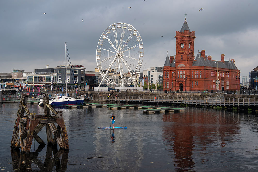
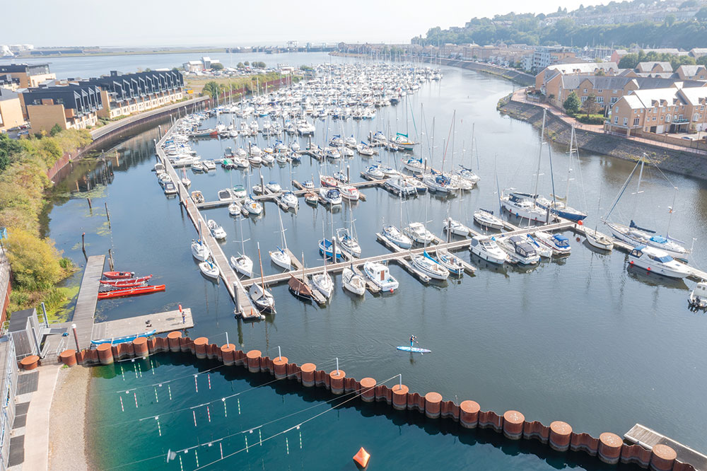
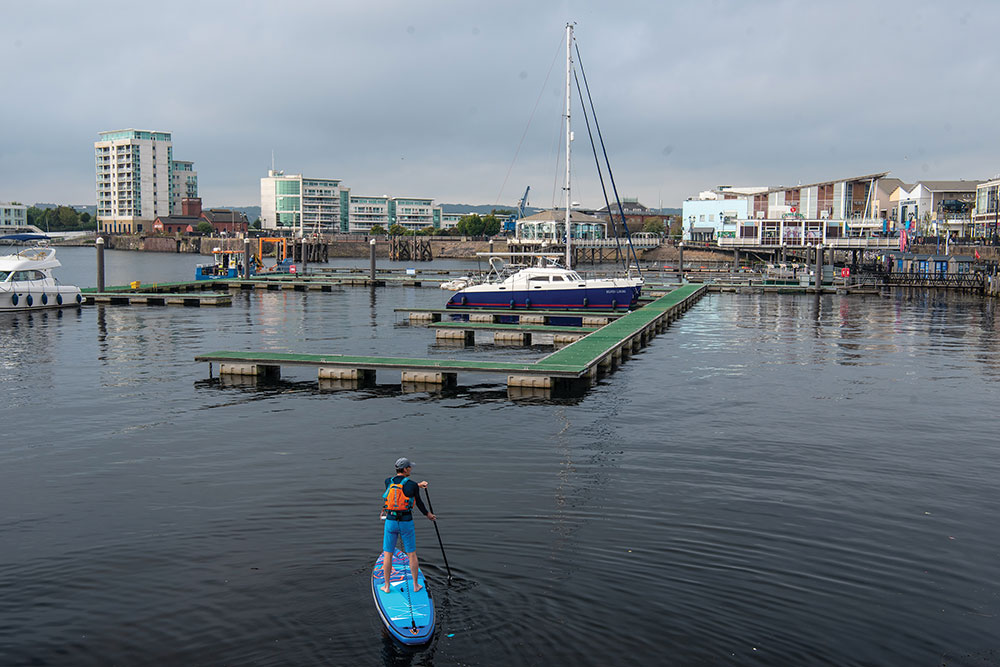
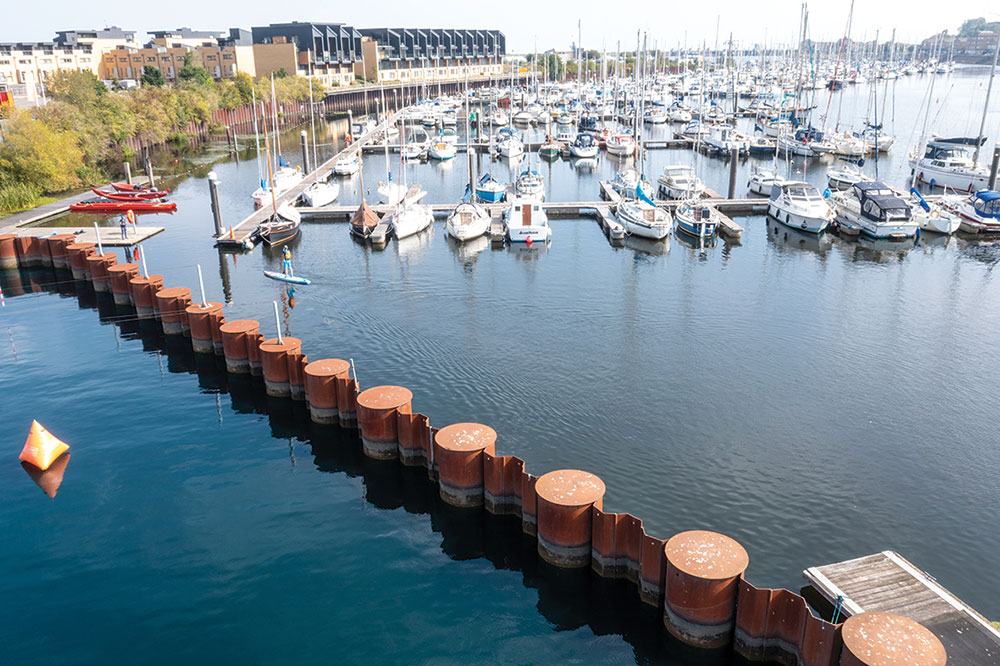
4. Cardiff (6.5 km return)
Large urban freshwater lake fed by the Rivers Ely and Taff, enclosed by the barrage and offering a unique paddling circuit past Cardiff’s waterfront landmarks, historic buildings and a thriving wetland reserve.
Leave Cardiff International White Water Centre, turn left onto the River Ely, passing Penarth Basin’s moorings. Round the Hamadryad Peninsula to barrage buoys, then head east across Cardiff Bay.
Follow the east shore, passing the Cardiff Bay Sailing Centre. Continue to the white clapboard Norwegian Church, now an arts centre and café. Proceed through Mermaid Quay, where the red-brick Pierhead Building stands opposite the Senedd and the Wales Millennium Centre, its copper, hull-shaped roof reflecting the bay’s maritime past. The Giant Wheel overlooks pontoons, pleasure boats, cafés, and restaurants.
Heading south along the west side, pass the Rugby Players Statue and the entrance to the former shipbuilding yards of Mount Stuart Graving Docks.
The five-star St David’s Hotel marks the approach to the Cardiff Bay Wetlands Reserve, where reedbeds support over fifty bird species, including great crested grebe, tufted duck and Cetti’s warbler. Cross the Taff mouth with views to the Lower Penarth Peninsula before returning to CIWW.
Access restrictions: Launch only at Cardiff International White Water Centre or Channel View Leisure Centre slipway (report to reception). Day pass £8 www.ciww.com/park-and-play-2.
Launch: Launching River pontoons, Cardiff International White Water Centre (CIWW), Watkiss Way, Cardiff, CF11 0SY. Grid ref. ST 179 728; Lat/long 51.448, -3.182.
Parking: Cardiff International White Water Centre (free when paying for ‘park and play’ day permit).
Pitstops: Ty Melin Bakery Seriously excellent bakery adjacent to the CIWWC, https://tymelinbakery.com.
Special points: Exposed to wind – check conditions at Penarth on Surfline. Landing only at launch sites. Avoid barrage and jet-boat exclusion zones (see Cardiff Harbour navigation map). Non-tidal, but the Ely and Taff may flow strongly after rain. Keep clear of sluices, stay to right of marked channels; watch for ferry and rowing traffic. Wear BA and leash recommended; check local notices to mariners.
Getting there: Car M4 J33 onto A4232 towards Penarth; after crossing River Ely, take fourth exit at roundabout onto A4055; first left following signs to International Sports Village, the first right along Olympic Drive to CIWW Rail Transport for Wales Train from Cardiff Central to Cogan rail station, 600-metre walk to Cardiff International White Water Centre.
OS Map: OS Explorer 151, Cardiff and Bridgend.
Full route map: www.islandeering.com/paddle-boarding-in-cardiff-bay/
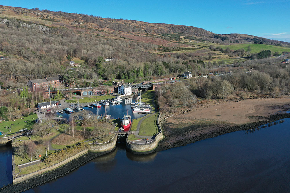
5. Glasgow, Forth and Clyde Canal (various)
Threading coast to coast across central Scotland, the Forth & Clyde Canal offers paddlers a sheltered corridor of flat water where shipyards, street art and kingfishers share the same reach. These two public-transport-friendly urban paddles show their range: Bowling to Westerton, with sea-loch views and Clyde heritage, and Applecross Wharf to Lambhill, where a mythical serpent, Glasgow’s answer to The Kelpies, and tranquil Cadder woods lead to the welcoming hub at Lambhill Stables.
Bowling to Westerton (11km one way; rail return)
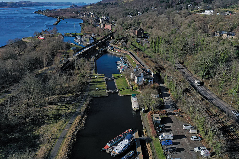
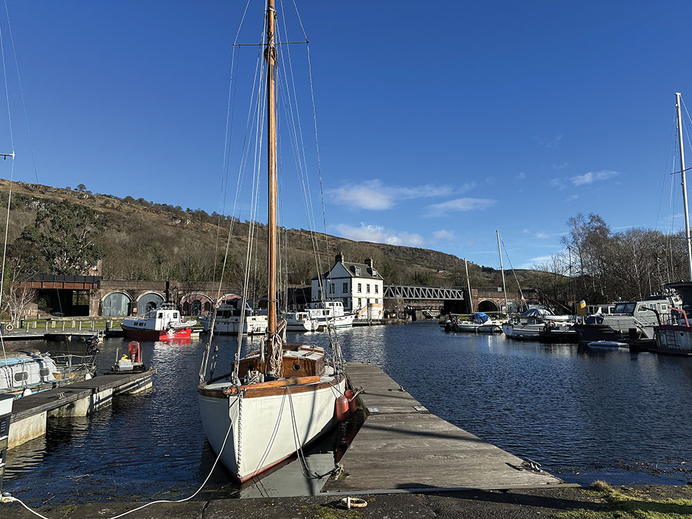
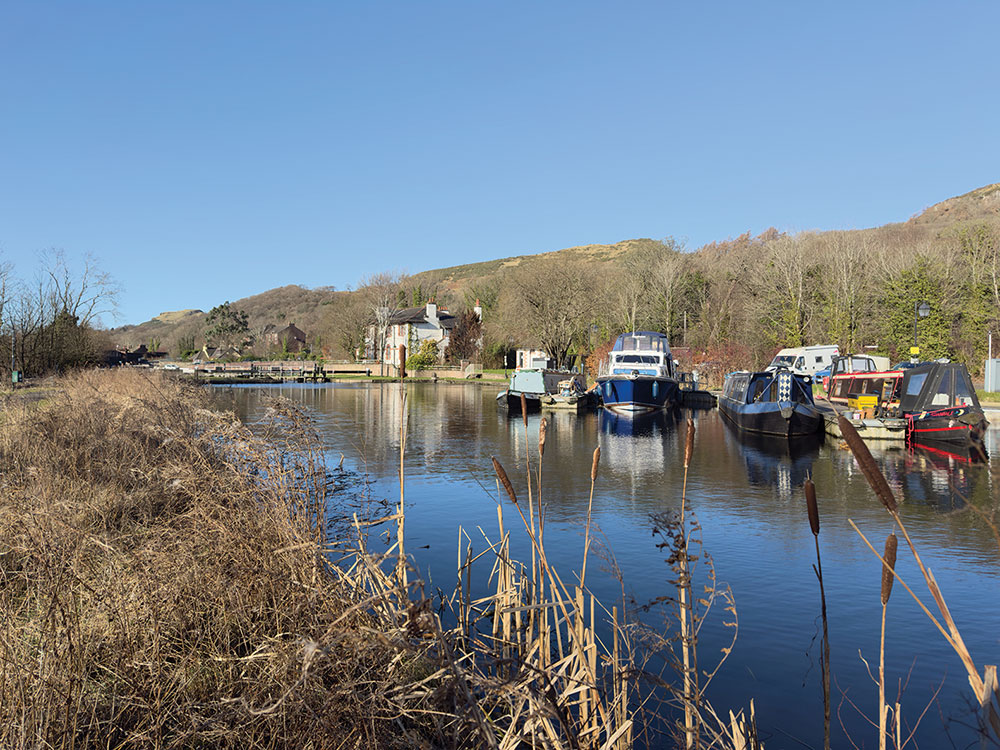
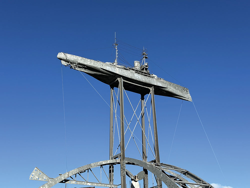
Launch at Bowling Basin, beneath the Kilpatrick Hills, among colourful moorings, the eighteenth-century Customs House and views down the Clyde. Paddle east past Ferrydyke Bridge and under the Erskine Bridge to Dalmuir Drop Lock – Europe’s only one. Portage via the traffic-light crossing, watching for the Beardmore sculpture marking the former naval yard that built Dreadnoughts. Continue through regenerated Clydebank, beneath shopping-centre footbridges and past the floating chippy. Follow the long straight pound to Boghouse Locks (4 portages), then under Great Western Road to Cloberhill Locks (5). Exit the canal just before the Westerton footbridge for the train return.
Applecross Wharf to Lambhill Stables (10km return)
Launch at Applecross Wharf pontoon (Scottish Canals HQ). Paddle west past Firhill Stadium to lively Stockingfield Junction with its 30-metre Spire and mosaic serpent, Bella the Beithir. Turn right (east) into a quieter, greener reach through Cadder woods. Slip under the A879 to Lambhill Stables (5km) – a historic staging post, now café, toilets and bike hub. Return the same way, or walk south on the A879 to Knapdale Street for bus 7/7A.
Access restrictions: No licence required, but paddlers are asked to complete a free online trip registration with Scottish Canals.
Parking: Bowling Basin (free), Dumbarton Rd, Bowling, Glasgow G60 5AF, Grid ref. NS 453 735; Lat/long 55.929, -4.477; Applecross Wharf, Applecross Street, Glasgow, G4 9SP; Grid ref. NS 587 671; Lat, long: 55.877, -4.259.
Launch/Egress: Bowling Harbour to Westerton Station: Launch at Bowling Harbour E of sea loch, Grid ref. NS 452 735; Lat/long 55.929, -4.478. Egress at Westerton Rail Station pontoon, Grid ref. NS 539 704; Lat/long 55.904, -4.337. Applecross Wharf to Lambhill: Launch at Applecross Wharf pontoon, Grid ref. NS 586 671; Lat/long 55.877, -4.261. Egress at Lambhill Stables, Grid ref. NS 584 694; Lat/long 55.896, -4.265.
Pitstops: Bowling Harbour Popular canal side café under the railway arches, Patons www.instagram.com/patons.place. Clyde Shopping Centre Great fish and chip takeaway from boat-based restaurant McMonagles www.mcmonaglesglasgow.co.uk. Lambhill Stable Paddle-friendly and community-run café serving great nosh www.lambhillstables.org/cafe-and-kitchen. Applecross Wharf Coffee, soups and treats in the community-run, Gathering Ground https://gatheringground.org.
Special points: The Bowling to Westerton route has several easy lock portages, where a sling may be useful to lift your craft out of the water at lower water levels.
Public transport: Scotrail from Glasgow Central to both Bowling and Westerton rail stations. For Applecross to Lambshill, use Firstbus 7/7A from Glasgow city centre to Baird’s Brae Road (150-metre walk north to Applecross Wharf). Return from Lambhill: walk south on Balmore Road to Knapdale Street for the 7/7A back.
Map: OS Explorer 342 – Glasgow, Paisley, Rutherglen and Kirkintilloch.
Full route map: www.islandeering.com/paddlboarding-glasgow-forth-and-clyde-canal
Final word
Cities are rarely thought of as paddling destinations, yet many of Britain’s most interesting waterways run straight through their centres. These routes show how water has shaped the growth, industry and renewal of our cities. Paddle them, and you’ll see familiar skylines from a completely different perspective – quieter, slower and surprisingly wild.


