
By Andy Hall
Photos: Andy Hall,
Stuart Wagstaff and
Karl Midlane
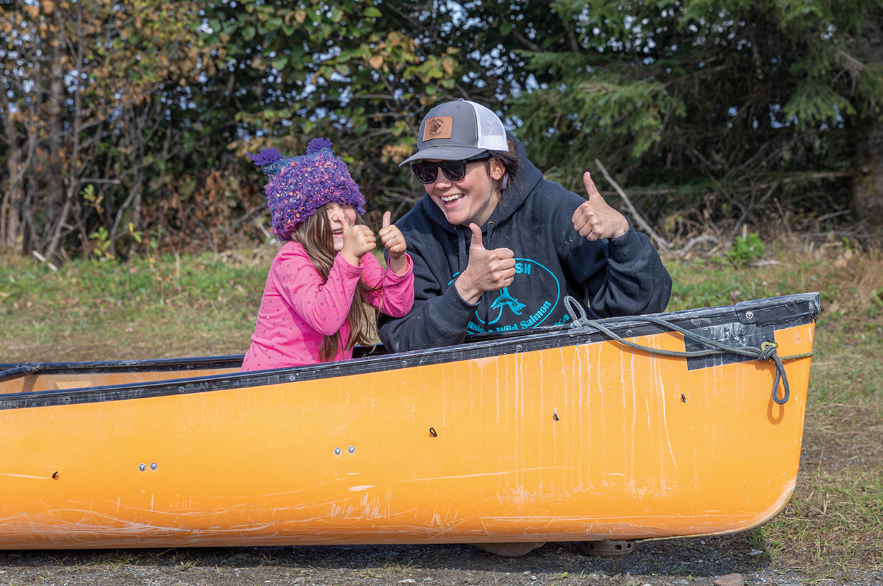
Both Karl and Andy are Freelance Mountain and Canoe coaches. Thanks to Wenonah for assistance with canoes and TJ composites with paddles and Palm, Peak and Kokatat for dry suits and other gear.
Tatshenshini: one of the world’s top ten white water trips (pt1)
Delving into this Google headline was intriguing. It was a raft trip and cost around US$6,000 excluding flight. However, the photos of the river looked terrific and starting in Yukon Territory, Canada, the ‘Tat’ flows through British Columbia to enter Alaska and finish on the coast at Dry Bay after 200km and 11 days of paddling.
My previous Canadian canoe expeditions had all taken more time than this and involved travel through trees, gorges or tundra. The photos had shown expansive vistas of many snow-capped mountains. A source to sea style journey through this landscape sounded too good to be true.
Initial soundings were encouraging: few bugs, grade 2-4, and a runway at the finish. Access to what is the largest area of protected landscape in the world could be problematic. Permits cost money and are unlikely to come up in the first year of application. A strong team materialised in mid-2018: Karl Midlane, Alli Inkster, Stuart and Cathy Wagstaff. So it was a massive surprise to get permits in spring for August 2019 at the first attempt.
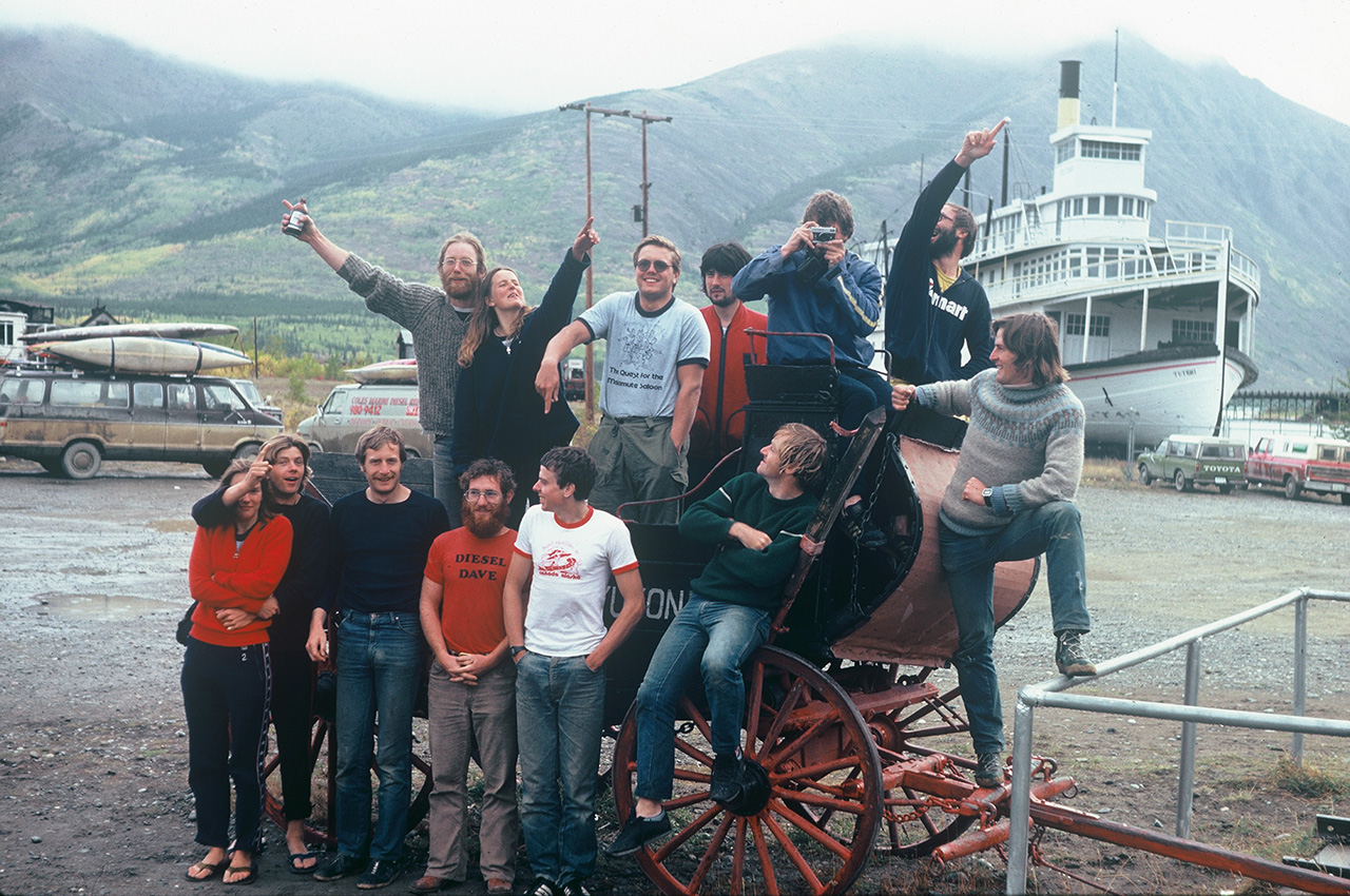
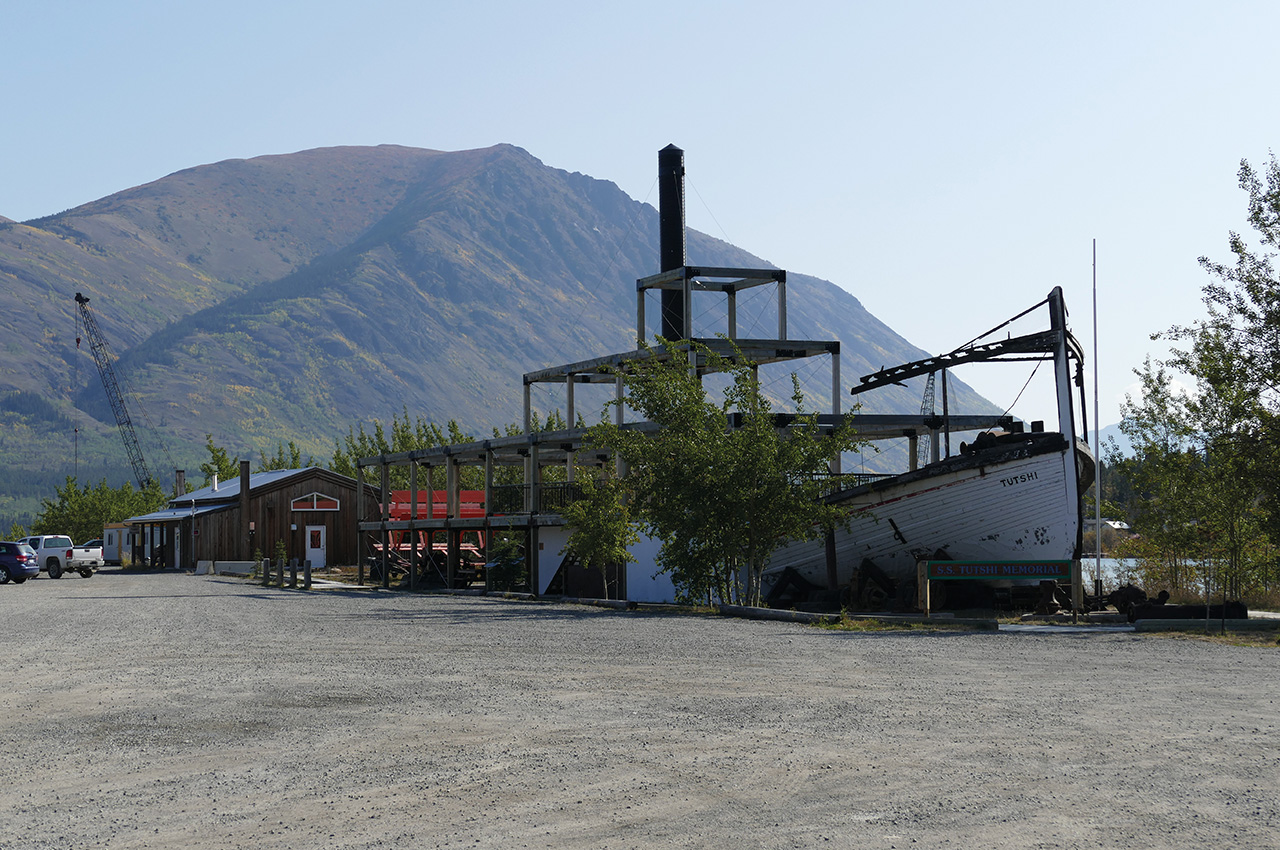
Long story short: a turmoil of organisation followed and on 12 August our team gathered in Whitehorse, Canada. With a population of 30,000, Whitehorse is the capital of Yukon Territory: total population only 40,000. It was founded as the finish of a portage on the Yukon River during the Klondike gold stampede in 1897. It’s now a big modern tourism hub and was the ideal place to gather our food and equipment for the trip.
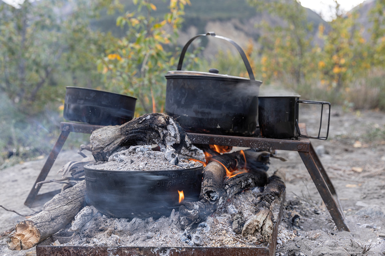
Our Wenonah Spirit II kevlar canoe, which we had used on the Thelon had been transported down from Yellowknife – a welcome sight! Stuart and Cathy were going to use a raft hired from Tatshenshini Expediting, one of many outfitting companies in Whitehorse. We managed a good look at its set up with a huge ‘cooler’ and an aluminium stow box. It also came with a ‘groover’ and firepan, both National Park requirements for the expedition. Sara, the helpful manager at the Bees Knees hostel, came up with enough pepper spray to seriously dent the local bear population!
A day of frantic packing and organisation followed, leaving us with the significant problem of having to cut our canoe in half to fit on our returning Yakutat Air flight!
At 0630 the next morning, we left to meet up with our canoe and raft four hours ahead at the river access. First, though we had to travel to the Alaska border and leave our details with US customs. Back at the river, we met the Tat Exped truck and eased the raft and canoe onto the shore.


The start
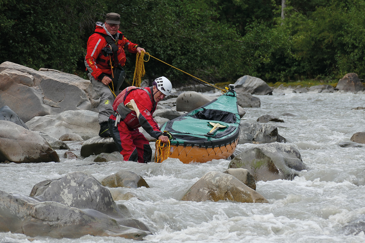
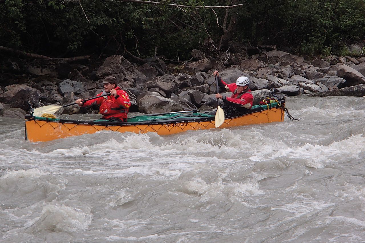
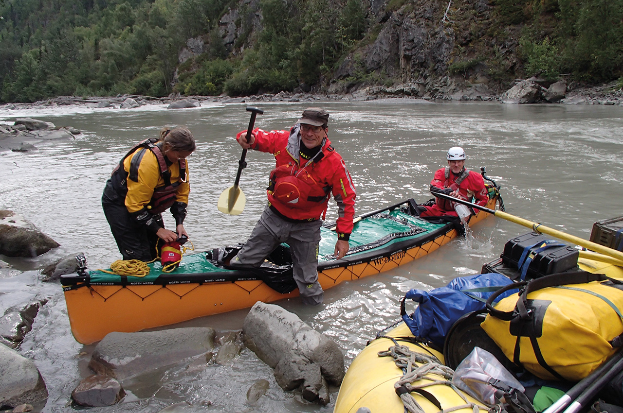
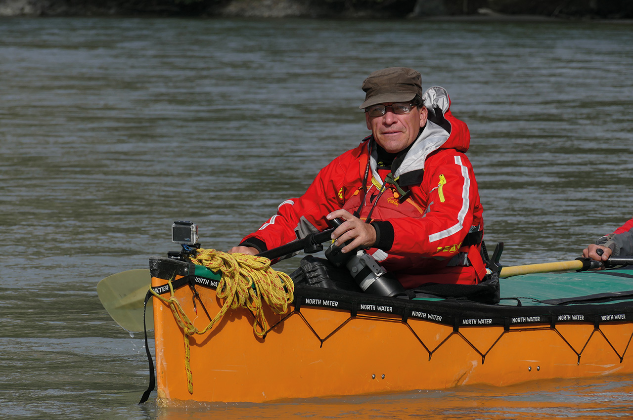
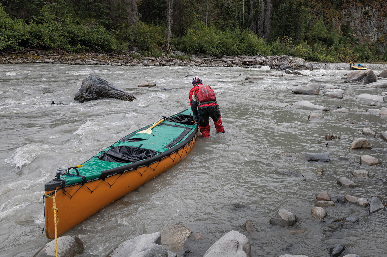
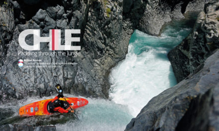
I launched our canoe into the grey glacial current climbing into the stern with Karl in the bow. We had decided that Karl would always canoe, and Stuart and Cathy raft; and Alli and I would swap between the craft. The 1980s guide book said canoes were not suitable for the upper gorge which could be grade 4. Karl and I were up for the adventure, though, and we had a tested spraydeck!
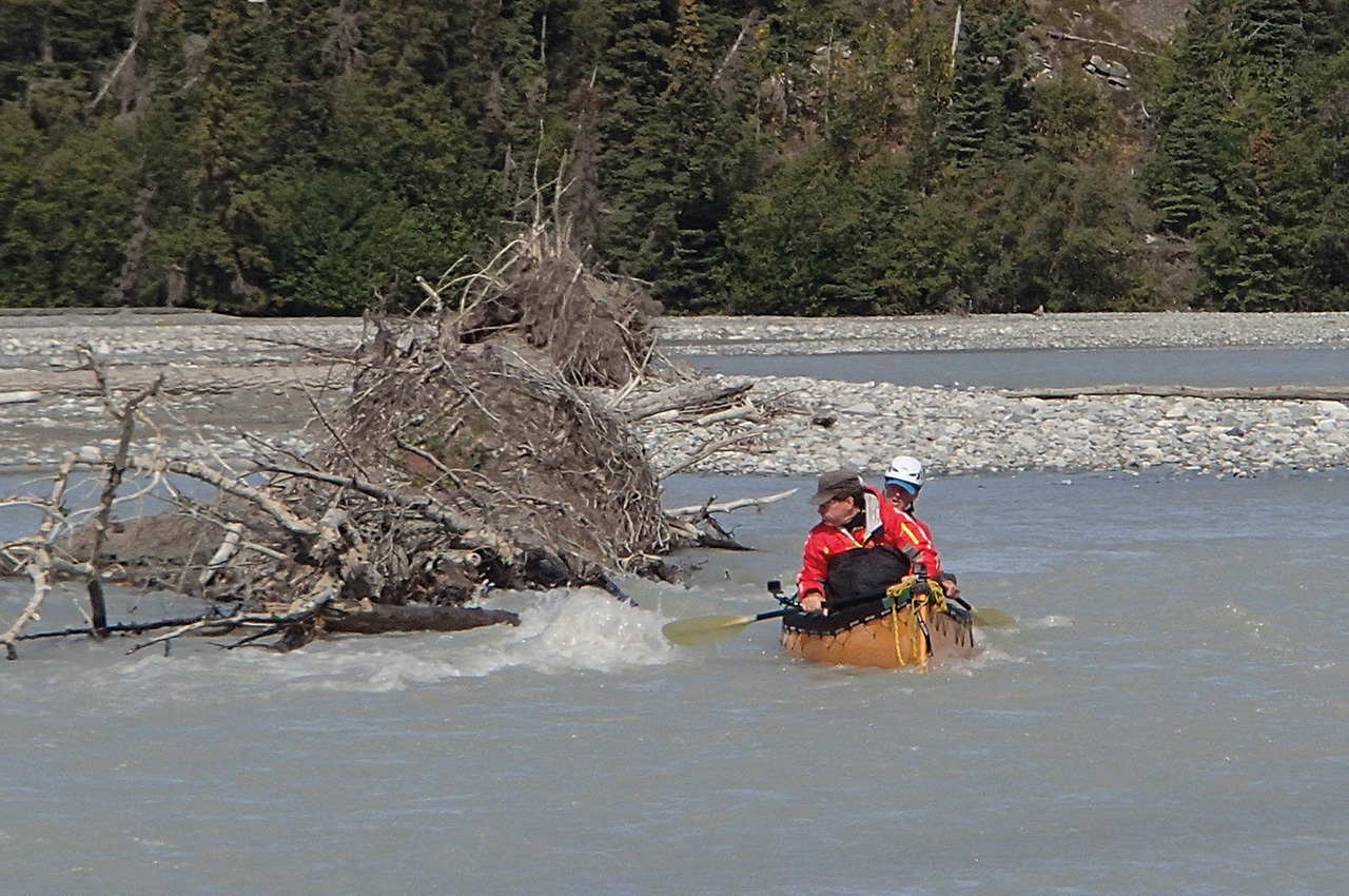
It was a sunny day, and the boat was performing well as we nursed its weight through the opening waves an hour above the infamous upper canyon. We had been told there would be a sandy washed-out cliff on the right bank that heralded its start, and bang on the hour there was the signpost. We broke out and clambered down the bank, waving to the raft as they were carried past on the wave train.
The gradient and volume had increased with giant boulders in the main channel, but we could see no drops, and there were eddies to go for. As soon as we joined the flow again, we were dinging invisible obstacles but slaloming those we could see. And then the boat shook with a gut-wrenching crack as we boofed a boulder we hadn’t noticed; after a fight to stay upright, we gained quiet water and came alongside the raft. Hands under the hull, there was a crack but no hole – thanks, Wenonah!
bigger horizon line
We moved on through technical rapids, gradually understanding the lines in the grey water. However, the sun had gone, and the psychological runes were coming into play! Around the next bend, there was a more prominent horizon line: a river-wide drop with a massive rock at the left bank. This rock was covered in debris, with a dodgy chute below it. The closer we got, the dodgier it looked, and we narrowly made the breakout just above it. I clambered onto the rock and reckoned we could avoid a rock centre-stage in the chute. Karl had other ideas, and fortunately, he prevailed: it was early in the trip, and we were in the middle of nowhere!
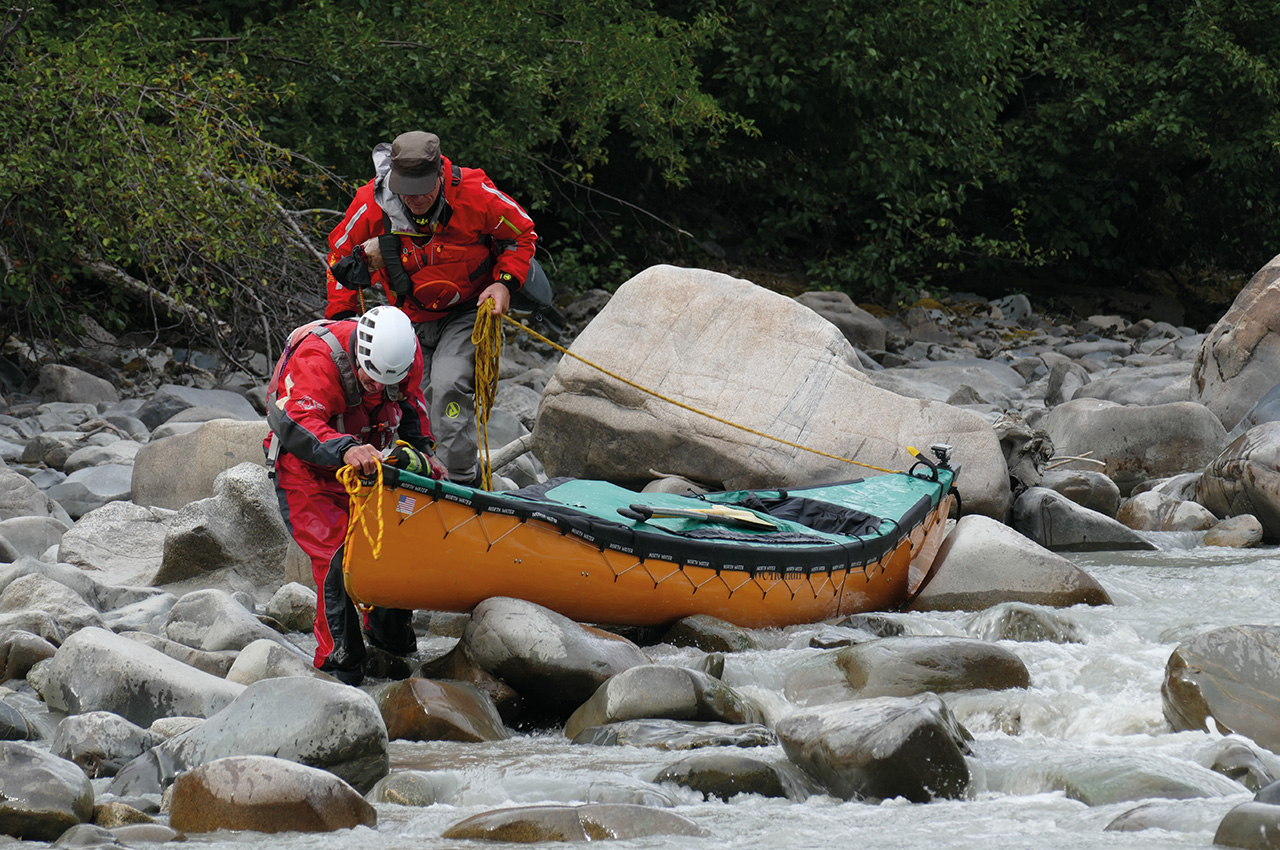
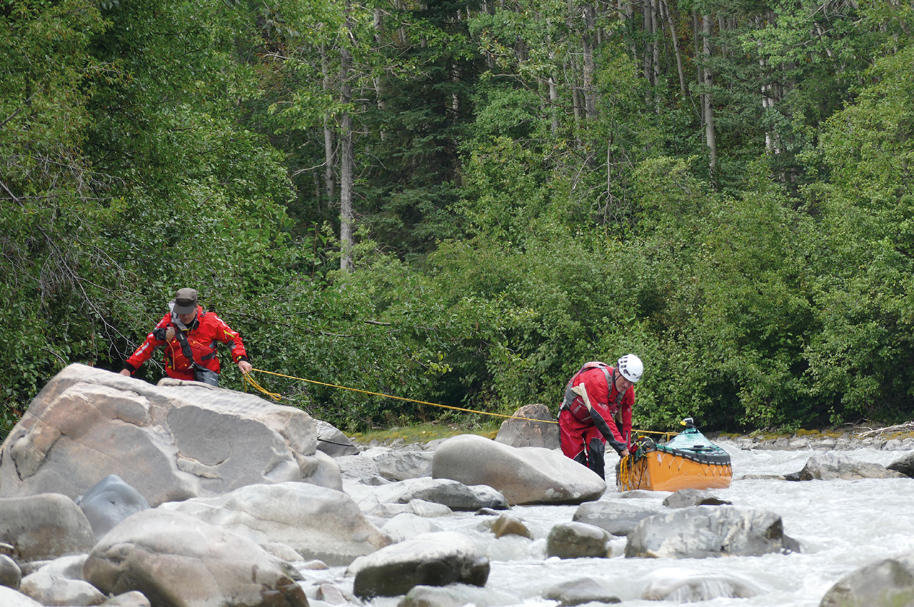
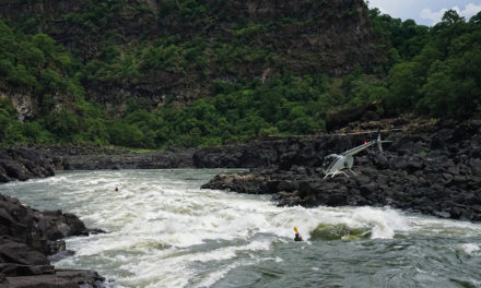
A necky ferry above the looming rapid followed and with a slippery lining down a chicken chute river right, we joined our relieved raft team. After more rapids than we expected, it was a tired team that rounded the last bend at Silver Creek, in lengthening shadows, to see a commercial raft group nestled in the best camping spot.
The Wildlife
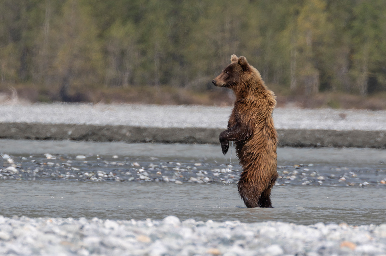
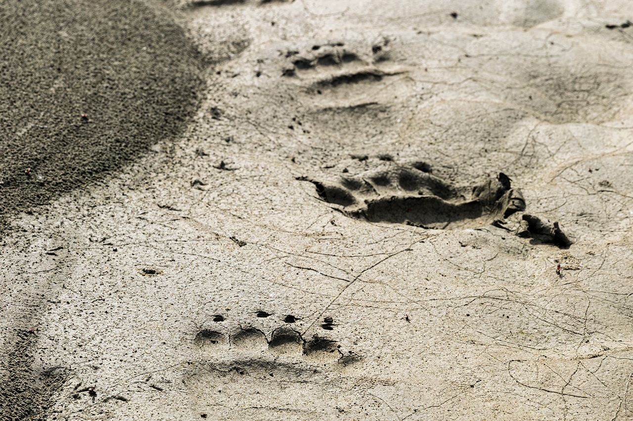
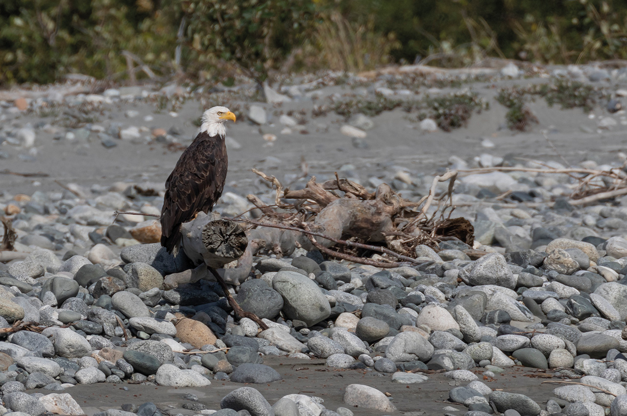
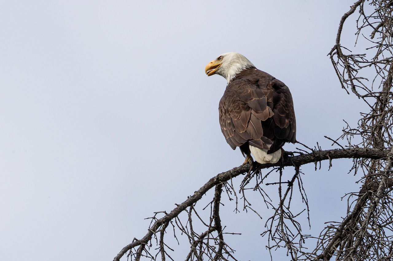
There are relatively few camp spots on the Tat with a freshwater stream, so we camped anyway. After a layover day with the excitement of spotting a lynx and a bear, we paddled through a smooth water canyon with resident bald eagles and grizzly bear tracks. Very different from black bear tracks which have a curved front footpad and toe alignment, those of the grizzly are larger, and the toes are in a straight line above a squarish pad.
If they look fresh, it’s a signal to be aware, they can smell food from a kilometre away, and will attack humans without provocation if hungry. And we had been told by Tat Exped that the grizzlies looked hungry this year!
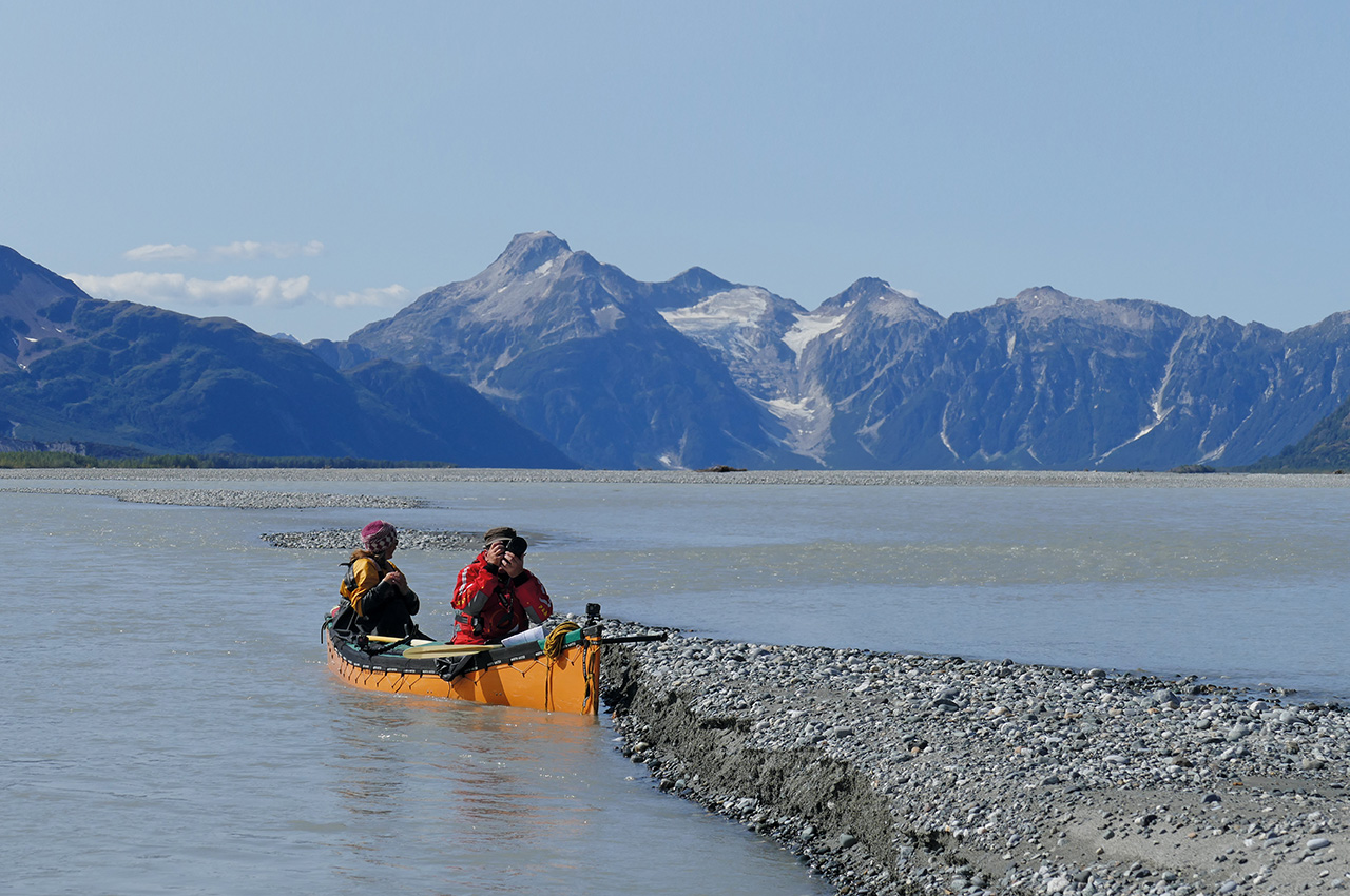
Sediments Creek saw a two-day stop to access the only path up to the ‘Alpine’ on the Tat. Our view from the top, of hundreds of miles of glaciers, snow-capped peaks and icefields but no people, roads or buildings was memorable. As Cathy said, “We are very lucky people.” The walk up had been higher than Ben Nevis, so we were pleased to be in bed before 22.00.
constantly changing background
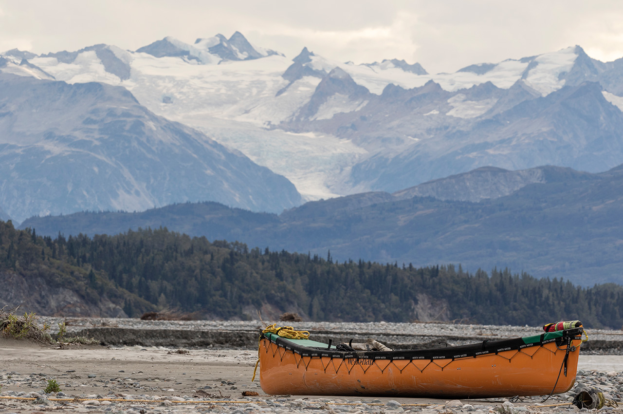
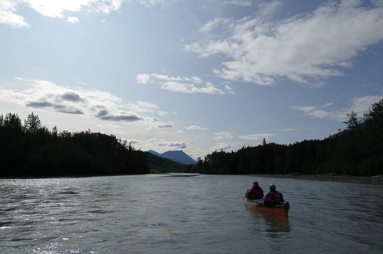
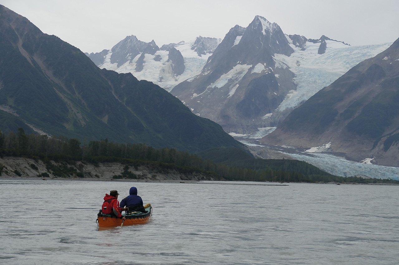
Fast water rushing through braided S-bends was the story the next day, with a continually changing panorama of mountains in the background, some topped with thin snow. Most canoe trips in Canada are in trees, and that is your view for the day. Exceptions are in the tundra or in canyons which give welcome variation.
Here we were blessed with the lot, and a swift current, which gave us less grinding effort and more changes of scene. Our camp, on an expansive outwash above the Tkope Creek, was so good we could all watch a bear about half a mile away lolloping along looking for food, thankfully heading out from us.
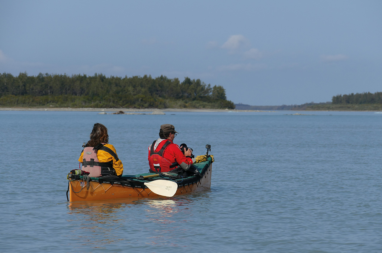
Two days later, the sun came up during breakfast to help the porridge take the edge off the cold. It heralded another unforgettable day. Where there were no braids the river was running fast and taking the fastest, deepest channel for the raft was a critical decision which fell to Stuart as he was on the oars with Cathy and me paddling.

Growing taller
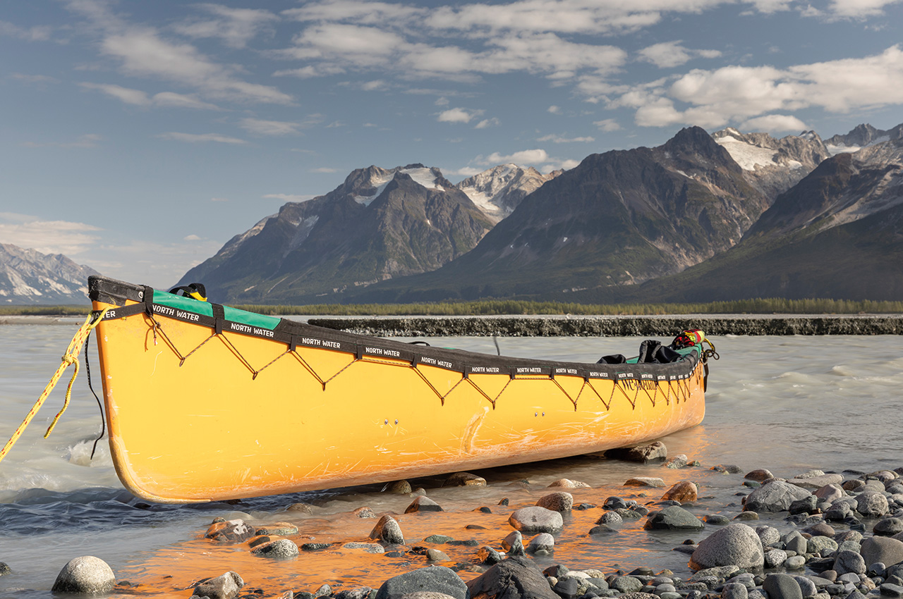
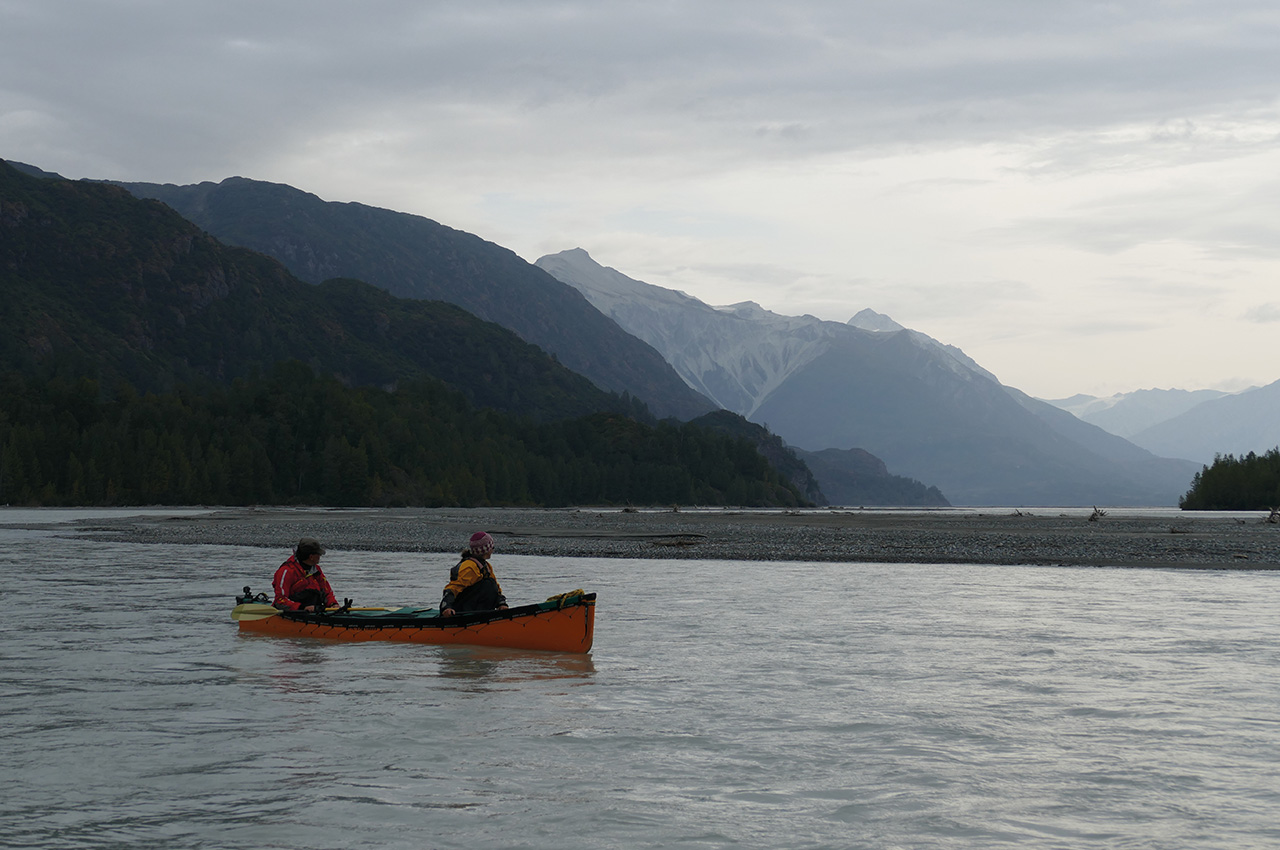
Grounding the raft was not an option! Karl and Alli, in the canoe till the end of the trip, were faster but aimed to keep within sight. The trees were growing taller as we neared the ocean, and today felt like a distinct change in the landscape as the Tat Valley fell steeply away towards the more expansive valley after the Alsek junction. Adrenaline was high as we swept the bends into the shadows at the edge of the river and then back out into the sun, all the time hoping not to meet a river wide hole on the next bend!
Suddenly as we had dropped into the valley, we were out of the trees and facing the expanse of a vast flat outwash area with mountains on our left with intersecting glaciers reaching down to the trees on the edge. We stopped for lunch on the sand of the outwash, and the sensation of taking my water shoes off and feeling the heat of the sand through my drysuit socks is vivid.
Part two next issue…
