Story and photos: Sarah Webster
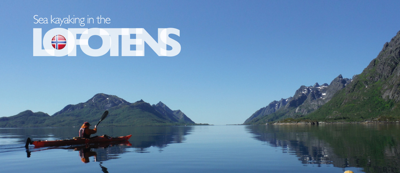
The Lofoten Islands are an archipelago of five larger islands and many smaller ones, off the northwest coast of Norway, some 300km inside the Arctic circle. Legend has it that the name comes from ‘Lynx foot’, and the five islands sprang up after a giant Lynx put its paw down in the sea.
Sea kayaking in the Lofotens
I was lucky enough to spend a week sea kayaking and camping there in late June with my family: Holly, Jack and Tom, my friend Robin Buxton, Robin’s Danish friend Hanne Hubertz and Hanne’s nephew Max. Robin deserves a special mention as he had polio when he was 18 months old, which left him with permanently weakened muscles in his legs, but he has never let this deter him from doing what he wanted in life. Unable to take part in sports at school, he took up kayaking at university, racing in 20k marathons, and remains a strong paddler today.
Lofoten Aktiv
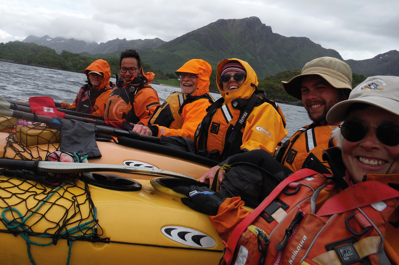
We had been inspired by Jann Engstad’s book, ‘The Lofoten Islands – a sea-kayak guide to the magical isles’ and we went with Jann’s company Lofoten Aktiv, who provided our boats and kit and a wonderful local guide, Kristian Jensen.
Our starting point was Jann’s base in Kabelvåg, which can be reached by boat (Hurtigbåten) or a short flight from the Norwegian mainland port of Bodø. Jann’s fleet of boats are Prijons of various vintages, all with rudders which proved useful on the trip.
The outer edge of the islands is exposed to the north-east Atlantic, but in stormy conditions, a more sheltered route can be chosen along the inner edge and between the islands.
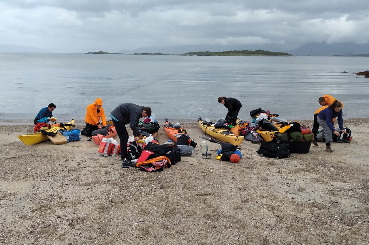
After kitting up with boats, tents and stoves, buying some last-minute pieces of clothing and a map at Jann’s brother’s excellent outdoor store, and stocking up with four days’ worth of food at the supermarket, we were finally off.
Holdøya
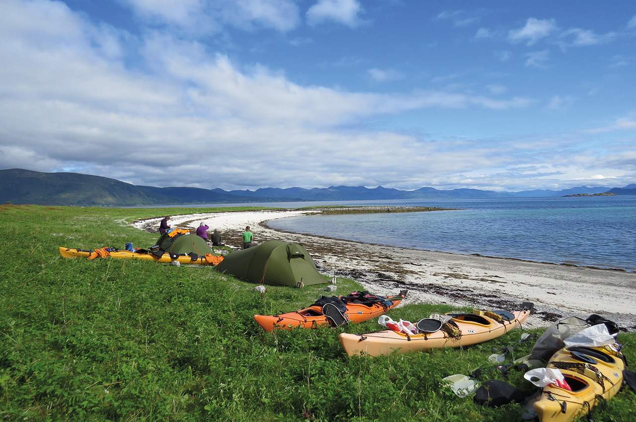
Our get-in was at Holdøya, from where we paddled to our first camping spot on the small island of Slattøya. We set off into a steady drizzle, but were immediately rewarded by sightings of otter, harbour- porpoise, a pair of White-tailed Eagles and an Arctic tern. Once on the island, after checking carefully for cattle, we pitched our tents among the beautiful, springy Arctic vegetation. As there is no freshwater on the island, we were glad of the supplies we had brought. At night we listened to the sound of sheep going round the island clanking their bells.
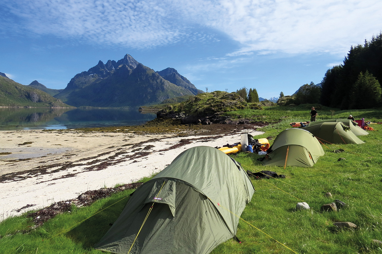
The next morning, we woke up to brilliant sunshine, the peaks of the snowy mountains embellished with white clouds. We first visited the tiny Falkfjord, which was rich in underwater life and where, to my surprise, Kristian said we could top up the water bottles from the stream – something that I have not done in the UK for many years. During a long day’s paddling we covered 24km and saw both Golden and White-tailed Eagle. As we headed towards Raftsund, we had tidal assistance but the wind was steadily picking up, making for some sizeable waves, and we were all grateful to reach a campsite that had running water and a drying room.
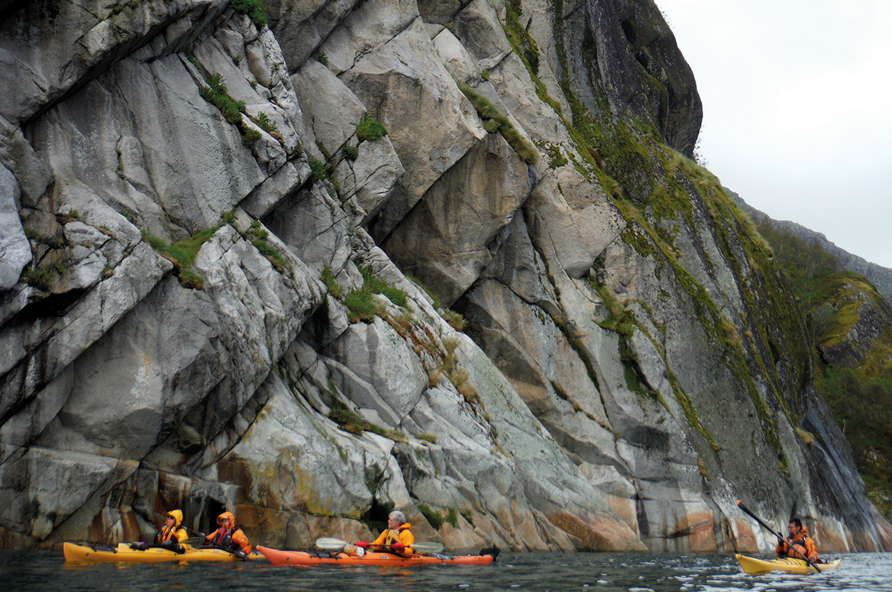
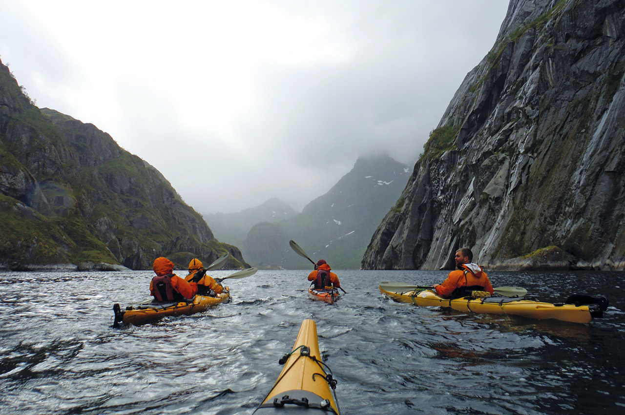
The following day we continued along Raftsund and entered the famous Trollfjord, amid dramatic scenery but a strong headwind. At night we heard the distinctive horn of the Hurtigruten cruise boat reverberating around the fjords and mountain sides.
Trolls
On leaving the fjord, Kristian recounted both ancient legends of the trolls, whose faces, now rendered harmless by the sunshine, glowered at us from the smooth granite, as well as the more recent story of the battle of Trollfjord, which led to the regulation of cod-fishing in the area.
Once we left the shelter of Trollfjord, we were back in the head-wind of Raftsund and, as it was time to stock up with food again, we landed on Brakøya and Kristian divided the group into two, with the stronger paddlers accompanying him to the shop, while the rest of us did battle pitching the tents in the wind. Nesting curlews made their presence felt with constant flypasts and calls, and Max was excited by the sight of a black grouse in the forest. In the evening we saw a pod of harbour porpoises go past.
Abundant marine life
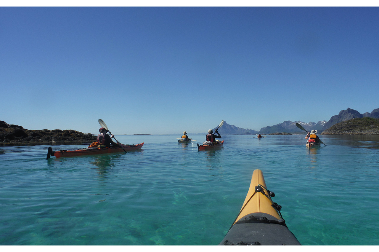
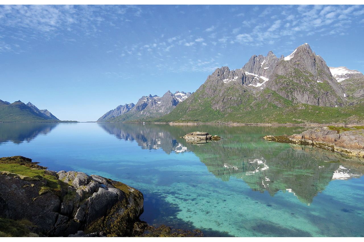
July 1st was a beautiful sunny day with calm water, which meant that we could see to the bottom of Raftsund and appreciate the abundant marine life as we paddled, seeing iridescent comb-jellies and many different sorts of jellyfish, including the large and colourful lion’s mane. After a while, we found ourselves looking down on what looked like the savannah, with many baobab trees dotted along the sandy bed. These were in fact sea cucumbers, a filter-feeding marine animal. We paddled 15km in three 5km stretches, Kristian brewed up coffee on the Trangia stove when we paused at little sheltered beaches and eventually reached the island of Sandøya, where several of the group had a brief swim. Hanne and I went out for a midnight sun paddle in the double kayak.
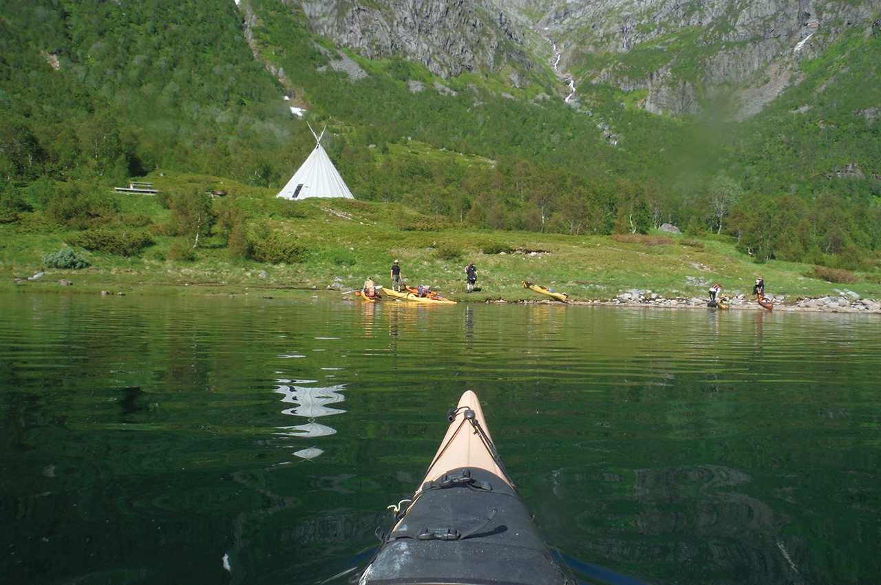
Storøya
We broke camp at Sandøya on another beautifully warm and sunny day. We meandered our way between several small islands and then made a crossing to Storøya where we had a second breakfast of chocolate and coffee and continued up Austnesfjord, enjoying the sightings of birds and underwater life. Eventually we reached our goal – a beautiful tipi, smelling of woodsmoke, with reindeer skins to lie on and complete with a picnic bench, fire-pit and composting toilet! A freshwater stream tumbled into the fjord and several of us had a swim in the cold water. That night there was a thunderstorm and we were grateful for the shelter of the tipi.
On our final day, we woke up to the sound of wind and rain, but once we emerged from the tipi the conditions were quite manageable. We paddled back down Austnesfjord, crossing by the island of Austpollholmen and to our final get-out, where Kristian called Jann to come and collect us with the minibus and trailer.
In a week’s paddling we had paddled 80km, seen all weathers and bonded as a group, but we had only just started to appreciate the scale of the place – we had only seen a very small portion of the Lofotens. Kristian is a wonderfully skilled guide, not only for his extensive knowledge of the area – the tides, the weather conditions and the campsites – but also in his ability to flex the plans for the trip according to the abilities and the morale of the group.
To do list
- Take a good, experienced guide with local knowledge. There is no substitute for someone who knows how the local tides and weather behave, where the crossing points, get-outs, water sources and campsites are and can make flexible plans with a range of options;
- Carry plenty of water; there is no freshwater on some of the islands. We took several five-litre bottles, which can be topped up at waterfalls;
- Plan your food shopping at the start of the trip; fresh food doesn’t last and food for a whole week is too bulky. We did one food shop at the start of the trip and another halfway through;
- It is a good idea to take a double kayak; while most paddlers have a slight preference for a single kayak, it is a wise precaution for the days when one person is tired or under the weather;
- Be prepared to change your plans according to tide, weather and people;
- Bring one thick fleece and fleece-lined trousers for the arctic evenings; although it stays light, the temperature drops as soon as the sun goes behind the mountains, and there is often a significant wind chill factor;
- Bring as many dry sacks as you have;
- Bring dry trousers if you have them;
- A mobile phone is useful for checking weather and tides, and general communication; there is good 4G in most places. It is also useful to bring a powerbank;
- Paddle along the shore; it is more sheltered and you will see more underwater life.