
By Taran Tyla
Catch up with Taran @ http://www.goseakayak.com
Sanguine Sardinia wild camping adventure
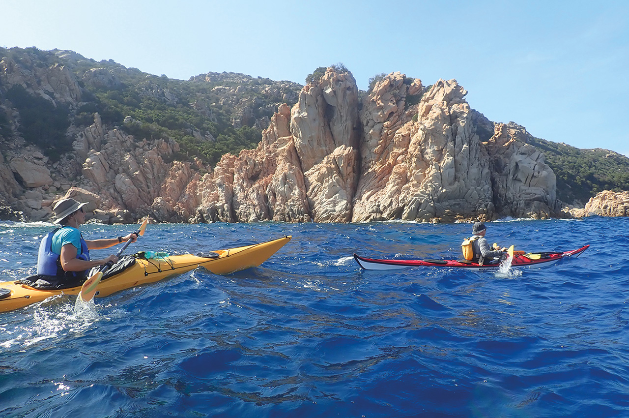
Sardinia, the second largest of the Mediterranean islands, reaching out up 1,800 metres above sea level, is a rugged, beautiful landscape and surprisingly green given its hot climate.
It was this rugged greenness that captivated me during my first visit to the island and it also appealed to a group of paddlers from the Danish Viborg Kayak Club, keen to have a wild camping adventure in a Mediterranean climate.
The club were a mix of experienced paddlers and some who were looking to build on their experience and gain more confidence in more challenging conditions. The weather was certainly going to provide them the opportunity!
briefing
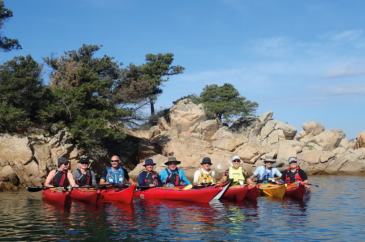
We started the adventure with a briefing at the hotel. With nine paddlers, Ole, Henrik, Kris, Jon, Mette, Stine, Lene, Berit and Annette, there were a lot of names to remember! I hate being the bearer of bad news but first on the agenda was the wind forecast. It was going to blow! With this in mind, we adjusted the route so that the exposed island circumnavigations we planned to do, coincided on days with a lull in the winds.
Day one and what a start!
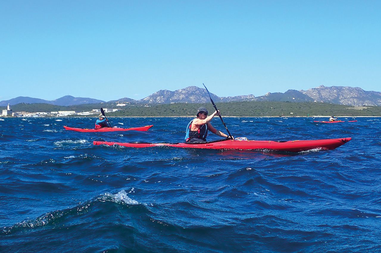
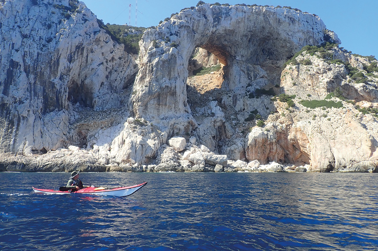
With a forecast of force 2-3 winds, I planned an island hopping adventure to get us started. The most southerly of the Maddalena Islands are Soffi, Camere and Mortorio. These gorgeous islands offer themselves seductively to the adventurous paddler. The feeling of exposure at Roccia Mortorio, the furthest point from the mainland and some 5km offshore, has a raw wildness about it, with panoramic views back to the mainland.
The winds were on the upper end of the forecast with a pleasant swell. The one hour crossing proved a good intro to see how the paddlers were on the water. We paddled and surfed our way 5km offshore to the first island of Soffi and rock-hopped our way to Le Camere for a stop on an idyllic beach.
Isola di Mortorio
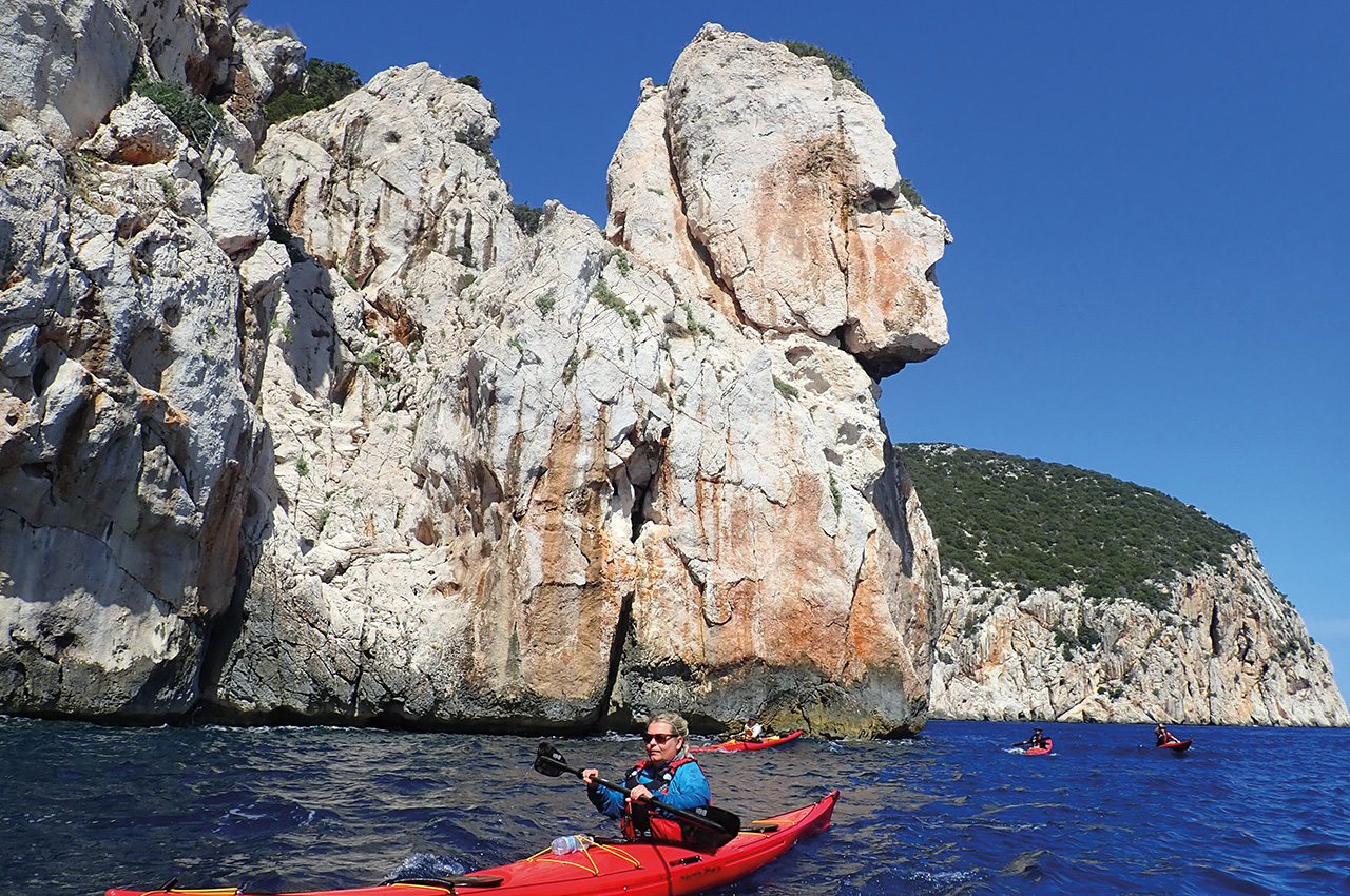
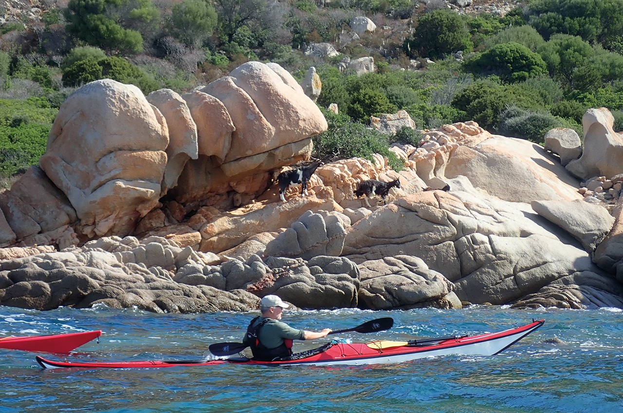
The next island, Isola di Mortorio, is made of weathered granite and covered in dense scrub with some exceptional beaches. Come here in mid-season and Spiaggia Mortorio looks like a boat park with mostly locals and Italians on holiday, showing off their expensive floating toys. We bypassed this beach and continued around to the wilder eastern side and headed offshore to Roccia Mortorio, literally two rocks protruding from the sea. Amazingly we saw a Hoopoo there, a quite beautiful bird and unusual to see offshore. There was a steep swell present and made it a fun exercise paddling around and through the rocks.
The sea was lively as we paddled back to Isola di Mortorio and made our way towards Cala di Ponente for our lunch stop. It’s an extraordinary place and one can run out of superlatives describing the scene, with the rocks looking like sculptures often taking on a likeness to animals. The sea in this bay is sheltered from most wind directions, turquoise in colour with the outlook to the mountains on the mainland holding your eye, either for beauty or the prospect of the paddle back to mainland terra firma.
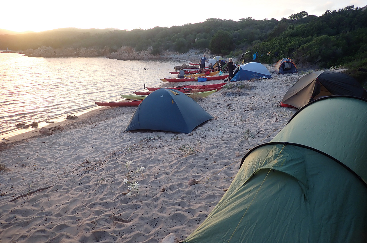
From Cala di Ponente we took the shortest route back to the mainland crossing from Isola di Soffi to Cala di Volpe (Bay of Foxes) and followed the coast from there to Petra Ruja, a favourite camping spot of mine and a great place to spend first night out.
Day two brought with it a forecast of force 5 winds for the route along the exposed peninsular of the Golfo Aranci. It was a day of contrasts, passing the marinas and the exclusive property of the super rich to low lying coastline and shallow shoals before reaching the deep sea and high cliffs of Capo Figari, a dramatic headland reaching 342 metres up.
Marconi semaforo station
On the summit of Capo Figari is the historic Marconi semaforo station. From the semaphoro station, Marconi received a strong signal from Rocca di Papa near Rome in 1930 and considered it a commercially viable signal.
Rounding the headland we passed the rock of Sa Mama Chiatta, a stack said to resemble an old woman, others say a Mamuthone, which is a traditional rural carnival mask found in inland Sardinia.
Entering the bay of Olbia we reached Isola di Figarolo, a small island that is home to the Moufloni, a wild sheep that all sheep are said to have descended from.
Leaving the island we paddled past the town of the Golfo Aranci with a stop for water and more importantly, ice cream and landed again just outside of the town for our second night’s camp.
Day three and the winds had arrived!
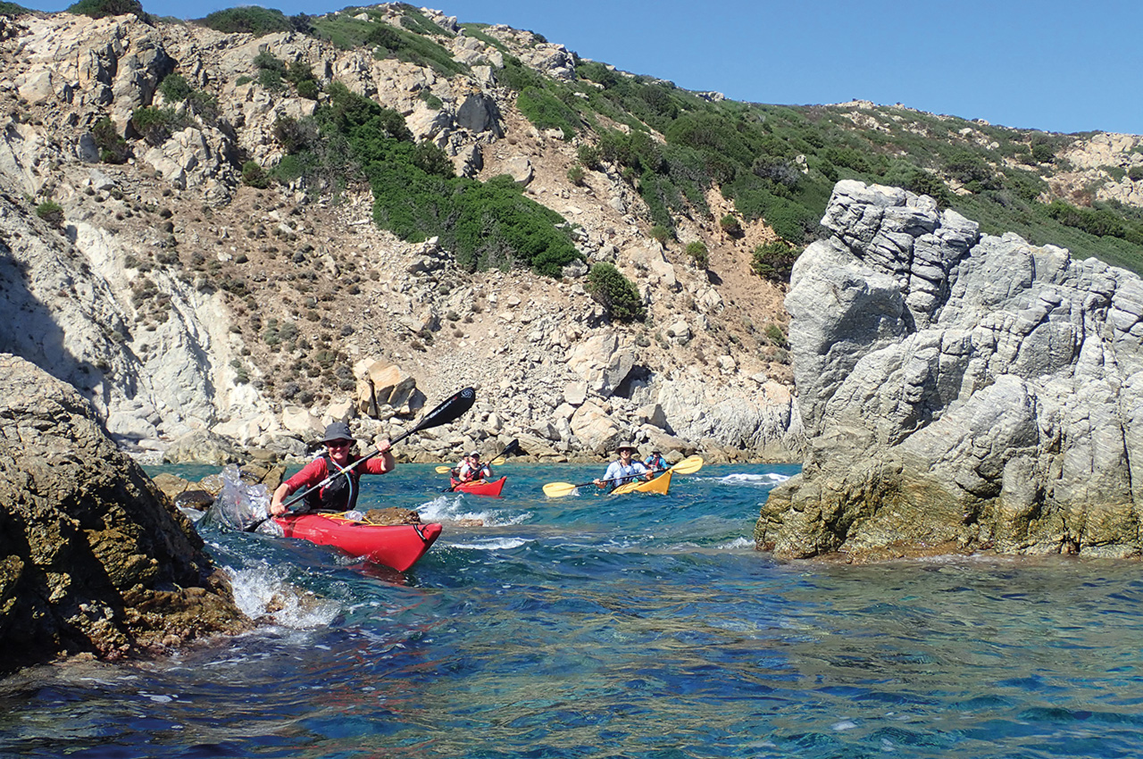
We woke to winds of force 5-6 and a metre of swell. To start the day we headed a little offshore for a 2.3KM crossing of the first bay. We caught the wind more than expected and decided to hug the shore for the rest of the day. Not only was this a good decision but it was fun too as the coastline lent itself to rock-hopping and we all got some good practice manoeuvring through some tight turns, as well as getting distracted by some nude sunbathers!
Before long we were paddling towards the approaches to Olbia and would have to keep an eye out for the ferries. We turned inland (due west) to minimise the length of the crossing as the winds were a steady force 5 and the sea was capping. The leading paddlers were having to hold position occasionally as the less experienced paddlers were struggling with maintaining direction in the high winds and falling back.
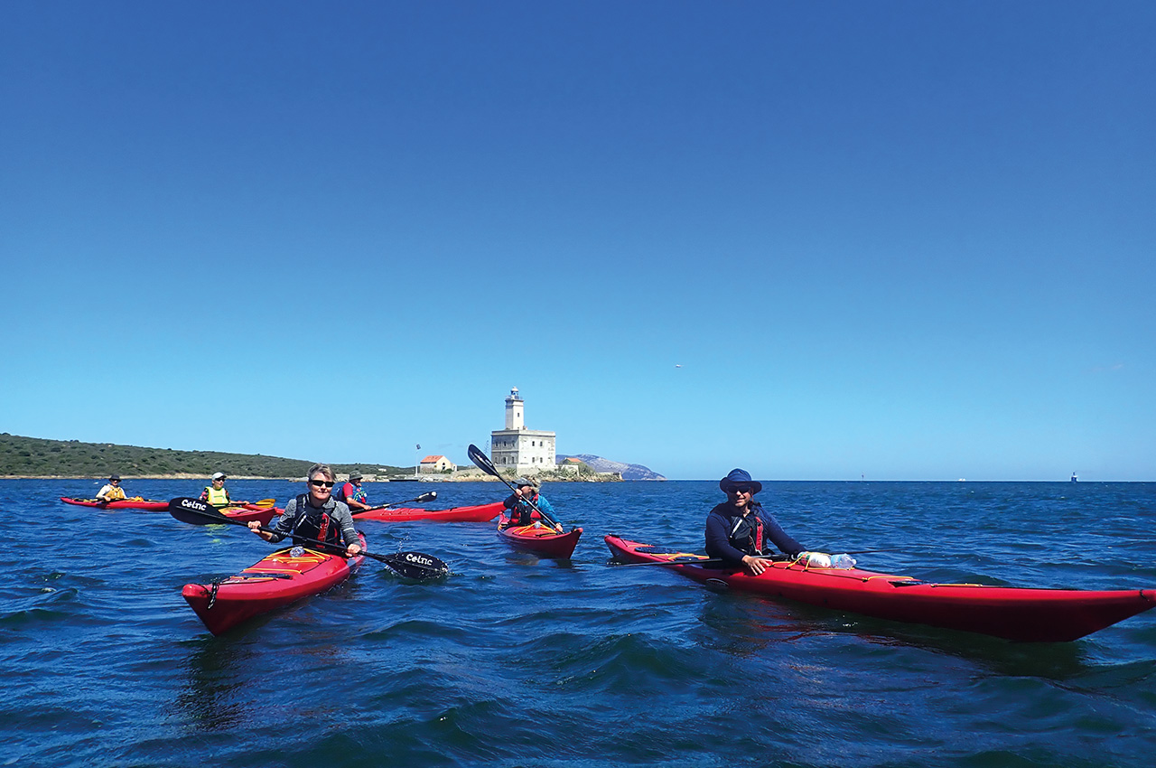
As we approached the lighthouse on Isola Della Bocca, a ferry chugged out of Olbia. We stayed out of its way but as it passed the sea drew away from the shore like a Tsunami before the wake of the ship hit us. It was exciting to say the least as I looked behind me to see all the paddlers leaping through the waves, some smiling, others concentrating, all of us living the moment.
The wind was on beam for the short 300 metre crossing of the port entrance and the route took us straight past the island of Isola della Bocca (Mouth Island). The lighthouse was built in 1887 and is 22 metres high. The light itself has a range of 28km.
From the southern shore we had fun running with the wind and surfing the waves as we headed towards Murta Maria, to camp early on a quiet stretch of beach and avoid paddling around Capo Ceraso in high winds.


Day four would see us paddling around the headland of Capo Ceraso. The name derives from the wild strawberry trees that are found there, the Corbezzolo also known as Ceraso di Mare.
granite rocks
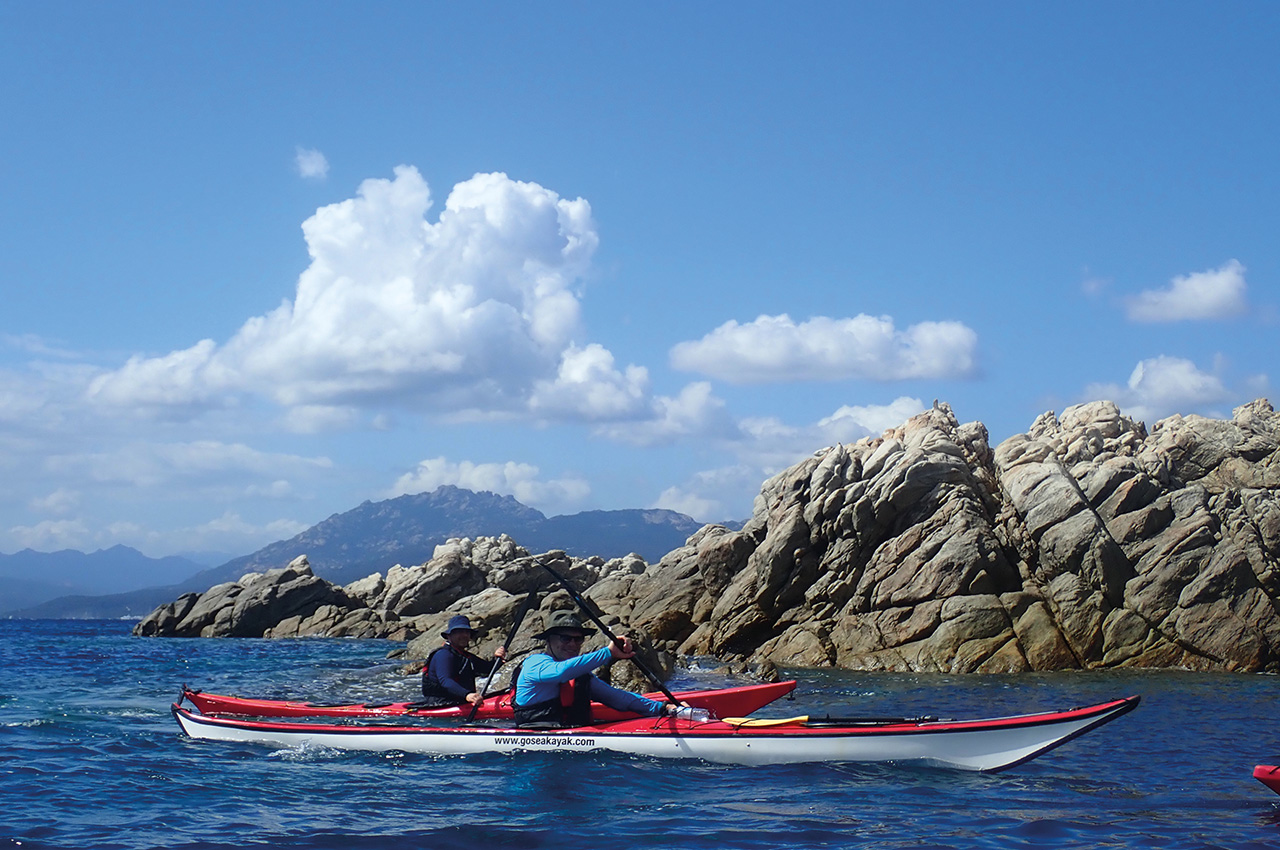
The coast here is a maze of sporadic granite rocks and indented coastline that is a joy to paddle in calm weather and challenging on a rough sea, which is why we stopped early the day before.
We were on the water early, just before 0800 and took our time paddling to savour the striking scenery and play amongst the rocks as we made our way east towards the tip of Capo Ceraso. We then made our way to the very secluded Spiaggia Capo Ceraso for lunch. The beach here has spectacular views of the coastline and islands that would occupy us for the next two days.
The sun was shining during our lunch stop but less than two hours later we were on another beach sheltering under a tarp from the heavy rain as thunder rumbled in the nearby mountains. We sat out the storm savouring our unintentional second lunch before resuming onwards for Cala Sqadrone o Delle Vacche for the night.
Day five and another 0800 start for what would be a wonderful day paddling around the island of Molara, my absolute favourite place to kayak on my days off from work.
Molara is a private island, granite in nature and home wild goats, descended from domestic stock. Much of the coastline in between Capo Ceraso and Coda Cavallo including Molara is part of a protected marine park.
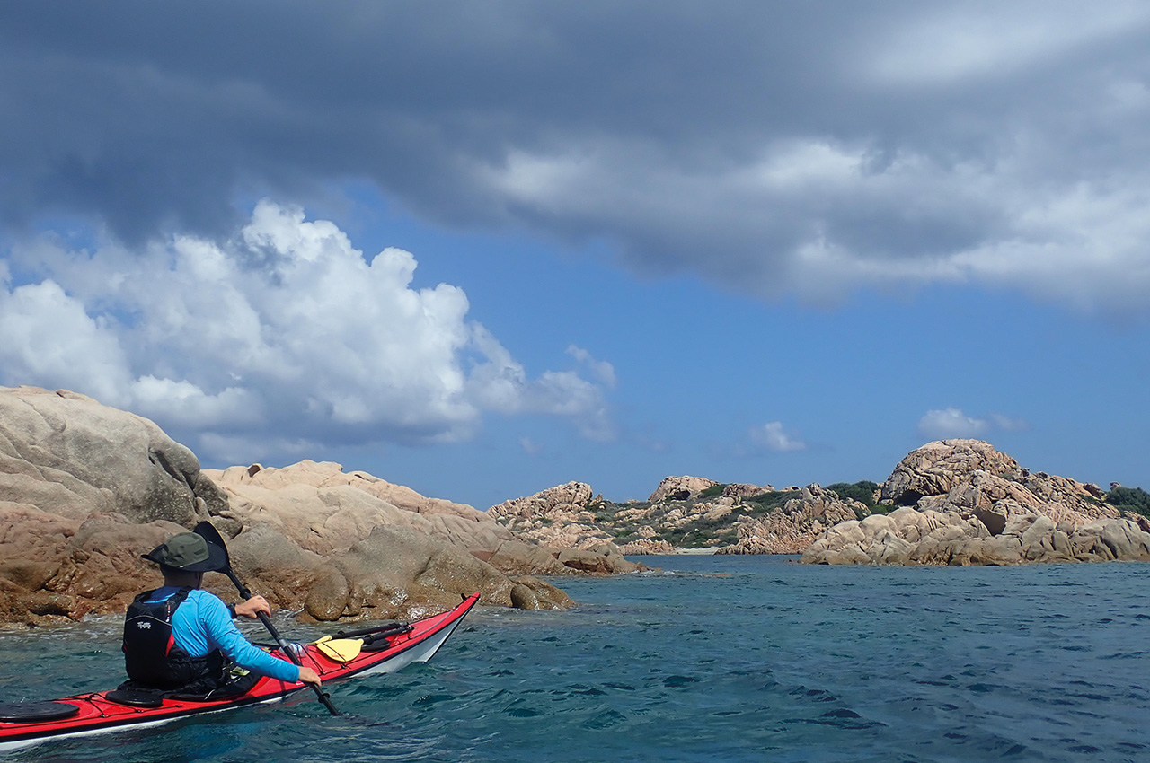
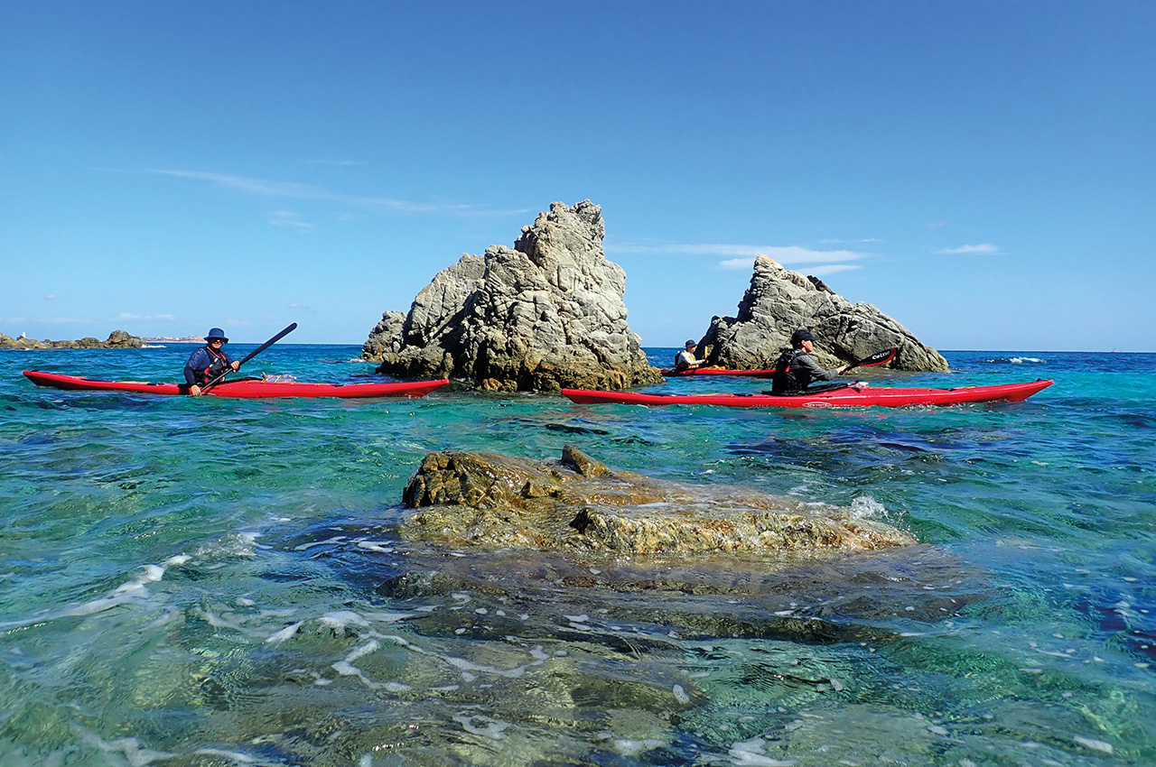
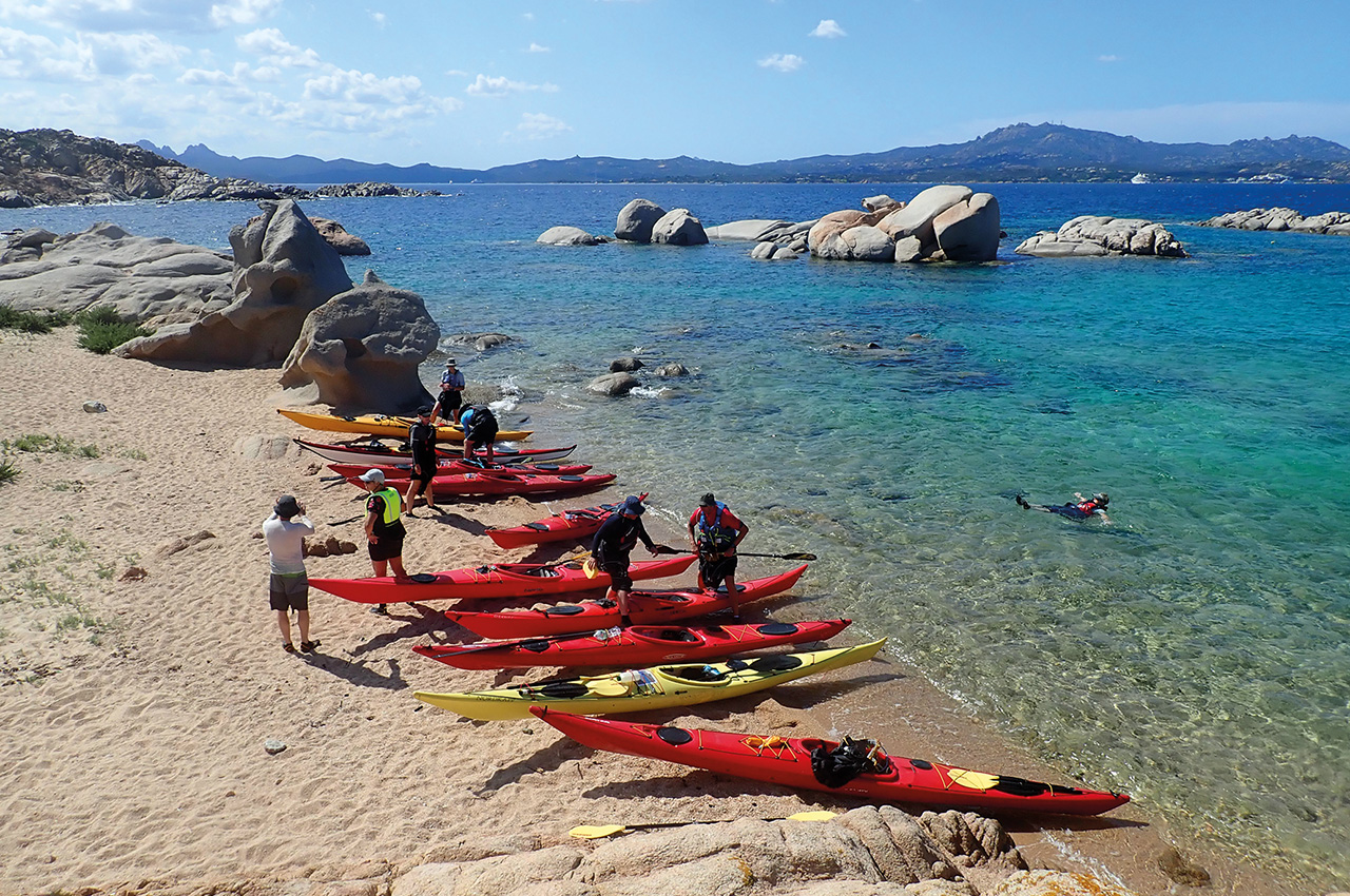
Leaving our camp we immediately started kayaking through nature’s wonders, granite rocks sculpted and weathered by the sea into works of art. One such wonder actually looks like a fish jumping out of the sea. From Punta Pedrosu we began heading offshore on the 30-minute crossing to Isola di Molara on a route that took us to Cala Mariolino for a break. It was early in the day but a rest was necessary as the circumnavigation of the island is effectively an open crossing due to lack of easy egress points. The landings available were awkward and best avoided. The good landings were all on the south west of the island.
big swell
Leaving the beach the sea was calm until we stuck out from the south-eastern tip at Punto Scirocco en-route for the rocks of Scoglio I Cerri, 2kms offshore. Out of the shelter of the island we were now feeling the presence of a big swell which made the paddling fun but would make paddling around the offshore rocks interesting. The sea was deserted on the seaward side of the island and we had it to ourselves save for the presence of some Mediterranean Shearwaters. At the rocks no one seemed keen to play with the large swell present. Only Cris moved in closer for a quick photo before we returned to the island, catching waves as we went. I even got hit by a leaping Fish!
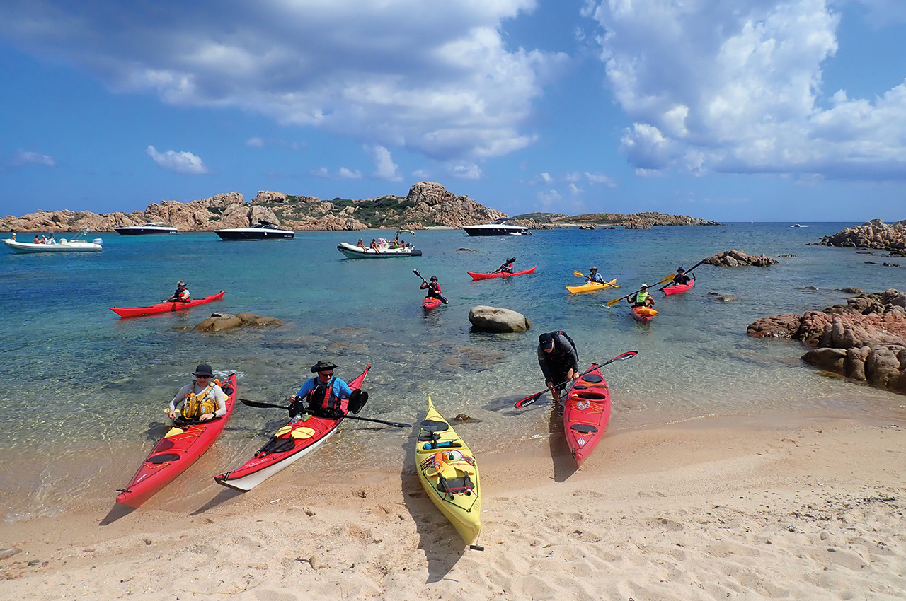
From the island we then paddled to the tourist mecca of Spiaggia di Capo Coda Cavallo for an ice cream and then followed the shore northwest to Punta Molara, an extraordinary beach with remarkable views that proved to be the groups favourite camp of the trip.
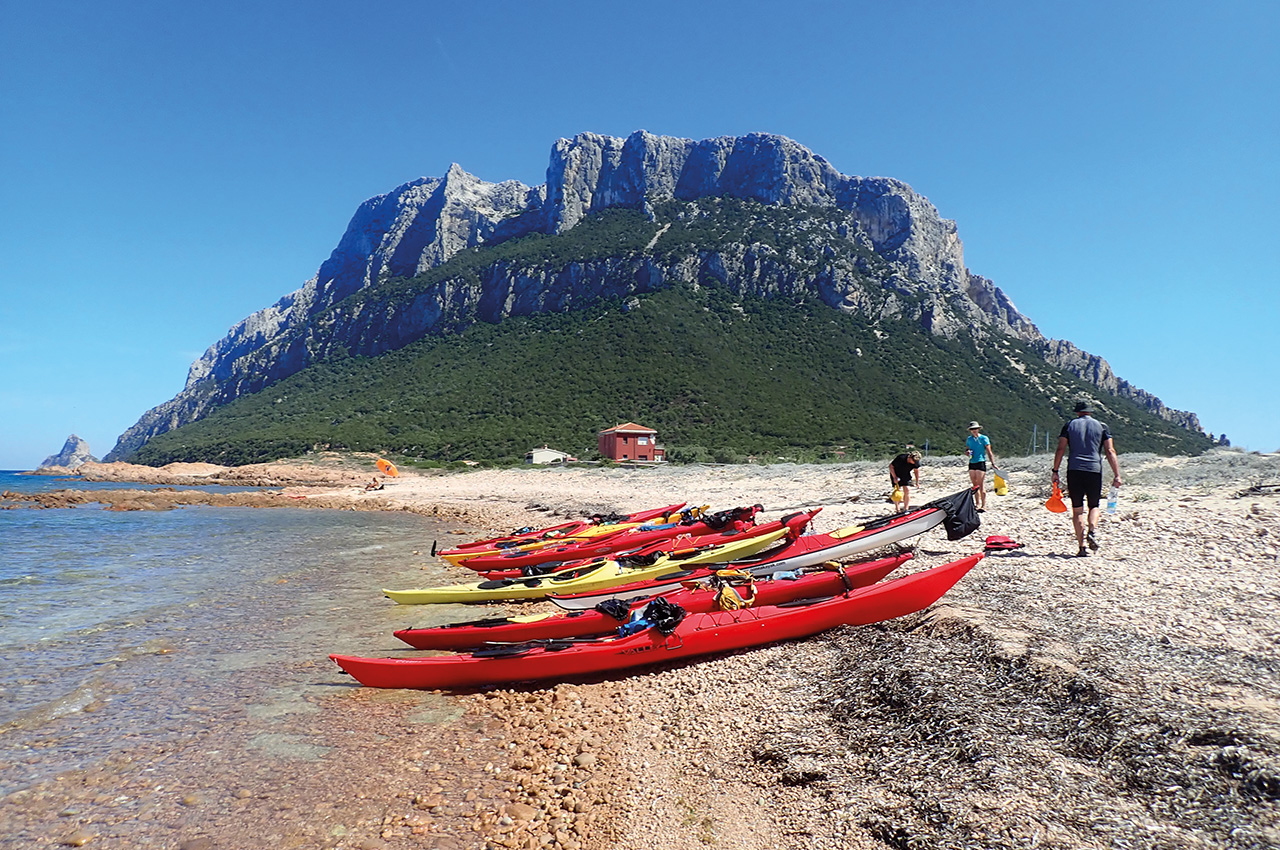
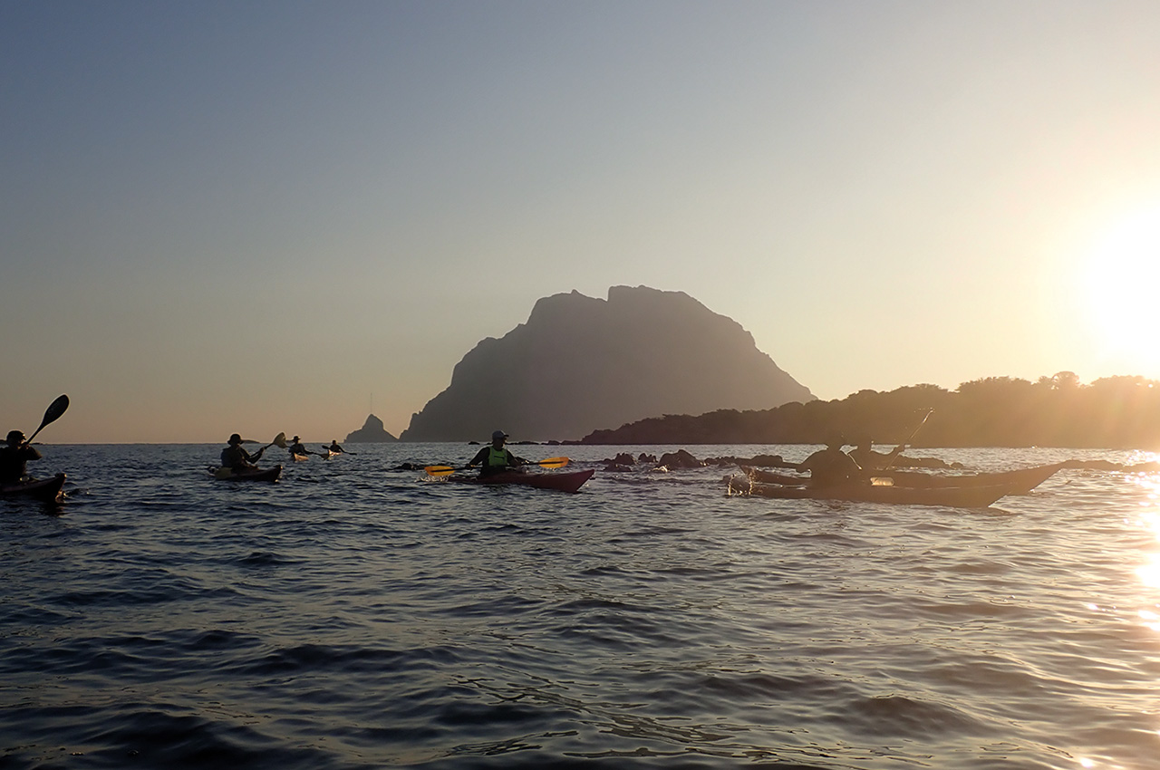
Day six and it was time for the big one, the big island! Tavolara is an impressive lump of rock! Limestone in fact. Said to be the petrified remains of the ship of Feaci. Guilty of bringing Ulysses back to his homeland Poseidon turned his ship to stone. Well, if that’s true then it’s a big ship! Five kilometres long, a kilometre wide and reaching up to 565 metres at its highest point Monte Cannone where the surrounding views really let you know that your in the Mediterranean and somewhere very special.
The weather was ideal for this long committing paddle with low swell and light winds, but it was hot! We were off early again, 08.00 and straight onto a 4km crossing to reach the island, giving us 40 minutes to loosen the stiff muscles from five days of paddling.
We stopped at Spiaggia Spalmatore di Terra to stretch a little before starting counter clockwise around the island. From the start of the circumnavigation there would be nowhere to land until we return to the peninsular on the southwestern tip as the northeastern end of the island is a restricted Nato base and off limits.
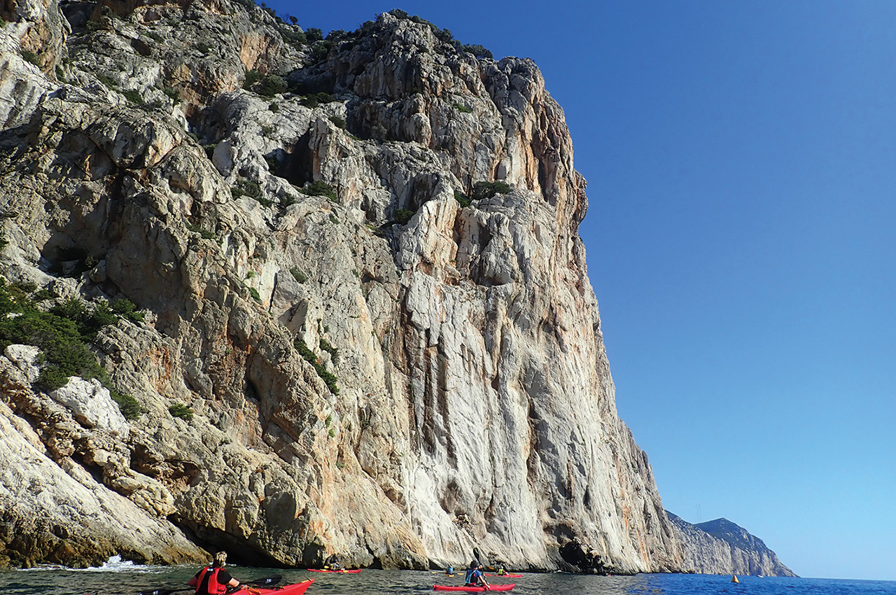
The route along the south-eastern side of the island really is quite an extraordinary experience with enormous sheer cliffs running the full length of the island and in places dropping 14 metres straight into the sea. Looking at the paddlers close to the cliffs really gives you a sense of scale.
From Punta Papa we turn almost directly north past Ulysses Bow, a sea arch left high and dry on the cliffs. From here we gingerly paddle past the NATO base! You are allowed to paddle past but at a distance and I’ve been told off before!
The northern side of the island equally as lovely but more gentle with sloping hills and some good rockhopping along the shore.
Lene had this to say about Tavolara, “The island is impressive itself with the massive vertical cliffs. But it was also a kind of goal to finally to be able to paddle around Tavolara, because we could see it from almost everywhere we went. It is an incredible beautiful island and fascinating to see the caves along the sides of the island.”
From Tavolara we headed to a quiet beach near Cala Finanza for the night in readiness for an early pick up the following morning as we were moving further north for the final days kayaking.
Day seven, the final day. We were all up and on the water very early for a vehicle shuttle that would take us to the Costa Smeralda. This would not only give us a new area to play in but also allow us to paddle empty kayaks. With force 4-5 winds and a metre swell forecast the empty boats would be a lot more fun!
most expensive location in Europe
The Costa Smeralda (emerald coast) is reputed to be the most expensive location in Europe with house prices around €300,000 euros per square metre! Wealth aside it’s a lovely coastline and is still very wild in places.
The morning saw us paddling past a wild undeveloped coast with mostly quiet beaches before the 1.5km crossing of Cala di Volpe.
Past Cala di Volpe there are some of Sardinias most popular beaches and expensive properties. It is a beautiful landscape and the paddlers loved peering into the multi million pound homes.
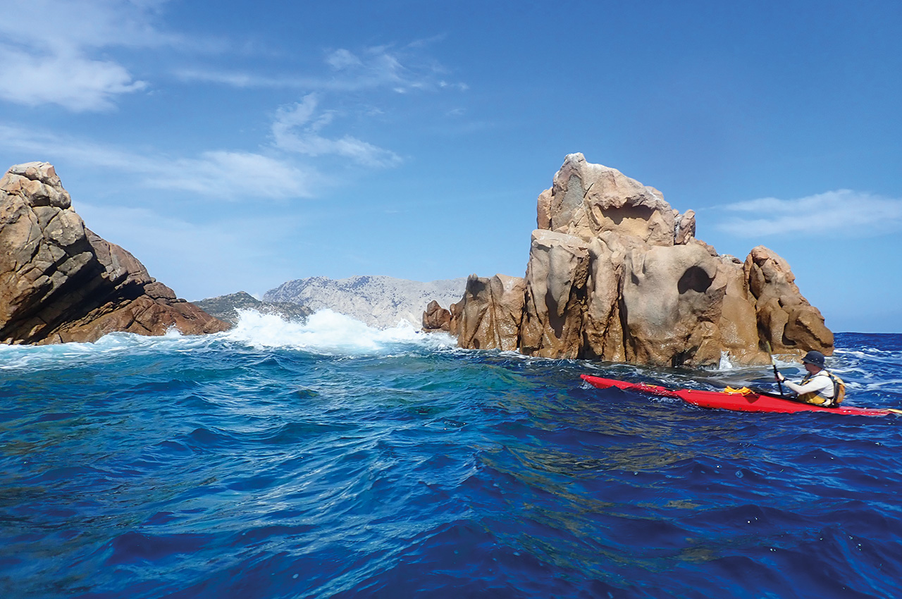
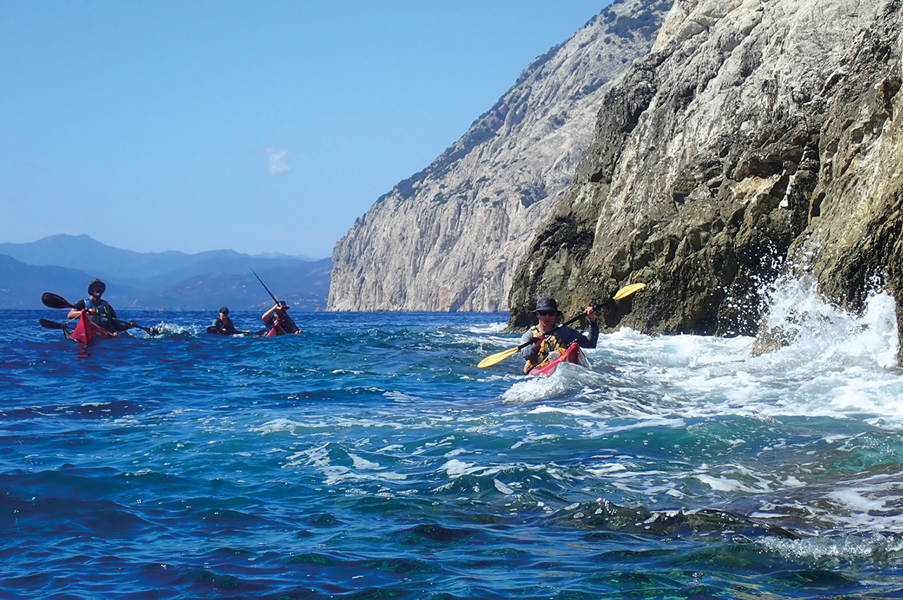
At Capo Capaccio the coast turns wild and rocky and we play in the swell paddling amongst the rocks. We then made our way north to the islands of Li Nibani. The Islands name comes from Gallurese, a north eastern Sardinian dialect and means the seagulls. However, to our group of paddlers the islands mean excitement!
There’s a good swell running with waves pushing through gaps and clapotis on the exposed eastern side. This is really going to test everyone and I hoped at the time that it wasn’t going to prove too much for some of the paddlers.
It was challenging for sure and the feedback I got from the clients afterwards was positive. Ole said, “The place we probably have spoken the most about, might have been Isolo Nibani. This was a final eye opener for the group. It actually showed the hidden capabilities, when we went through the funnel with swells coming from behind and white foam in between. The entire group was thrilled after passing this gap in the rocks. The pictures you took, where we could only see a hat or a tip of a paddle, was great to see afterwards.”
From the island it was a short 2.4km back to the mainland and the end of the adventure.
I’ll leave the final words to Ole, “The trip in total gave the entire group a memorable experience and friendship just grew amongst us. Everybody was just happy and relaxed, even after seven days on the sea and camping…”
