
Words: John Campion
Photos: Robert Carroll
Social media
join our Upper River Nore Blueway (https://www.facebook.com/TheURNB) Facebook page and register your interest and thoughts on the subject. It has been encouragingly positive to date. It is so important that the wider community here in Laois knows what’s on their very doorstep and ensures that any actions align with their wishes and interests.
Upper River Nore Blueway (‘U R NB’)
Someone told me that stage 1 of Covid lockdown was making banana bread. Stage 2 was making sourdough apparently, but stage 3 was a dip in the sea or local river! The mental wellbeing that it brought was to work wonders! From growing up in Errill, Laois and swimming as a kid in local spots like Cullohill or Castletown, I remembered the sensation of the cold dip but now a bit older, with kids of my own, I was looking to get back there but maybe see what it like from a kayaking perspective.
My cousin, Padraig Bree from Abbeyleix, had always spoken about a beautiful stretch of the Nore from Castletown right down to the Dunmore Demesne outside Durrow. He had kayaked it himself many years previously and again in 2019, and while he stressed the river was now a bit choked up in places, it sounded like a magical experience.
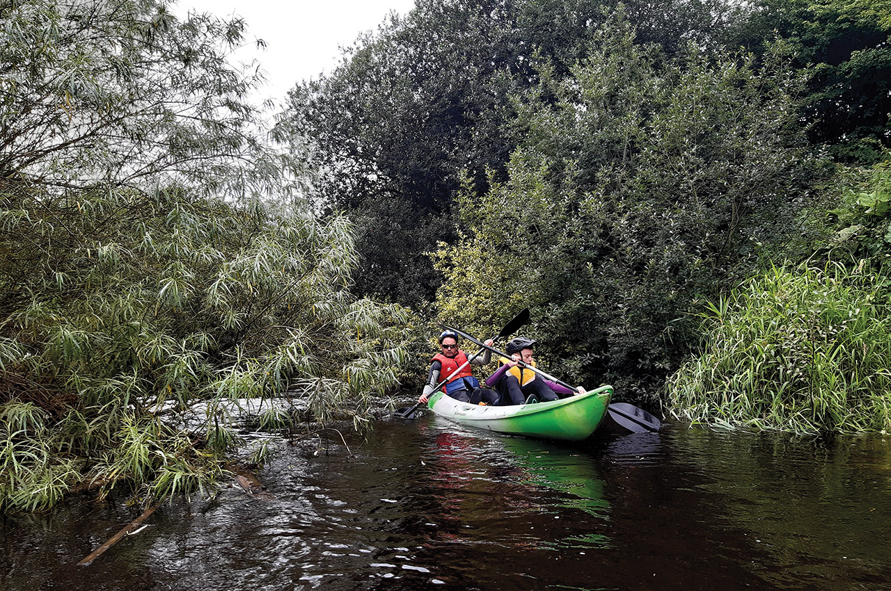
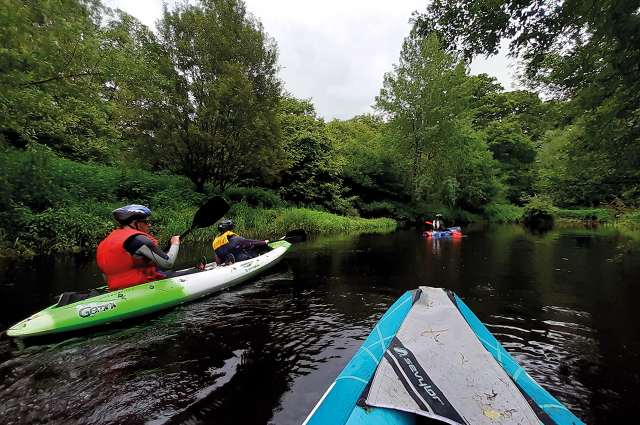
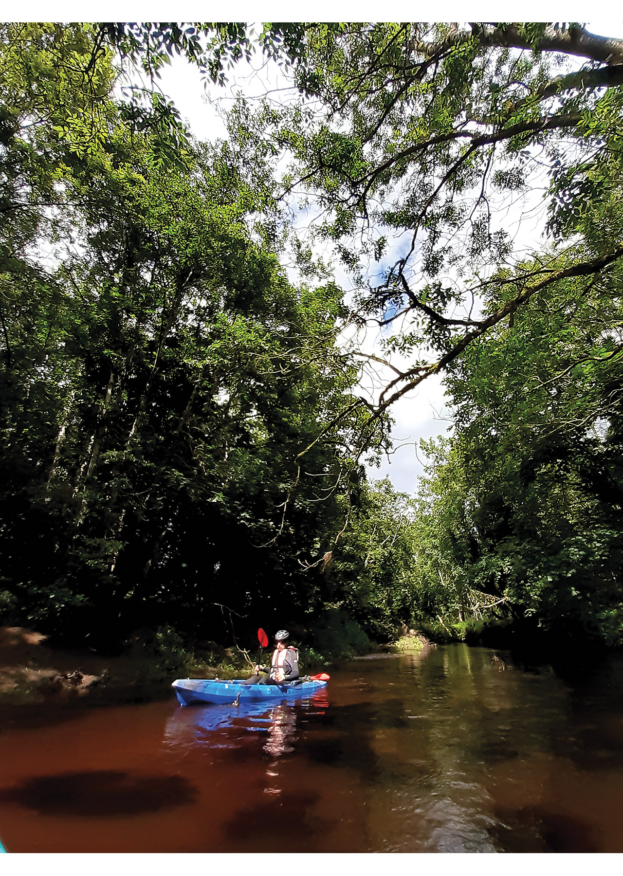
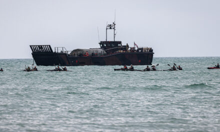
He relayed this experience to several people. Soon enough, he had Robert Carroll of Borris-in-Ossory, myself and my 14-year-old son Eoin enchanted enough with his stories and pictures to agree on meeting up at the Castletown weir on July 28th. Not having a double kayak of my own, Michael Gee Phelan in Ballacolla very generously offered Eoin and me one of his kayaks. Together with the more experienced Padraig and Robert, we pushed off from the grassy banks. Very quickly we realised we had happened upon a hidden gem here in Laois. I’m sure others have known about it for years, but it just hadn’t reached our ears.
A Nore dunking
While the plan was definitely to stay afloat for the full 24-kilometre stretch, Eoin and I had different interpretations of me shouting, “Paddle left” or “paddle right,” so needless to say we took a Nore dunking a few times. However, with helmets and buoyancy aids, we stayed safe and righted ourselves quickly again.
Other than the noise of my ‘helpful’ parental instruction and oars gliding through the water, the peace and tranquillity were everything Padraig had promised. The river brings you through areas and landscapes you never see from the roads or bridges we had driven on for years. The birdlife was a real surprise and quite spectacular along the way with the grey wagtail’s beautiful yellow darts. There were also colonies of sand martins exiting and entering their tunnelled nests and blue flashes of the kingfisher welcoming us as we would turn around another river bend.
Gordon Coffey, who helped with taxiing us on the day, had also reliably informed us that, as a keenangler, it was thankfully well stocked with fish and a salmon run in places. It was also a known stretch for the important freshwater pearl mussel – a fascinating creature that is only found in near-pristine freshwater habitats – and is capable of surviving for up to 140 years, thereby making them Ireland’s longest living animal. With the importance of this habitat; therefore, for a myriad of creatures, we were mindful of maintaining this ecosystem and thoroughly enjoying the journey as we passed through.
Raw beauty and enjoyment
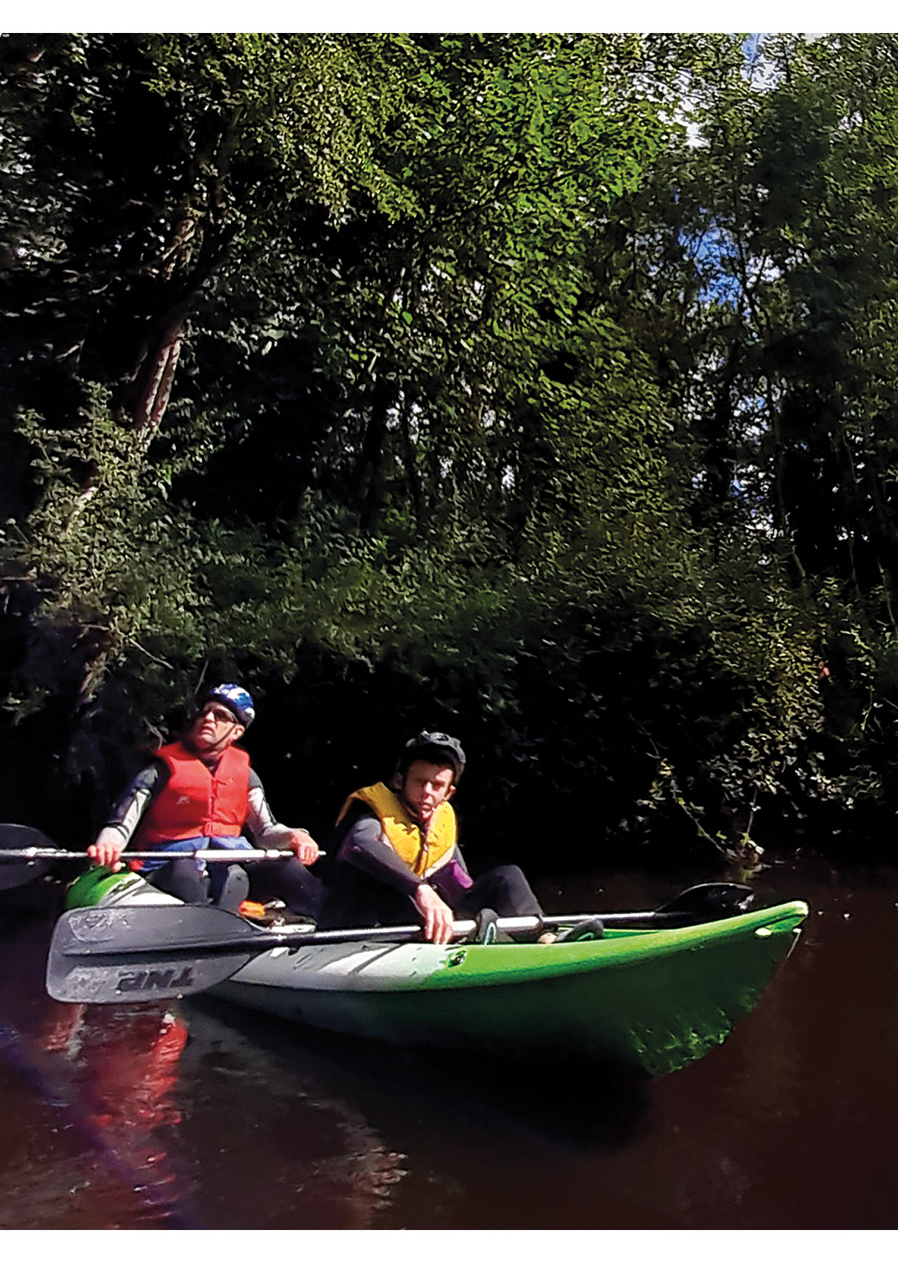
Over the years and as mentioned in other parts of the country, it was clear that the river wasn’t as managed as it possibly was in the past. While this created challenges for us kayakers, it also added to the day’s raw beauty and enjoyment. The vigorous growing willow, ash and hazel in places made for quite difficult passage with some areas completely impassable without getting out and lifting the boats over trees which had fallen in storms and now blocked the entire width of the Nore River. Low hanging branches tested the strength of our helmets like an old fashioned junior B cornerback in Ireland’s traditional game of hurling!
Unfortunately, these blockages also acted as a barrier for plastic debris coming downstream or wooden fence stakes than had fallen from the riverbank. It also meant for reading changes in the river current, and thankfully, with the guidance of Robert and Padraig, we made it through these obstacles safely.
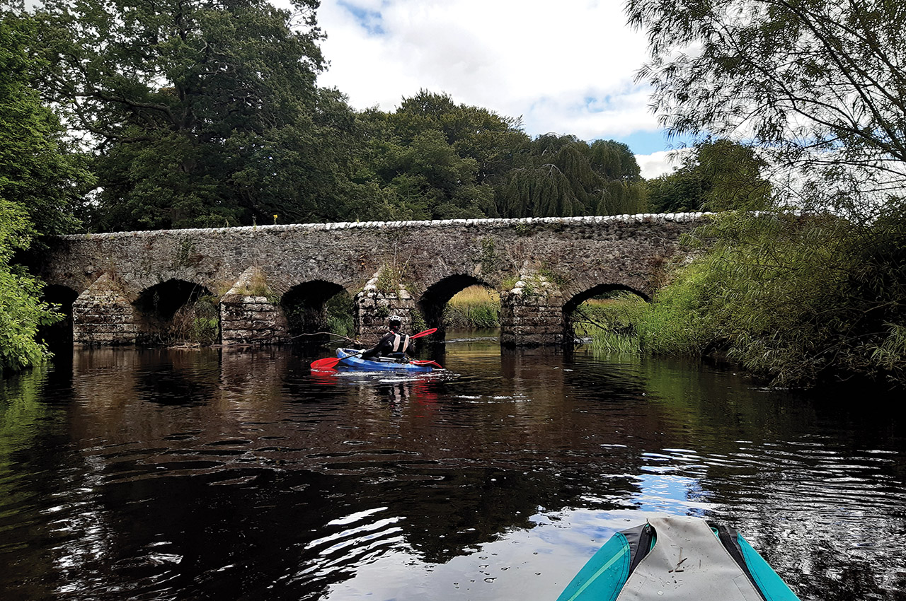
It’s hard to keep count, but apparently, we went under about 12 bridges of different sizes and shapes and purposes. We all would have driven over these bridges numerous times, including the M8 motorway bridge being one such structure – seeing their craftmanship from a completely different angle made you appreciate their history even more. Whether it be Lady’s Bridge, Waterloo Bridge or the seven-arch limestone Kilbricken Bridge is dating back to c1800 each has a story to tell and sound of its own as we’d floated underneath.
However, Poormans Bridge in Shanahoe – another seven-arch limestone road bridge – probably lording it over the others not just in dating back to c.1770, and with triangular cutwaters but boasting historically that the legendary beggar man ‘An Beal Bocht’ lived here.
Poormans Bridge also happened to be our halfway point with the homeward leg bringing us through the majestic mature woodlands of De Vesci estate and along the Leafy Loop walk banks in Dunmore Demesne.
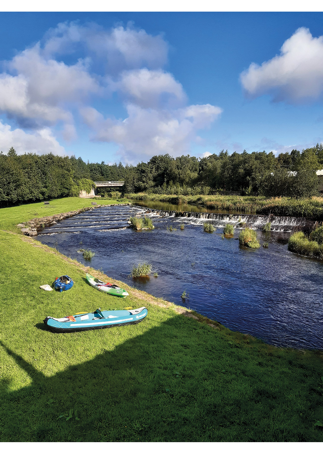
While exiting at Dunmore after 24kms had been both exhilarating and tiring, in truth, there were few other natural points at which we could have left for fear of either damaging the river banks, entering private lands or being too far away from a road or laneway. We’re sure better local knowledge would probably have pointed to some areas we had paddled past.


Objective
Our core objective is to make the river safer and more accessible for travel bringing its mostly hidden beauty and wild character to the community both locally and beyond. Therefore, we are engaging with like-minded people who support such a sustainable, eco-friendly activity and potentially raise it to a Blueway status. While the Greenway status is much in the news these days, the lesser-known Blueways are a network of formally recognised multi-activity recreational trails, based on or alongside idyllic lakes, canals and rivers. Approval has already been given to the nearby River Erkina Blueway between Boston Bridge and Durrow following great work by the Woodenbridge Paddlers Group.
The Nore’s uniqueness is that it is exceptionally rich in biodiversity as it has been left relatively untouched. Therefore, any clearance of trees and vegetation would be guided by an appropriate assessment and an environmental impact study.
On September 1st, nine more kayakers, mainly friends from the west of Ireland (during a less restrictive lockdown period than we have now), could join us.
While we didn’t go the full length again, we spotted an exit on the Ballacolla Road near Waterloo Bridge. They were of varied age, experience and ability. Still, in grabbing a bite back in the hotel they were staying in Abbeyleix later, all had their own stories and experiences from the day and felt they had definitely gotten a greater appreciation for the land snuggled away between the distant roaring traffic on the M7 and M8 motorways on either side of this rural landscape.
Elevated Blueway status
As noted already, a lot of consideration still needs to be taken into account to progress the dream of turning this stretch of the Upper Nore into the elevated Blueway status and strict criteria must be met (as available to see on the Blueway website application). Core to this is an independent environmental impact survey, discussion with local landowners, engagement and dialogue with local community groups and sporting and angling clubs.
With mental wellbeing being more critical now possibly than ever before as we all struggle under different lockdown pressures, it was no surprise that the acronym of ‘U R NB’ for the Upper River Nore Blueway turned into more of a motto for us than merely enjoying a paddle down a rural river in our home county.