
By Ray Goodwin
Alan Pinnington runs www.mountain-water.co.uk
Ray Goodwin’s website:
www.RayGoodwin.com
Ray’s YouTube Channel is:
www.youtube.com/c/
RayGoodwinCanoe
Ray Goodwin’s Scottish adventure – the worst portage ever
Well, not quite…
The route:
start at Glenfinnan Memorial at the head of Loch Sheil, along the length and out to sea at Loch Moidart. From there an open crossing to Arisaig before running up the coast to Loch Morar. Head east on Morar until the portage up Gleann an Obain Bhig to cross the watershed into the top of the Glen Pean, Loch Arkaig and down into the Great Glen. A right turn and down the Lochy to Fort William.
Day one:
The forecast was beginning to crowd out our plan. Strong southerly winds and heavy rain were coming in 24 hours. With an exposed crossing from Moidart to Arisaig, we were now under pressure to get this done on the first day. We needed to paddle the length of Sheil and cross to Arisaig before the storm arrived. It was going to be a big day.
Alan and I trolleyed the canoe past the Glenfinnan Monument. This commemorated were Bonnie Prince Charlie had raised his standard in August 1745. Charles’s path would head south into England, as far as Derby, before ending in bloody ruin on Culloden Moor the following April. Hopefully, our very much minor venture would not end in ruin.
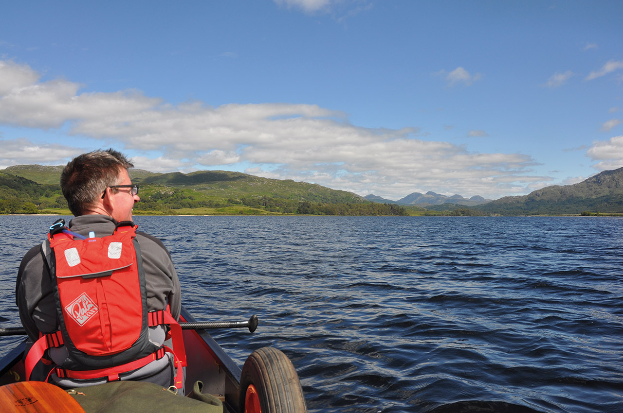
Boat loaded and with Al in the bow we headed into a slight headwind. With a long day ahead we paddled purposely along the spectacular loch. All the while we could see it stretching to the bends some 18 km further down: always a good idea to close the mind to a distant but seen objective. With the breeze against us, we needed to keep up a steady pace. This was the day that would make or break the trip.
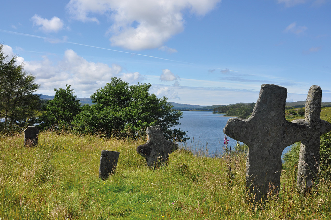
A brief stop for lunch and we passed through the narrows. We stopped on Eilean (island) Fhianain. It has been a burial ground for centuries, and I wanted to have a quick look around this ancient site. But there was little time to savour before we were back in the canoe.
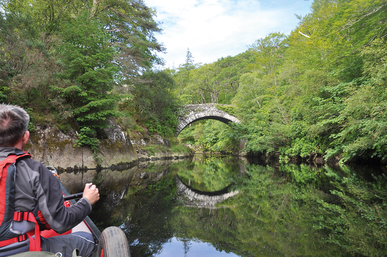
As we plodded to the end of the loch, the landscape opened out with marsh on either side and shallow water to contend with. Some 28 km from setting out, the loch narrowed and became the River Sheil. An ancient bridge and now we had the current with us. Fishing walks and platforms lined the sides of this prime sea trout river, but out of season, no fisher folk were out and about.
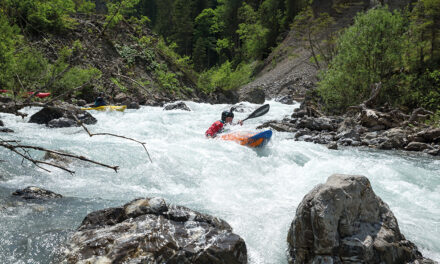
The river can have a little surprise for the unwary with a final drop to the tidal Loch Moidart. We knew this could be tricky or even ill-advised to run. Caution had us out for a quick inspection. The drop was there, it disappears on a big tide, but there was a line cutting through the edge of the main wave. Back to the boat, turning the brain from flatwater plod to a proper white water mode. A nod to each other and we broke back into the current and ran through. In reality, the line was straight forward but not a one to underestimate in different water levels.
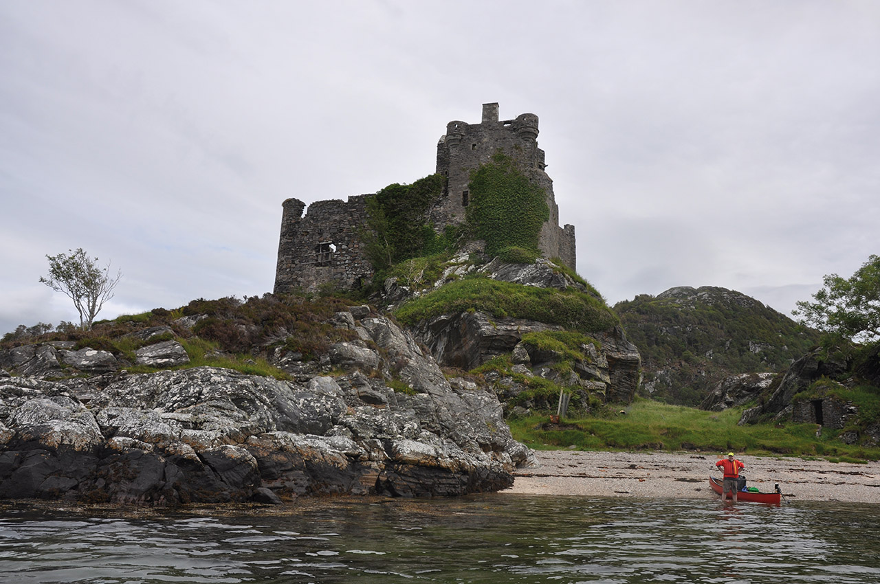
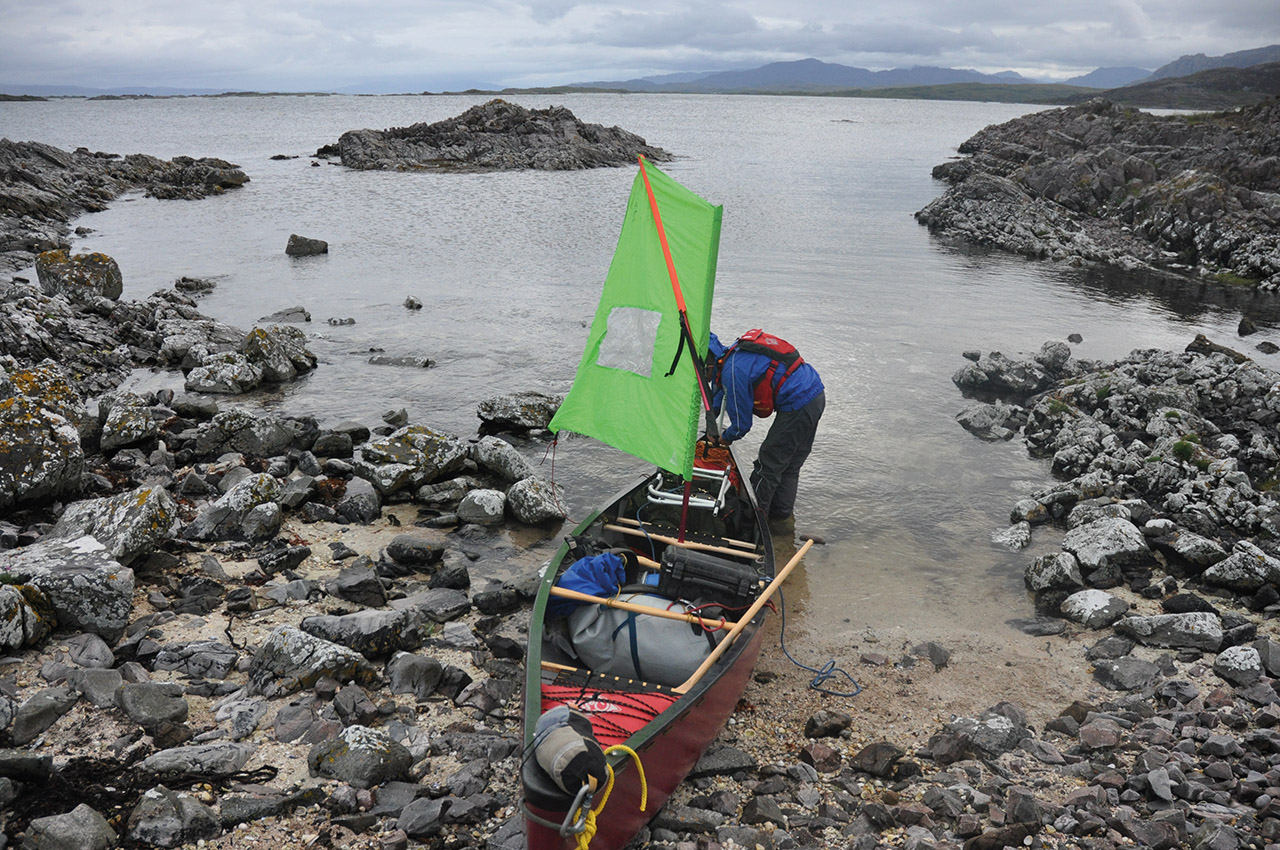
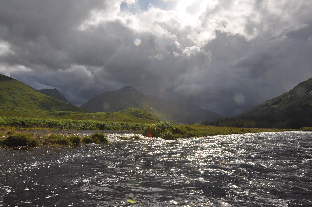
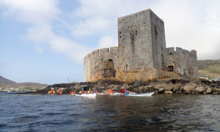
Loch Moidart is spectacular with Castel Tioram looming over our route. We waved at a pair of canoeist drawn up at its foot, but we needed to move on. 33 km done another 17 to go. We headed out of the multitude of rocks of the South Channel and could finally see the crossing to Arisaig. A slight swell was running, but the wind had dropped away. Out to our left were the Small Isles, Rhum, Eigg and Muck. So many good memories of guiding sea kayak trips around those. To the north rugged Skye dominated the horizon.
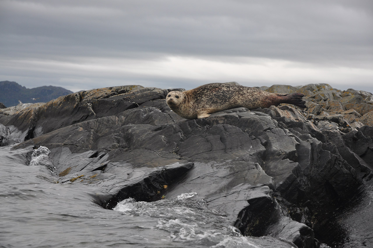
We paralleled the shore to start with, but it soon started angling away, and we started the crossing. Partway Al informed me this was the furthest from the land he had ever been in a canoe. I smiled and told him to keep paddling. Basking seals dotted the small islands on the route, the swell making us keep a slight distance from the shallows.
Reaching the peninsula, we still couldn’t rest. All the landing on the south side would be an impossible launch the next morning, so we paddled a few more kilometres to enter the channel to the north of the peninsula. Finally a landing in a narrow cove, a patch of grass for the tent, and a meal was soon cooking. Some eleven hours and we had covered 50 km. There was not a lot of chat.
Day two
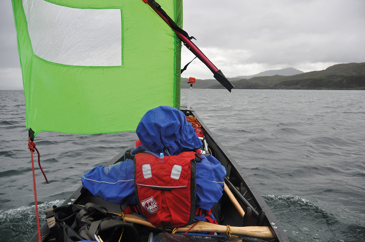
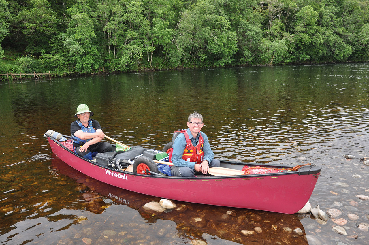
The wind was buffeting my tent, but the rain hadn’t started (yet). The wind was directly from the south so we could run up the inside of a chain of reefs and islands. Time for a bit of sailing. Al moved his position back in the canoe to give us a bow light trim. Everything was now in our favour for the run-up to Loch Morar.
With high tide early in the morning, we could cut through what otherwise would be big dry beaches connecting the islands. Outside of this chain, we could see white horses. The big first day was now paying off. Eventually, a turn took us into the stunning, but short, estuary of the River Morar. We even had to drop sail and paddle before hauling the canoe out and putting it back on its trolly. The River Morar, with its weir and falls, is far too steep to work a boat up. It is a short pull up a steep little road to get back to a launch and paddlable water.
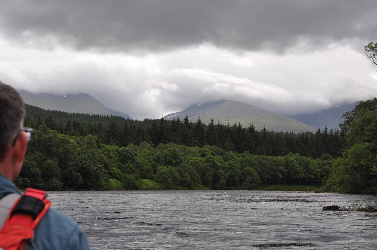
The rain had started, and we had 3km of open loch before we could get into the shelter of the south shore. We were getting buffeted and had to pull hard on our paddles. Even with such a short fetch, waves were building, and we picked our way from island to island before a final kilometre of open water to the south shore of Loch Morar. With the loch running west to east, we were now, mostly, sheltered from the strong winds. We paddled away hugging the shore. All the time the spectacular scenery drew us eastward, all the time the rain fell.

Oban Bothy
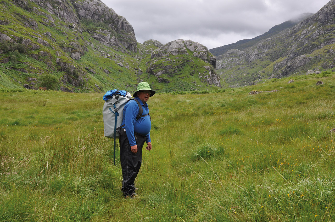
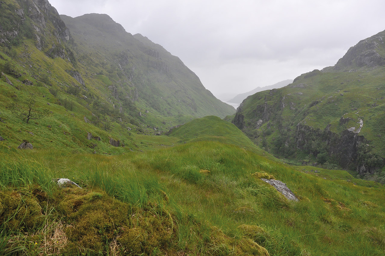
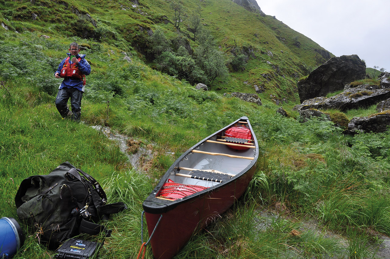
A motor launch passed us, waves were exchanged, and we plodded on. Finally, 18 km of the loch was coming to an end, and Oban Bothy came in sight as well as the bleak and rugged valley at its head, Gleann an Obain Bhig. Not a view for the faint-hearted to get a canoe up and over the heights of land.
At the small jetty, the launch was tied up. It was still early in the afternoon. There was time to get the canoe and some gear up to the pass. The boat passengers appeared from the bothy (hut). It was the laird, his gillie and a couple of other folks. They were chatty and soon wanted our plan explained. The laird and his gillie couldn’t contain their incredulity. I explained that we would follow the old stalking path. The laird’s face broke into a broad grin, “Path? The path that disappeared years ago?” It was apparent they were amused by what we were about to face.
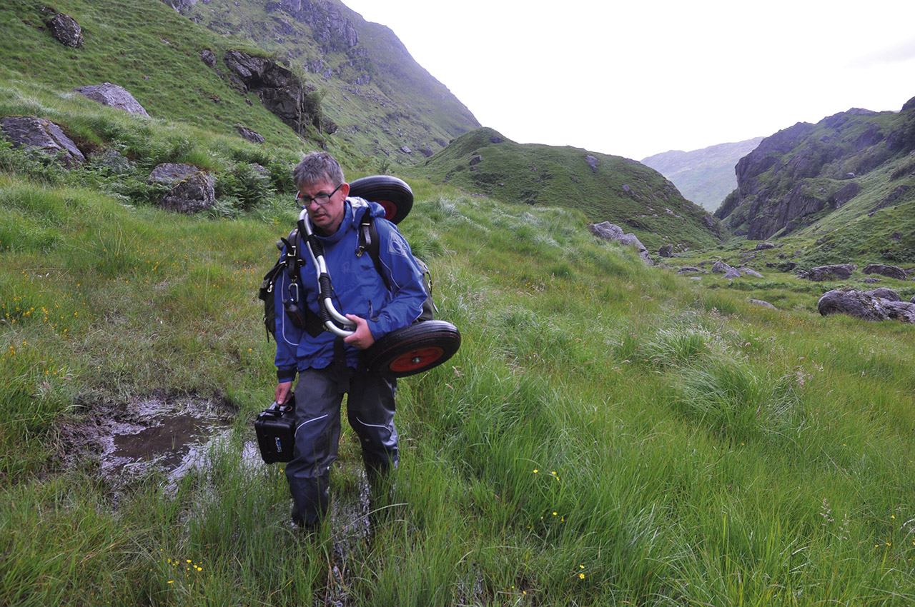
Al was also to be disappointed. He had fond thoughts of using the trolley. I had previous with this glen and knew it would be just another thing to carry. Ah yes, we now hit another problem, Al informed me that his shoulders couldn’t manage the canoe. I would have to carry it the whole way, some 2 km and gaining 140 metres in height. I was going to be a lot shorter at the end of that.
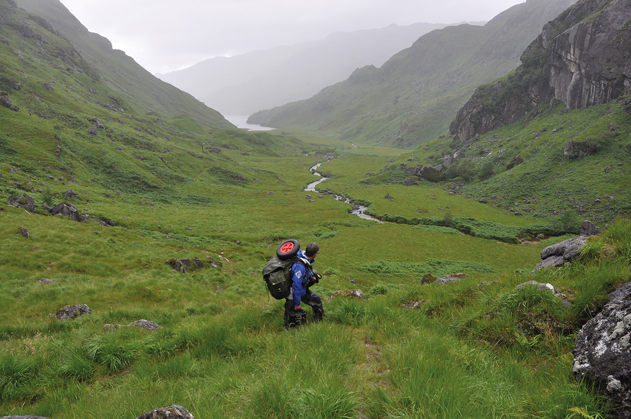
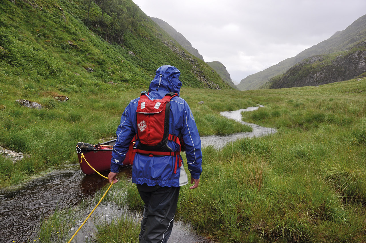
The rain was now heavier, and the laird was right the path, so nicely marked on the map, no longer existed except on the steeper sections. All the flat land was saturated or bog, fortunately, we were still sheltered from the wind. Al didn’t escape the pain though; he had a traditional Canadian canvas portage pack loaded with paddling kit and anything else we wouldn’t need this night, along with the redundant canoe trolley hooked over his shoulders. As he walked, the canvas increased in weight as it soaked up the rain. He might not be carrying the canoe but was sharing in the brutality.
Finally, we reached the high point. Initially, we had intended to take the kit further, but the final stream was now an impassable torrent. Far too steep and powerful to attempt a crossing. We found a place amidst the boulders to tie the canoe down, left the kit under it and retreated down to the bothy, now wading what had been small streams. Up to my waist at one point, but it didn’t make any difference to my comfort, not a single stitch of clothing was dry anymore.
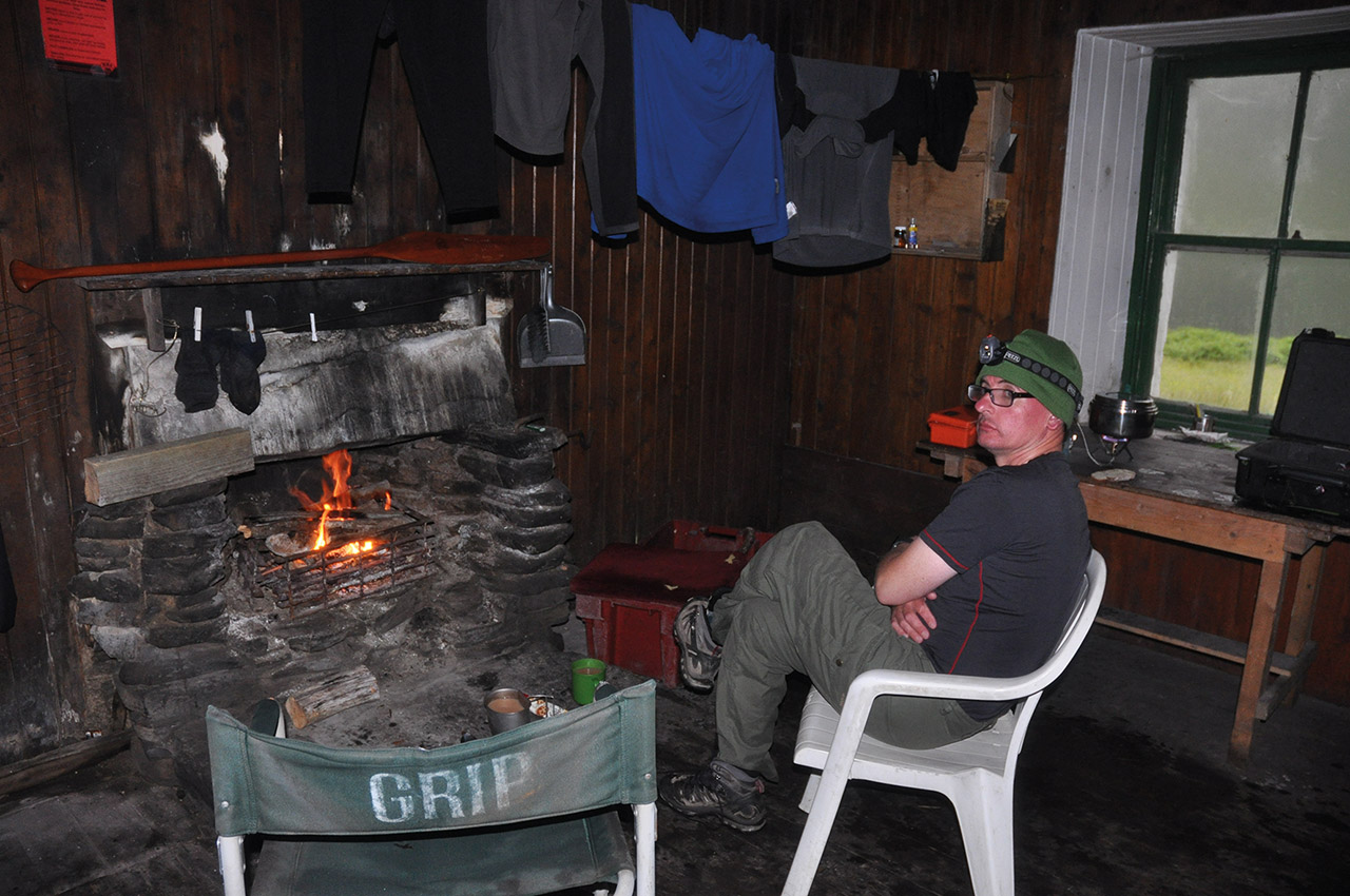
Oban bothy was a welcome retreat. We could hang the clothes, and kit up and there was even some firewood. At least the night would be dry and comfortable. (NOTE: Oban bothy is locked and shuttered in the main deer stalking season otherwise you are free to use it).
Day three:
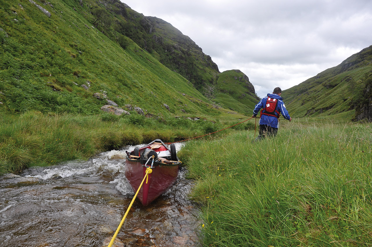
Back up the hill, the loads were lighter, and the rain had stopped. The stream was now easily passable, but the ground was rough, and at one point we had to lower the canoe down a section. But it was short, and we were soon through to the very start of the River Pean. We were on our way downhill.
The worst portage ever? Well, not quite. Did I ever tell you…
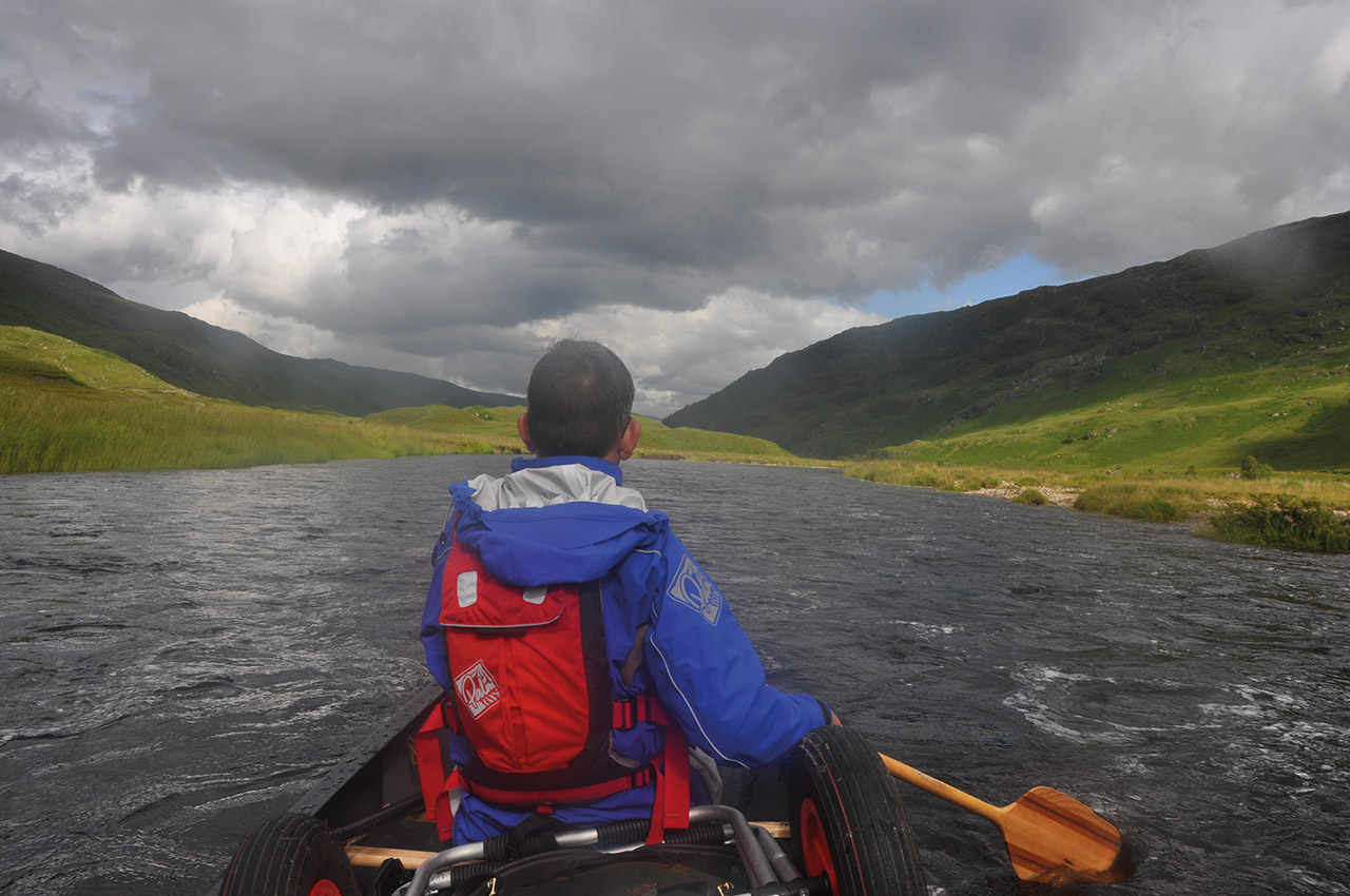
The start is on a stream barely wider than the canoe, and we needed to wade and line. Soon we were in the boat but bouncing off the sides with shoves, shoulder barges off a high bank and the occasional stoke. Soon it widened, and we were weaving our way down Glen Pean. We did not know this river and took it as we saw it. It was a full-on adventure mode, and we were both enjoying it. We crossed a small lochan as the rain and clouds came back in. The views behind were stunning.
Kilometres passed, one portage around a gorge like section but my body now felt broken from the day before, and I struggled to carry the canoe down the muddy track. Back on the water, we weaved on until we finally reach Loch Arkaig. Now exposed to the wind again, we tried sailing, but the direction kept shifting, and it was barely worth the effort. Paddles out again and we plodded on another 15 km until a sheltered spot offered a decent campsite. Tents up, brew on, as the midges came out to torment us. Al was not feeling good and retreated to his tent. I took him a midge infested mug of tea, and he sipped away at that, but he couldn’t eat any food. He had picked up a stomach bug.
Day four:
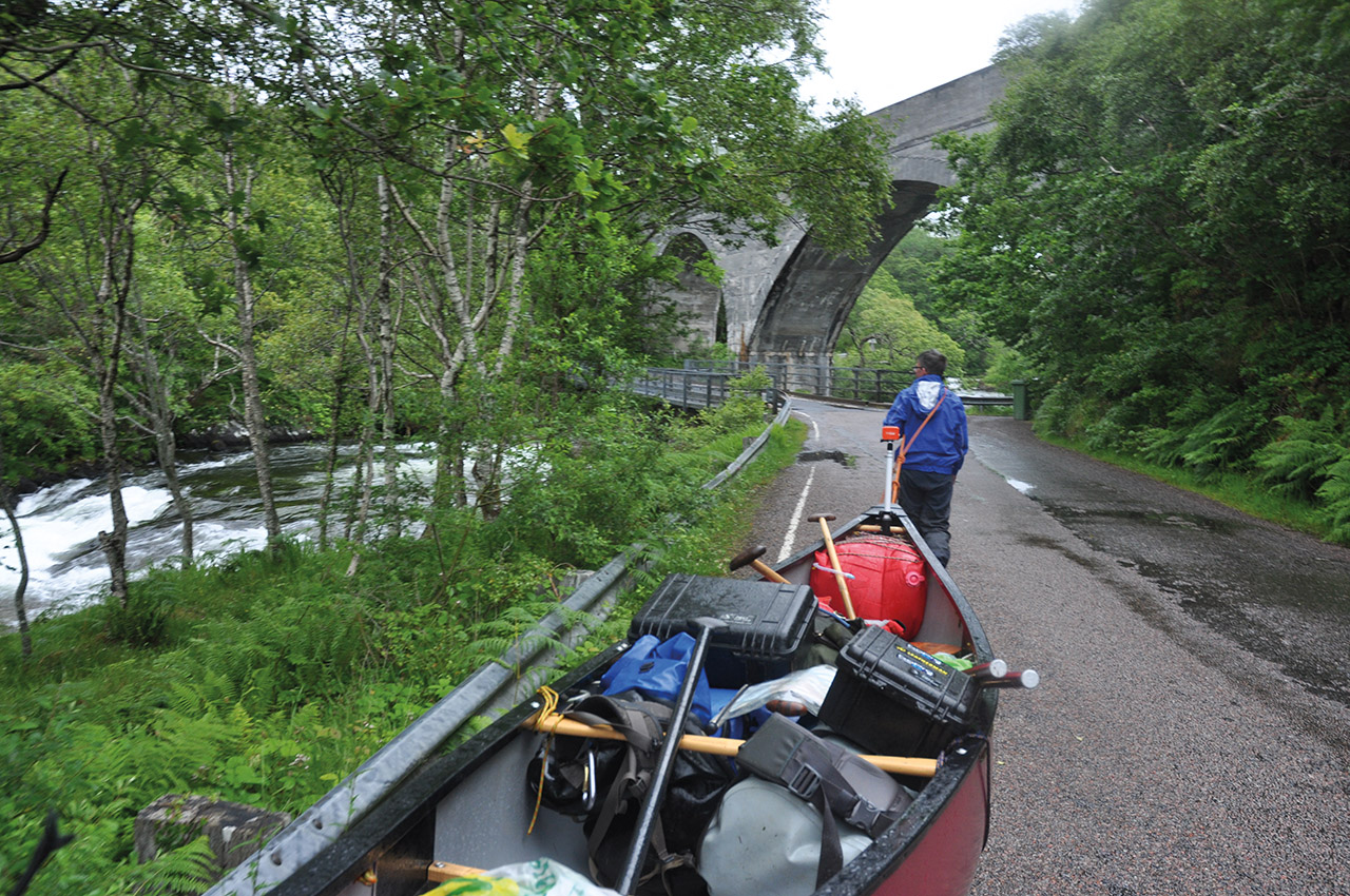
Only 3km to the end of the loch and we paddled down into the River Arkaig. I was had paddled here before and was aware of a weir and a much harder rapid. As we swung around a corner there, in front of us, were warning signs and a vast construction site. The weir was being replaced/repaired and a new hydro scheme as going in. The portage route was behind high fencing. We could only take to the road and trolley. I tried to find a way back to the river and even walked down to the posh estate house to get permission, but no one was answering the door. I didn’t fancy dragging the canoe across cut lawns so headed back down the road to drop onto the water further down.
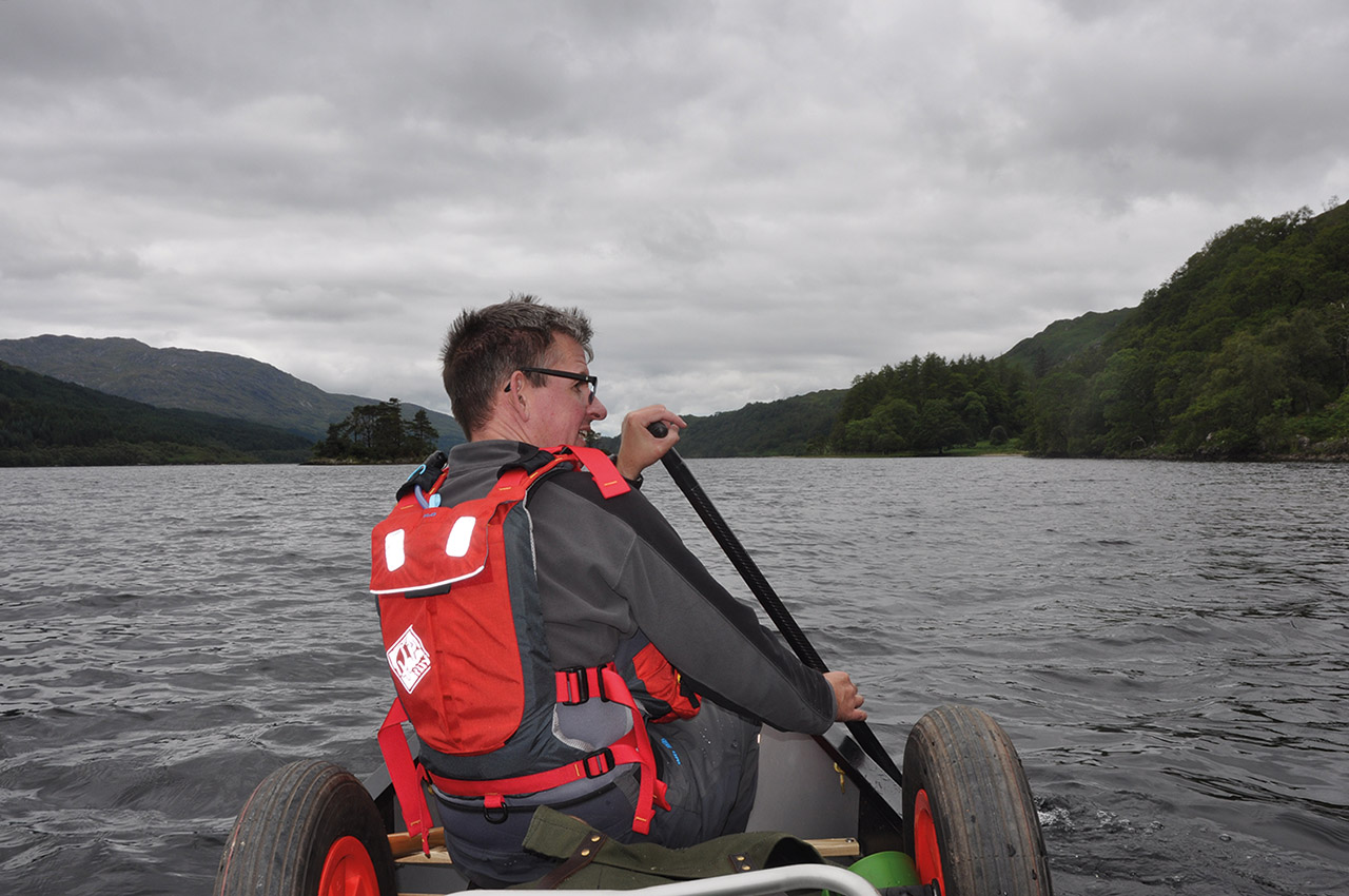
A quick paddle around the shore of Loch Lochy, We were now in the Great Glen. A short paddle around the shore of Loch Lochy and we were at the locks of the Caledonian Canal. It is not possible or advisable to paddle out of Loch Lochy into the River Lochy. So again a little trolleying and we were on the broad sweeps of the river. Al was now visibly wilting, the stomach bug had knocked him for six, and his energy levels were low. He kept paddling.
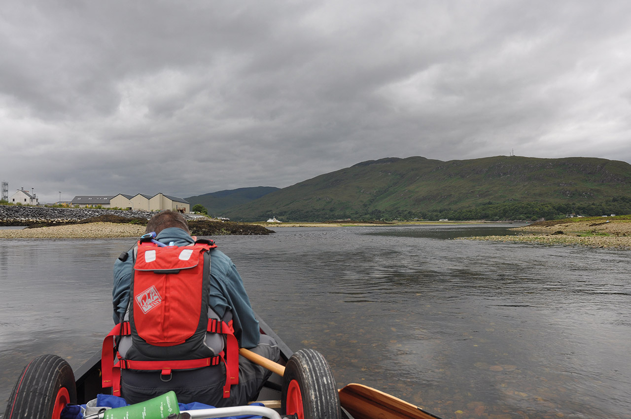
A quick scrape and drag to avoid the only harder rapid and we sped along and into Fort William. We were back on tidal waters. The original plan to close the circuit by paddling up Loch Eil was dropped. With Al poorly, it didn’t seem worth the effort.
I felt no disappointment. It was great to do the Morar to Glen Pean trip finally. We had dodged around the winds, and that felt good. Every bit of it was as spectacular as I expected, and my soul felt satisfied. It was time to finish.