WORDS & PHOTOS:
JOHN R. DEAN &
SAM N. DEAN
John R. Dean
Sam N. Dean
Paddling the west of Scotland 2
In the second part of this two-part series (the first part was in the August issue (https://paddlerezine.com/paddling-the-west-of-scotland/), we look at the most memorable places to paddle in the West of Scotland. Look at our final five choices of iconic paddling locations in the West of Scotland and see if you agree (or not). And if you haven’t visited any of them yet, why not plan a visit soon?
1. Loch Morar
Along the main Fort William to Mallaig road (A830), another fantastic location to paddle is Loch Morar. Take the road exit to Morar, cross the bridge over River Morar where the water level drops from the loch to the sea, and head to Bracora to reach the northern edge of the loch.
Parking is at a premium on the single-track road, but it is possible; just be mindful of other users and residents. Access (and egress) at this eastern edge of the loch provides some interesting islands to both paddle around and shelter from the wind.
Loch Morar is the fifth-largest loch by surface area in Scotland, at 26.7 km2. It is 18.8 km long, but perhaps more surprising and interesting is that it is the deepest freshwater body of water in the British Isles, with a maximum depth of 310 m. The glacially formed landscape also has a surface elevation of nine metres above sea level.
It separates the traditional district of north Morar (which contains the village of Morar) from Arisaig and Moidart. It even has its own monster, not as famous as Nessie of Loch Ness, but named Morag.
As you paddle its length, you notice that the low-lying coastal west end hills give way to steep-sided mountains as you progress in an easterly direction. For those looking for overnight shelter after a day’s paddle, the Oban Bothy is located at the top end of the Loch, on a sandy outcrop on the southern shoreline.
An alternate or add-on detour is also possible along the Loch. Around 30% the length of the loch (from Morar), you will find a mountain pass which, with a bit of effort, you can portage, via an up-and-down track, from Loch Morar to the sea loch of Loch Nevis, at the hamlet of Tarbet (there are many places in Scotland called Tarbet).
Then you can spend some time by turning right and continuing along to the end of Loch Nevis, with the Munro mountains of Sgurr na Ciche (1040 m) and Garbh Chioch Mhor (1013 m) in the distance.
Or continue in a more northerly direction from Tarbet and visit the remote peninsula of Knoydart at Inverie. Inverie has no road access. Continuing along the southern coastline, paddle onwards to the busy fishing port of Mallaig.
If this is the plan, you’ll need to leave a vehicle here, as it’s a long walk (approximately four miles) back to Morar along a busy road. A tourist boat covers the same route from Tarbet to Inverie to Mallaig.
Recommendation: A single day trip is possible, but to get the most out of the area, a multi-day expedition is a must. This would depend on weather, wind, and tide.
2. Loch Carron
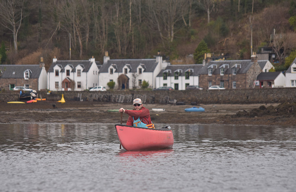
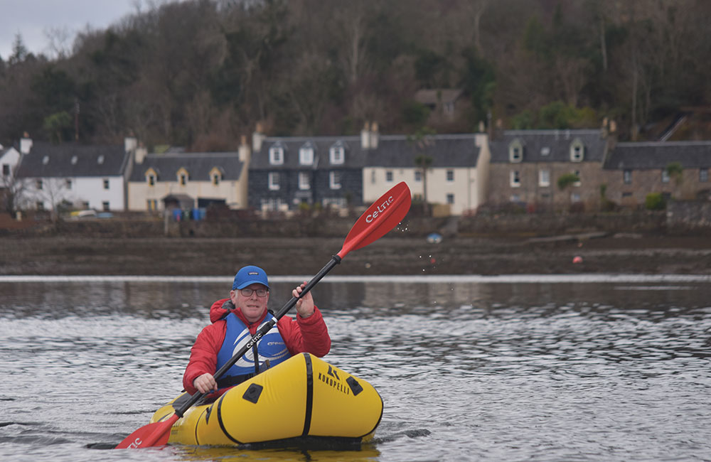
If you want a picture-perfect film set to start a short or long trip, think no further than Plockton, located on a sheltered inlet of Loch Carron. Loch Carron is a sea loch on the west coast of Ross and Cromarty in the Scottish Highlands, which separates the Lochalsh peninsula from the Applecross peninsula.
Plockton is located about 10 km northeast of the Kyle of Lochalsh (the gateway to the Isle of Skye) and is reached by road along single-track roads that go between Kyle of Lochalsh on the A87 and Achmore on the A890. The shoreline and bay, with small, coloured boats, and the more distant hills and woodland-covered shoreline all rise above the crystal-clear waters.
Plockton has featured in various television series, including Hamish Macbeth (starring Robert Carlyle) and the Inspector Alleyn Mysteries. It also appeared in the British folk-horror film The Wicker Man, starring Edward Woodward, Britt Ekland, Diane Cilento, Ingrid Pitt, and Christopher Lee.
The opening scenes where Sergeant Howie arrives in a small seaplane to the remote fictitious island of Summerisle to investigate the disappearance of a young girl, Rowan Morrison, are recognisably Plockton. But what makes it special when you arrive in Plockton is the presence of New Zealand cabbage trees (Cordyline australis), which have dominated Harbour Street (the main street) since the 1960s.
Strictly speaking, New Zealand cabbage trees are not true palms, but rather evergreen monocot trees from the asparagus family; however, locals and visitors alike often refer to them as ‘palm trees’. Cordyline australis (cabbage tree) thrive in Plockton due to the village’s microclimate, warmed significantly by the north Atlantic Drift (Gulf Stream).
The trees were introduced to Britain from New Zealand in 1823; Victorians favoured these hardy, exotic-looking plants for coastal gardens, and they became iconic in milder Scottish west coast locations as well as the southern coast of England, with their presence meaning the towns of Brixham, Paignton and Torquay are sometimes referred to as the English Riviera. Plockton is often described as having a distinctive ‘sub-tropical or Mediterranean appearance’.
A car park as you arrive at the seafront promenade (Harbour Road) on your right-hand side provides easy access to Loch Carron. The local tourist boat announces that if you do not see any seals on your trip, you will get your money back; it is a certainty that as you paddle into Loch Carron you will see them too.
Depending on the tides and weather, it is perfectly feasible to head northeast and further into the sea loch of Loch Carron towards the village of Lochcarron. Hugging the southern shore of Loch Carron will (hopefully) protect you from the weather, as you pass some small islands (a haunt for seals and seabirds), then through the narrowing that features the hamlet of Strome Ferry on the southern side, and Strome Castle on the northern side. Tidal currents can reach three knots in the narrows.
Beneath the cliffs at Strome Castle is the world’s largest flame shell bed, and this area has been designated as a Nature Conservation Marine Protected Area (NCMPA). The flame shell (Limaria hians) is a small saltwater clam, a marine bivalve mollusc, that resembles a scallop, with a bright orange fringe of tentacle-like filaments emerging from between the valves of its shell. It is native to the northeastern Atlantic Ocean, ranging from the Lofoten Islands in Norway to the Canary Islands, including the Mediterranean Sea.
The designation of this particular Marine Protected Area means that the use of fishing gear that may damage the seabed is prohibited. This is also a good time to move away from the main road (A890) side of the loch on the southern side and cross to the more remote northern side, and continue to the village of Lochcarron, and the wood-clad valley.
Provided you arrange a shuttle in advance, it is perfectly feasible to start at Lochcarron and paddle towards your egress point at Plockton. In this direction, you have the magnificence of viewing the Isle of Skye in the distance, and the Cuillin Mountain Range (provided you are fortunate enough with the weather to have a cloudless day).
Recommendation: A single-day trip can be done at a leisurely pace. This will depend on the weather, wind, and tide.
3. Loch Maree
The northwest Highlands have many lochs and rivers, but one highlight must be Loch Maree, located in Wester Ross. The loch is 22 km long and has a maximum width of four km, making it the fourth largest freshwater loch in Scotland, and it lies in a glacial trough up to 110 m deep.
It is the only freshwater loch in Scotland that has not been affected by large-scale forestry, fish farms or dams. It is approached along the A832 from Kinlochewe (in Scottish Gaelic meaning the ‘Head of Loch Ewe’) and just past the Beinn Eighe Visitor Centre (on the left-hand side), with parking at the Beinn Eighe National Nature Reserve, which has direct access (and egress) to Loch Maree on its southern edge.
This nature reserve is the oldest in Britain, established in 1951, and one of the largest at 48 km2. Alternatively, if paddling around the islands is your interest, you can park and access (and egress) further along the A832 at the car park at Slattadale, which is directly opposite the islands, and just before the A832 moves away from the loch side on its way to Gairloch and the sea outlet of the loch at Poolewe.
The eastern end of the loch is surrounded by mountains, and at least one Munro (higher than 914 m), Sgurr Tuill Bhain at 932 m. The northern edge of the loch is mainly tree-lined at the water’s edge, with the mountains steeply rising along its length. The southern edge continues the A832 along its length, with a shoreline that is a mixture of woodland and rocky outcrops. Around 70% the way along the loch, it opens out, and this is where most of the larger islands are located.
Because of their remoteness and location, the islands of Loch Maree are nationally and internationally protected and are a designated National Nature Reserve. The Loch is reported to have 66 islands. The islands are also noted for their rare ancient Caledonian pine forest. The islands are also noted for their very rare plants, insects, and bird habitats, and have special protection.
Of note are the Black-throated divers, which are ‘Schedule 1’ birds, meaning they are legally protected during the breeding season. However, Nature Scotland has developed a Code of Conduct that provides local access guidance for non-motorised craft to come and enjoy this unique location. Camping is not allowed on the islands from April to August.
Best practice advice for paddlers
- Be vigilant – from April – August, we advise that when out paddling, you remain vigilant and look out for Black-throated divers and other wildlife. If you see a black-throated diver, then it is best to paddle away from the bird(s) calmly, especially if you are close to the islands.
- Keeping on the move at a steady pace is likely to minimise disturbance to these birds.
- Paddle at a safe distance from wildlife. Try not to surround wild animals or block exit routes. If animals change their behaviour in reaction to your presence, then move away.
- Try to keep noise and sudden movements to a minimum.
- Look, then move on; don’t linger for too long. If you plan to stop near the shore, or are looking to land on an island, it is best to view the area from a distance (ideally with binoculars) and approach slowly to ensure there are no divers in the area. If you see any divers on land, or moving into the water from land, then you should immediately move away from the area quickly and calmly.
Note: Nature Scotland welcomes responsible access on Loch Maree all year, but if you are planning a visit and would like more time on the islands, we advise you to visit from September to March.
Agreeing and complying with this guidance will preserve this unique habitat for future paddlers, and it really is a special place. You should also be aware of the weather, as the steep sides of the loch valley can cause unique wind direction changes, providing an opportunity to sail from your sea kayak, canoe, packraft, or SUP.
The largest island, Eilean Sùbhainn, has a unique feature all its own: a loch which itself contains an island, a situation that occurs nowhere else in Great Britain. Isle Maol Rubha has the remains of a Pre-Reformation chapel and Christian pilgrimage shrine believed to be the 8th-century hermitage of Saint Máel Ruba (d. 722), from which the loch’s name is derived. I also suspect a little-known fact about Loch Maree: it has been reported to have its own monster, Muc-sheilch(e), which translates as “turtle-pig.”
For those who like a bit of history, a visit to the small museum (Arctic Convoy Museum) at Aultbea (it is 21 miles from Slattadale) tells the story of the north Atlantic Convoys and how merchant ships, escorted by warships and with air cover, maintained a supply of food for Russia via the ports of Murmansk and Archangel, between 1941-1945, from its home base of Loch Ewe. The path chosen, while direct, allowed the ships to pass between the Norwegian coast and the Arctic pack ice. As the Germans occupied Norway at this time, the journey was perilous due to attacks and the weather.
Recommendation: A single or multi-day expedition, but do note the restrictions on camping on the islands.
4. Loch Veyatie circuit
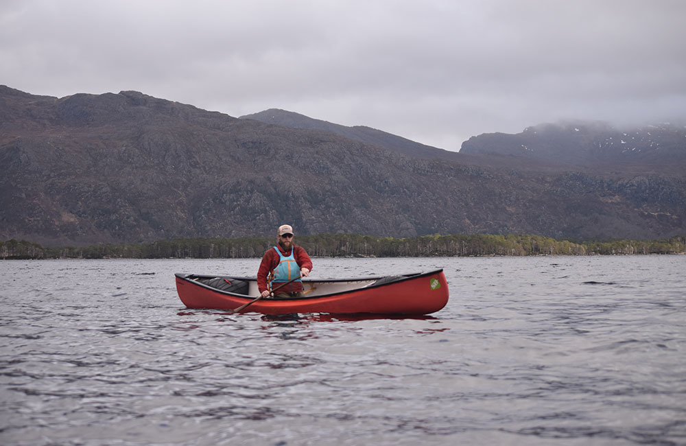
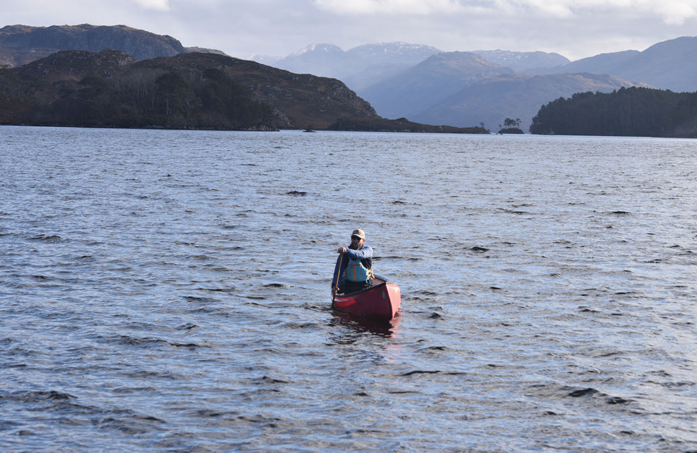
Want a more strenuous, wilderness experience with the opportunity to paddle some glorious lochs in the presence of some of the most iconic mountains in Scotland? Then this expedition trip, or a part of it, is for you.
It all starts north of Ullapool in Sutherland, the northwest Highlands. As you drive north, fortunately, at this point, still on a two-way road (A835), you will arrive at the hamlet of Elphin. Access to Loch Veyatie was previously gained by enquiring with Ledmore Estate, which allowed loch-side access via their fishing track; however, the estate has been sold, and access is currently unclear.
However, it is certainly possible to drive a short distance further north and access the loch system at Cam Loch. A short portage from Cam Loch, via a rugged track alongside the connecting river that drops quite a few metres, provides access into Loch Veyatie.
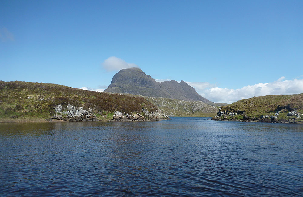
Once on Loch Veyatie, you enter a landscape of mountains and wooded loch valley, with, at its end on the northern side, one of the most distinctive mountains in Scotland: Suilven. Suilven sits in an isolated, desolate landscape of moors, bogs and lochs known as Inverpolly, which almost certainly adds to its appearance of standing alone.
The mountain forms a ridge of steep sides about two km long, with the highest point, known as the Caisteal Liath, or ‘the grey castle’, at the north-western end of the ridge.
There are two other summits, Meall Meadhonach (‘Half Round Hill’) at the central point of the 723 m high ridge, and Meall Beag (‘Little Round Hill’) located at the southeastern end. If the desire takes you, walking to the summit of Suilven from a base campsite can certainly add to your expedition in this area.
If that is not your intention, and viewing Suilven at a distance is your preference, you should follow the southern shoreline and turn left into a large inlet, which, depending on water levels, may have a sand bar within it. Beyond the sand bar, you enter Loch a’ Mhadail. By egressing in the corner, we then portaged up a small grassy bank to identify a valley containing a watercourse, in the most boggy, marshy land possible.
After what feels like an eternity of portaging, you come across a ruined building and the sight of a small loch (Loch na Clais), and a bit of respite from portaging. The joy of paddling across the loch adds to the expedition’s remoteness. Halfway down this small loch, we turned right, up the narrow track to a small gap in the hill, entered a small bay, and launched into Loch Sionascaig.
Loch Sionascaig is an area of outstanding natural beauty that lies at the centre of the Inverpolly National Nature Reserve. It is surrounded by many other lochs, with the large, forested areas of Inverpolly Forest to the south. Loch Sionascaig has numerous wooded islands, the largest being Eilean Mòr, which, in addition to offering plenty of places to camp, has a small hill rising to 116 m and providing excellent views of the surrounding area.
A worthwhile diversion at this point is to head southeast, up the connecting stream, via portage or by following it upstream, into Lochan Gainmheich, which connects to Loch an Doire Dhuibh. You have now entered the most spectacular and remarkable scenery possible.
These lochs lie beneath some of the highest mountains in the area, and all are picturesque. On the northeast side, the continuous mountain range starts with the 758 m Bod a Mhadail, then continues clockwise to the 849 m Cul Mor, next to the 828 m Creag nan Calman, the 566 m Cloch a Chuil Bhig, with the 769 m summit of Cul Beag immediately behind.
Following the mountain view round to the south, you view the iconic Stac Pollaidh (612 m), renowned for its spiky, ‘porcupine’ ridge of Torridonian sandstone at its peak, with many pinnacles and steep gullies. That feeling of being surrounded and enclosed by mountains on most sides is exhilarating. A return to Eilean Mòr provides the base for an overnight camp before a decision is required.
At this point you can return the way you came or change direction and continue with the exploration. On our trip, we headed northeast to Boat Bay, a short portage into Loch Baine Moir, and a final portage to a minor road and our shuttle. This minor road continues north to the main town in the area, Lochinver.
The area has many options to extend your expedition. From Loch Veyatie, instead of turning to the south and the inlet that led to Loch Sionascaig, you can continue paddling past Suilven, into Fionn Loch and the start of River Kirkaig, then take a walk along the track to view the spectacular waterfall that is the Falls of Kirkaig.
Another option is to exit Loch Sionascaig in its southwest corner and continue into Loch Ùidh Tarraigean and Loch na Dàil using the outflow from the larger loch and continue the journey via portaging onto the minor road, and heading south, or if sufficient water follows the River Polly (at least for lining a canoe).
However, the River Polly is a highly technical, shallow, rocky route that will only be runnable at high water levels. The final section after the road bridge near the fish farm may well have strainers and sluices that require extreme caution.
After a long portage along the minor road (the fish farm hatchery is about one km, with the first loch around a further four km), you will meet up with the Inverpolly Lochs of Loch Bad a’ Ghaill, which after a short portage enters Loch na h-Achlaise, and another short portage to the final loch, Loch Lurgainn.
It is worth egressing Loch Lurgainn at the large island on the north side, near the Stac Pollaidh car park, as the road becomes quite elevated to the loch the further east that you go, making the portage more excessive. This car park is also the start of the trip for those planning on walking up Stac Pollaidh.
Recommendation: A true multi-day expedition (3-5 days) away from the main road and in a true wilderness of outstanding natural beauty. This would be weather, wind, and tide-dependent, depending on the route taken.
5. Loch Assynt
Loch Assynt is a freshwater loch in Sutherland, Scotland, eight km north-east of Lochinver. The loch is 10 km long, with a maximum breadth of 1.5 km. Loch Assynt is located at the point where the A837 Lochinver-Lairg road meets the A894 to Durness, 16 kms east of Lochinver at Skiag Bridge. Sitting between the mountains of Canisp (847 m), Quinag (808 m), and Beinn Uidhe (734 m), its position is spectacular.
The loch discharges into the sea at Loch Inver, via the river Inver. The general trend of the loch is west-northwest and east-southeast, while the western end bends sharply at Loch Assynt Lodge to the southwest. In addition to the mountain scenery, Loch Assynt is home to the ruins of Ardvreck Castle (just south of the A837/A894 junction), which sits on a promontory on the north shore, west of Inchnadamph.
The castle dates to about 1490, when the Macleods of Assynt owned the lands. Its history, however, is a little tarnished. On 27 April 1650, the Marquis of Montrose, fighting for the Royalist cause, lost the battle of Carbisdale to a much smaller Covenanter army. His flight brought him, two days later, to Ardvreck Castle, where he sought sanctuary with Neil Macleod of Assynt.
Unfortunately for him, Neil was not at home, and his wife, Christine, tricked Montrose into the castle dungeon and sent for Government troops. Montrose was taken to Edinburgh, where he was executed on 21 May 1650. Please note that the castle ruins are in a dangerous state and should be approached with care. But the view from the loch is spectacular and, depending on the recent weather, can be enhanced by the Ardvreck Castle Waterfall, which flows into Loch Assynt right by the historic castle ruins.
Like many a loch in Scotland, Loch Assynt boasts the folklore tale relating to the MacLeods’ lost daughter, Eimhir, and her continued presence at the loch. Instead of jumping to her death, they believe Eimhir plunged into the caverns of the loch and, hiding from the devil to whom she was promised, made a new home beneath the water’s surface, becoming the elusive ‘mermaid of Assynt’ or selkie (half woman, half sea creature). But do not worry; the area has little in the way of tourist shops selling souvenirs.
As the prevailing wind is often from the west, it is a good idea to paddle from west to east. A good access point is near the dam that separates River Inver from Little Assynt/Loch Assynt. Provided you access the loch on its east side, the dam will be behind you and the open loch ahead of you, with the mountain scenery providing the opportunity for an enjoyable paddle.
The outflow of Loch Assynt is River Inver, which runs close by the main A837 road. The river flows for 10 kms from Loch Assynt to the sea at Lochinver. Under certain atmospheric conditions, it is possible to paddle the River Inver, but it is primarily a whitewater kayak trip with significant hazards (Grade 4/5), rather than a casual paddle.
Recommendation: The loch offers the option of either a single-day paddle or a more relaxed two-day paddle.
Footnote
Warning: paddling on open water, whether it be the sea or loch, can be hazardous. Beware of the sea state and conditions and do some tidal planning, as not only are the tidal ranges quite large in these areas, but it can make a difference to the length of the portage whether the tide is in or out. Check relevant websites and charts for predicted sea conditions.
Open water can appear harmless, but a sudden change of wind direction and strength can wreak havoc. So do check out the weather for the planned day of paddling. Rivers do need to be inspected for water levels, the presence of debris (strainers), as well as weirs and other manufactured obstructions.
Useful Resources:
Mallaig to Inverie to Tarbet by ferry (https://westernislescruises.co.uk/)
Loch Maree, NatureScot Local Access Guidance (https://www.nature.scot/lochmareeaccess).
Arctic Convoy Museum at Aultbea, north West Highlands (https://arcticconvoymuseum.org/).