
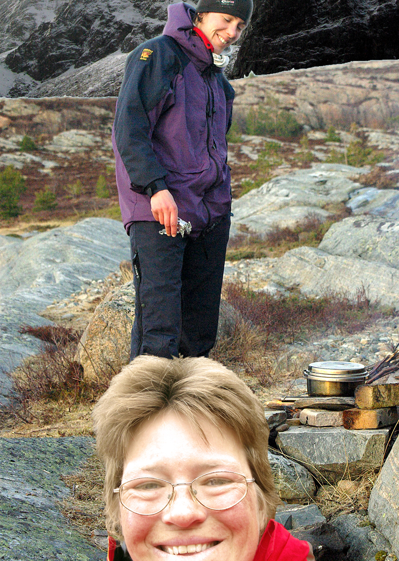
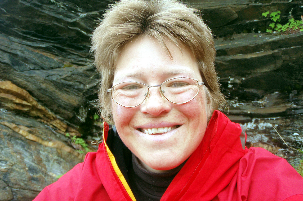
By Alice Courvoisier
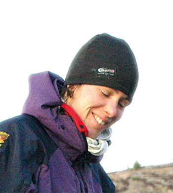
Alice Courvoisier
“Maybe we could paddle a wee bit along the Norwegian coast on the way there? It looks nice with all those islands and mountains,” I had suggested with naïve enthusiasm. Ruth wasn’t against the idea, so several years later, in 2010, we arrived in Trondheim with all our equipment. Before heading for the river, we had decided to visit the North Cape.
Nothing in our experience had prepared us for the size of swell we faced or for the overwhelming feeling of remoteness and inaccessibility. For the first time, we paddled in conditions that neither of us could reasonably assess nor felt comfortable with.
We caught up with Alice eight years later and she said, “What became clear to me following this journey was that being outside had to be part of how I lived, not just for weekends or holidays. I am now based on a small holding in Wales. The North still fascinates me and I have had the privilege to return to Lapland a few times over the last ten years, to explore areas we’d passed by too fast, even at kayaking speed, and I still long to visit again. Since this journey, I started to blog occasionally at www.adwonder.wordpress.org”
From Trondheim to the North Cape
A cold start
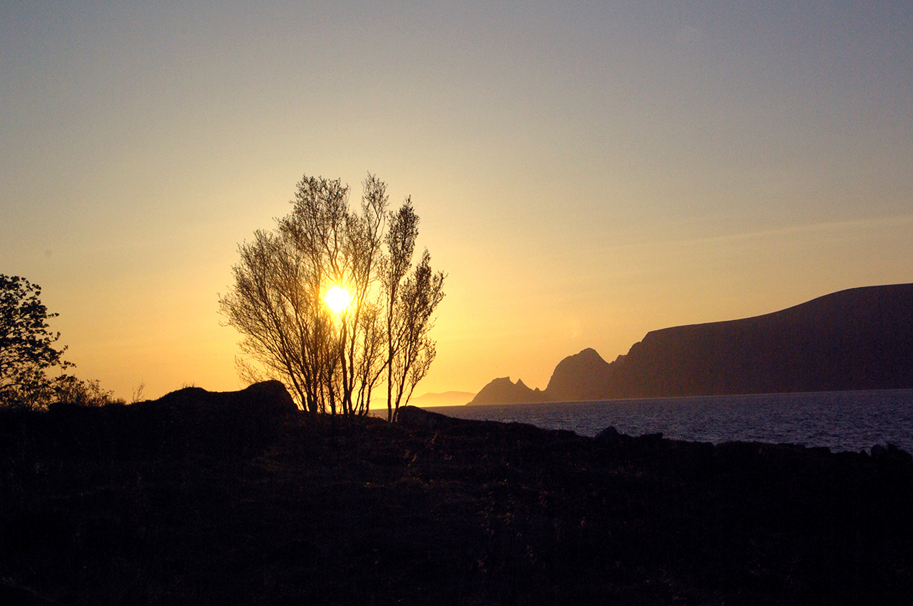
It takes us four hours of active packing under a grey sky before we are ready to depart. A timid sun welcomes us on the sea as we leave Trondheim harbour and paddle westward along the coast, past waterfalls still frozen to cold, barren rock. Dark green pines and purple birches stand out sharply against a backdrop of soft, golden larches. Then the weather closes in, and the landscape loses all colours, turning grey, shapeless, like a badly printed black and white picture. As night falls, we pitch the tent on a flat snowfield by a navigation light.
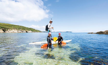
The following day, damp and drizzly, brings us to the mouth of the Trondheimsfjord and the next morning, to our great delight, the sun makes its first prominent appearance since our arrival in Norway. Heading out of the fjord, we see to the northwest a band of colourful houses that seem to levitate above the light blue sea. We head in their direction, sneak under a causeway, and follow the coast northwards, paddling on turquoise waters through the Grandefjæra nature reserve, home to seals and a rich avian life. It is March 28th and our journey to the North Cape has truly begun.
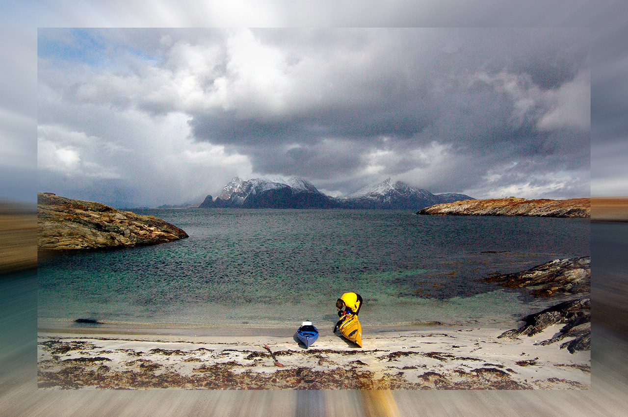
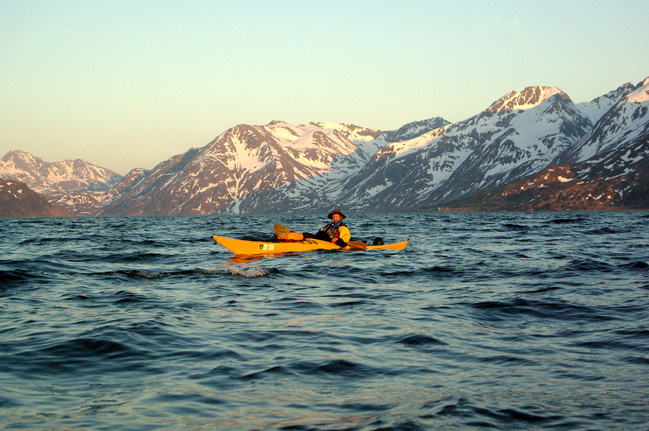
We have reached the skjærgård, a rampart of thousands of islands, rocks and skerries that protects the Norwegian mainland from the worst of the sea and allows for a relatively sheltered coastal passage. Clear days reveal a collection of small, barren islets to the west and snow-sprinkled, craggy hills to the east. We start noticing sea eagles, and the occasional otter: Ruth nearly bumps into a snoozing specimen one day, and watches fascinated as it dives deeper and deeper in the transparent sea underneath her kayak.
Stop and go
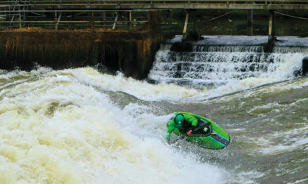
Our rest day is sunny and windy, we wash clothes, survey the equipment, recharge batteries. For dinner, Ruth concocts a delicious lentil, carrot and tomato stew, seasoned with herbs and topped with suet dumplings. Whilst on the move, menus are less elaborate, but we always make sure to have a hot lunch. At 3 o’clock in the afternoon, we catch the weather forecast on the VHF. We hear a few ‘frisk bris’ (force 5) and even a ‘kuling’ (force 6 to 8). Four hours later, as we shelter from the strengthening wind and rain in the tent, a gale warning is issued in English. The next day, we prepare to launch against all odds and, growing increasingly impatient, we finally leave at noon as conditions quieten. But the lull is short lived and a strong front quarter wind quickly develops, forcing us to stop after covering less than 7km.
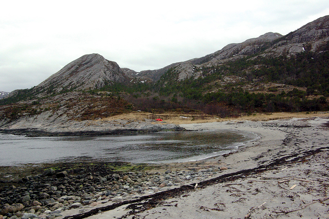
The Norwegian coast is well known to be deeply indented by fjords, ancient valleys carved by the action of the ice then flooded as the sea level rose. As a result, our daily paddles are punctuated with crossings a few kilometres wide as inlets of varied depths open up to our right. According to the map, we have now arrived close to the mouth of Skjørafjorden, so we walk along the shore to inspect the next crossing. The ground is boggy and covered with pastel-coloured mosses. Smooth, barren headlands jut out into the sea, isolating small rocky bays, sandy at low tide.
Inland, a sparse woodland of dwarfed, twisted pines and bare birches soon gives way to rugged cliffs. The place looks savage, with no other human trace than the occasional boat motoring past. Wearing our bright yellow storm cags over bulky buoyancy aids, we stick out of this wilderness like two Tweety Pies escaped from a Disney Park. Eventually, we discover that Skjørafjorden is a windswept expanse of water and reluctantly return to the kayaks to set up camp. We pitch the tent where we landed, on a small grassy beach littered with jetsam.
The next day, I open my eyes at 7.30, but decide it isn’t worth getting up just yet. I hope that by dozing a bit more, I will magically awaken to a windless day, but so far this has failed. The tent is shaking in every direction and there is little prospect of getting on the water any time soon, if at all today. In the end, we decide to explore our surroundings rather than get ready for a doubtful departure. It is a beautiful day: the wind has chased the clouds, sea eagles are soaring in blue skies and we enjoy great views of low-lying islands to the west. After a short walk, I feel warm enough for a shower in the nearby stream and soon we’re off with soap and towels.
The air is cold and windy, the water is icy and we fight the chill with many “uhs” and “ahs”. Ruth exclaims how much she relishes feeling the sun and wind on her skin. Then we notice the extended family walking in our direction. They form a group of about 25 people and must have witnessed our prancing around from afar. So much for the wilderness and isolation! We greet them shyly and retreat towards the tent, too intimidated by their number to start a conversation.
Visit to Utvorda
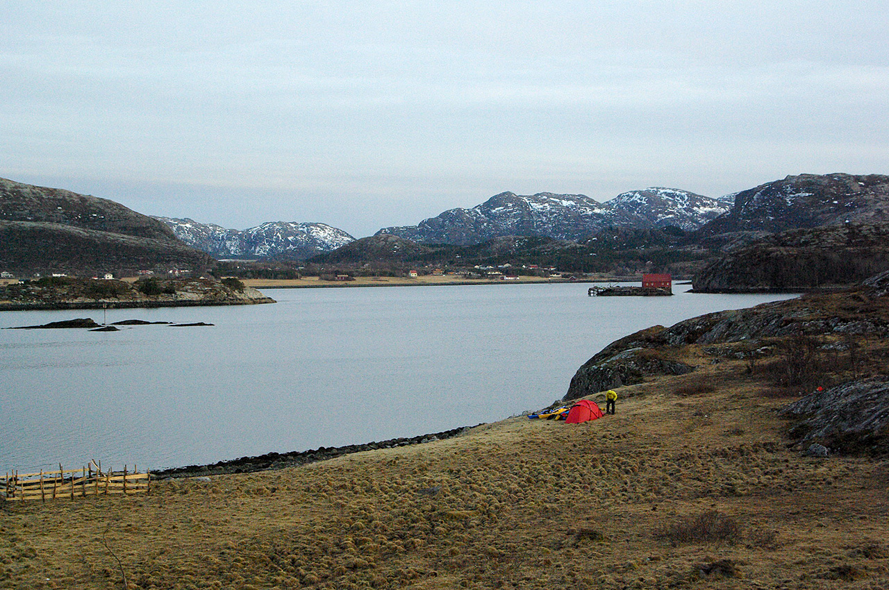
Over the next three days, conditions are calmer. We make good progress until we reach the southern side of the Namsosfjord, then strong winds are back. We are stuck at a place called Utvorda with, ahead of us, the exposed waters of Folda. In the evening, the owner of a nearby cabin suddenly materialises. Hans had not expected to meet campers this early in the year and isn’t surprised to find out that we are foreigners. Since the wind hasn’t abated, we visit him the following morning.
A candle is lit on the dining table; gentle heat comes from the wood burning stove; our mugs of coffee are steaming; through the window, we can see overfalls breaking over the shallows to the north-west. The conversation turns towards World War II, a topic difficult to avoid when following the Norwegian coastline, which is littered with the concrete remnants of Hitler’s Atlantic wall.
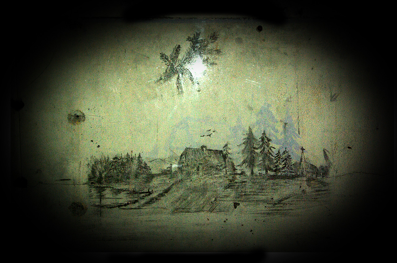
At Utvorda, the German fortifications were designed to protect the approach to Namsos. Torch in hand and armed with a map provided by Hans, we spend the afternoon exploring the site. We walk along trenches and underground tunnels, climb out of ringstands using rusty iron ladders, enter casemates and shelters with steel roofs and two-metre thick concrete walls. The command bunker is imposing. We penetrate the structure via a partly buried observation post at the top of a hill and walk three floors down a lengthy staircase into giant rooms blasted out of the rock.
In one of the many concrete rooms, protected by a piece of perspex, is an unsigned and undated drawing. It represents a thatched cottage in a strikingly peaceful setting. There are ploughed fields in the foreground and conifers reflected in calm lake waters to the left; hills are outlined behind a small water pump next to the house; four birds fly above the chimney; an avenue of cedars leads to a church spire on the right. Does this place exist? We imagine the artist to be a German soldier yearning for peace and a return home.
We finally leave Utvorda on April 8th. The next section of coastline is more exposed and, with no offshore islands large enough to protect us from the Norwegian seas, we travel in the deepest swell so far. Lumps of solid spume float by, a testimony to the strong winds and high seas of the previous days.
Foldfjorden itself is calm as a pond however, and we see our first porpoise, its sleek, black body knifing through the oily water surface. Further north, we journey through a maze of rocks and tiny islands east of the main shipping route through Nærøysundet, the narrow sound which separates the Vikna archipelago from the mainland. The sea to our port is grey, overcast with dark rain clouds and busy with traffic. In contrast, to starboard, fields and rolling hills shine yellow in the declining sun; an isolated white church, bright as a beacon, is a welcome landmark.
After approximately 35km, our record so far, we stop for the night on the island of Marøya. We pitch the tent on long, bent lyme grass in a very damp area. Water runs down the moss covered rocks nearby and, later in the evening, I can see my breath as I write my diary by torchlight.
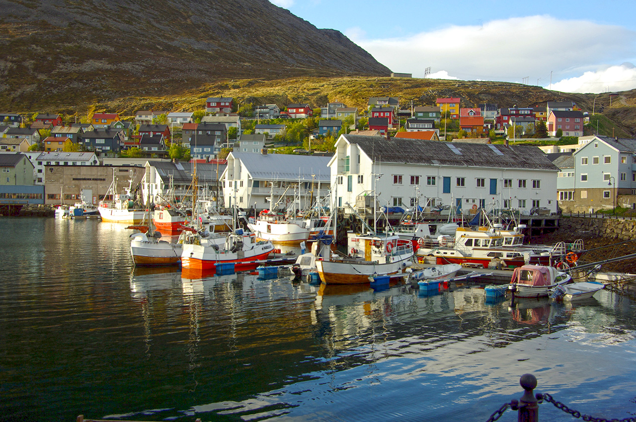
The next morning, low clouds slowly drift in the sky and we enter Rørvik harbour under light rain.
Ruth asks three Norwegian seamen whether we can moor the kayaks in the marina whilst shopping. In response, she is shown the guest harbour facilities and, after two weeks of wild camping in the cold, we can relish a hot shower. Conveniently, the shops we need are close by. We begin with the pharmacy, where I show my hands to two nonplussed chemists. Mysterious, red, swollen spots resembling insect bites have appeared on the back of them. They subsequently evolve into small blisters filled with clear yellow liquid and, once pierced and bloody, end up looking like tiny erupting volcanoes. The chemists blame exposure and sell me an antibacterial ointment to help the wounds heal. We then visit the supermarket to buy fresh products, and the petrol station to refill the fuel bottles. Shortly afterwards, we leave the guest harbour to spend a damp evening 10km further north.


Challenging days
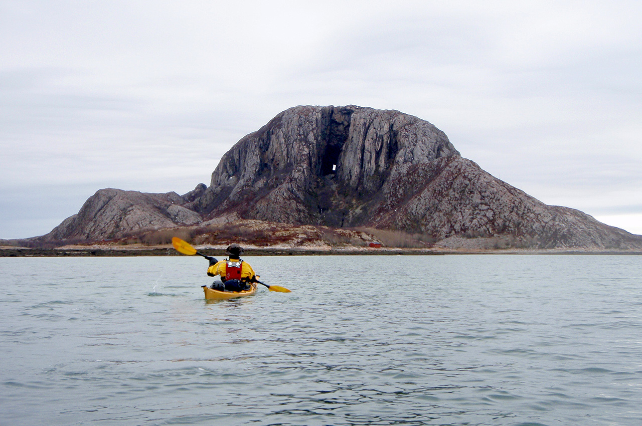
The following afternoon we get our first glimpse of Torghatten, a hat-shaped mountain with a 160-metre long hole running straight through it. Such a geographic oddity demands an explanation and geologists suggest that the gallery started as a sea cave, which rose as the land was relieved from the pressure of the ice some 10,000 years ago. For others what we see is the path of the Horseman’s arrow through the hat of the king of the Sømna mountain.
The Horseman’s intended target was the young maiden Lekamøya whom he wanted to ravish, then kill as she was about to escape him. The story’s characters are linked to distinctively shaped hills, which, in line with our own experience, provide mariners with extremely useful landmarks. It is possible that the legend of Torghatten was one of many tales used by ancient sailors to memorize and pass on their navigation knowledge at times when maps and charts didn’t exist.
A couple of cold but tranquil days bring us to the foot of Torghatten and we settle to camp a few kilometres short of Brønnøysund. The next morning, the stove refuses to start. We dismantle it, remove the soot, clean the jet following the instructions, but to no avail. In the end, we are forced into town to buy a replacement and somehow end up enjoying a hot shower at the welcoming harbour master’s office!
By the time we return to the water, the day has turned windy and rainy; the sea is choppy and white-capped; the landscape is alternately grey and yellow, following the succession of showers and brief sunny spells. On exiting Brønnøysund, we follow a rocky coastline with few landing spots. At twilight, we eventually find where to camp by a small harbour near a local ferry terminal.
Ruth’s feet are still suffering from the cold and the state of my hands is deteriorating. We are tired and slow, and the wet, windy weather impedes our progress. Two days after leaving Brønnøysund, we still haven’t arrived and conditions are such that I wear my storm cag and mittens throughout the day. By 7pm we can go no further, and with darkness approaching, we land on a pasture island 10km short of our destination.
More rain and wind greet us the following day. All we need is to head northwest, but against the westerly breeze, this proves hard work. Ruth’s kayak weathercocks badly in the cross wind, so we put a rope between us to act as a directional tow. Soon after, as we attempt to cross a slightly wider channel, we turn to paddle directly against the wind, battling for every metre. The towline has become a hindrance, we try to pack it away but it gets tangled, we lose ground, and I lose my temper.
Later, when this struggle is over and we are once more sheltered in the lee of an island, I apologise to Ruth. I could no longer cope and my behaviour could have been dangerous. We are however thankfully past the most exposed area and can hop between islands, fighting the wind in short bursts and remaining in somewhat sheltered waters. Another hour of zigzagging between low islets eventually brings us to Husvær as the sun pierces the clouds. Soon, a soft-spoken Bent Skauen shows us to our bedroom. We blink in disbelief at the beds covered in clean, white sheets and warm, thick duvets.
A welcome rest
Bent and Inge’s guesthouse is, as many describe, a ‘sea kayaker’s paradise’. They have worked hard over the past five years to turn an old fish factory into a truly hospitable haven for travellers, cosy, functional, and decorated with taste. Guests are rare at this time of the year and we have the place to ourselves. We spend three days talking to our hosts, enjoying hot showers, drinking fresh coffee and reflecting on our experience.
Over the past three weeks, we have come to realize that a long-distance sea kayaking expedition is as much about camp-craft and coping with outdoor life as it is about paddling. Perhaps more than outstanding kayaking skills, essential qualities would be resilience, patience and wonder. Resilience, or the flexibility to accept whatever the sea and weather throw at you with equanimity.
Patience, with external conditions of course, but also crucially with ourselves: the acceptance that as amateurs, we still had a lot to learn and would go at a slow pace. Wonder, or the ability to discover traces of eternity behind every fleeting instant, behind the flicker of a wave crest in the sun, behind the diminishing sound of a cormorant’s beating wing as it flies off in the distance. There are dangerous moments when we want to ‘have done’ the trip instead of simply ‘doing’ it. Clocking the miles brings moral support, but this should not be to the detriment of living our adventure as it unfolds. Wonder allows to freeze time, to be fully present to now.
We leave the guesthouse on April 18th, a glorious morning. A new leg of our journey is about to start. I am slightly apprehensive, but in high spirits: thanks to our hosts’ help and advice, I feel better prepared. In contrast, Ruth is homesick and weighed down by doubts, yet ready to carry on.
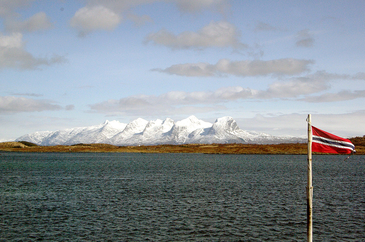
The landscape is bathed in sunshine. To our right, the snow covered peaks of the Seven Sisters (Lekamøya’s sisters) glow in the distance. In the foreground, across an expanse of royal blue waters, the wooden houses on Tenna form a thin line of primary colours that stretches along the horizon. However, following the weather pattern established over the last couple of days, a sudden change brings a blizzard that pushes us northwards.
By the time we land at the foot of Dønnmannen, the 860m high mountain that dominates the isle of Dønna, the wind has stirred the sea into a restless green expanse criss-crossed by white horses. Tall yellow grass on the shore bends softly in the gusts. Dønnmannen’s summit is lost in grey clouds, its dark flanks sprinkled with snow. We pitch the tent in between junipers bushes in a wood of thin, twisted birches, the only location somewhat protected from the relentless wind. Sleet showers race past our camp all evening and we fall asleep to the sound of hail drumming on the flysheet, missing somewhat the comforts of the guesthouse.
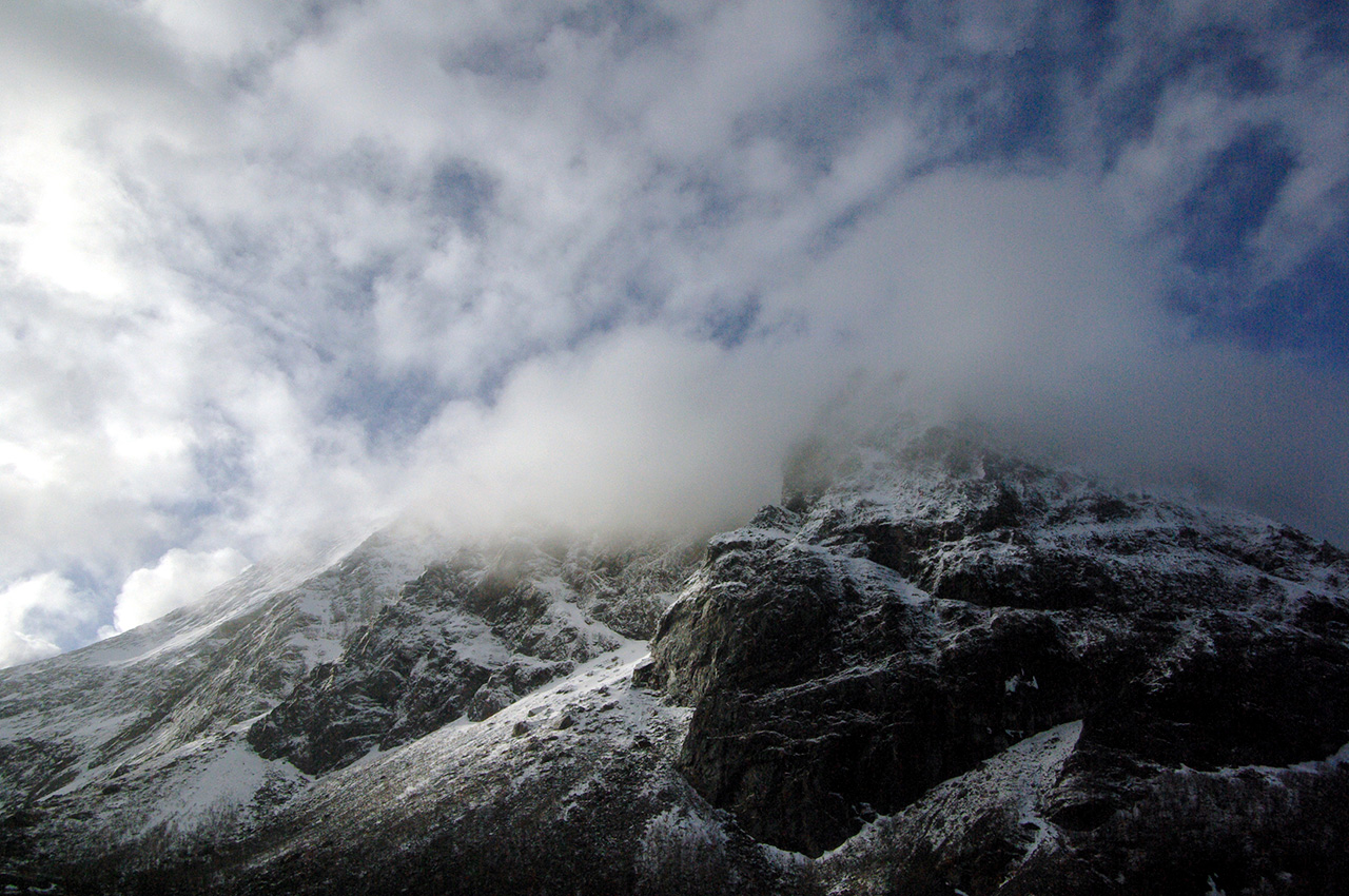
The next dawn is misty and damp, but the wind has dropped. Dønnmannen is still hidden when I get up. However, as I perform the morning chores, the clouds thin and spread, gradually uncovering scree slopes and sunlit rocks, their contours highlighted by a fine layer of snow. Every instant the lighting shifts, underlining different shapes of stones in an infinite combination of fractal patterns. I am in no doubt that Dønnmannen is alive. In turn, the mountain hides and reveals its curves, little by little showing more and more, while its summit remains concealed behind a nebulous and ethereal veil. A mountain’s morning striptease, as she gently welcomes the delicate, warm touch of the morning sun.
Although we launch in a slight headwind, the sea is peaceful once more. Yesterday’s waves have been replaced by gentle, transparent ripples that softly lap the shore. We follow the jagged coastline of Dønna northwards, crossing small fjords, zigzagging amongst skerries or rounding low promontories. Towering cumulonimbus drift past us in the distance. I keep glancing over my shoulder towards the alluring Dønnmannen, now a receding, black and white peak, shrouded in grey clouds that reflect the sunlight.
Three days later, we cross the Arctic circle on a beautiful, windless morning, and over the following days, settled conditions allow for steady progress through a landscape of flooded Alps. To starboard, the Svartisen mountains rise from the mainland, offering a grandiose scenery of contrasts, black rock against the whiteness of the snow, sharp ridges rising from creaseless slopes, their dark edges standing out against the pale blue sky. Fluffy cumulus hang atop summits, and we can’t tell where the snow ends and the sky begins.
This mountainous landscape isn’t restricted to the mainland as the skjærgård’s main islands en route to Bodø boast distinctive rocky summits, still sprinkled with snow in early spring. According to Norse mythology, Odin and his brothers slayed Ymir, the first frost-giant, and used his body to build the world. The story goes that the blood flowed so profusely from Ymir’s wounds, that the resulting deluge drowned all but one of the remaining frost-giants. Perhaps the brine had receded since then, as the water had in Genesis’ flood story, and the heads of the frost-giants had resurfaced, creating Helgeland’s original seascape.
Bodø and beyond
When we finally reach the southern side of the Saltfjord and views of the city of Bodø under gathering clouds, we know that our weather luck cannot last and prepare for an early start. Shortly after 5am, the dawn atmosphere is eerily quiet and suffused by a surreal glow. The ripple-free, light green sea meets with dark blue clouds on the western horizon, and sunlit rain curtains move silently across the bay. The wind finally arrives as we launch into Saltfjorden and increases steadily, driving sleet showers and generating sets of manageable, entertaining waves.
Eventually we reach the opposite side of the fjord, round its northern point, and enter Bodø’s small boat harbour in the sunshine. However what has been planned as a brief resupply stop turns into four days of stand still. Arriving on a Sunday when all but the smallest of shops are closed is bad timing, then the wind picks up and leaves us stranded, grateful for the hospitality of a local pensioner who lets us sleep in his boat and shower at his flat.
Bodø lies at the southern entrance to the Vestfjord, which separates mainland Norway from the Lofoten and Vesterålen archipelagos. There the skjærgård thins, the coastline is more exposed and our progress is dictated by the weather. Two days after leaving the town, we land in a small valley where an old, seemingly abandoned farmstead still stands. Ruth goes to investigate, only to be confronted by a herd of about twenty reindeer that swiftly disappear back into the woods, scared by the appearance of this odd, dripping, bee-coloured biped.
The place is extremely peaceful and we decide to enjoy the afternoon there, lulled into a reverie by the regular sound of the waves breaking on the silvery sand and the soft murmur of a nearby stream. A man walks past and his dog jumps happily on us, but we exchange few words. After doing some washing, I shelter in the tent with a book while Ruth enjoys a cigarette, sat on a rock, watching the sea. She is in good form and has regained some optimism. Later, we talk to an elderly lady who is delighted to meet people from England and recall her time as John Lennon’s neighbour in the 60s!
Most of the following day is spent fighting a cold headwind. The only way to stay warm is to keep moving. By the afternoon, we are zigzagging within a maze of skerries and islets, trusting that the channel markers will lead us out of this confusing labyrinth. Funnelled between islands, the wind only ripples the sea but makes any progress difficult. In the end, we give up the battle and land in a small bay at high tide.
The ground is hard and the breeze strong so we anchor the tent with rocks. As the sea ebbs, the water retreats to a few hundred yards from where we landed, replacing narrow fjords, constricted sounds, and isolated bays with large areas of sand and mud that stretch out towards the sea. To the south of were we camp, groups of dome-shaped, weather-beaten rock mounds, sparsely covered with light green moss rise from grassy bogs, like as many molehills.
The next morning certainly doesn’t feel like May. The wind is strong still as we venture across the next fjord. Steep, dark green waves assault our kayaks from random directions until we reach some shelter by a tiny sound at the tip of the next headland. In the meantime, the wind has picked up and snow started to fall. I feel that the conditions are beyond my comfort zone, but when we land, we see no protection, only grass, fields and a few houses in the distance. Eventually, we decide to look for shelter back the way we came. The afternoon’s weather remains very unsettled, alternating with no transition between blizzard and sunshine. As I sort the camp out, I watch the sea take on diverse shades of blue and green in response to the cloud’s rapid drift.
Sørdal
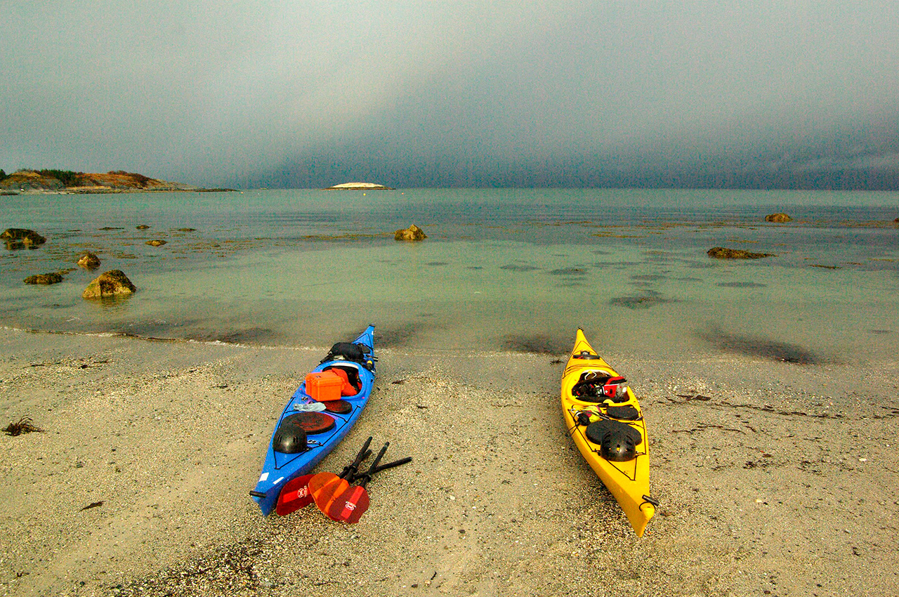
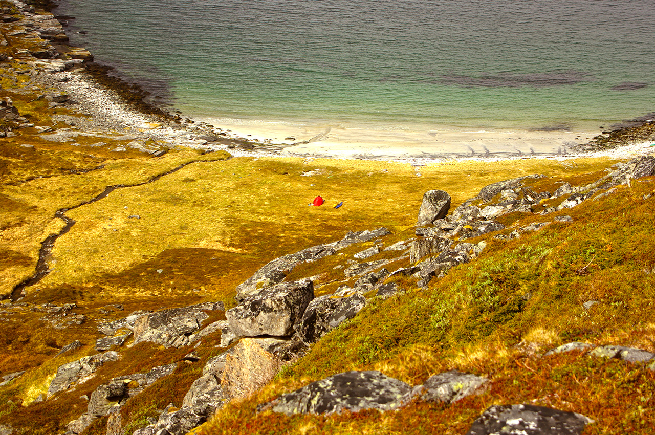
Conditions are calmer the next day. We reach an area of shallow seas amongst a collection of small islands that remind me of Arisaig in western Scotland. The sun shines, and we paddle on turquoise waters above sand and coral beaches. “It’s amazing, it looks as though the sea’s lit from below!” Ruth exclaims. Taking full advantage of the increasing southwesterly wind, we carry on past the island of Lundøya and aim for a place called Sørdal, an ‘abandoned settlement’ according to the map. We find a sandy beach at the end of a sheltered bay where we set up camp. Later, as we turn in to sleep, a fox runs noiselessly along the shoreline.
The following day brings wind and snow, and instead of packing up, we decide to walk towards Sørdal. We follow a narrow woodland path, which echoes with the sounds of birds and streams; spring is on its way, although this far north, at the beginning of May, buds are still struggling to come out. There are no roads to the settlement, only footpaths and an old forest track, with deep ruts and fallen trees across it.
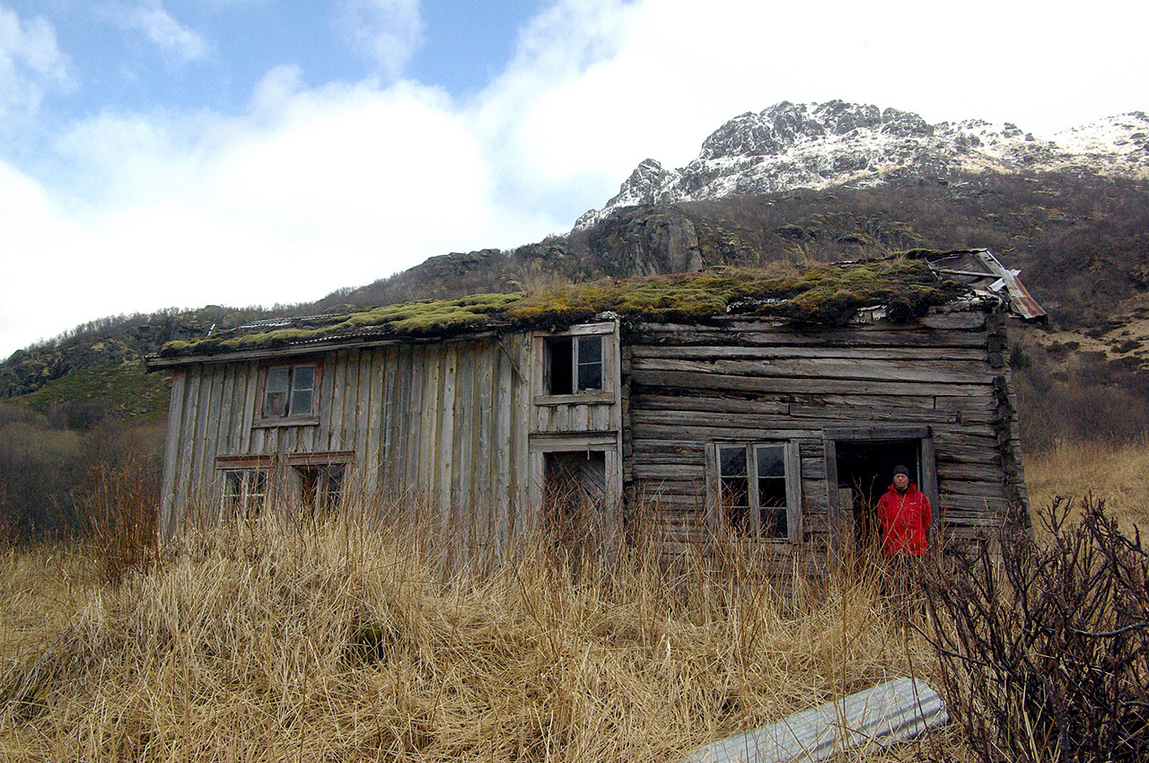
The place is accessed by sea during the summer months and close to the shore is a modern, well-maintained summer cabin equipped with photo-voltaics; there is no evidence that electricity otherwise reached this isolated valley. We see older constructions too and indications that the land used to be farmed; Ruth notices a vast number of raspberry canes and some large currant bushes.
Inland, towards the rising fells, a group of buildings particularly attract our attention. They are made of unpainted wood and roofed with corrugated iron covered by patches of bright green moss. Straw was used for insulation inside the walls, some of which had been covered by thick, painted paper panels sewn together. We climb a wide ladder to the first floor of the main house; one of the rooms is still furnished with a wooden cot and a narrow bed frame. Downstairs, the kitchen looks as if it has been abandoned in haste. The old cast iron stove is still there, with a pan and an egg-slicer rusting on top of it. On a shelf lies a dusty, yellow cardboard pot from a Dutch sugar beet company founded in 1919.
Close by is yet another set of buildings from a more recent period. The main house is white and covered by pale green metal roof; through a gap between drawn flowery curtains, we spy wallpaper with big floral prints and a rocking chair. Behind stands a large red-painted shed, part stable, with wooden troughs, part warehouse. Until a few decades ago, people could still subsist along these shores on a combination of fishing and farming. Small-scale primary industries started their decline with the government-led modernisation that followed by World War II.
Since then, looking for work, the inhabitants have moved towards more urbanised areas. This rural depopulation is starkly evidenced on our maps where empty black circles appear with increasing density as we progress northwards. They indicate deserted places, usually at isolated locations that no road ever reached and where, in our modern age, human life is no longer sustainable.
Visibility is low as we leave the dark green, shallow waters of the bay and enter the calm, grey expanse of Vestfjorden. To starboard, the rocky shore is shrouded in mist and clouds that slowly break up along the mountains’ sides. A gentle swell pushes us onwards and by lunchtime we paddle past the red and white tower of the Tranøy lighthouse. That evening, we watch the sun disappear behind the jagged crests of the Lofoten and Vesterålen; the blond yellow grass by the beach remains golden for a long time afterwards.
Norse mythology suggests that Odin and his brothers built Midgard, the dwelling of men, and surrounded it by a protective rampart made of Ymir’s eyelashes. I couldn’t think of a better description for the Lofoten skyline, densely packed with serrated peaks and improbable slopes that now stand out blue, against a pale, pink sky. Tomorrow, we will cross the Vestfjord. Part 2 next month.
Six weeks after leaving Trondheim, we have reached the end of the Vestfjord, which separates mainland Norway from the Lofoten and Vesterålen archipelagos. We are about half-way through our planned journey to the North Cape. It is the beginning of May, and spring is arriving in the Arctic.
The route to Tromsø
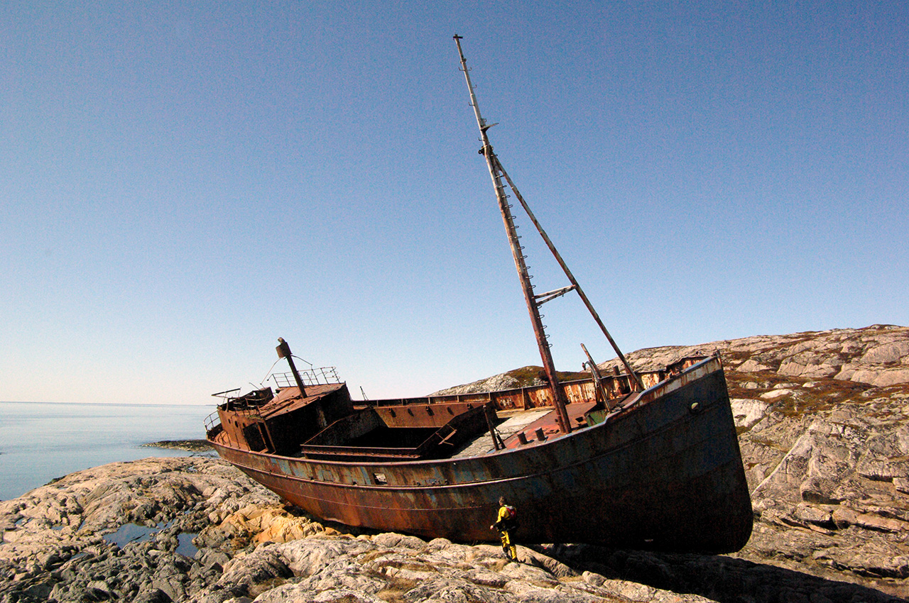
In the morning, for the first time, I am woken by heat as the sun shines brightly over the tent. Today, we are crossing the Vestfjord, which despite a mixed reputation, is flat as a mirror. En route, we land on the south-eastern corner of Barøya to explore the imposing wreck of a fishing vessel. The rusting boat is stood on the reddish rocks, its structure seems strangely intact, as if it is simply moored here, ready to leave again at the turn of the tide. To port, snowy summits recede behind one another as we head towards the southern entrance to Tjelsundet. The next day, a nine hour paddle taking advantage of the north-going tide brings us to the city of Harstad. We stay there for a few days, washing, resupplying, and visiting museums, grateful for the warm hospitality and invaluable advice of local sea kayakers.
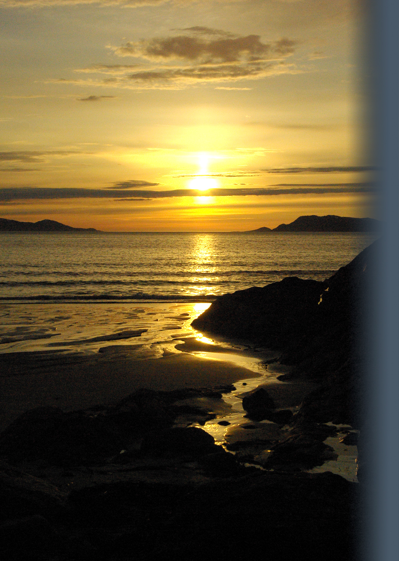
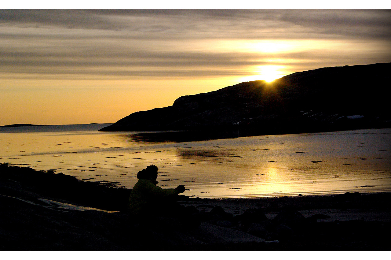
We resume our journey on a beautiful evening. Snowy peaks to the south-east are bathed in soft, pink tones; behind them subdued, violet clouds stretch along the horizon; in the foreground, a pastel blue sea reflects the evening sky. The tones are peaceful, nearly soothing. As I paddle, my blade sheds sparkling, pink droplets of water. When we land around midnight, the sun is still there, its golden disk illuminating the north-western horizon.
While we set up camp, it slips away very slowly under the sea, and by the time we are ready for bed, the sky has brightened up again in preparation for sunrise. It is early May at 67o North, twilight and dawn will soon become one.
We take four days to reach Tromsø via the inside route. The sheltered sounds we are travelling through are more populated, with roads and houses on both sides. Vigdis, a sea kayaking instructor we are in touch with, invites us for breakfast at her mother’s who lives about 40km from Tromsø.
The small kitchen table is covered with a number of delicacies to sample: dried lamb; various cheeses; home-made traditional cakes; smoked salmon, fished in local waters and prepared by an old neighbour according to a secret recipe; bread and jam, all accompanied with freshly brewed coffee; a very welcome feast, which we gratefully enjoy. The day is beautiful and, surprisingly, even the gentle easterly breeze is warm.
We reach the flat waters of Balsfjorden and catch the first glimpse of the city’s buildings in the distance. Ruth rolls a few times just to keep cool, and so do I, relishing the cold water trickling down my neck. As we approach Tromsø, the warm atmosphere, filled with noises of incredible intensity, begins to vibrate. Seagulls squawk; the eiderducks’ hooting and cooing is reverberated by the surrounding mountains; people shout from a beach nearby; motor boats, cars and aeroplanes pass by.
Families have pitched their tents and lit fires on Grindøya, a small island to the east of Tromsø; we are Saturday 15th May, the beginning of a long bank holiday weekend.
In the evening, we paddle past the airport and reach a boat house where Vigdis’s smiling friend Hilde meets us. She’s only wearing a vest and three-quarter length trousers, and I feel ridiculously overdressed in my dry-suit and wellies. Hilde brought us drinks and sandwiches, and patiently waits as we get changed and sort our kit out; in the bay we’ve just left, two kids manoeuvre a makeshift raft with long poles. The bulk of our equipment will remain in the boat house for a few days while we stay with the sister of a kayaking friend from York, enjoying the unusual heat and the National Day festivities, until we are ready to head further north, towards more exposed waters and the Cape.
Onwards towards Finnmark
The few days following our departure from Tromsø are overcast, cold and damp. We travel over greenish waters under leaden skies. The frequent drizzle, the dark, glistening scree slopes touching the sea, and a familiar looking beck remind Ruth of the Lake District. Grey hues dominate the scenery and at times, a wet mist surrounds us, blurring the horizon and shrinking space. The sombre mountains, partly hidden in grey veils, are shrouded in mysteries; shapes are guessed rather than seen, shifts in the clouds give the illusion of movement, and a space is left where trolls and fairies might appear. Sandy beaches are rarer and replaced by rocky shores or stretches of smooth pebbles.
More often now, we camp by lone, empty houses or deserted hamlets where pathways cleared of large stones allow for easier landings. The wind remains light and conditions settled, so we cross Ullsfjorden and the Lyngenfjord without mishap. At times, the sea is so calm that we see puffins from a distance, tiny, bath-toy figures that stand out sharply against a green-grey gloss. As we round the northern tip of the Lyngen peninsula, we spot rusty debris, torn on sharp rocks at the foot of an inhospitable, black crag. Only part of the boat is recognisable, testifying to an ongoing battle against the elements.
The sun returns when we reach Skjervøy, where we resupply before heading across Kvænangen towards the Loppa peninsula. That night we are camping north of 70° latitude and, less than a month before midsummer, we are truly in the land of the midnight sun. Darkness, even dawn and dusk, have become alien concepts; on clear days, the sun is omnipresent, relentless.
Foldfjorden itself
We decide to round the north-west corner of Loppa overnight. By 9pm, the vivid daylight has been replaced by a warm, golden radiance. Wet boulders shine along the shoreline; the cliff faces, partly covered in snow, have been painted pink by the low-lying sun. There is traffic in the distance, a yacht, a fishing boat, a cargo ship, black silhouettes outlined against a hazy, dark yellow horizon. Following the high water mark, a red fox trots gaily, intently sniffing the ground, appearing and disappearing amongst the rocks, oblivious of the two human figures watching nearby.
Later, as we turn south-east down Søndre Bergsfjorden to follow a V-shaped route skirting round the southern side of Silda, a small island off Loppa, a unexpected headwind slows our progress down to a wet crawl. This sudden change wakes us from our nocturnal reverie, as we have to fight our way forward until we find an acceptable spot to pitch the tent. It has gone 3am when we go to bed; in the north-east, the sun is on the rise again.
The wind remains powerful over the following days, forcing us off the water for long hours. Eventually, on a calm afternoon, we enter Stjernsundet, an avenue of light-blue water lined with majestic brown cliffs. We land on a beach of black sand by an empty cabin. I find two rusting stoves and an old Singer sewing machine half buried in the grass nearby. In the evening, we scramble up a moss-covered scree slope to take in the view.
We are now following the coast of Finnmark and the landscape has changed. The sharp peaks have given way to brown cliffs and high plateaux; the labyrinths of low-lying islets that bordered the coastline between Trondheim and Tromsø have been replaced by wide sounds separating large, indented islands; snow is still very present, highlighting the relief of the rocky faces. Close to the beach, we spot two reindeer grazing amongst young birches in leaf; their footprints mingle with those of oyster-catchers in the sand.
Patience
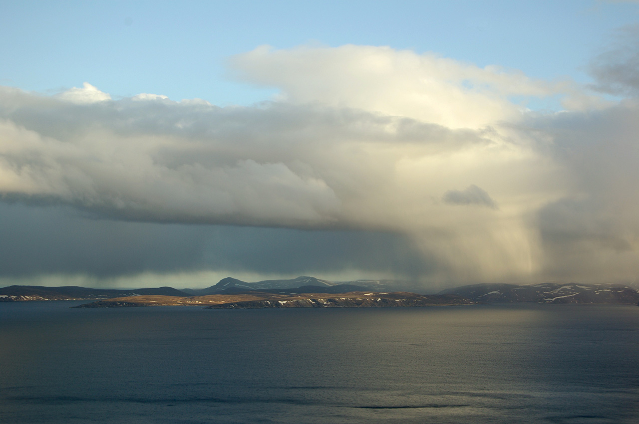
The weather stays variable and our progress irregular. On June 1st, we have reached the approach to Kvalsund; ahead the coastline is exposed all the way to the North Cape. We start the day by playing a few hands of cards in the tent as eastwards squalls speed by. When we launch tentatively in the afternoon, the wind is bitterly cold and even with our skegs down we have to work hard to prevent weather-cocking. My muscles tense with the effort, but I relish the challenge brought by the stormy conditions undaunted, wholly absorbed by the scenery.
The sun appears, disappears, re-appears, Nature’s own spotlight. Through gaps in the clouds, it sweeps land and sea with powerful shafts of light, emphasizing details in turn: a waterfall, a bright green valley, a white line of snow, an unexpected feature in the rocks, a shapely wave about to break. A rainbow forms in the east, along a shower curtain, it gets brighter and brighter before slowly fading away, leaving traces of colours to dry on the hillside. Lit by sunshine, soaked by rain and spray, freshened by the breeze, we are integral parts of this living landscape, a yellow dot and a blue dot tossed up and down by the waves.
In the evening, we land at high tide on a tiny shingle beach next to a stream. The land is barren, a desert of rock, moss and low bushes enlivened by tiny, pink mountain azaleas; reindeer are grazing in the distance, we can hear the ring of their leader’s bell. In the morning, we hurry to leave at high tide to avoid a difficult scramble on rocks. Ruth heads towards the stream to collect water and a while later, I see her limp back towards the tent with a twisted, swelling ankle. She bandages it, takes a few painkillers and copes silently.
Two days later, we reach a sandy beach near Havøysund and the next morning, in agreement with the forecast, the wind picks up. Our tent is successively light and dark, hot and cool as cloud patches drift overhead; it rains intermittently. The following three days blur into one. I am lucky to escape the confines of the tent and explore our close surroundings, but Ruth, hindered by her painful ankle, is stuck by the beach. Cards prove our main distraction.
In spite of the conditions, the landscape loses none of its appeal. One evening, we watch spellbound as crepuscular rays emerge from dark storm clouds, like powerful searchlights from an alien spacecraft. Short wanderings up moss covered grey rubble take me to the hills surrounding our camping spot, rarely, it seems, do I feel solid rock under my feet. I first go east towards a wide ridge called Boalonjárga, and follow it northwards until I overlook the sea. As the horizon opens up in front of me, I have the feeling of standing on a map. Below me, the wind-streaked sea is a tangle of dark and light silver strips that merge seamlessly into one another in response to the whims of the sky.
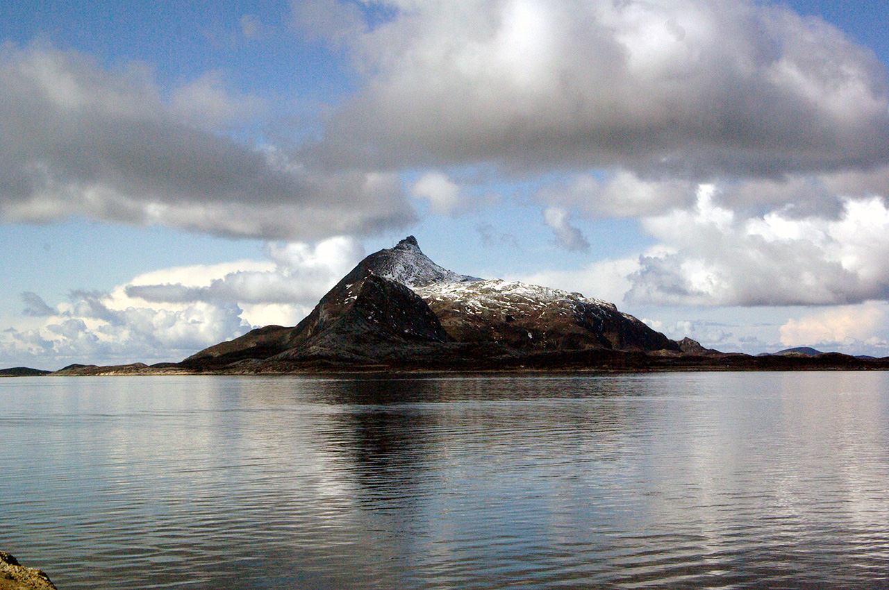
Barren, dark islands emerge from grey waters. The island of Havøya stretches to the north-west; bright-coloured houses cluster by the narrow sound that separates it from the mainland and provides boats with a reliable shelter; a green grass slope leads gently towards its highest point, only wind turbines stand tall there, trees do not grow at 71° N. To the east, behind Måsøya, the seagull’s isle, I spot the rugged cliffs of Magerøya, the meagre isle, where the North Cape lies.
Lying on a smooth, flat rock to protect myself from the wind, I watch intently as longer sunny spells reveal treasures of colours and nuances; the sea’s hues become bluer, then tinted with subtle traces of ochre; various shade of greens and rusty browns appear along the hillside; the grey rocks themselves have turned whiter, almost luminescent. The sun still shines when I walk back toward the camp. A few reindeer are grazing on the steep slopes enclosing the valley. Below, close to the beach, our red tent and yellow and blue kayaks stand out against the green tussock grass that surrounds them. A thin dark stream, winds its way towards the sea. From a distance, the emerald waters of the bay look deceptively peaceful.
A decision
For once in a long time, I do not sleep well. I listen to the wind, to raindrops hitting the flysheet, to the waves breaking on the shore. The weather isn’t improving and I ponder gloomily the perspective of spending a fourth day stuck on this desolate beach. In the end, we decide to head for Havøysund a few kilometres away to check the weather forecast. We launch around noon in a dark green sea.
A few people are out fishing; their small motorboats appear and disappear in the swell. We moor the kayaks in one of the small harbours and find the public library. It is rather small, located in a basement under a convenience store, but it is well furnished and has computers with good internet access. With apprehension, I search for an area marine forecast: it states that the calmest weather will be tomorrow night, then the wind is due to pick up again.
We’re back outside, heading for the kayaks, each waiting for the other to break the silence. In the end, we decide to go for it and set of nervously eastwards. The waves and swell are the biggest I have paddled in so far and regularly hide my surroundings behind dark, liquid walls. Intimidated at first, I slowly relax. The waves are not breaking and looking at the mainland to the right, I can see that we are making progress.
We cover the 10km crossing to Måsøya in less than two hours and decide to carry on and head for Magerøya, another 10km to the east. The ride is exhilarating; we are accompanied by flocks of cormorants, puffins and razorbills. Wave crests shine in the squally light, which outlines the relief of this ever-changing liquid landscape. We finally reach a place called Gråkollen on the east coast of Magerøya. It is 9pm and very cold. There are clear traces of ancient habitations amongst the tussock grass close to the beach; reindeer with their calves had been grazing nearby but fled as we approached.
Nordkapp
Apprehension and excitement keep Ruth awake at night. In the morning, there are sleet showers when the forecast had given hopes of sunshine. We slowly get ready and, as we paddle out of our sheltered bay, the head of a lone seal pops up between the waves. We make decent progress and arrive in sight of Gjesvær within two hours. Tourist boats circumnavigate the Gjesværstappan bird reserve, three small distinctively cake-shaped islands. The sheltered sea is deceptively calm, rays of sunshine are finally piercing the clouds and I feel secure, trying to believe that in a few hours, we will have safely rounded the North Cape. Surely, it cannot be that easy?
We set our course north-east. Squadrons of puffins and razorbills fly in tight formation around us, while others confer in small groups on the water. The amplitude of the swell increases steadily as we progress northwards; there are overfalls far off in the distance. As we travel past the next headland, from the top of the waves, we distinctly see a sandy beach. We recognise it as our planed lunch spot, which, we realise, will remain beyond reach since the north-easterly swell sends huge waves crashing on rocks by the shore.
It slowly dawns on us that, should we decide to carry on, we will not be able to land until we reach Skarsvåg, 20 kilometres away. In the current conditions, it seems that only a harbour will offer a safe enough landing spot. As we digest this new fact, two freak waves break unexpectedly close to our left with an enormous roar. This sends the adrenaline rushing and we rapidly paddle further out. Kayaking was enjoyable in the morning, now it has become downright scary. Ruth notices my unease,
“We don’t need to carry on, we can go back,” she says, half hoping I’d agree.
“We should still try though,” I reply, reluctant to give up despite the knot forming in my stomach and the uncontrollable fear rising inside.
We give the cliffs a widening berth and paddle uphill, downhill, uphill… and so on. There is little wind, no evidence of more waves breaking, no spume, just moving mounds of dark water. The cloud cover gives a pinkish glow to the afternoon light. The next headland is Knivskjelodden, at 71°11’08”, it reaches further north but is much less dramatic than the North Cape itself. It appears and disappears following the rhythm of the waves.
Our feeling of isolation increases when a fishing boat that was keeping pace with us finally turns around and vanishes off towards Gjesvær. We seem to progress dangerously slowly. I want this stretch done with and paddle as fast as I can sustain, shouting at Ruth to hurry, soaking myself with sweat. I keep steering northwards, away from the cliffs. “Ruth, please, let’s go further north!” I plead regularly, panic in my voice, and paddle even faster. She fears I’m off to Svalbard and struggles to reason with me; my reaction worries her more than the sea state.
Once past Knivskjelodden, a pair of gannets fly close by, as if to salute us. I am relieved and extremely happy to see to see these birds, as if receiving the unexpected visit from an old friend. They remind me of Flamborough Head, our favourite and oft visited kayaking spot on the Yorkshire coast. Their familiar presence reassures me: maybe it’s a good sign, maybe rounding Nordkapp is no more difficult than our local paddle after all? I relax slightly.
The famous cape is now visible in the distance with its 300-metre cliffs plunging straight towards the sea. We see the metal globe that marks its top and the breakers at its base. Buses filled with tourists are coming up along the road. As we eventually round the Cape we catch sight of Nordkapphornet sprouting from its side, a prominent rock formation sacred to the Sámi people.
The waves do not abate until we reach the entrance of Risfjorden, which leads to Skarsvåg, so we keep concentration levels high. As sunny spells succeed brief showers, we are treated to a sequence of magnificent rainbows. Ahead of us, golden cliffs shine through sunlit curtains of rain. Gradually, we relax, and laugh, and cry, and chat more casually. Tiredness suddenly overwhelms me and my legs struggle to function.
I am wet with sweat and cold and the little harbour seems very far still. Ruth copes courageously with sore feet and an aching right wrist; she had felt like the bones were coming out of their sockets in the morning, before the adrenaline kicked in. Then we arrive. Some men are preparing to go out fishing while others just returned. The cars nearby have German and Polish number plates.
Epilogue
Early the following day, bright sunlight is pouring through the window, heedless of the thin curtains, preventing me from returning to sleep. Or perhaps it is the coffee I drank until the small morning hours that now keeps me awake? The previous evening, local paddler Magnus had driven us to his home in Honningsvåg, and cooked us dinner. Then we chatted for hours, about Norway, about sea kayaking, about the North Cape, while the intense Arctic light shone relentlessly outside.
Ruth celebrated our arrival here by drinking a miniature Bowmore, which we’d dubbed the ‘Nordkapp whisky’, a gift from my mother on her last visit to York, Magnus drew from his own reserves of Glenfiddich, and I swallowed mugs of coffee whilst eating most of the large chocolate bar he bought for us.
The North Cape was given its famous name by Englishman Richard Chancellor as his ship passed the cliffs in 1553 whilst in search of a north-east passage to China. Since then, like any point at the edge of a map, it has come to symbolise the quintessential goal, a destination, which, if it isn’t reached, leaves an after-taste of unfinished business. A few days ago, we would never have guessed that our quest was to be over so suddenly. We have reached Honningsvåg, the exit port of Magerøya, after a single day of kayaking along the island’s cliffs and the aim that kept us going for over two months is no more.
We have been lucky. Kayaking along Finnmark’s exposed coastline and around the Cape meant treading the limits of what we had been ready to undertake and, in that sense, we had not been disappointed. Although our technical abilities hadn’t been tested, I had certainly hit a mental barrier. Nothing in our past experience had prepared us for the size of swell we faced, or for the overwhelming feeling of remoteness and inaccessibility. For the first time, we paddled in conditions that neither of us could quite assess nor felt comfortable with.
We hadn’t come to Norway with conquerors’ mindsets, yet we had been acutely aware that on this occasion, the sea gods could have dealt with us as they pleased. It had been a humbling, awe-inspiring experience. Upon reaching Skarsvåg we hadn’t felt elated, but relieved and deeply grateful for the sea had let us pass. We knew then that this was the right place to end our journey north.
It is important to stress this journey would not have been possible without the selfless help of many, our families, our friends in York, Denmark and Norway, fellow sea kayakers and local people in Scandinavia. Ruth and I will always remember their selfless generosity with profound gratitude.