Words & photos:
Garry Packer
Monmouthshire & Brecon Canal
The Monmouthshire and Brecon Canal was built in the 1790s for £200,000. By 1860, most of the coal and iron transported on the canal was now transported by rail. In 1933, all commercial traffic had stopped, and the canal fell into disrepair. In 1970, the canal was officially reopened for leisure use. After ankle surgery in December, my days of walking in the mountains are probably over, so while my wife and her friend went walking in the Black Mountains, I wanted something a bit less challenging, and the Brecon Canal seemed perfect.
Day one: Llanfoist to Llangattock (Crickhowell) 13km
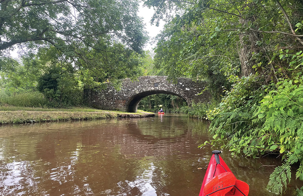
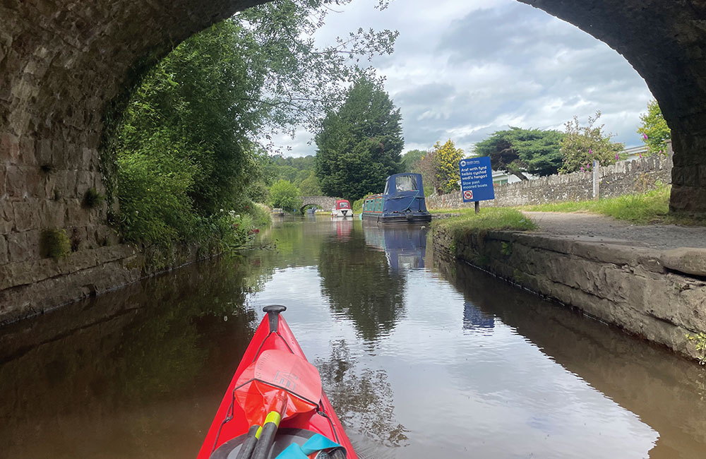
Head out of Llanfoist on the B4269, turning right up a short hill to the canal OS SO 29045 12269. There is parking for three cars. Access to the canal is through a gate. The canal then wends its way along leafy banks, and in places it’s like paddling through a green tunnel. Pit stop in Gilwern for coffee (too early for the Towpath Inn to be open).
A little further on there’s another launch point with parking for several cars at Gilwern Wharf OS SO 24256 14737. I then paddled on getting out at Llangattock by the boat club on the towpath bank just before going under bridge 115, OS SO 20705 17273. I wasn’t sure whether parking in the boat club car park was allowed, so I parked on the road towards Crickhowell, a three-minute walk away.
Day two: Talybont-on-Usk to Llangattock 9.8km
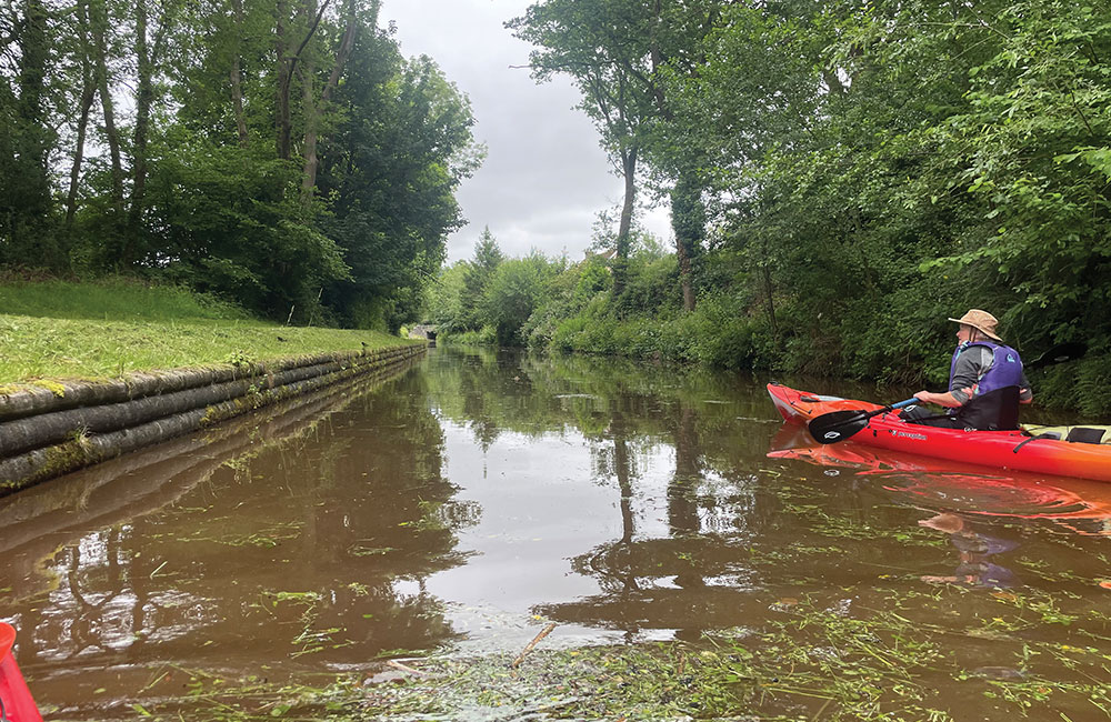
I dropped the boat off at the lifting bridge OS SO 11278 22743 and then parked at the village hub (Henderson Hall). I also met up with two friends who had travelled over to Wales to paddle with me today. In addition to parking, there are toilets and showers; the hall asks for a donation, and you can either post the money in a box or scan a QR code. This section of the canal is also wooded with amazing birdsong.
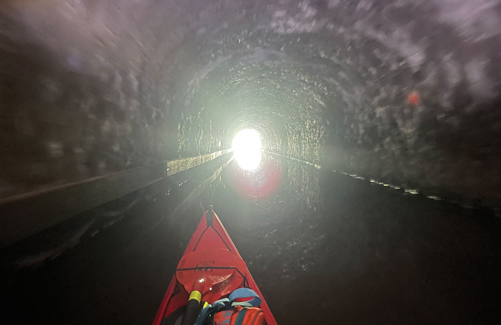
After a short paddle, about 1.5km, you reach the Ashford Tunnel. You will need a torch (and whistle to attract attention if needed). The tunnel is 343 metres long and surprisingly disorienting, as you can only see the end of the tunnel and a short distance in front of you by the light of your head torch. Everything else is pitch black! While I think you could squeeze past a stationary canal boat, I wouldn’t want to take the risk as the tunnel is quite narrow.
Fortunately, there wasn’t a lot of traffic, and we were able to paddle straight through without needing to wait.
Three km from the tunnel is a series of five locks. We portaged the first three in one go because they were close together, then put in and paddled to lock 4, portaged, and paddled to lock 5. From there it should have been a straightforward paddle to Llangattock. However, one of the group was struggling (they’d had a stroke a couple of years ago, and the portage had sapped their energy) and our average speed dropped to less than 2km/h.
We quickly set up a tow, which improved our speed. Rather than tow the remaining distance, we dropped the tired paddler and boat off at the road bridge at Hendreforwydd. The remaining two of us paddled to the finish, and we picked up our friend on the way back to Talybont.
Day three: Talybont on Usk to Brecon 12km
The previous two days, my wife dropped me at the start point and left the car at the finish. This made logistics easy; she planned to walk up Table Mountain on day three, so a similar arrangement wouldn’t work. I opted to drive to Talybont and leave the car there, then catch the bus at Brecon (43) to get back. This worked out really well: I arrived in Brecon around 12:30, giving me plenty of time to catch the 13:07 bus from the bus interchange. Buses seem to run every two hours, the next one being 15:07.
The canal starts in a similar style to the other sections with woodland on each side and an overhanging tree canopy. As you get closer to Brecon, there are fewer trees and the canal is more open. There is a short aqueduct at Glanusk where the canal goes over the River Usk and shortly after that a lock, which is a bit of a steep portage, then across the road to get back onto the canal. The canal runs alongside the B4601 as you approach Brecon, offering some alternative get-out options before reaching the town.
I opted to finish at the canal Basin and it was easy to load the boat onto the car in the nearby Brycheiniog car park OS SO 04624 28195. There seemed to be no problem leaving my kayak propped against the wall on the canal side in the basin, although a group might have to consider other options so as not to block the path. I also had a lovely lunch at the theatre café overlooking the canal.

Planning and safety considerations
Paddling solo is always riskier than paddling in a group. While I have a fairly reliable self-rescue (roll), I also included a paddle float rolled up behind my seat, giving me a backup deep-water rescue method. The canal banks are well maintained, and in many places the towpath side was also shallow, making it feasible to swim to the bank and get out. I wore a PFD, made sure my wife had a rough idea of the plan, carried my phone and PLB (Personal Locator Beacon), and stayed well within my paddling ability. I also have a routine where I message once I’m ‘off the water’ (I do this even when I’m part of a group).
In preparation, I did a lot of looking at a paper map (I feel it gives you better perspective), consulting paddlepoints, Google Maps, and the OS App. Mostly around the best start and finish points.
Our base for the three days was Riverside Caravan Park in Crickhowell. It’s a lovely campsite with very clean facilities and, most importantly, decent showers.
I will be back in 2027 to complete the remaining navigable section from Llanfoist to Cwmbran. That will be part two.