
By Mal Grey
Mal runs the ‘Wilderness is a State of Mind’ website @
WWW.WILDERNESSISA
STATEOFMIND.CO.UK

By canoe to the Maiden
Canoeing and hillwalking in Britain’s great wilderness
The two mountains of A’ Mhaighdean, The Maiden, and Ruadh Stac Mor, the Big Red Peak, are among Britain’s remotest. By international standards, they’re not remote, being just six miles in a straight line from any road, yet the terrain surrounding them is wild and unforgiving, and the lie of the land prevents any possible straight lines! Here lie some of Scotland’s best mountains, hills for the connoisseur, rewarding the considerable effort needed to reach them.
Most people who climb these hills do so by walking in one of three directions. However, any lover of the fabulously road-free Ordnance Survey maps that cover this area will notice Fionn Loch thrusting deep into the heart of this mountain fastness. The problem, from a paddler’s perspective, is that no roads reach Fionn Loch either.
That, though, is a challenge that couldn’t be ignored. Northwest of Fionn Loch, the little Highland village of Drumchork sits by the sea loch of Loch Ewe. From here, a rough track heads inland. More interesting to us, it winds its way roughly parallel to a series of small lochs. It looked like a route could be followed that would be roughly half paddling and half portaging, using three lochs to break up the 9km or so distance to the shores of Fionn Loch.
From there, we could paddle right into the heart of the Fisherfield Forest, that wild wilderness area beloved of many a Scottish hill wanderer. There we hoped to climb at least one of the fabulous hills that sit above the head of the loch. We would return by taking the easier route out, wheeling downhill if trolley wheels did not explode.
It was clear that
it would take us several days to get there. Our group of pirate kids and adult crew is not known for speed, nor are we known for travelling light. A review of our previous rough portage speeds suggested we should work on an average portage speed over rough ground of, wait for it, 1/3 of a km per hour. Yes, this sounds slow, mainly because it involves three carries each (two for bags, one for canoes), thus doing every leg five times, but that’s the way we like to do it. We like to take a few luxuries for these longer trips, we like to eat well, and we don’t care if it sounds ridiculous. Doing silly things in the middle of nowhere is half the fun!
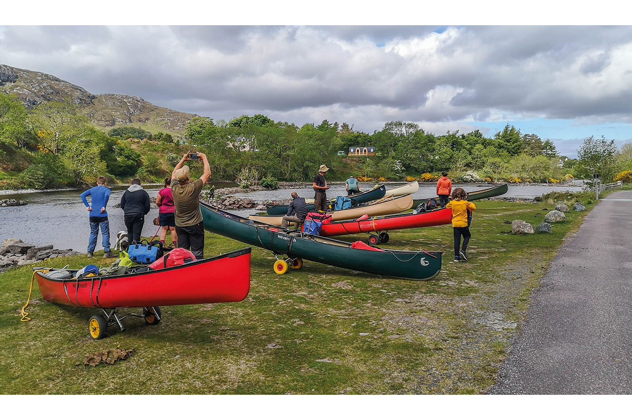
We usually make these trips at Easter. Two Easters passed, both locked down due to Covid. We weren’t waiting another year, and with restrictions finally allowing travel and meeting outdoors, we jumped in the cars and headed north in late spring this year. Eventually, we found ourselves at the seaward end of a stony track after running a shuttle and parking cars. In one direction, the sea. In the other, nothing but moorland, not a hint of water. That was, of course, the direction in which we were heading.
Loch a’ Bhaid-luachraich
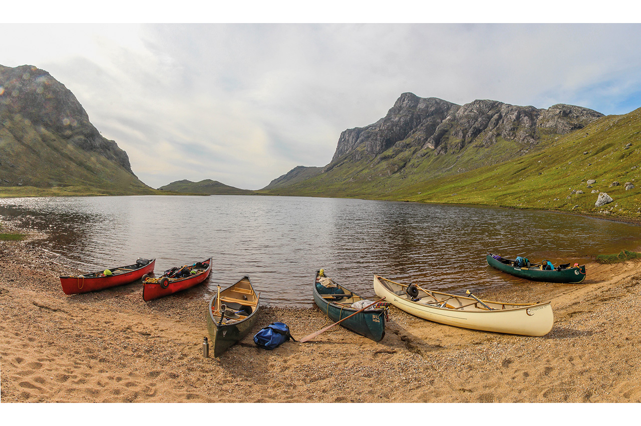
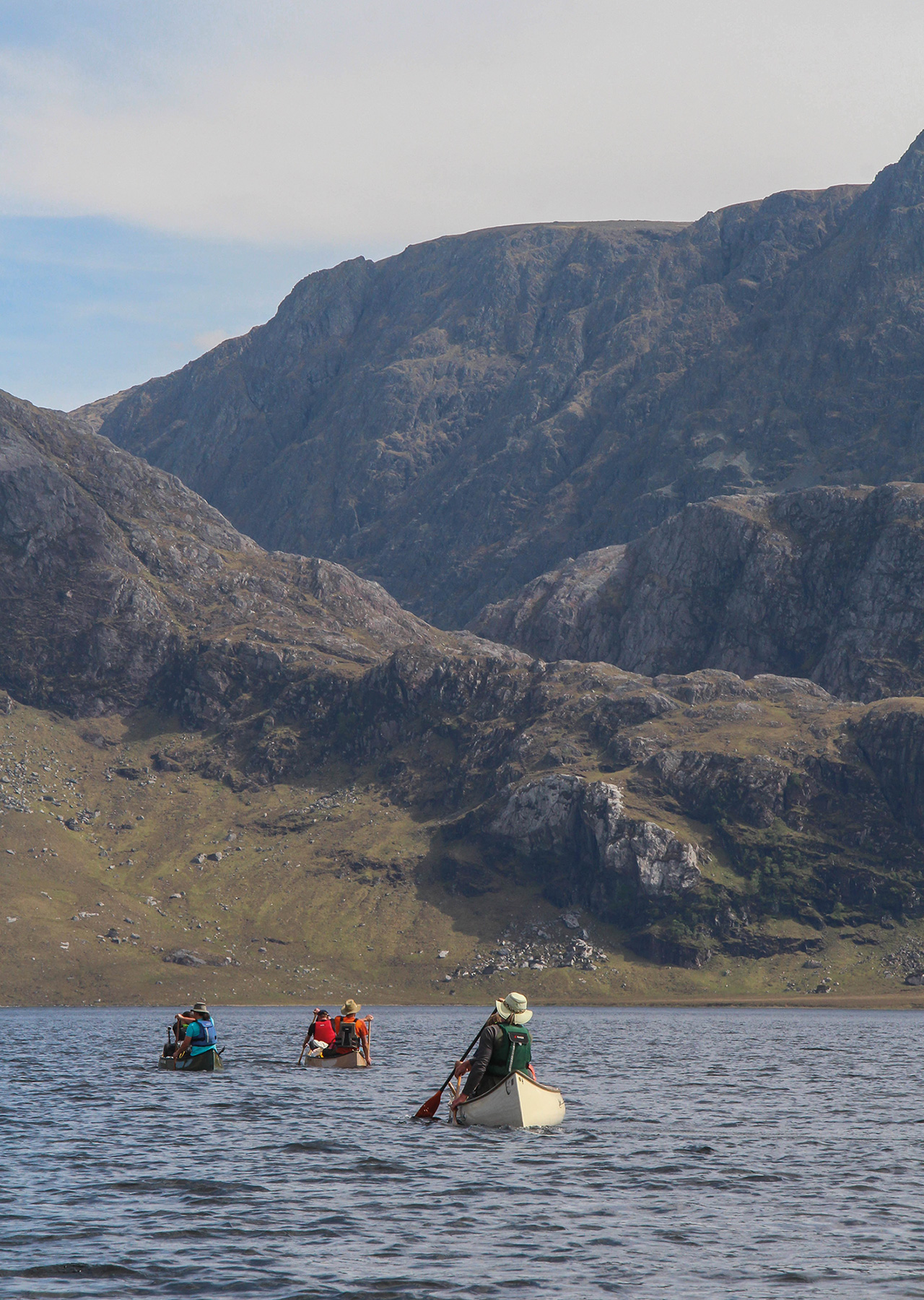
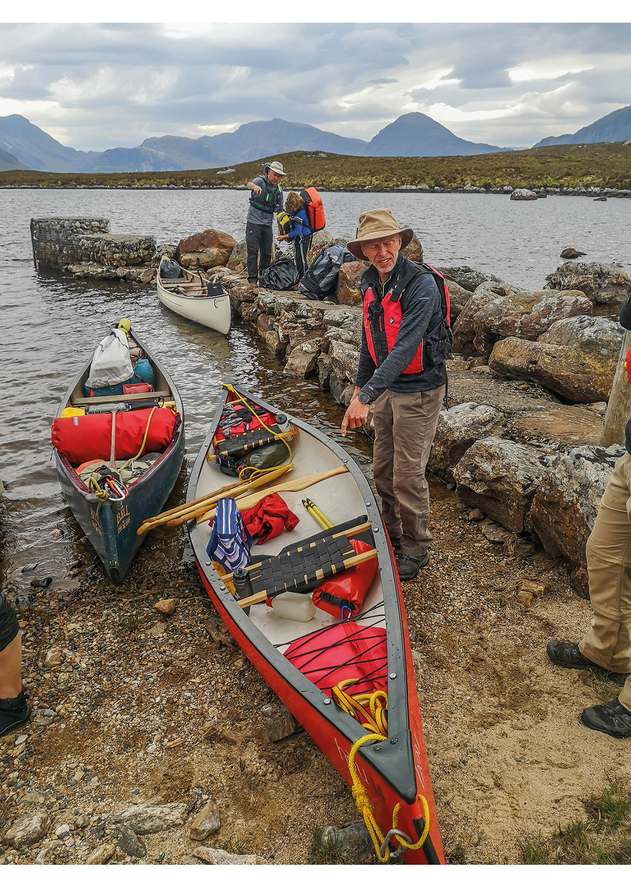
The first section was easily trolleyed, but of course, it was mostly uphill. Because of the weight of ridiculous meals and bags of ‘ballast’ made of fermented grape juice, it took several people to push each canoe up the steeper sections whilst carrying the heaviest bags on our backs. We settled into the task, a useful shakedown of our packing ability and teamwork. It took a couple of hours to reach our first loch, a tongue twister called Loch a’ Bhaid-luachraich. Here we transferred to the water for the first time. Given the size of the fleet (seven canoes) and limited put-ins, it took a fair time to get afloat, and we realised we’d be losing more time at each get out or put in. It was, though, a real relief to get on the water.
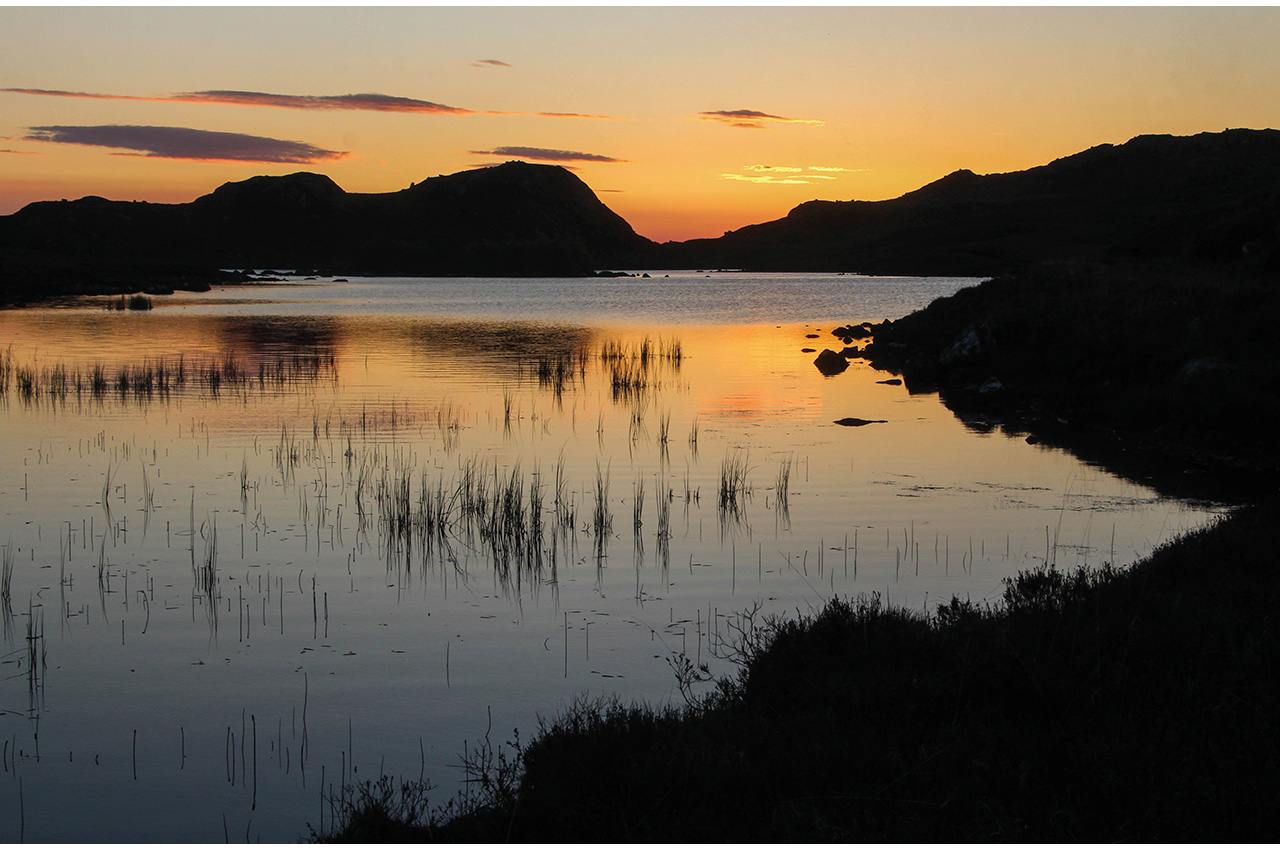
Suddenly it all made sense. After a long, long winter of lockdowns and restrictions, finally, we were afloat on a sparkling wild Scottish loch, with not a soul to be seen. The weather was fine, the views even finer – a wonderful moment. This wild terrain is full of rocks, many underwater, scattered across the landscape, and we wound our way between them onto more open water. We would meet plenty of rocks over the next few days, for this country breeds them almost as well as Norway! In places, small trees clung to cracks in the stone, and everywhere we paddled, the sound of a cuckoo followed us. The loch is split in two by a narrows. At the head of the upper loch, alongside a small plantation, a lovely sandy beach looked like the perfect spot for our first camp. And so it was, a lovely stretch of gritty sand with a stunning outlook towards the mountains to which we travelled.
We tend to cook communally and eat well, using off-the-ground fireboxes where possible and appropriate. This means carrying bags of wood too, yet another thing to add to the loads, as there is no sustainable firewood in these parts. Gas supplements the fireboxes and would be our primary fuel later in the week. That first night was my turn to cook a Chinese chicken with noodles and prawn crackers. At least prawn crackers are light! Cake and real custard followed. The midges visited later, but only for a short while, and the evening light more than made up for it. A truly beautiful first night of our trip was made even more special by an incredible moonrise in the wee hours over the rugged outline of Beinn Airigh Charr.
A challenging portage
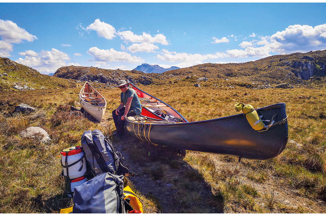
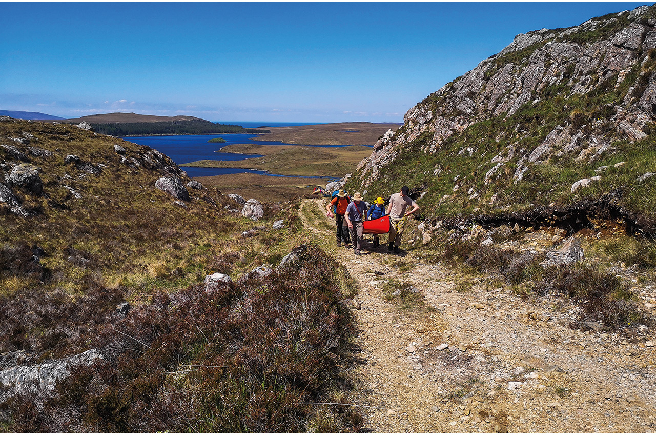
We woke to a scorcher of a day, bright sun under endless blue skies. This was expected to be the most challenging day of the trip, as today we would climb to the plateau upon which Fionn Loch lies, though we didn’t think it likely that we would make it to the loch today. The key to our trip would be getting from our current loch up to the next smaller one. A track on the map would help, though we knew from a little research that infamous highland blue-line follower Graham Warren (Moosehead paddles) had declared it ‘untrolleyable’. We would see.
The paddle along the loch was delightful, but ahead we could see our track climbing steeply to the horizon. It looked rocky and worse, even getting to the track meant a brutally steep climb or a long zig-zag across heather and bog. A lovely little inlet, with waterweed waving gently in clear water under our hulls, gave access to the hillside. Now it became hard work. The first bags went on ahead, scouting out the route. We settled on two approaches; the canoes would go, empty, up the gentler slopes to the left, where the track was lower, then get trolleyed up a steeper section to a spot further on at a fence. The luggage would take a more direct route, straight up the hillside to the same spot.
Here the kids proved, for the first time on this trip, to be complete stars. After years of just carrying small bags and sitting on rocks playing whilst we laboured, now they seemed actively keen to join in, grabbing bags and heading off uphill at a pace that made us oldies feel exhausted to watch. Meanwhile, we got the canoes up to the track and started hauling them along the rough track. It was hot work, and we’d hardly really started, for ahead the track, covered in rubbly rocks, climbed out of sight. The canoes would have to remain empty, and the bags go up in shifts.
I don’t know why it is, but these moments help make these trips so memorable. We sweated and hauled, lugged and carried, but at every ‘cache’, we paused and laughed, shared out snacks and drinks, and returned for the next load. Soon, we were constantly passing each other, offering the opportunity for plenty of banter and giggle with each other at the ridiculousness of hauling canoes up a track in the middle of nowhere with no water in sight ahead. I love it.
The steepest part was indeed ‘untrolleyable’. Here, though, we had an advantage over Moosehead, for we had many hands to make light work and simply picked the canoes and wheels bodily up to lift over the rougher or boggier parts. In this manner, slowly but surely, we climbed towards our next bit of relief, Loch Mhic’ille Riabhach.
This we reached in mid-afternoon, after maybe five hours of hauling, and despite a strong breeze, we all enjoyed paddling its 1km length. With our next loch another kilometre further on, and a reasonably flat area conveniently placed at the get out, we declared this camp two, just 3km in a straight line from camp one. Later we watched the sunset as we digested Lynne’s excellent spicy sausage pasta.
We woke to another scorcher and to the hope that by lunchtime, our portage would be over. A kilometre of portaging, only slightly uphill and mostly roll-able, took us to the last loch of our approach route, Loch na Moine Beige. What a relief it was to reach that and paddle its sparkling waters knowing we were almost at Fionn Loch. Almost, for a final sting-in-the-tail, separated us from the big water, a 100m bit of boggy moor, well protected by the most awkward rocks so far at both get out and put in. We’d done it; we’d reached Fionn Loch, almost exactly two days after setting off from Drumchork. Lunch was, of course, declared.


Paddling at last
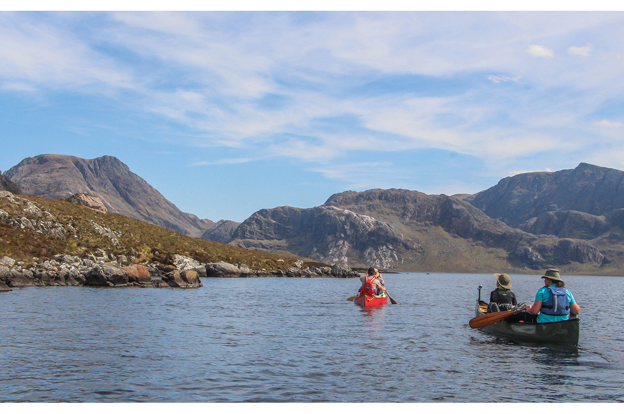
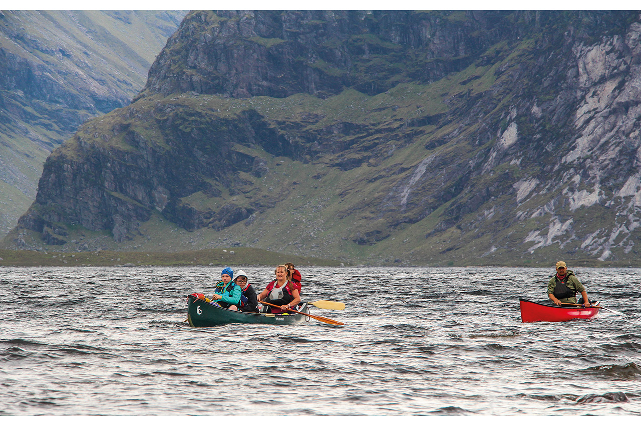
Ahead of us lay an afternoon of near-perfect loch paddling. As we headed out onto the open water, mountains gathering on three sides now, what breeze there was finally dropped away. This is a fantastic place, a big loch with no roads or habitation on its shores, that draws you onward into the wildest mountain country in Scotland.
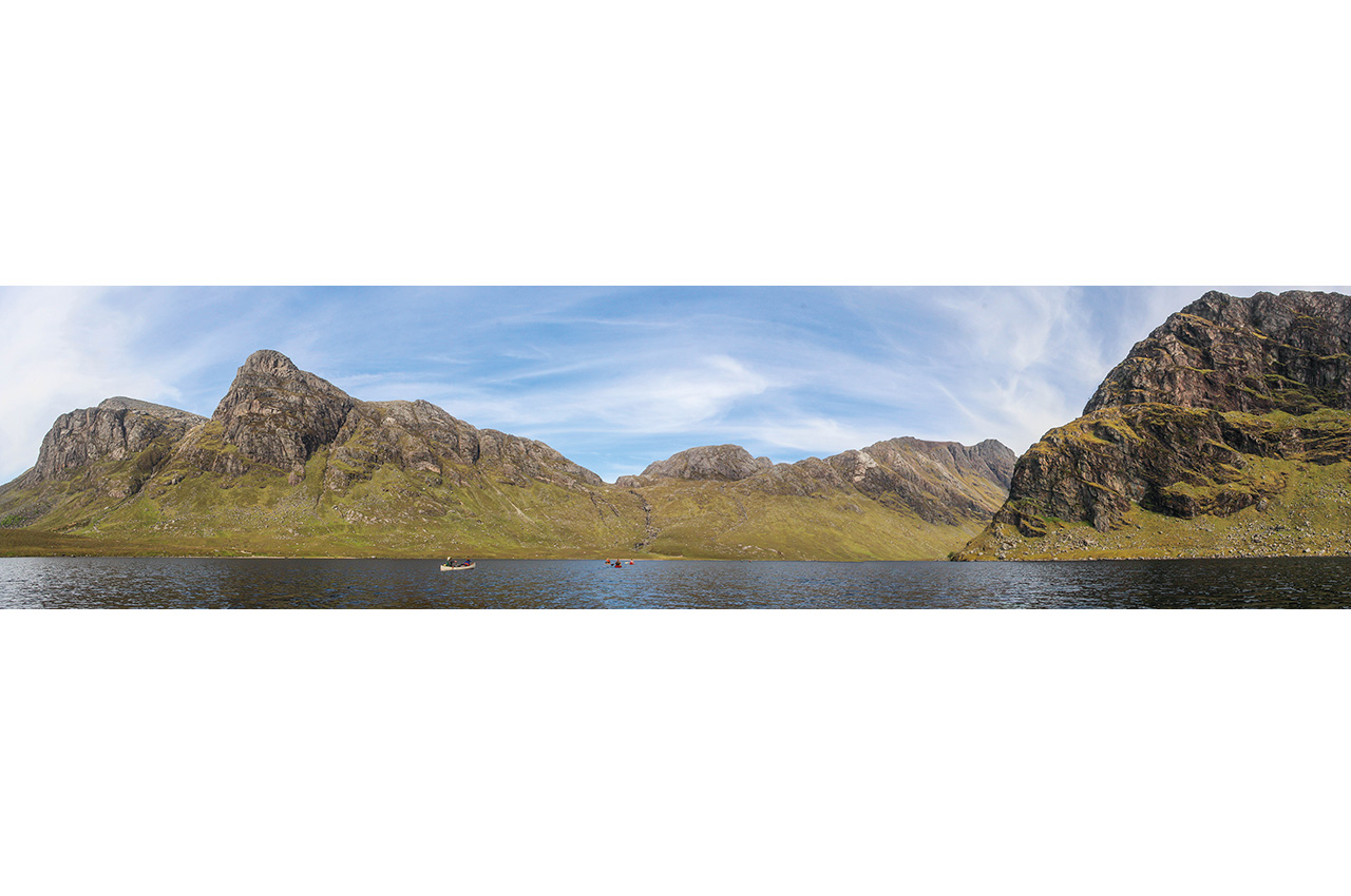
We could paddle happily out in the middle, take our time, stop, drift, chat, and soak up the sun in such conditions. Bliss indeed. Roughly following the northern shore, we hopped between isles and headlands. The further we travelled, the more we became surrounded by hills, towering and complex mountains like Beinn Airigh Charr, Beinn Lair and Beinn a’ Chaisgein Mor, made largely of billions-of-years-old Lewisian gneiss. As you approach the head of the loch, it is indeed like some ancient lost world.
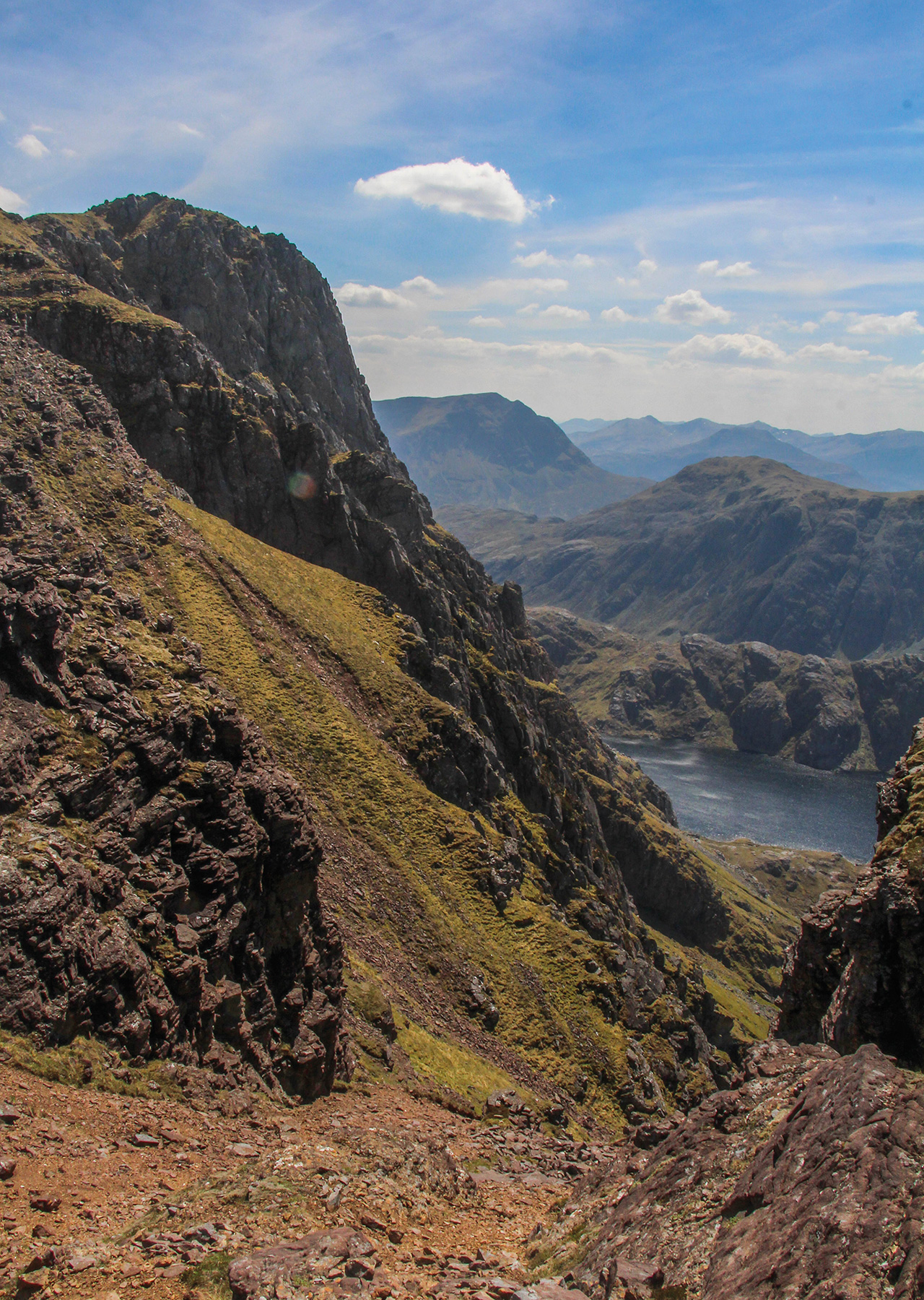
A causeway crosses the waters near Carnmore, a hunting and fishing lodge named after an immense crag hulking above it. Beyond is the Dubh Loch, the Black Loch, a proper contrast to Fionn Loch, the Fair Loch. This awe-inspiring bowl is like somewhere out of Tolkein, huge slabs tumbling into the dark waters, mountains towering on all sides, with mighty A’ Mhaighdean as the backdrop. This was our destination, somewhere on Dubh Loch we would camp, in this truly astonishing place.
First, a very short but annoyingly awkward lift and walk over the causeway, which was, of course, defended by rocks. Now we headed out onto the dark waters, feeling tiny beneath its massive flanks. I lingered, not wishing to rush, awed by the landscape soaring around me. At the back of the loch was a perfect flat meadow behind a gently shelving beach. This would be our campsite, a comfortable spot with a meandering burn and even a choice of different areas to pitch. The pirate kids set up their camp at one end of the beach and drew a line forbidding the crew to cross it. The rest of us chose either a flat section of the perfect soft meadow by the winding stream that became known as Oxfordshire or closer to the communal centre of the camp, i.e. where the food and drink were, by the beach. Liz’s bean chilli fed our hungry bodies as the waters became utterly still, and later I followed young Alex’s example and slipped out onto the water to paddle as the sunset.
A day of rest and exploration followed. Behind camp, a glen rose to Gorm Loch Mor, a hidden trough of water trapped in this magnificent, folded landscape. Most of us visited it, for it is a remarkable spot in its own right. Generally, though, we relaxed and ate almost continuously, culminating in Pete’s excellent soya curry with naan bread and mango chutney.
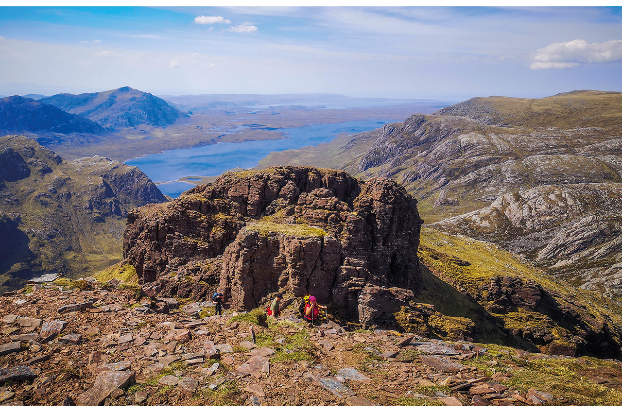
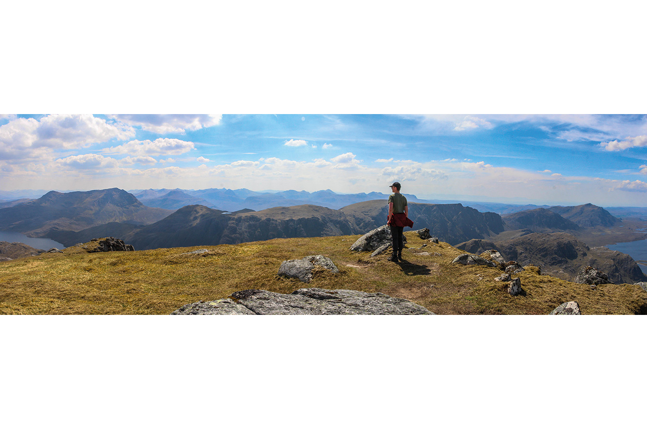
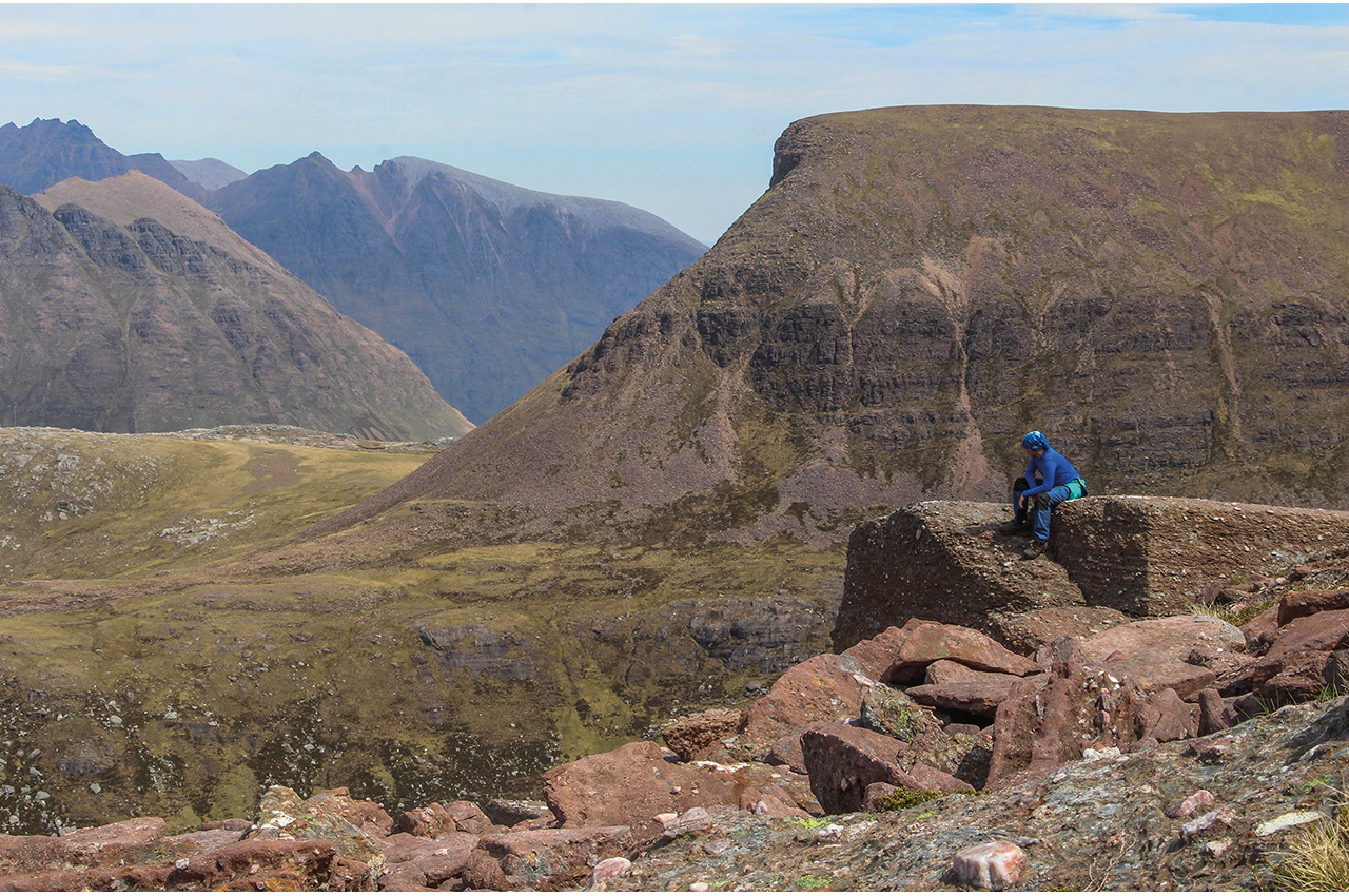
The ascent of Armageddon
With its hard-to-pronounce Gaelic name of A’ Mhaighdean, this remotest of British mountains is often known as Armageddon by those who reach it and its sister top of Ruadh Stac Mor. Rising immediately above camp, vast walls led to a ridge capped with Torridonian sandstone and then to the quartzite cap of the summit above. This was the target for half of the group on the following day, yet another day of sun. We chose to climb the northwest ridge, reached after a tough slog up steep slopes to the beautiful rocky corrie that houses Fuar Loch Beag. Above, after replenishing our rapidly diminishing water supplies and taking on as much as possible to avoid dehydration on a hot day, we wound our way on pathless terrain to the ridge proper. Here, the sandstone forms a series of broken, rotting towers that block progress along the ridgeline. A tortuous and insecure route dips in and out around these pinnacles before a final clamber reaches the summit slopes.
This is a fantastic route up a mountain, by far the best way to reach the top of A’ Mhaighdean, really doing it justice. And from the summit, perched right on the edge of a considerable drop, the views are simply magnificent, endless layers of remote hills laid out in all directions except for that looking to the sparkling, island-studded sea. We sat and pondered how many folks might have climbed this as their very first Munro other than 13-year-old Tobey and 10-year-old Ben. Looping round to the north to descend the hill allowed some of us to nip up Ruadh Stac Mor, a less impressive summit with more outstanding views. Eventually, we reached camp in the early evening after an unforgettable mountain day to find Liz had already started work on Lynne’s corn beef hash. This would be our last night in the mountains.
Leaving the Dubh Loch behind
Paddling out the following day, I’m not sure any of us wanted to leave. It was a greyer day than we’d had, with moderate winds whistling down the glen to camp, and we wanted to press on. By now, we’d not had a good weather forecast for five days, and we didn’t want to push our luck, so we were leaving with a day in hand in case we had to stop halfway. We hoped to divert to Loch Maree for a night to use that day if we got a favourable forecast once back in mobile data range.
The Dubh Loch felt a little more threatening than it had done when we arrived, but still, it was sad to leave. That annoying short portage over the causeway was quickly behind us, and we were back on Fionn Loch. Here the wind funnelled from two glens was reaching the head of the loch, and the waves were only just within our safety zone; no white caps, but not that far off them. We agreed to hug the end of the loch and then make our way parallel to the far shore to avoid crossing later on. It was a bit of a battle, especially for the time we were side on to the wind, and it seemed to be getting stronger. Once we reached the southwest shore, the wind was behind us, and concentration was required to keep canoes at the best angle to the waves and make sure we stayed in close contact. A bay or small point allowed us to tuck in and get a little respite every kilometre or so.
hard to judge
I was concerned that the increasingly long fetch would make larger waves the further we went. However, the opposite was happening. The wind was easing slightly, and the waves were flattening. What I think was happening was the effect of two mountain-funnelled winds meeting, then easing where the hills fell back. So many factors come into play on mountain lochs; it’s often very hard to judge what will happen even if you have a good forecast.
The remaining miles were far more relaxed, and we could enjoy ourselves again as we headed once more to the moorland end of the loch. We planned to head out via an alternative, easier, track and we’d put a car at Poolewe for this eventuality. Three-quarters of the way back along Fionn Loch, a small pier gives access to this track, which heads off across the fabulously named Bad Bog.
Here we stopped and lunched and then re-packed our canoes for trolleying. We were 10km from the car. Fortunately, the track is good enough for a proper trolley portage, and we could carry all our kit in the canoes, though most of us put at least one bag on our backs. At least we didn’t need to do any more ‘there-and-back-and-there’ portage legs. That doesn’t mean it was easy, though, and once again, we were glad the kids were happy to help push and pull our heavy loads. The track was flat then downhill, but the little climbs felt more frequent than the short downs.
Steep portage
Eventually, we reached the edge of the moor, and the track dropped more steeply. Now it was a case of ‘brakeman’ at the back and careful not to let the loads run away from us. As we rolled onwards, the landscape became less wild, with plantations and then the site of the small fields around the estate farm of Kernsary. We’d once camped near here, and with time pressing, hoped to be able to do so again. In the meantime, I’d finally got a forecast. Unfortunately, this was for strong winds the next day. It, therefore, didn’t seem sensible to plan to paddle on Loch Maree, and instead, we would continue the portage straight out to the car.
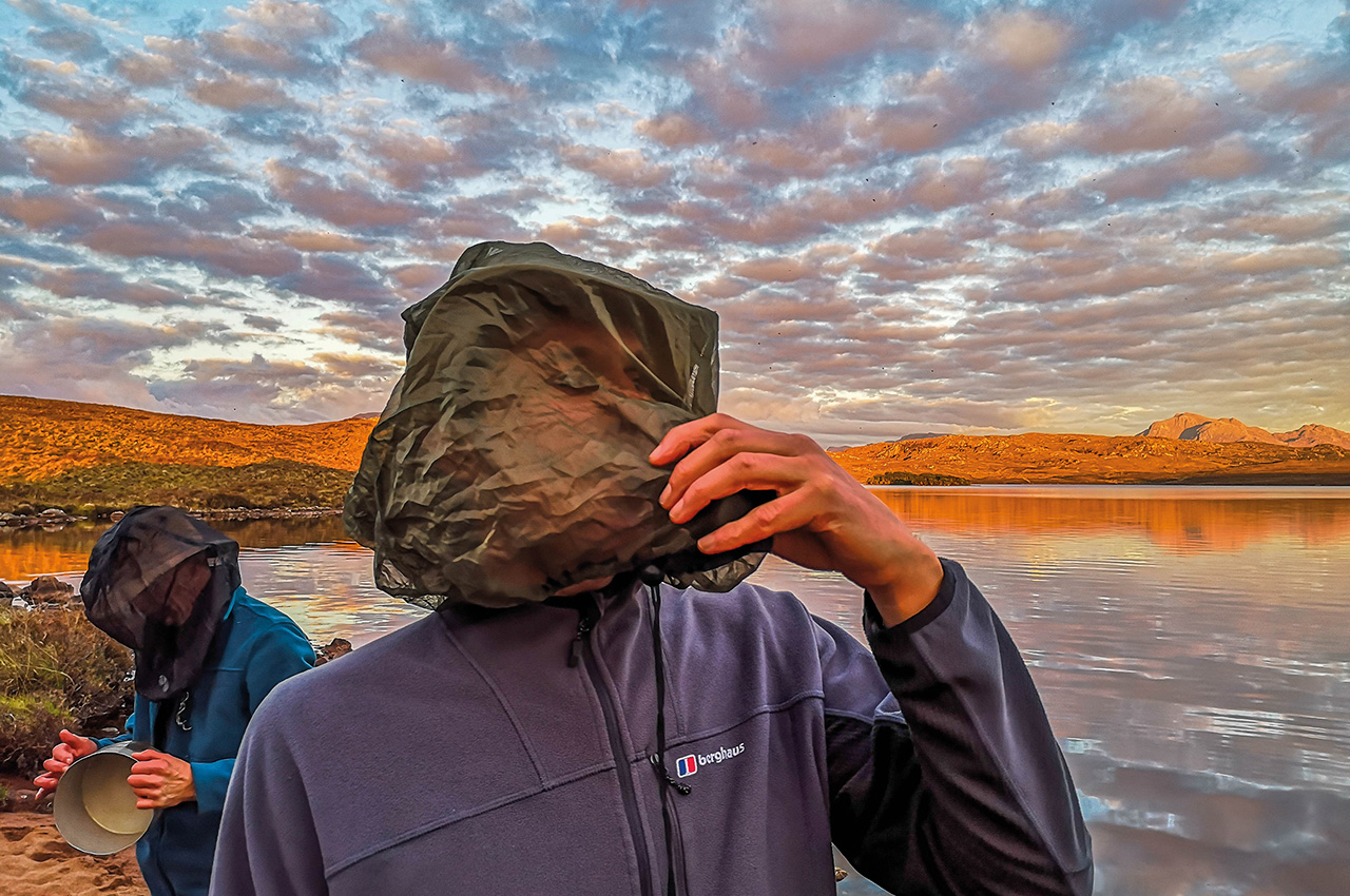
The estate workers were happy we could camp in a meadow a few hundred metres beyond Kernsary, though concerned that it would be very sheltered, warm and muggy, and that we’d therefore be eaten alive. There wasn’t much choice, so camp we did, but they were right about the midges, the first really bad ones we’d had and amongst the worst I’ve experienced over the years. Dinner, again by Liz, was a hasty affair and was eaten “on the hoof” whilst constantly walking around camp to avoid being eaten too badly when lifting your midge net to spoon the food in. Everyone was early to bed, and most of us then spent the next half hour or more chasing down every midge that came into the tent with us.
Our final morning arrived. All we needed to do was to roll ourselves the final 5km to Poolewe, though I was secretly hoping we might find a straightforward way to drop from track to river for the last 2km or so. Though the route dropped slightly overall, it was very much up and down short steep hills and was pretty tiring. New deer fences prevented simple access to the river, so it was pushing and pulling all the way. We all breathed a sigh of relief when we hit the tarmac with a km or so to go, and then suddenly, we were at the end of the road. We’d done it. Though easier than the portage in, rolling like this wasn’t nearly as satisfying, but boy were we proud of where we’d reached and climbed, with canoes and kids.
Spending time travelling through this magnificent country was what made the trip, that and the days spent living beneath those spectacular towering mountains at the Dubh Loch. The paddling was only part of the trip, but linking those little lochs together to find a canoe route to Fionn Loch and following its shining waters into the heart of the remotest hills in Britain, will be an experience none of us will ever forget.
Location on PaddlePoints: https://gopaddling.info/paddlepoints/?PP=17716
Some stats
- Total distance travelled, excluding the hillwalking: total 42km; 28km paddling, 14km portage.
- Height gain/loss about 350m.
- Wine drunk 15L.
- Custard consumed 4L.
- Cans of tonic drunk by Lynne with her gin 24.
- Whisky decanted into plastic pouches in hotel rooms 3L.
- Whisky leaking into luggage from plastic pouches, 0.5L.
- Flour spilt into hotel room sinks whilst making bannock mixes, leaving suspicious white powder everywhere 200g.
- Midges killed in his tent by the narrator on one evening. 502.