WORDS:
LISA DREWE
PHOTOS:
LISA DREWE

Bio
Lisa is an award-winning outdoor writer, paddler and guidebook author, best known for her Paddleboarding book series published by Wild Things Publishing. She has explored hundreds of routes across Britain by paddleboard and kayak and writes regularly for outdoor and paddlesports publications.
https://www.islandeering.com
Read Lisa’s prior post on ten of the best paddling routes in London and thr South East at:https://paddlerezine.com/10-best-paddling-routes-in-the-se/
Five family summer paddles
Summer’s here, and it’s the perfect season to get the family on the water. These five paddles combine gentle adventure, wildlife, and exploration.
In Newquay, the Gannel estuary’s calmer waters offer a scenic trip in beautiful turquoise waters. Abercastle and Ynys y Castell let kids explore craggy islands, peek into sea caves, and enjoy the charm of a small, historic fishing harbour. West Mersea’s tidal creeks and oyster-rich islands are perfect for short trips or longer adventures, with birds, boats, and beaches to keep everyone entertained.
Wimbleball Lake offers sheltered waters, rolling hills, and wildlife encounters, while Loch Morar’s mirror-like waters and small islands give a taste of Highland adventure without long or challenging paddles.
Here are five favourite family paddles to make the most of summer on the water in the UK.
1. Newquay, the Gannel (6.5km return)
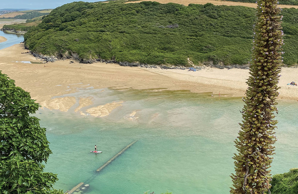
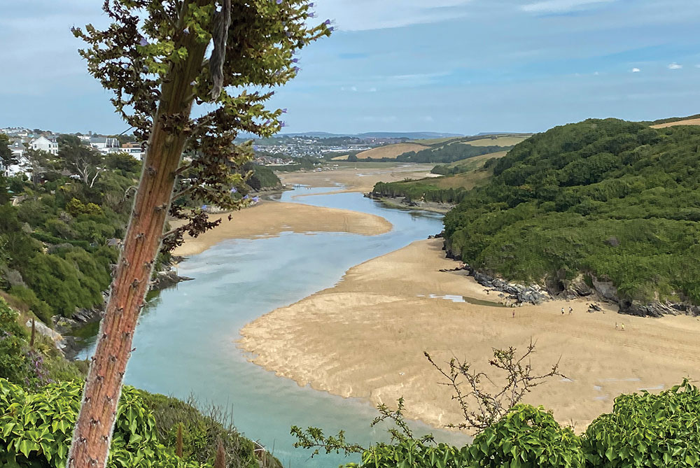
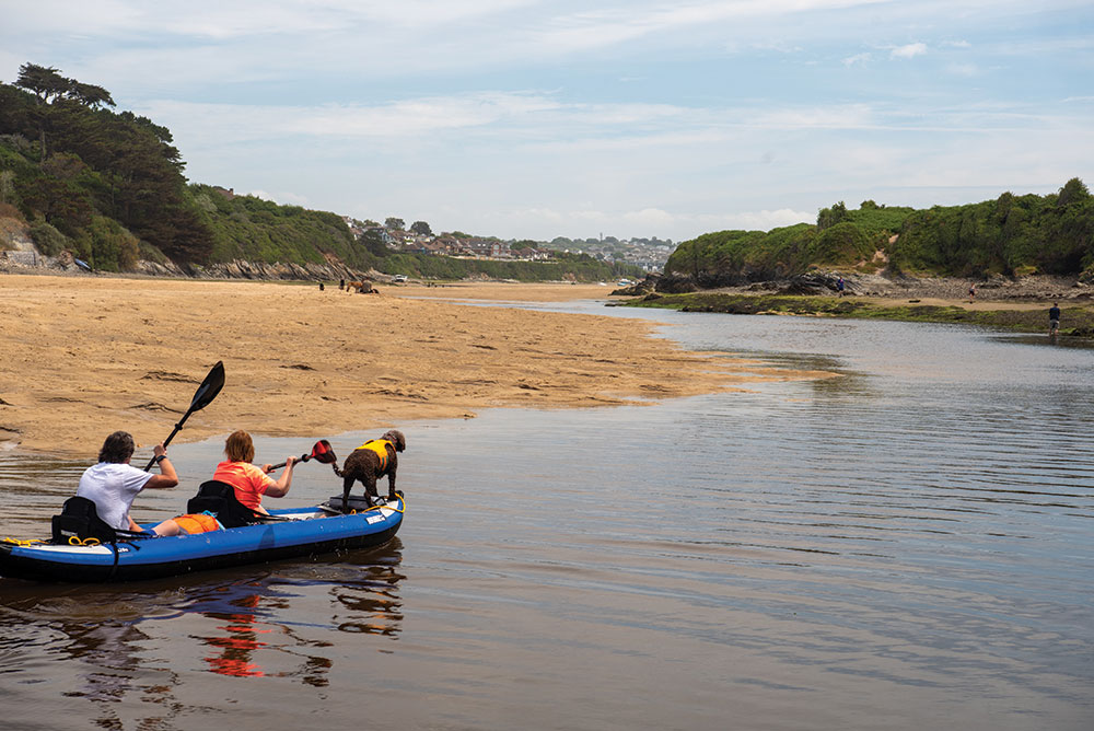
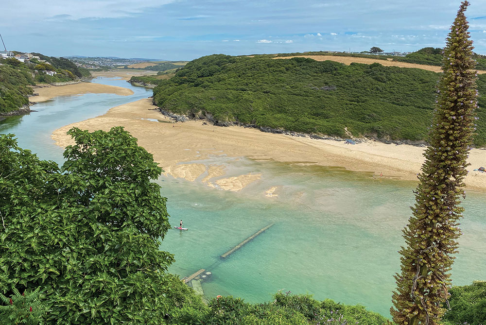
Shallow and with vibrant green-blue lagoons, the Gannel estuary is a safe family paddle on lower tides, with a stunning higher-tide option for the intrepid, almost into Newquay’s centre.
Launch at the northeast end of Crantock Beach and head upstream, then immediately pass the Fern Pit ferry boathouse, taking care when paddling over the submerged footbridge at the base of East Pentire’s cliffs.
Cross the mouth of Penpol Creek on the right and look out for ancient rotting vessels – the river was an important passage for the schooners and barges that ferried coal and timber up to Trevemper Bridge.
Continue upstream, avoiding another hazard: the submerged Penpol footbridge, which crosses the Gannel at low water. Hotels and large houses spill down the north bank of the river, with pasture and woodland on the south.
On the approach to Newquay’s boating lake, glide through a peaceful salt marsh – home to wading birds and salt-loving plants. Turn around at the footbridge south of the A392 (or before, depending on tide and time), then return to Crantock Beach for fresh crab and lobster from the Fern Pit Ferry Café.
Access restrictions: No licence required
Starting point: Crantock Beach TR8 5RE. Grid ref. SW 7887 6110 (50.4080, -5.1134).
Parking: Crantock Beach Car Park (NT), Beach Road, Crantock, TR8 5RN.
Pitstops: Great coffee and cake from a converted army truck on the beach, Cargo Coffee, tel. 07976 238548; delicious crab sandwiches and views, Fern Pit Café, tel. 01637 873181.
Lessons, hire, tours: Big Green Adventures, Crantock Beach, tel. 01637 479279.
Getting there: Exit Newquay on A392, right at second roundabout onto A3075 (Goonhavern), then right again following signs to Crantock Beach. Height restriction barrier at Crantock car park (2.1m), open when the car park is attended (09:00-17:00, April to October). Very busy during summer; alternative private parking nearby.
Special points: Full journey upriver best paddled on a spring six-metre plus tide. At high tide, buoys mark the position of the two underwater footbridges. Generally sheltered from a north wind, but east and west winds can funnel along the estuary. Avoid the estuary mouth where a rip current is created when the tide turns or when sand bars start to appear. Crantock beach area is best paddled 90 minutes either side of high tide.
FULL Route map: www.islandeering.com/paddleboarding-newquay-the-gannel/

2. Abercastle and Ynys Y Castell
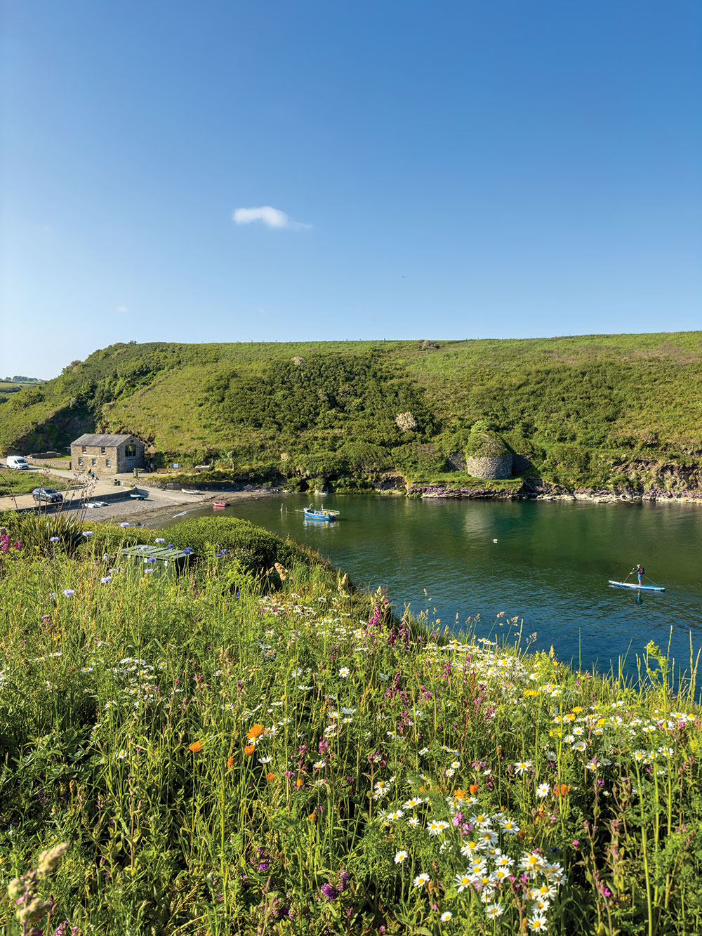
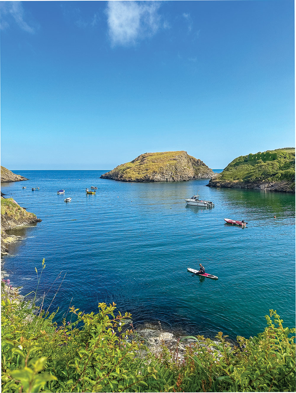
A craggy islet at the mouth of family-friendly Abercastle Bay, Ynys y Castell is a fun island to paddle around. Abercastle’s charming historic harbour once exported local slate and grain, limestone, butter, honey, corn, and coal, and today, managed by Abercastle Boat Owners Association, is busy with colourful fishing and leisure boats.
The entrance to this long rocky inlet is guarded by the rugged and wild islet of Ynys y Castell, where a promontory fort crowns the island’s high point.
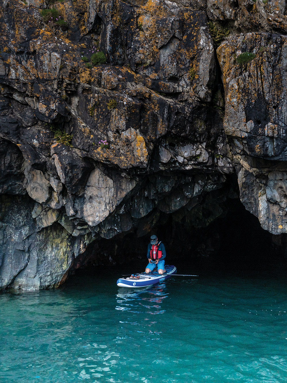
To circumnavigate the island, leave Abercastle beach and head through the moored boats to reach the small channel between the south tip of the island and the mainland. There is a cave to look into on the east side of the island.
If conditions permit, continue anti-clockwise around the base of the tall cliffs, exploring its rocky inlets, to find another large cave on its western side. The trip can be extended, if conditions permit, to Ynys Deullyn, a short distance north-west of the inlet’s entrance.
Starting point: Abercastell Beach, Abercastle, SA62 5AF. Grid ref. SM 852 336; What3Words relatives.restore.crumple; Lat/long 51.960, -5.127.
Parking: Limited (charges) next to the slipway to the beach.
Getting there: A87 south of Goodwick/Fishguard; right to Mathry, through village to top of Mathry Hill; right at T-junction and follow road (ignoring multiple junctions) to Abercastell. Follow the road downhill, turn right in front of the white house (before heading uphill) to follow the river to the harbour.
Special points: Protected bay from all but north winds; check Surfline (https://www.surfline.com) at nearby Abereiddy for local conditions. Best on a rising tide, two hours either side of high water, as the bay can drain out all the way to the island, but north of the island can be explored at any state of the tide in calm conditions.
Offshore wind: south east in the bay, south around the island.
FULL Route map: www.islandeering.com/paddleboarding-abercastle-and-ynys-y-castell/

3. West Mersea (various distances)
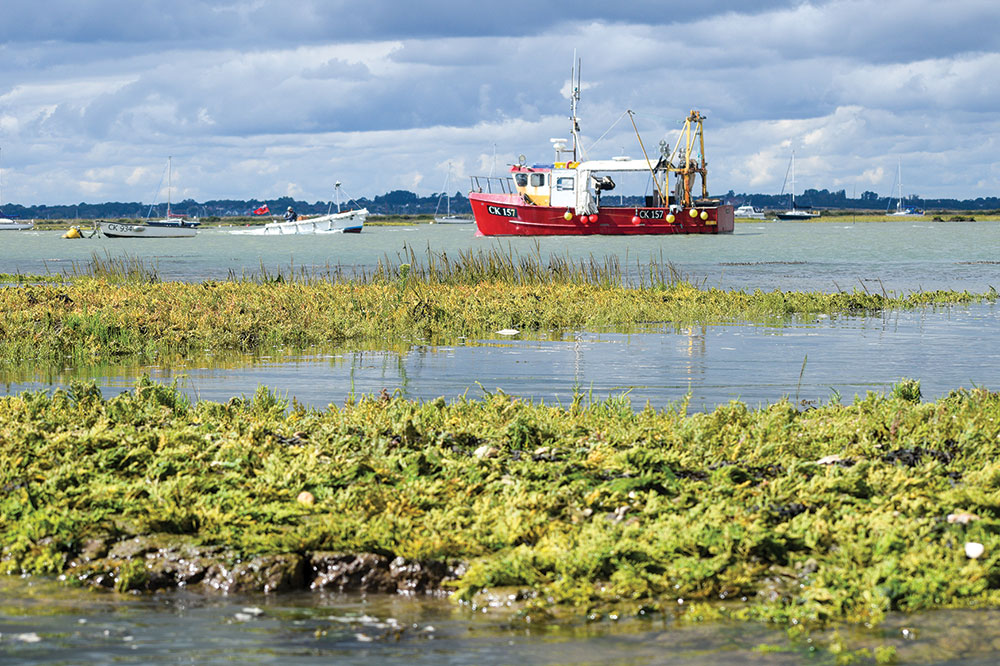
Launch from the Town Hard at West Mersea and explore the tidal waters and hidden creeks of the Strood Channel, perfect for both short paddles and longer explorations.
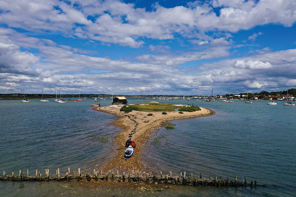
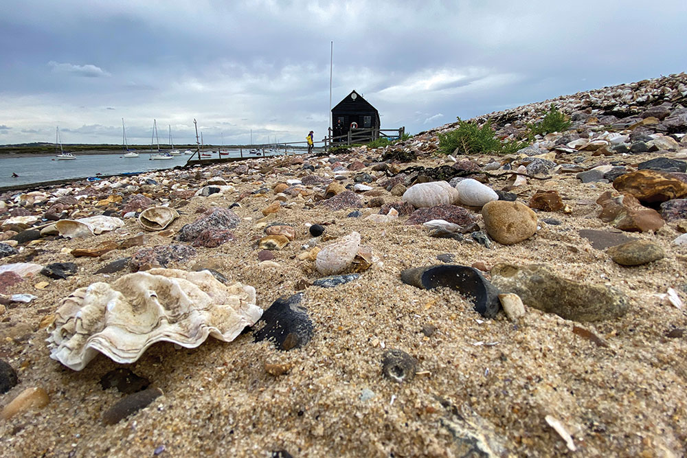
Head downstream (left) past lines of moored boats, soaking up the nautical atmosphere of the harbour, before reaching Packing Shed Island (1.6km return). Here, an oyster-shell beach and the restored 19th-century Packing Shed recall the island’s historic oyster industry, when Mersea Natives were prized across Europe.
For a longer journey to The Strood (5.2km return), head upstream (right) from West Mersea Beach along Strood Channel. Pass weathered boathouses with salt-worn facades and the eerie remnants of historic oyster beds. Low-lying Ray Island rises just above the water on the left, its salt marshes and tidal flats teeming with oystercatchers, shelducks, and sea lavender.
After about 2.5 km, the Strood causeway appears, a tidal link to the mainland often submerged at high tide, becoming lively during the Round the Island Race when crews lift their boats across it. The route combines history, wildlife, and scenic charm, and after the paddle, West Mersea offers fresh seafood as a perfect post-paddle treat.
Access: Access restrictions: No licence required.
OS map: OS Explorer 184 Colchester, Harwich & Clacton-on-Sea.
Parking: Coast Road car park (charges), Coast Road, West Mersea, CO5 8PB. Grid ref. TM 000 129; What3Words guesswork.precluded.silently.
Launching: Town Hard opposite West Mersea Yacht Club.
Pitstops: Seafood heaven, The Company Shed, West Mersea, (must book ahead, tel. 01206 382700); delicious food and great vibes, Waterfront Pizza, West Mersea, tel. 07493 184037.
Lessons and hire: Mersea Island Watersports, tel. 01206 381859.
Getting there: Cross The Strood and follow B1025, then Coast Road to the car park on the left (in front of West Mersea Yacht Club).
Special points: Best paddled 2-3 hours either side of high water to avoid a muddy walk back up to the hard. The ebb tide drains quickly around The Strood, where the flow concentrates in the channels around mid-tide onwards. Check wind, tide and swell conditions on Surfline surfline.com at nearby Walton-on-the-Naze.
Offshore wind: North west when visiting Packing Shed and Cobmarsh islands.
Full route map: www.islandeering.com/paddleboarding-west-mersea/
4. Wimbleball Lake, Somerset
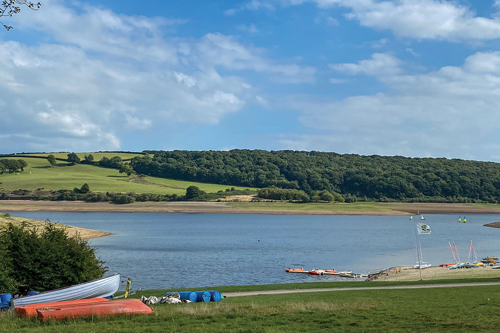
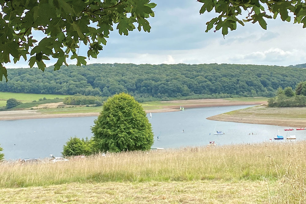
Surrounded by the rolling hills of Exmoor National Park, this beautifully situated reservoir offers plenty of opportunities for exploring, with waterside camping and a café nearby.
The lake is a wildlife hotspot, and you’ll glimpse a range of wildfowl on the water, iconic Exmoor red deer browsing on the lakeside, and, if you’re lucky, a very special butterfly.
The small pearl-bordered fritillary, which is orange and brown with white pearl markings and black chevrons on its hind wing, may be spotted around the northern arm of the lake beyond Bessom Bridge.
Apart from wildlife watching, the Activity Centres offer a range of water sports with tuition from qualified instructors and equipment hire, or you can launch your own craft. There is also a network of paths and cycleways around the lake.
Wimbleball is a designated Dark Sky Discovery Site with telescopes for hire. Stay at the campsite here, and on clear nights, you’ll witness the amazing starry skies of Exmoor, Europe’s first International Dark Sky Reserve, and possibly catch sight of the brown, long-eared bat.
Access restrictions: Self-launching costs £9 per craft per day; third-party insurance is required; book online at www.swlakestrust.org.uk/book-your-holiday. To paddle outside of the rescue area or rescue coverage times, you must adopt a buddy system.
Starting point: Wimbleball Lake Activity Centre, Dulverton TA22 9NU. Grid ref. SS 9688 3079 (51.0671, -3.4731).
Launching: Pontoon/beach 150m walk from the car park.
Parking: Next to the activity centre.
Pitstops: Great coffee and delicious homemade millionaire’s shortbread adjacent to the campsite; Coffee Couture, tel. 01398 371460.
Lessons, hire: Wimbleball Lake Activity Centre,
tel. 01566 771930.
Getting there: From Minehead, head east on the A39 to Washford Cross, turn right onto the B3190 towards Bampton, then, after the B3224, turn right,
signed Wimbleball.
Special points: No mobile phone signal anywhere on the lake; use the buddy system.
Full route map: www.islandeering.com/paddleboarding-wimbleball-lake/

5. Loch Morar, Highland
Nestled beneath the towering mountains of Lochaber, Loch Morar offers a spectacular setting for paddleboarding around its islands, including Eilean Ban, An t-Eilean Meadhoin, Eilean a’ Phidhir, and Eilean nam Breac.
Launching from the northern shore near the western end of the loch, paddlers can enjoy the calm, mirrored surface of the loch as it stretches from the River Morar to the remote eastern reaches.
The loch is famous not only for its islands but also for its depth – at 310 metres, it is the deepest freshwater loch in the British Isles – and for Morag, a rarely sighted, possibly mythical aquatic creature. Wildlife sightings are far more common, from otters and red deer to golden eagles and the elusive sea eagle.
Paddling around the islands, you’ll encounter jagged rock formations, trees clinging to steep cliffs, and a sense of prehistoric isolation. Though it’s best to avoid disturbing wildlife by landing on the islands, observing their rugged beauty from the water is enchanting.
Loch Morar’s western end provides safe entry points and gentle conditions for relaxed paddling, while the remote eastern stretches promise a more challenging and adventurous expedition.
Starting point: Getting there, A830 south of Mallaig, then left onto B8008 following signs to Bracara/Morar. Turn left at Loch following the Bracara Road along the north shore for 1.3km to find limited verge parking close to the grid ref. NM 697 932; Lat, long: 56.972, -5.790.
OS map: OS Explorer 398 – Loch Morar and Mallaig.
Pitstops: Fabulous homemade bread and snacks at The Bakehouse and Crannog, Mallaig.
Special points: Be mindful of a north wind, as if caught on the south side of the loch, there are few exit points.
Full route map: www.islandeering.com/paddleboarding-loch-morar/