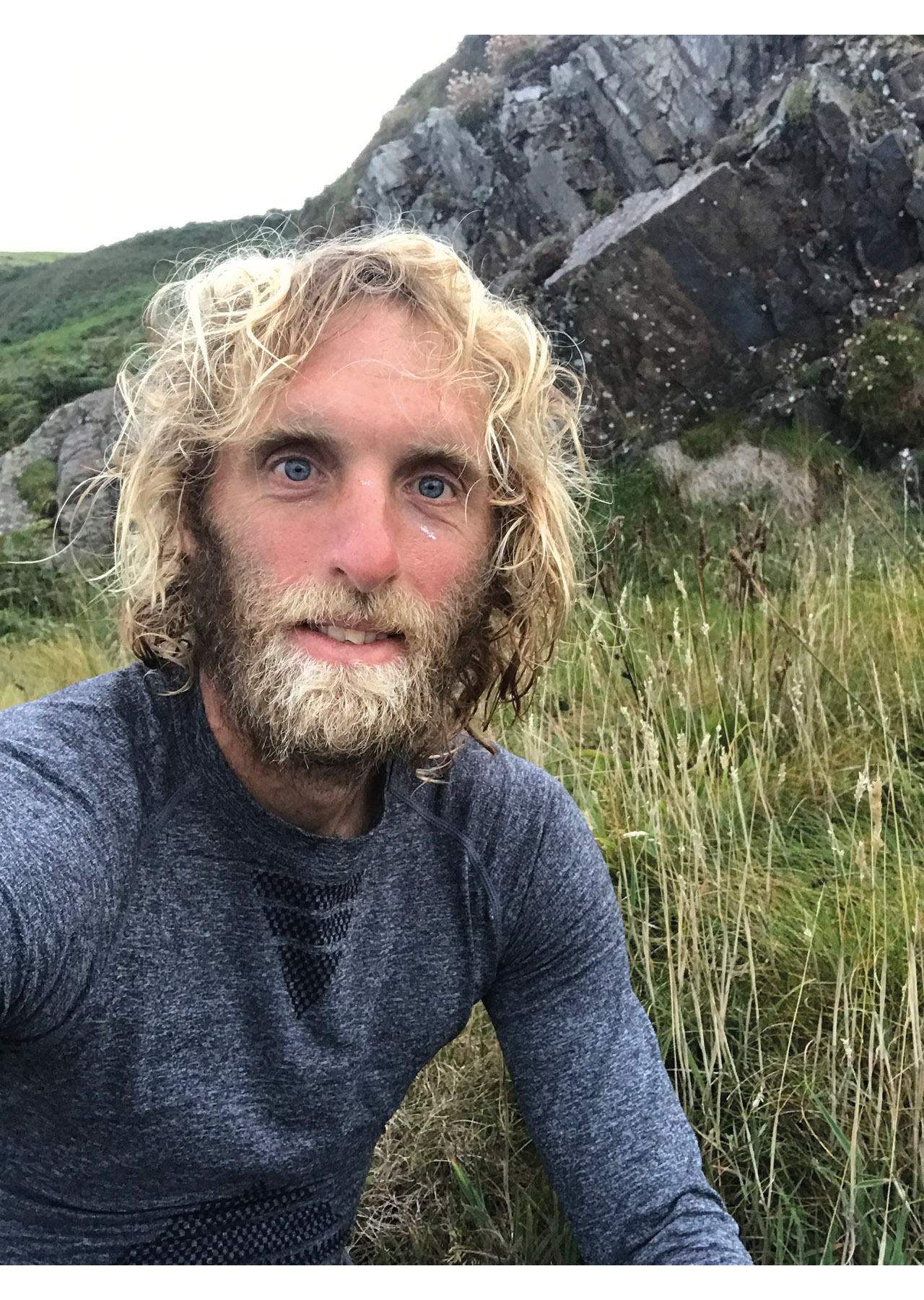
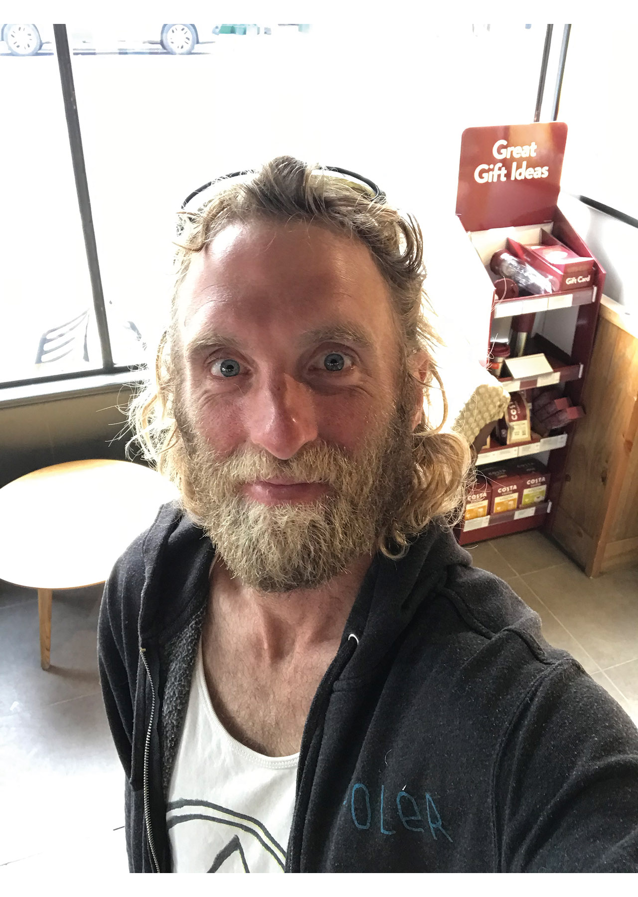
Words and photos:
Tom Thorpe
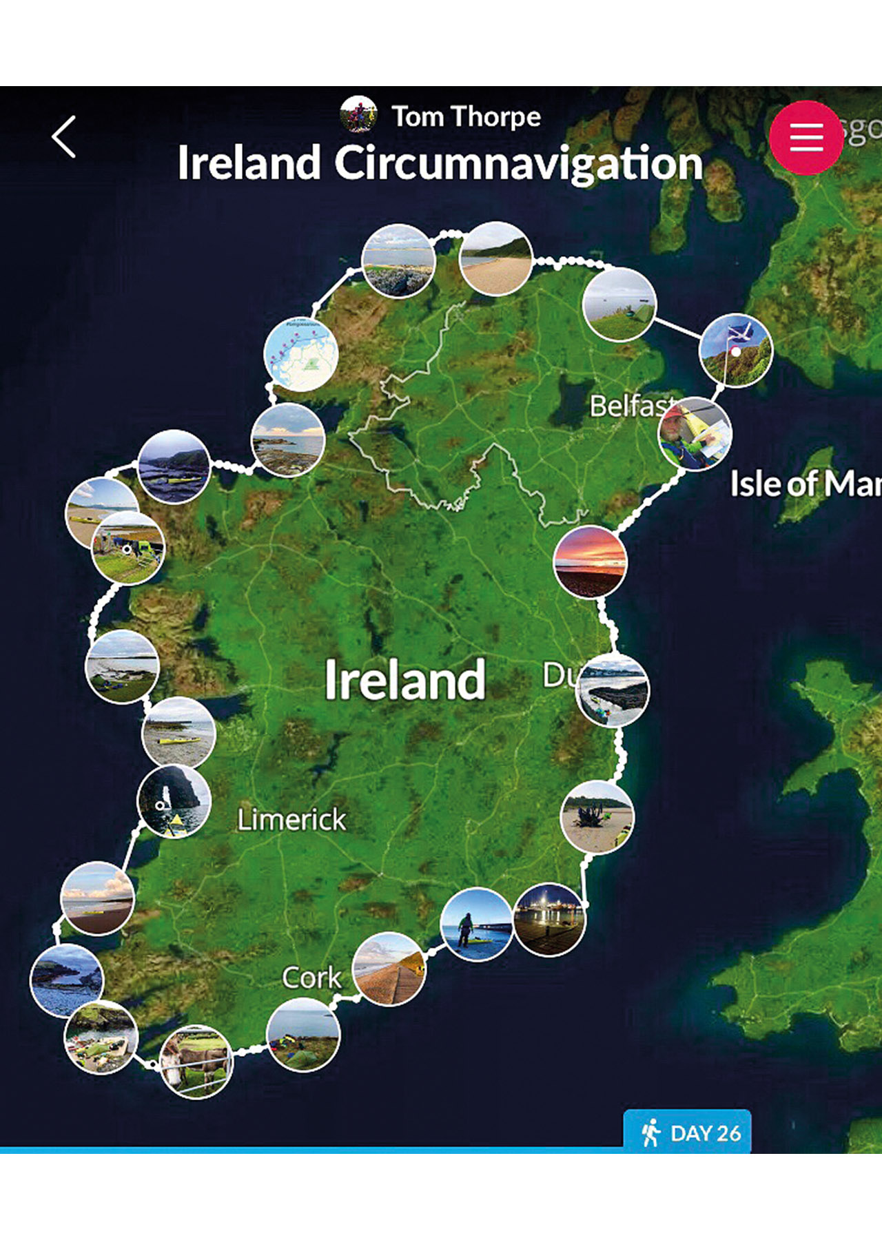
There has been a lot of Irish circumnavigations in the last few years. But each trip is unique. My trip was completed in August 2019.
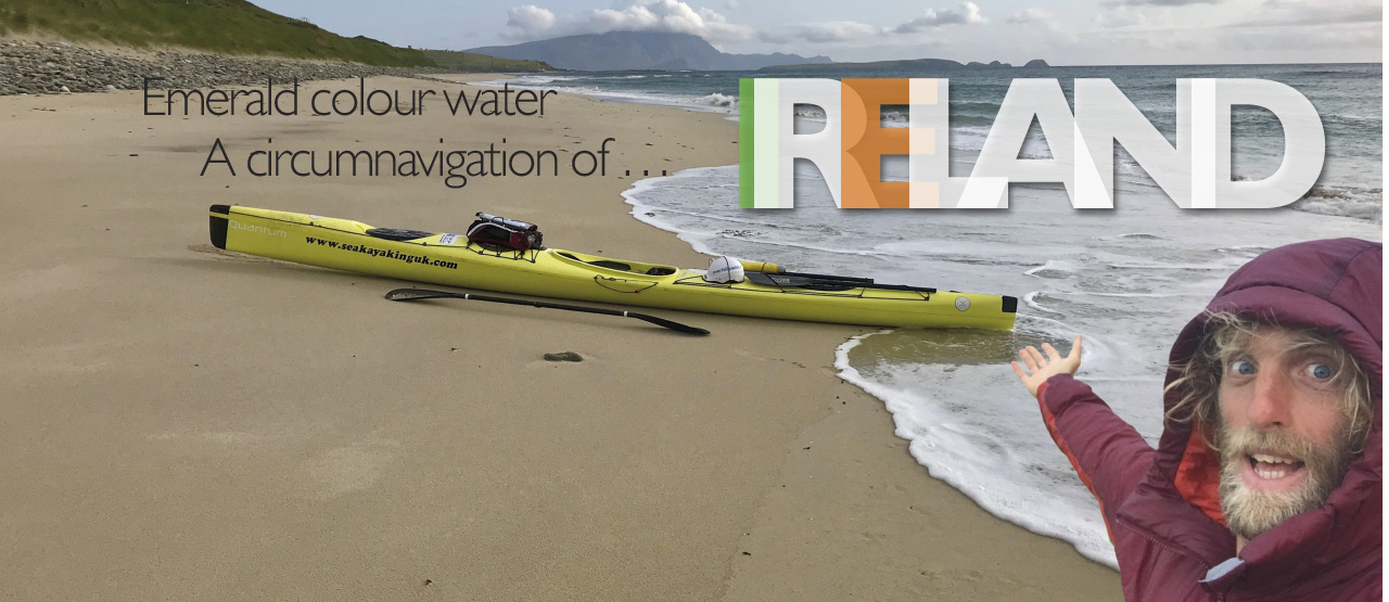
Emerald colour water – A circumnavigation of… Ireland
Paddler: Tom Thorpe is a teacher and semi professional sea kayaker based in Devon and Cornwall.
Days: 26.
Distance: 800 miles approximately.
Start and finish point: Portpatrick, Scotland.
Route: anti clockwise.
Ireland is a place that is made for sea kayaking. Whether you wish to circumnavigate the whole island, or cherry pick the best stretches, there is something for everyone. Around half of the Irish coastline is exposed to Atlantic swells and winds, therefore paddling whilst being surrounded by white caps and clapotis is pretty normal. Irish conditions are notoriously hard to predict and if a circumnavigator chooses to go clockwise or anti-clockwise it’s almost certain they’ll encounter headwinds and opposing conditions.
If you talk to folk that have undertaken the expedition you’ll hear them talking about the long days, the rough water and the notorious headlands and for the most part what they say is unlikely to be an exaggeration – it’s pretty full on! The Atlantic swells rise up from the deep water and meets huge cliffs. Anyone who paddles around Ireland will be put to the test and anyone that belittles it probably hasn’t done it.
By far, the most impressive trip that has been done was by a group of Irish chaps in 1990. The group included Mick O’Meara and took 33 days. The boats they used were Valley Nordkapp copies and although the Nordkapp was an extremely advanced design for its time, it’s still an older style displacement hull and all of the equipment would have been heavier than most of today’s circumnavigators use. The 33-day trip was never supposed to be a record, it was how things worked out and for the guys it was simply something they wanted to do.
Interestingly though, that 33-day time would stand for 20 years and even today, with the lightest and fastest equipment, most will struggle to beat that. The trip is between 800 to 1,000 miles depending on the route taken. If you choose the 800-mile version, a paddler will find themselves in open water very often.
My trip took 26 days, anti clockwise, including the crossings from Scotland. My 26 days included two days off the water, one day due to force eight headwinds and one day due to strong winds and a choice I made to rest instead of battle and make slow progress.
In any sport there seems to be a set path. A climber will find themselves in Fontainebleau and Yosemite at some point in their journey. A surfer will find themselves in Morocco or Indonesia and a sea kayaker will find themselves in Greenland, Norway, Ireland, Scotland and other places. There seems to be a well-trodden path and areas that attract more hype than others.
I travelled around the world when I was younger, searching out national parks and hidden areas. I tried desperately to stay away from other westerners and tourists. Towards the end of my travels I realised something; that there is often a reason why people flock to some areas and why they are so popular. It’s because they are outstandingly beautiful and inspiring.
As I progressed through my sea kayaking career I kept hearing about Ireland and as I studied maps of the world, I’d often check out the Irish coastline. I didn’t mentally prepare and fully commit to the plan until six weeks before I set off.
Roof of Britain Ultra
In 2018 my friend Steve Bowens and I paddled around the top of Scotland, which included many of the islands on our route and some of the best crossings and exposed sections of water in the UK. We called it the Roof of Britain Ultra at around 620 nautical miles. It was the perfect preparation trip.
During the six weeks leading up to Ireland I got hold of all of the maps and things I needed. All of my heavy equipment was switched out for lighter gear. My training schedule was tripled and I did my reps and exercises most days. Where I live is perfect for training and trips around Plymouth breakwater with a heavy boat or towing Mr Finn was a regular occurrence. That training was essential. Luckily, my girlfriend is very supportive and I regularly towed her whilst she sat on my longboard surfboard. That resistance training was a big help.
Training for long trips is tricky; long distance sea kayaking is a lot about endurance and mental grit. The Scillies crossing and islands is one of my favourite places and paddling trips and it was great to be able to test my equipment there.
Settled weather
The best time to do an Ireland circumnavigation is around the longest day of the year. Often the weather is pretty settled through June and around the longest day. If you read the books about UK and other Ireland circumnavigations, folk always try to be on the Irish west coast at that time. Obviously the more settled the weather, the more distance one can achieve and for most, the more fun the paddling.
August is when I get my summer holidays. Bumpy water helps me stay engaged and focused so I wasn’t worried if it wasn’t going to be super calm.
For me paddling for 8-10 hours a day can get pretty laborious and monotonous if the water is flat, if there is a swell, tide or wind blowing or flowing I’m happy. The thing that does bother me on long distance days is a headwind. A headwind increases a paddler’s stroke rate and causes more fatigue. Paddling 30-50 nautical miles each day means that one cannot go crazy on any one of the days because rest and recovery is not an option, its really important to know your limits. I had many headwinds in Ireland and that’s one of the reasons why my total came out as 26 days and not 21. I was careful and more conservative on the distance and a couple of times only achieved a 25-30 mile day.
Once you get a good relationship with yourself and know what you can achieve it allows us to find out what is possible and plan more realistically.
My route was planned out from the beginning and I had targets, but I took it day by day. I’d check the forecast twice a day and sit looking at the sea eating my breakfast. The plan was very dynamic and I made alterations to my goals the night before, the morning of and during the paddling days. Utilising the good weather days is so important and when the conditions allowed, I pushed the distance to 45-55 nautical miles. Eating and carrying enough food was a major challenge.
The route
I had studied the weather patterns all year, watching the synoptic charts and how the systems were moving. This year we have had abnormal conditions. Many easterlies and northerlies and prolonged periods of settled weather were common. Whilst working through June and early July, the weather was amazing and I knew it couldn’t last forever.
Our predominant winds here in the UK are south westerlies. Some years easterly winds and swells are quite rare, but not this year (2019).
I looked at the charts, tides and forecasts religiously in the weeks leading up to the trip. It would be so cool to do the crossings from and to Scotland within the circumnavigation, so I checked it out. The maps suggested that Portpatrick in Scotland would be an ideal launch site and I had a really positive phone conversation with the RNLI station and the Harbour Master. I began to get really excited.
The decision to paddle clockwise or anticlockwise would be made a day before I set off, I wanted a week of semi-reliable forecast to make the decision. So sitting in Portpatrick the night before and studying my apps, charts and maps – the decision was made. The tides and weather matched up and if I could maintain a good speed and reach my target distances, I could get down to the south west corner and meet the south westerlies, which were sure to come in at some point. If it went to plan the wind would assist me along the south coast and up the east coast and that would counter any conditions I met on the west coast. At least that was the theory. Definitely a risk, but I’m paddling around Ireland; the whole trips a risk!
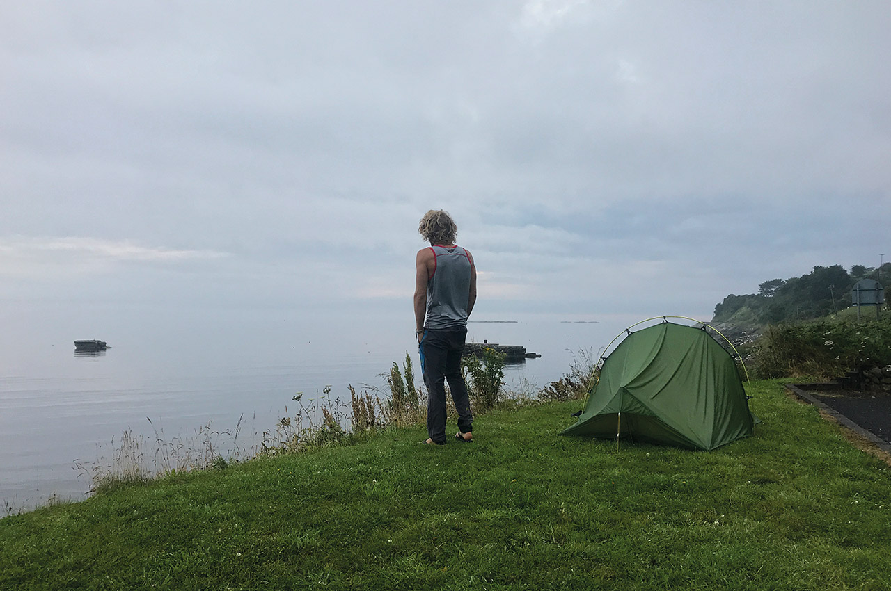
I set off from Portpatrick after a windy and wet night in the van, I struggled to sleep that night because I was so excited. At 04.00 the weather settled and I woke up and looked out, the rain was still there but the wind had dropped. The tide told me that I didn’t have to launch until 08:30 and I was pleased as it gave me chance to sort my gear and van and make sure I had everything for a potential month on the water.
I paddled out from Portpatrick into the fog and locked onto my bearing, it was an amazing crossing and 45 nautical miles later I paddled out of the fog and landed at a place near Waterfoot in Ireland. I had made it, the first challenge done, for me being in Ireland was magical and I was so happy. The forecast was telling me the weather was really settled for the next few days and I prepared for a few big days creeping around the north coast. At this point the tides were on springs and they would push me and be on my tail all morning.
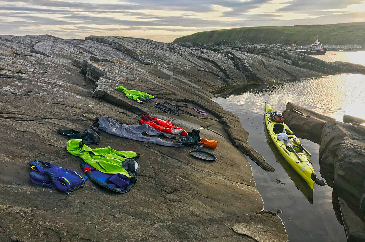
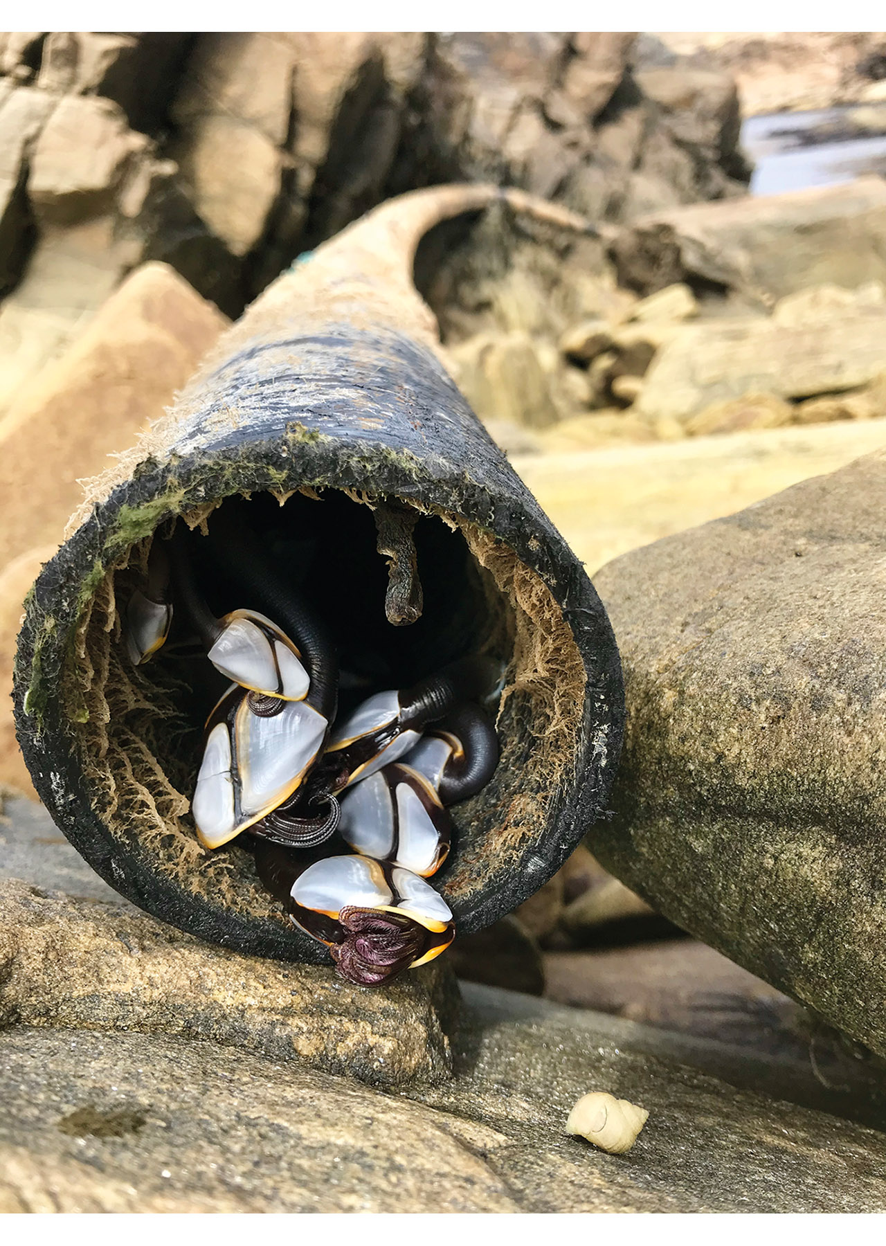
In Waterfoot I experienced my first taste of Irish hospitality. My plans to paddle around Ireland with minimal equipment and weight meant that I carried little food and water, no shoes or non-essential items. The plan was to knock on doors or find springs for water and to stock up on food every three of four days.

new GPS unit
I went to find someone willing to fill up my water bottles. I knocked on a door and the family invited me into the house and I met an amazing chap who had sailed around the world and worked on super yachts. He told me his story and about how he had dived into shallow water, broken his neck and paralysed himself from the neck down. He was wheelchair bound and his positivity and his willingness to talk openly about his situation was very inspiring. He was really interested in my plans, I’d told him of how on the way over from Portpatrick I had attempted to get a good GPS track and check my location a couple of times due to the fog and shipping lanes. Unfortunately my GPS had decided it was time to die and wasn’t functioning at all. To my amazement he gave me a new GPS unit after hearing that mine had shut down. That was so amazing!
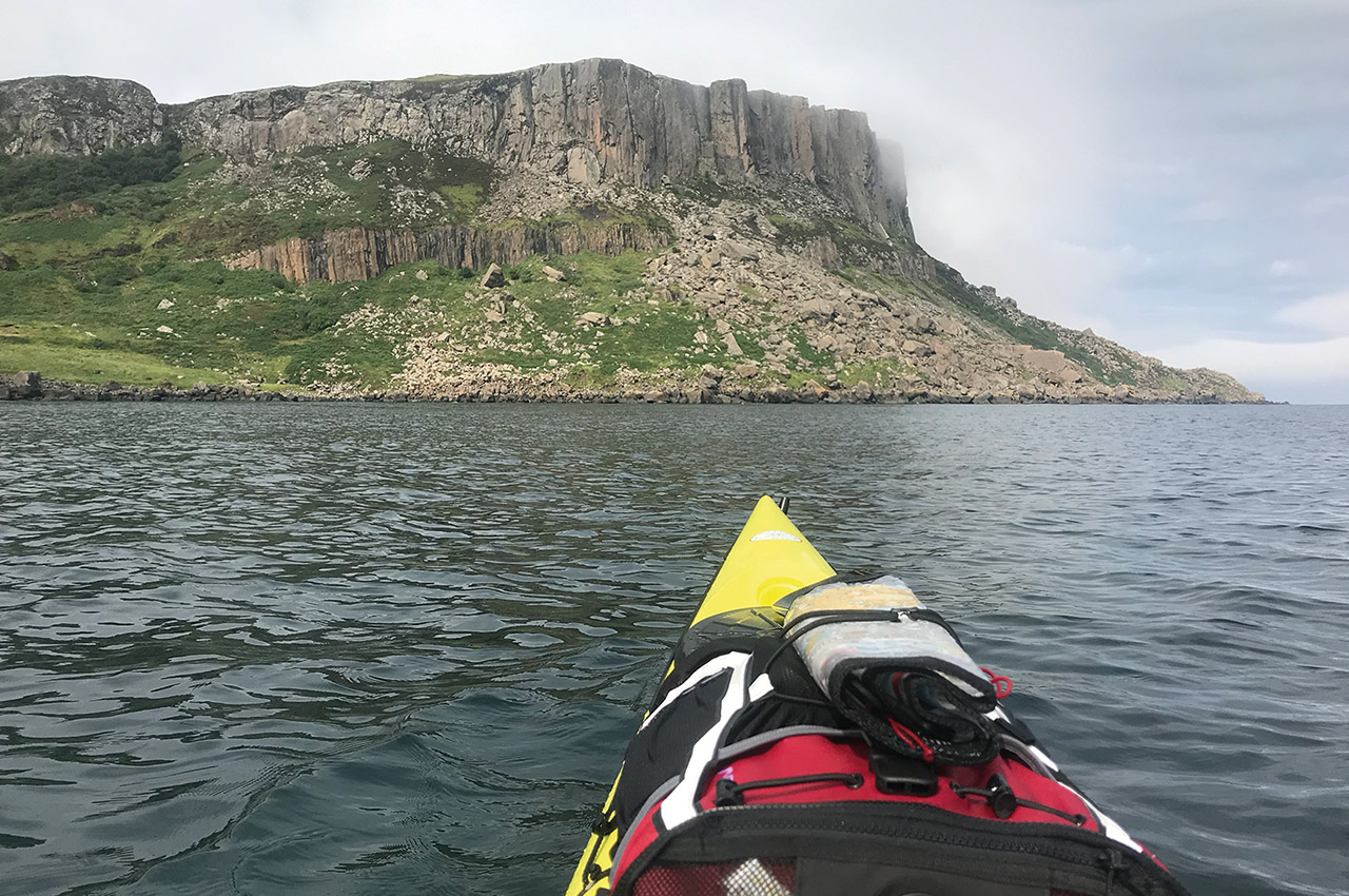
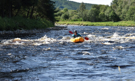
Here I was in Ireland, I had to embrace the fact that this was happening and fully commit to each day and to my plans to go anti clockwise. I moved through the north coast and managed to make good time. The first day gave me a boost and I paddled through tide races in lovely warm weather, looking out towards the Scottish islands and passing the giants causeway.
The headwinds arrived on the third day and I hugged the coast and took part in some tactical rock hopping to avoid the winds and tide. The weather was really changeable and as I moved around the northern tip, progress was slowed by strong headwinds. I battled on. The north coast is amazingly beautiful, the clouds hang over the mountains and the sandy beaches stretch for miles, I was soon to understand that the majority of the Irish coast is sandy beaches split by large cliffs.
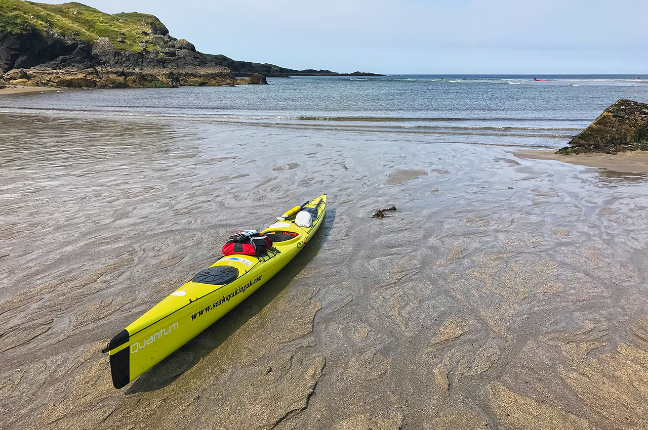
When I made it to the west coast the wind was opposing tide and the water was pretty bumpy but I was moving quickly and managed to keep the wind on my tail for most of the day. Moving down towards Dawros was a full on day and arriving at a remote headland at 22:15 was a big relief. I surfed into a natural harbour as the sun was setting. It was an amazing day and these were the conditions I had been expecting, the true Ireland. I had paddled past ten islands that day and covered 50 nautical miles.
I sorted my gear and sent my girlfriend a picture of the sunset. She sent me an alarming message back and I called her straight away. She had answered the phone in tears and she had just hung up from calling the coastguard. She had called them after becoming worried. I apologised profusely and after she had calmed down, I decided I needed some help on the safety front to relieve pressure on myself and others.
The next morning I messaged Steve Bowens, one of my best friends whom paddled around Scotland with me last year. He is a surf lifeguard trainer and AALA inspector, knows the Irish coast and understands the processes involved with FSK expeditions.
Every day I would send Steve a route card with timings and anyone would be able to follow me on an app. Elise my girlfriend would be able to call Steve if she couldn’t get hold of me.
Basically the instructions were, if you cant get hold of me, haven’t heard from me by 02.00 and the tracker isn’t working, call the coastguard and tell them my last known location and my target location for that day. The thing is with these trips, by the time anyone can get to a solo paddler on an exposed coast, it’s probably too late and I was fine with that, it’s something I accept when I paddle solo in remote locations.
6,000 calories a day
The next couple of days I passed Rossan Point, stopping quickly to re-stock the boat at Malinmore. This was when I realised what Steve had tried to tell me was true – being a Vegan in Ireland will be hard. Milk is in most things and whole foods won’t be common. Even cereal bars were hard to come by but I bought what I could and loaded up the boat.
My decision to only carry minimal food was still good, a heavy boat is a slow boat. It’s crazy how much food a paddler consumes when paddling consistently quickly over long distances. The amount of calories burnt per day is estimated at 6,000. To get a balanced intake of carbohydrates, sugars and fats is hard. Most energy bars are hard to eat after one has eaten ten and some of them taste horrible. Flapjacks for me are the best but I couldn’t buy them in most places. Biscuits and peanut butter sandwiches would provide the energy.
Moving towards Easky was challenging, the wind was changeable and making it to an island called Invermurray with a headwind was tricky. In Ireland there were monasteries and signs of historic habitation on most islands. I didn’t get much time to explore but luckily the islands were home to many species of birds and it was great to hang out and watch them. Camping on Invermurray was really fun and the next day I paddled to Easky in wind, fog and rain. My original aim was to cross the whole of Sligo Bay in one go but the weather just wasn’t right. That lost me a day. Luckily I had a tail wind heading towards Benwee Head and I camped at Raheen, which set me up to pass through my first crux section of the trip.
When I woke up on the sixth day knew that it was only a matter of time before that swell and west wind came in – the weather forecast was promising bad things. The Mullet Peninsula was challenging with really strong offshore winds, followed by strong headwinds and squalls. I realised that my dream of settled weather for the whole of the west coast was just that: a dream.
I made peace with the decision that breaking the record of 23 days was very unlikely. To be honest, as soon as I made that peace, I was relieved and I felt more relaxed. From that point on, I wouldn’t be attacking Ireland and launching an offensive. I decided to work with the conditions and go with the flow. Whatever I could achieve and whatever happened, just happened. If the weather was bad I would do a shorter day and get to a sheltered camp. I didn’t take unjustifiable risks, exhausting myself, trying to make the same distances.
I rounded one of the southern points of the Mullet Peninsula and met Sean Pierce of Shearwater Sea Kayaking and his group. What a great guy! He spent time with me and we looked at the maps and he explained a few areas, giving me some tips. It was great to talk to such an enthusiastic and nice fella for a while. He understood my journey and he was interested in my plans – his advice was sound and local.
Opinions are always tricky for me to gauge and advice is always hard for me to accept, but it does allow me to form a well-rounded vision of what I should expect and be aware of. Early on in my planning for the trip I had learnt not to listen to other paddlers advice and their horror stories. I needed to make my own plans and rely on my own judgement and experience. Other paddlers just made me nervous and anxious of certain phantom cruxes and stretches of coast. The outdoor world loves a bit of horror.
Strong rain and winds
Waking up at Surge Beach, I knew the weather would get bad. I set off from the beach at 06:30 and battled my way toward Achill Sound and Achill town. The rain and wind got really strong and the rain was so thick at times I couldn’t see. The squalls and wind would come and the wind would be so strong that I would just hold my position for up to 20 minutes and let it pass, when it subsided slightly I could carry on and find a wind eddy.
When I arrived at Achill town I was tired and luckily a local chap called Patrick let me stay on his lawn, he provided me with a shower and a cup of tea. It felt amazing and even after only a few days of being wet and sweaty, it felt so good to come into contact with a modern world. I made a base camp on Patrick’s lawn and re-stocked the kayak, ate a lot of food, stayed dry and made some alterations to my kayak. I was sitting there, chatting on the phone, I look up and who is there? John Willacy! Can you believe it! John holds records for most of the circumnavigations, crossings and circuits in the UK. John has never set a time for Ireland but it’s very likely that when John does, he will set a new record time.
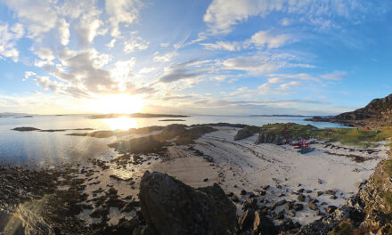
With the boat packed and maintained I moved on from Achill and I was treated to the best day so far, I paddled past many islands, two big headlands including Slyne Head and I arrived in Connemara. When I got to the bay where I was due to camp, the dolphins came out to play and they swam with me for half an hour, I love dolphins.
The camp was set up and I sat above a beautiful beach watching clouds rising and moving towards me like monsters in the sky.
The weather forecast was not good and I stood on the hill and looked towards the Aran Islands and the middle section of the west coast. This was the section of coast that I had received the most warnings about, with horror stories about clapotis and boomers.
A big low pressure system was coming and that evening was the calm before the storm. The northern section of the low pressure system, bringing easterly winds, which annoyingly would provide me with headwinds on this section. The winds got stronger and I had to get to the Aran Islands as quick as possible and sit out the first 30-knot winds. I made it to Inisheer and that night the wind and rain got so strong it felt like I was camping in a hurricane.
hundreds of people
It settled slightly the next morning and I climbed into an old 15th century castle, ate my porridge and stared at the sea. The easterly winds were still there but that would mean the cliffs of Mohar would provide me with a wind shadow, clapotis would be minimal and I’d be able to make progress, if I could get there. The winds were touching F4/5 but I loaded up and paddled out from the island. I had a battle to get to the cliffs and when I looked up they were lined with hundreds of people staring down. I paddled along the cliffs in flat water and passed through the arch at Hags Head and out into stronger winds, probably F6/7.
After getting to a beach close to Spanish Point, I sat and ate lunch, stripped off and swam in the sea and washed out all of my dry clothes. Sometimes with strong headwinds one has to just wee and deal with it later, stopping paddling isn’t possible, a relief zip in my dry pants is essential and toileting isn’t usually an issue. Strong offshore winds with a short fetch are hard in a sea kayak because it hits the boat and the paddler square on, gaining shelter in the troughs isn’t possible.
Looking up there was blue skybox looking out to sea or inland there were walls of cloud. I’m not exaggerating; this was paddling in the eye. I had identified Whitesands, Doonbeg as a sheltered location and my plan was to get there, set up camp and wait for the southern part of the depression and the westerly winds. The winds came that night and the winds reached gale force for the next few days, with frequent small craft warnings put out over the radio by the coastguard. Luckily social media worked amazingly well and Ireland circumnavigations have a strong following of very enthusiastic paddlers. A group of great guys showed up and we all ate food and talked about paddling whilst I waited out the storm. A big thanks to a chap called Ted.
The weather moved through and luckily it was ok to paddle out. I knew there would be some swell and clapotis hanging around and the headlands would be spicy but I had to move south. The sea-state was still around SS5 but it was ok. I have spent a lot of time surfing, coasteering and rock hopping and it has really helped me analyse a coastline and read it like a river. I can see where the eddys and sheltered sections are and which beaches I can land on, so I wasn’t worried too much about the rough water and swelly sections.
All I was thinking about at this point was getting around the south west tip, the crux. I pushed south and made great progress making it to Brandon. Brandon is the start of the south west’s headlands. It had taken 15 days to get here and I was pleased with that.
The clapotis through the south west section was relentless and my stroke rate was much higher with my glide phase being reduced, having to low brace was pretty normal.
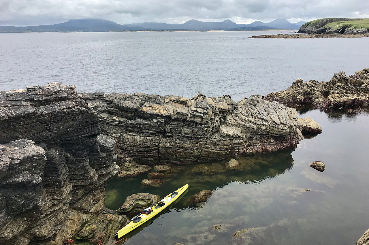
Blasket Sound and the islands were inspiring and this section is where the incoming tide splits on the west coast. Dunmore Head gets hammered by all the conditions but luckily I managed to pass it on a relatively calm day. I knew the next two days would be pretty rough.
Mountains next to the sea create their own weather patterns. The weather was so changeable, there could be blue skies and F3 winds one minute and then the temperature would drop and the rain would start and the wind would pick up to F5 the next minute. It was hard paddling and when I reached my camp spot near Puffin Island, Portmagee, I was tired, the 15-nautical mile crossing had worn me out. I made soup using spring water and ate a lot of food. I was halfway right now and that felt really good.
Part two of Tom’s circumnavigation of Ireland will be in the next issue.