By Mal Grey
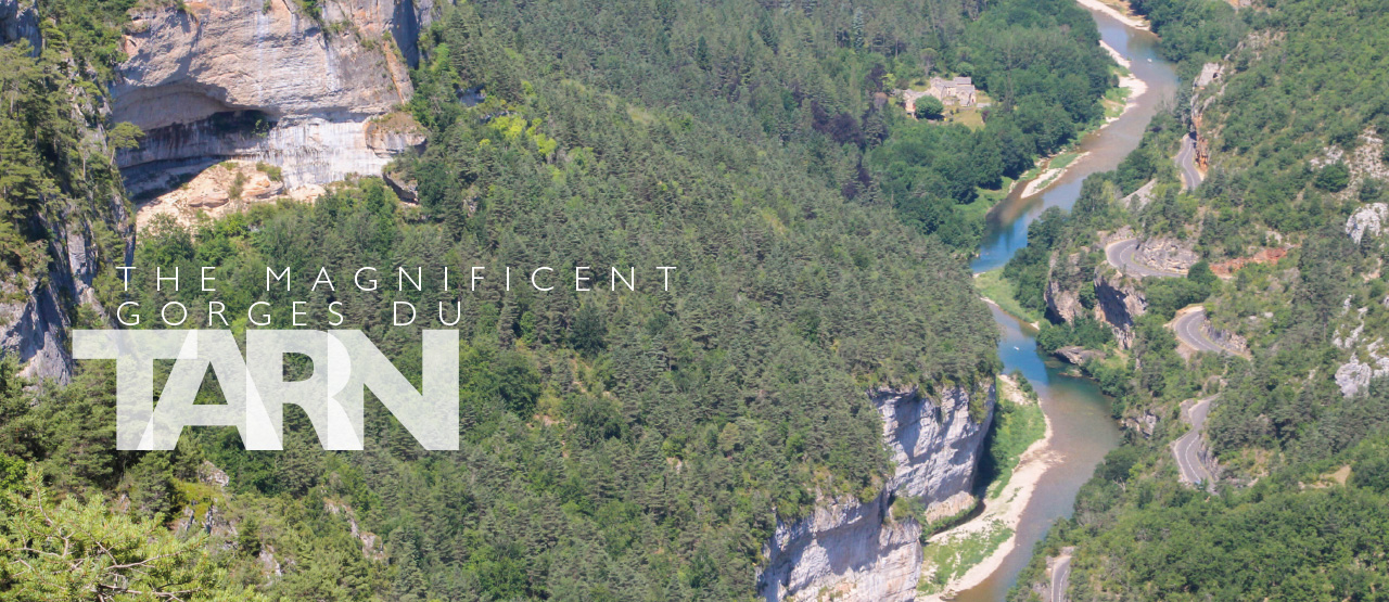
The Tarn is a river of southern France. Rising only an hour’s drive from the Mediterranean, on the high plateaux of the Causses, it winds its way westwards to join the Garonne and ultimately reach the Atlantic. On its 400km journey, it falls from 1,500m to just 60m. Most of this drop is in the first 100km, as it cuts deeply through the ancient limestone of the Causses, carving out huge canyons on its way. The biggest, and most impressive, of these are known as the Gorges du Tarn, the main section of which runs for 40 miles through simply stunning scenery.
The Magnificent Gorges du Tarn
Here warm limestone cliffs tower up to 600m above the river but, perhaps surprisingly, the river itself is amenable and almost all paddleable at a modest grade. I’ve been fortunate to paddle here several times, but my most memorable trip was probably in summer 2016 when a group of us paddled the four days from Florac to Le Rozier as a continuous journey, and this is mostly the tale of that trip, with a few photos and observations from other trips thrown in for good measure.
It was the end of May and France was wet. Very wet. We’d arranged to meet and paddle on the Lot at Entraygues, a nice warm up run for the Tarn later, but it had been in full flood and conditions were cold and wet. Not what we’d travelled to southern France for. We were surprised to find, though, that RiverApp suggested the levels over the watershed on the Tarn were modest but sufficient, so we abandoned the Lot and headed for Florac.
Just a two-hour drive, and we were on a campsite at Pont du Tarn, by clear bubbling water at modest levels. Perfect for our intentions. Florac is a small and likeable little town in the deep valley of the Tarn a few miles upstream of the Gorges du Tarn proper, and has all the facilities you need to stock up for your trip. From here we would paddle for 40 miles to Le Rozier, dropping around 150m on the way.
Florac to Castelbouc
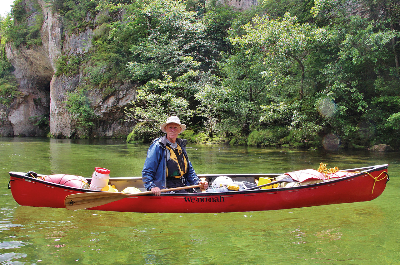
Having dropped my car off at Les Vignes on the way over, we were free to paddle straight away in the morning, no faffing about with the dreaded shuttle run. Soon enough, we were ready to go with laden canoes. Fortunately, you don’t need too much gear for this trip, as even in the slightly disappointing weather we were experiencing, temperatures were mild, and there are places to eat and drink along the way. In summer, you need little more than shorts, a hat and suntan lotion. Some locals wear less…
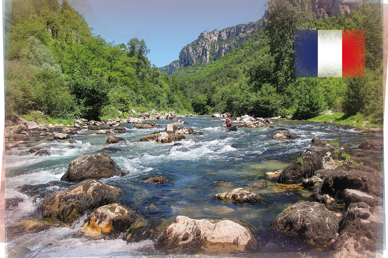
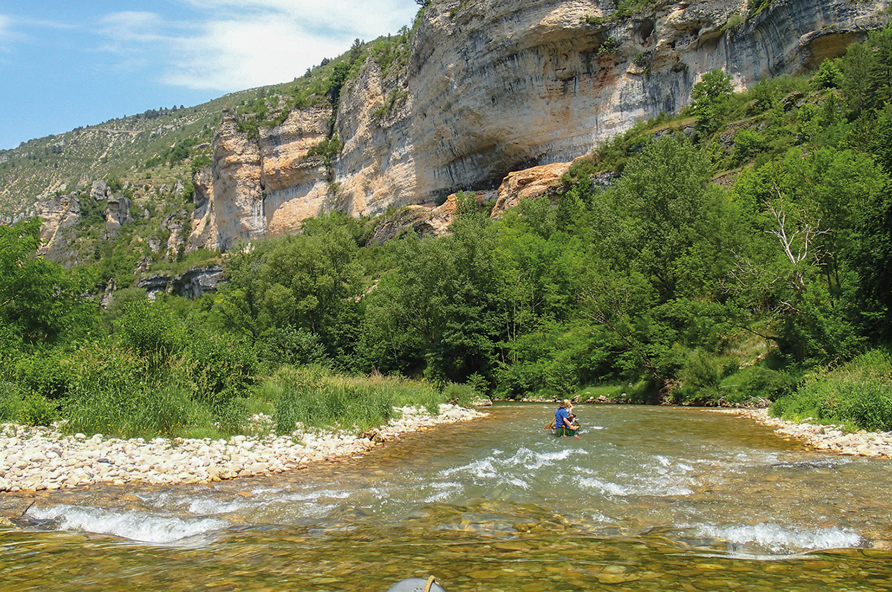
The first day is quite shallow, and needs a little water. We had just enough, but the first few rapids were a little scrapy as we got used to handling our laden canoes whilst our paddles banged off the stones a few inches under our hulls. Mostly though, we paddled on gently moving water beneath steep wooded slopes, with the odd small crag poking through the trees, and numerous villages and farms about.
The rapids became more frequent, and the valley sides got closer, and steeper, the river winding its way around a series of bends. The river was now classic easy pool-drop paddling, with no difficulties other than the danger of getting stuck on a shallow bit.
We didn’t have a great deal of information about this first day, but ‘The Bible’, Pete Knowles’ White Water Massif Central guide, suggested a couple of harder rapids and our map even had some blue chevrons marked near Ispagnac. The first of these we passed unnoticed, just another one of the numerous little riffles. However, ahead the water was slowing and deepening, the classic sign of a steeper drop approaching. At a tight left-hand bend, we came to our first proper challenge.
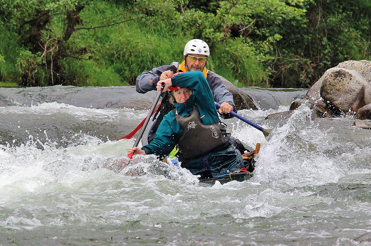
A longish rapid fell away below us, briefly steep at the top, before levelling off through a bit of a rock garden. Just below the initial drop, a large, slightly evil-looking, rock pushed out into the flow exactly where your canoe would be taken. We’d need to be careful and to commit to the move.
Luckily we have a couple of daft keen types, John and Peter, who always leap at the chance of things like this, so we sent them down first. Peter bounced off the end of the rock, John avoided it to the right but too close to hidden underwater rocks which spun him round and he finished the move backwards. Both were fine, thanks to their paddling skills and eddied out. It was my turn.
This was the first time I’d paddled a harder rapid with a laden canoe, so I was a little nervous. As I dropped down the initial slope, the acceleration was alarming, and that tooth was definitely looking at me with a greedy expression on it face. I paddled hard to move to the right, and just scraped by with a heart-in-mouth moment as the upstream gunwhale dipped, before I recovered it. Phew, I eddied out on the right half-way down, to fulfil my role as photographer. The rest came down in turn.
Nobody had a problem, but everybody had a little moment I reckon, either just missing the rock or spinning on hidden boulders if further right. We’d passed our first challenge, but I was hoping there would be nothing any harder ahead.
Next challenge
Our next challenge was quickly upon us, a broken natural weir. I wasn’t sure it would go, but John spotted a slot we could get through, and in the end it was straightforward. We knew the day would now become easier, and stopped for a welcome lunch break. One of my favourite bits of French paddling is breaking out the baguettes, cheese and meats and sitting on a gravelly shore watching the sparkling waters bubble past.
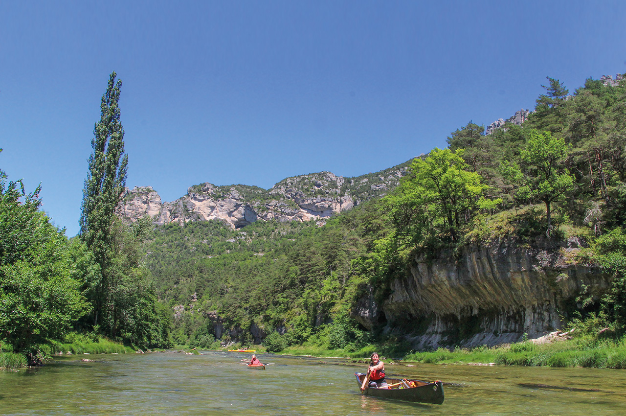
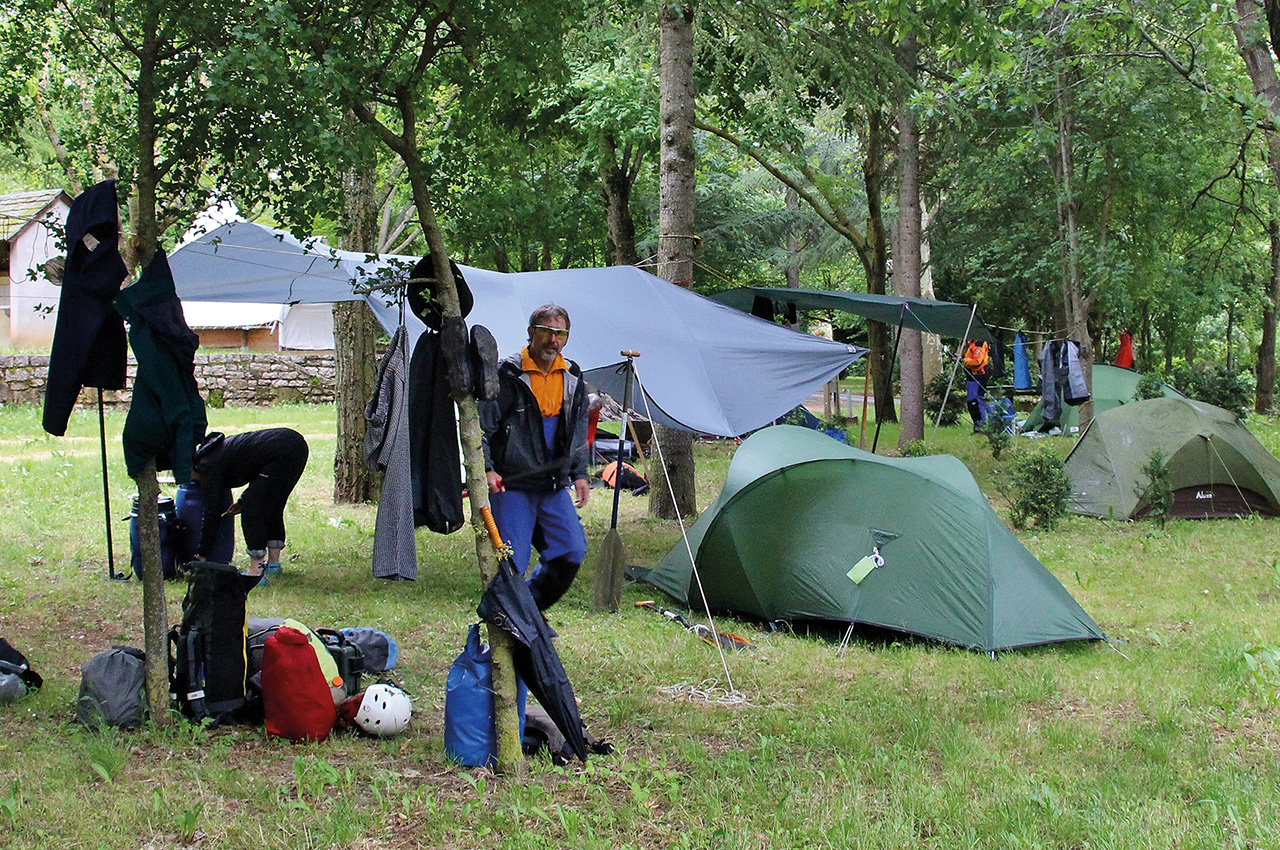
The afternoon was easy, the scenery becoming ever more spectacular as we swung west into the Gorges proper. The pastel-coloured cliffs became larger and more frequent, sticking their warm faces out above the clinging pine trees. At times the water undercut the cliffs, and we could drift in calm pools beneath the towering limestone walls. The day pressed on, and we turned our thoughts to camping. Enquiries before the trip had been met with a universal, “No need to book,” reply and the gorge was remarkably quiet.
The season is so short here, this last week of May and first week of June was still too early for the French, something I find remarkable given the spectacular nature of the region; in the UK it would be rammed all year. Anyway, there were half a dozen campsites marked on the excellent IGN 1:25k map, so we happily floated past the first couple, where we could see just a few tents pitched and pulled up at the next. It was closed. As was the next. Hmmm. This left us with one remaining option, the site at Castelbouc. Fortunately, they were open and we had a home for the night.
Castelbouc to La Maléne.
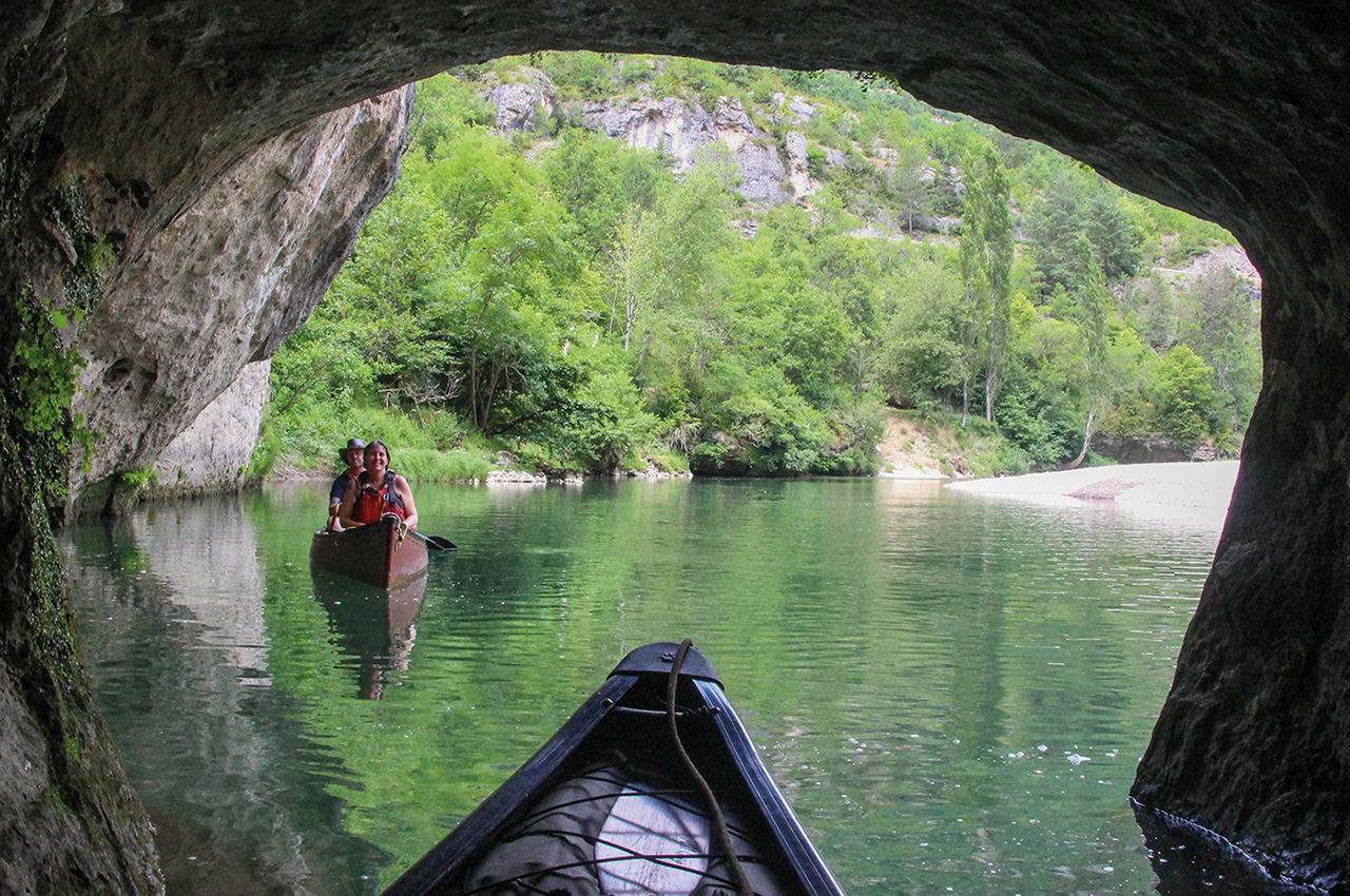
The village of Castelbouc, just downstream of camp, is a spectacularly perched little hamlet on the south bank, reached only by another low bridge. Here a crumbling tower above the village is all that remains of one of the many castles which perch on little bluffs above the river. Today we’d be heading into the heart of the Gorges, paddling down past the villages of St Enimie and St Chely to La Maléne, right in the middle of the gorge. The river becomes easy, with long sections where you can drift happily in awe at the scenery above, broken up by fun little riffles where clear waters burble over rounded pebbles. At Prades, we had to portage around the large weir, as it was too steep with shallow water below. Kayaks would probably get away with it. In other places, huge piles of tree debris pressed against the rocks, an indicator of what the canyon must be like in winter floods.
Above St Enimie, another long pool heralded the next big weir. Here, the river drops off sharply on the left down a remarkable little channel, almost like a tunnel between overhanging cliffs and leaf-laden trees. A few rocks and some swirly water in the narrow gaps between them keep you alert, before you pop out opposite the town beach. St Enimie is the ‘capital’ of the gorge and here there are small shops, bars and cafés should you need them.
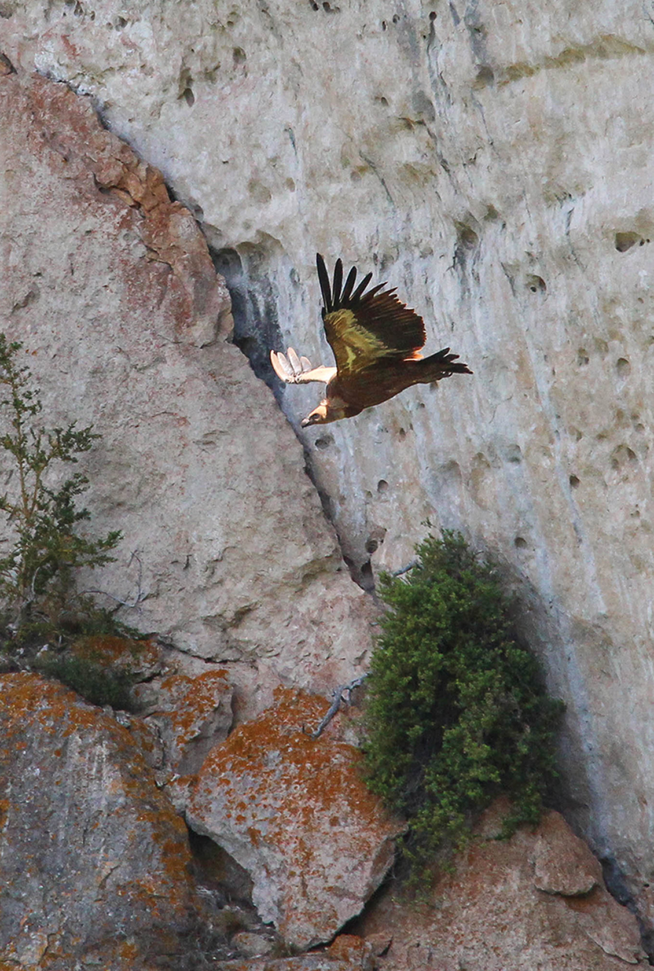
Now you start to enter the true gorge, and the valley sides rear up above you. The paddling is a doddle, but you could never be bored. At times, we simply lay back in our canoes, put our feet on the gunwhales and gazed in wonder at the towering walls above, where small specks circled. These little black dots were actually Griffon Vultures with two-metre wingspans, for a healthy population lives in these parts.
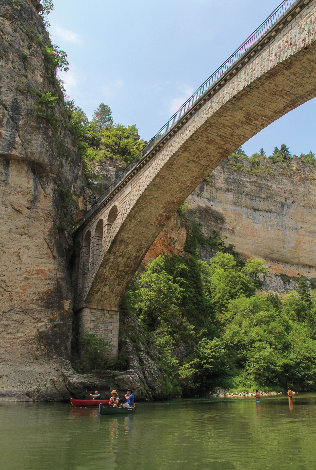
St Chely du Tarn has to be one of the most spectacular villages of the gorge. A stone span leaps from cliff to cliff overhead, above a welcoming beach and deep, slow pool, perfect for swimming. Here a tributary stream tumbles over a glistening waterfall into the clear water, where large fish can be seen swimming lazily below your canoe.
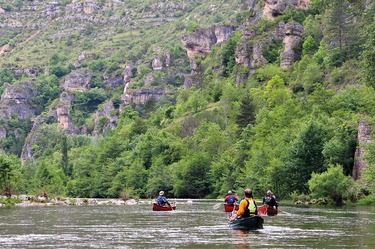
The canyon opened out a little round the corner, and the rest of the day was spent paddling happily down easy riffly rapids, and along long slow sections with eyes upwards to the hundreds of crazy pinnacles that march towards the skyline.
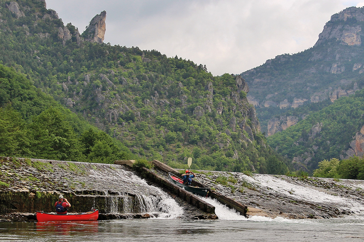
La Maléne arrived after a long straight stretch, lined up with the prevailing winds which tend to rise in the afternoon as the heat causes the air to rise and the breeze is sucked up the valley floor to replace it, so we had to work a little here. A big weir here can be run on the left if there is enough water below, or clambered down if not – this time it was easy enough. The campsite is a little further on after the bridge, within easy walking distance of the village, and that night we fed on excellent pizzas in a vault beneath the hotel by the bridge.
La Maléne to Pas de Souci
The third day is short but makes up for it by passing through simply astonishing scenery. There are only a few shallow rapids and it is likely you will see more people than on the other days, including the traditional flat-bottomed tourist boats that take people down this part of the canyon. On this trip, though, we only saw a handful of people even on this stretch, so quiet was the whole valley.
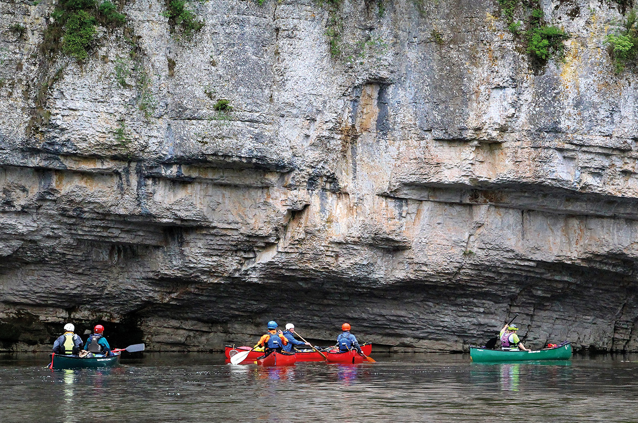
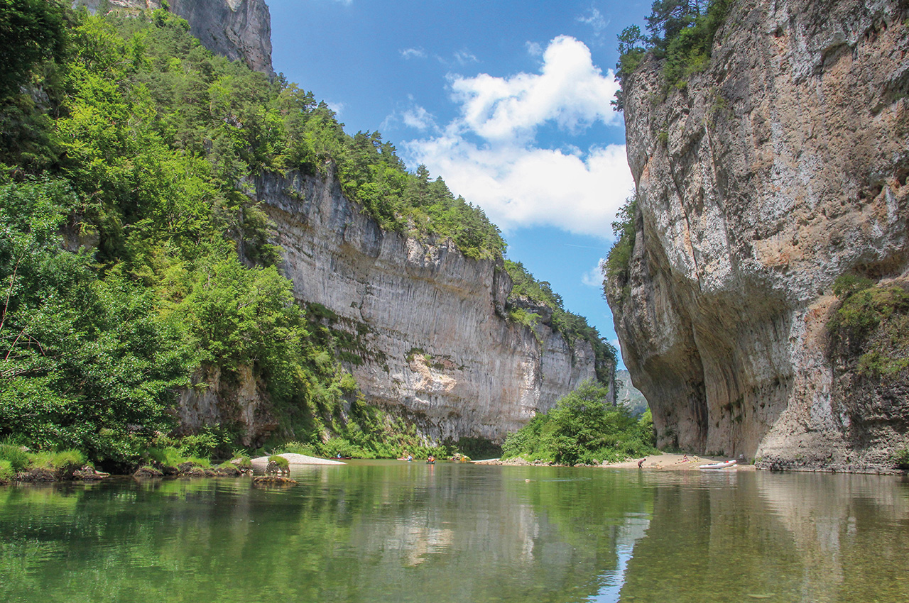
After a few kilometres of sublime easy paddling, we found ourselves in the very deepest part of the gorges. Here, the walls close in, and limestone towers above your head on both sides of the river, above which steep pine-clad slopes lead to a final massive tier of cliffs over 500m above you. This is Les Detroits, the most famous part of the Gorges du Tarn. A small beach made for a perfect place to stop for a break. As we put in after a lazy lunch, a sleek shape glided along the face of the cliffs above, a short-toed snake eagle.
The reason for the short day comes at the end. At the Pas de Souci, half of the valley sides has tumbled in giant blocks into the river over the millennia, forming lethal strainers and syphons where several people have died. These are continuous enough to warrant climbing up to the road, and portaging down that with trollies, a slightly risky exercise on narrow winding roads. We, though, had come up with a sneaky plan. We were staying that night at La Beldoire campsite (note this was closed in summer 2017), so had asked to leave my vehicle there and after the short day we’d had, there was plenty of time to complete our car shuttle by walking to the campsite, then fetching the other cars from Florac and picking up the boats on return.
The get out above Pas de Souci is worth a little description. I would recommend inspecting this whilst running a shuttle, just so you know where it is. You can’t really miss it, there are numerous hire company signs and two battered old buoyancy aids suspended on a cable above the river. A track leads here from a layby on the road. Technically there are a few get outs, each owned by a different hire company, and no official public access. We had no problem, but as each is gated, you might not be able to bring your cars down from the road and have to carry up to it.
Les Vignes to Le Rozier
After camping at La Beldoire, just above Les Vignes, our final day would arguably be the most fun. The gorge sides open out a little, the steeper cliffs retreating upwards to form a mighty precipice along the rim, below which steep pine forests have an almost North American look to them. If you start at Les Vignes itself, you miss a superb long glissiére slide down the weir, but otherwise this would be the obvious launch for a day trip.
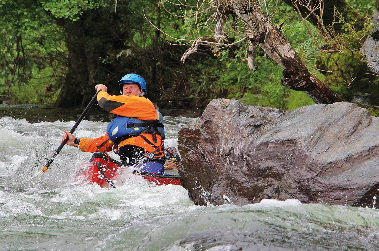
You still get to enjoy a day of regular grade 1 and 2 rapids, with a little bit of spice thrown in with one slightly harder 2+/3. As we left behind the village, the valley ahead is clear and obvious, no longer winding as it has been for the last 30 miles, but straight and with an obvious downhill trend. Little drops appear regularly, each with enough eddies for as much or as little play-time as you want.
I’ve done this run three times now, and I can honestly say that it’s my favourite white water open canoe day anywhere, continuous but not difficult, with the magnificent scenery of the Gorges du Tarn all around you, and all in warm French sunshine. On this occasion, there was a little more flow than on the others, so a little less rock dodging, but some good defined little play waves. We were loving it, especially as we’d emptied our canoes of the camping gear and just run a quick shuttle from camp to the finish.
As the valley drew us onwards, our eyes were pulled to the rocky tower of Le Cinglegros, a huge limestone bastion that marks a turn in the river, and lies above the hardest rapid of the day. Here, La Sablière is a grade 2+ rapid, maybe a 3 in certain conditions. A hundred metres or so long, the flow pushes you straight at an obvious rock which regularly collects hire canoes. On this trip, it was almost washed out, but still required a definite move to the right.
From there onwards, the faster rapids come more quickly for a while. I remember the utter feeling of contentment the first time I did this part, watching my mate paddling ahead down these gorgeous sparkling modest rapids, whilst above his canoe towering walls of limestone hung under blue skies.
All too soon, as it’s only a seven-mile trip, we approached Le Rozier as an afternoon thunderstorm built up, rumbling amongst the tops high above us and we finished under the bridge in a downpour. No matter, it had been a wonderful journey, through this spectacular canyon. Despite the villages, decent campsites and the nearby road, every time I’ve done this it has felt surprisingly remote, and out of the height of the summer season, we only saw one other paddled craft on the whole river.
Sparkling waters, towering limestone, warm sunshine and whitewater paddling in shorts and t-shirts? What’s not to like?
Information
Starting point:
Our route started in Florac, at the campsite marked on Paddle Points here: www.paddlepoints.net?PP=10041
Resources:
The book Whitewater Massif Central by Pete Knowles is the acknowledged bible for paddling in this part of the world and is aimed at families and open canoeists. Currently out of print, a revised and updated second edition is due out by summer 2018 from Rivers Publishing.
Camping:
We camped at; Pont du Tarn, Florac; Castelbouc; La Maléne; La Beldoire, Les Vignes. All are typical relaxed, tree-lined, French campsites, though in the height of the season booking would be essential. Typically, bakery products can be ordered for the morning.
Supplies:
There are supermarkets at either end in Florac and Le Rozier. The villages of St Enimie and La Maléne have small shops and a few hotels.
Temperatures:
In summer, it can be warm, very warm, in the high 30s Celsius. However, on the water it doesn’t feel as oppressive, though its very important to cover up and use water-resistant sun cream.
Family paddling:
The two middle days would be perfect for families of any age, and the final day for those who’ve done a little moving water before. The first day is a little harder, a mistake having more serious consequences.
Canoe hire:
Each village has plastic sit-on-tops for hire, which are fine for a short trip.
If you want to hire proper open canoes, and to get help with the logistics at either end, a British couple, Mark and Louise, have set up a business targeting this market with bespoke hire trips on rivers like the Tarn, Lot and Cele. Based in Cajarc on the Lot, the Tarn is one of their most popular itineraries. More information can be found on their website: www.canoemassifcentral.com