
Words: Janni Williams
Photos: Janni &
Kevin Williams
South Skye Sea Kayak
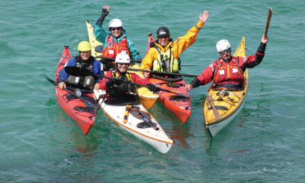
South Skye Sea Kayak is a small kayak centre, founded in 2008 and run by Kevin and Janni Williams, offering day trips, expeditions and skills courses. Situated in Sleat in the south, it is an ideal spot for trips and coaching days for all levels.
![]()
- Fleet of 26 sea kayaks by Valley, Northshore, Venture and Evolution.
- Equipment by Peak PS, Reed, VE, Lomo and more.

Discover the magic of Skye by sea kayak
The Isle of Skye is one of the most iconic islands in Scotland and, with a population of 10,000, is the biggest of the Hebridean islands. The island’s five peninsulas, each with unique character and charm, give Skye its Gaelic name: An t-Eilean Sgitheanach or The Winged Isle.
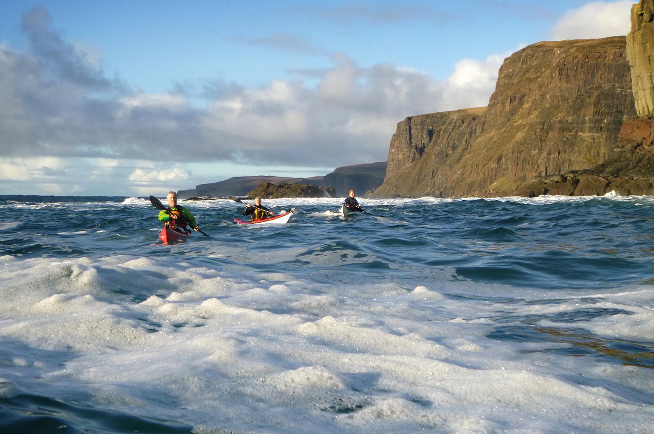
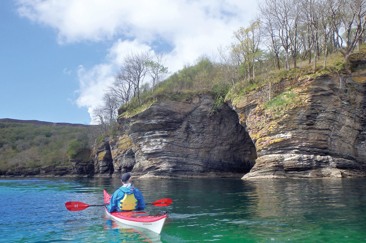
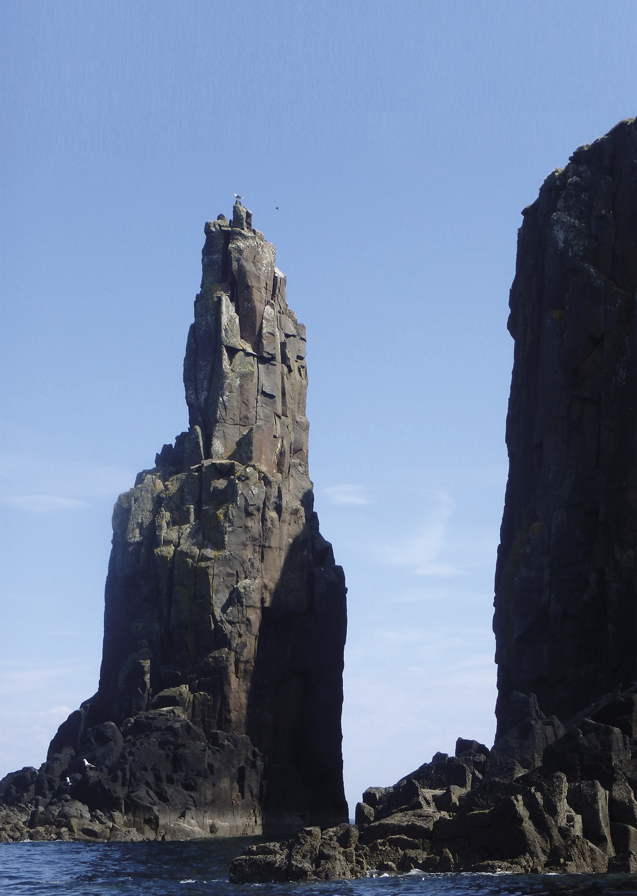
The diverse nature of the island’s distinct regions creates endless opportunities for sea kayak trips. The northern peninsula is rugged and boasts impressive rock needles and pinnacles, high cliffs and waterfalls, and the famous Trotternish ridge plateau.
The south is defined by gentle hills lush with flora and fauna, beautiful beaches and an often sheltered coastline. The northwest, in contrast, is more barren, with steep cliffs and caves. At the heart of the island towers the Cuillin Ridge: a dramatic volcanic mountain range of dark and grippy gabbro rock. The Ridge is a favourite of mountaineers and hill walkers wanting to attempt its 12 Munros (Scottish mountains greater than 914m).
The geography of Skye is ideal for kayaking and allows paddlers to choose whether to hide from the West Highland weather or to seek out the thrill of waves and tide races. While the classic highland summers are often wet, the weather in April, May and June is warmer and more settled and often includes long dry spells; It may be the best time to visit Skye. That said, one cannot deny that each month brings its own appeal: the daffodils and warm sun of April, the heather bloom of August and the clear brisk of an October day.
Though tourists throng to the island’s famous attractions, many hidden gems go undiscovered by most visitors. The natural scenery of Skye – Jurassic sandstone cliffs, sandy beaches, zebra gneiss pebbles and remote coves – are complemented by the historic castles, brochs and remains of highland villages scattered along the coast.
Most visitors arrive on the island via the Skye Bridge at Kyle of Lochalsh and head directly north, where many of the most well-known attractions can be found close. The Fairy Pools, a crystal clear stream that runs out of Coire na Creiche in The Cuillin, and the Old Man of Storr, an impressive rock pinnacle which is the result of the biggest landslide in Europe and which, even today, slips several centimetres every year, have been widely publicised on Instagram and are now visited by upwards of 200,000 people a year.
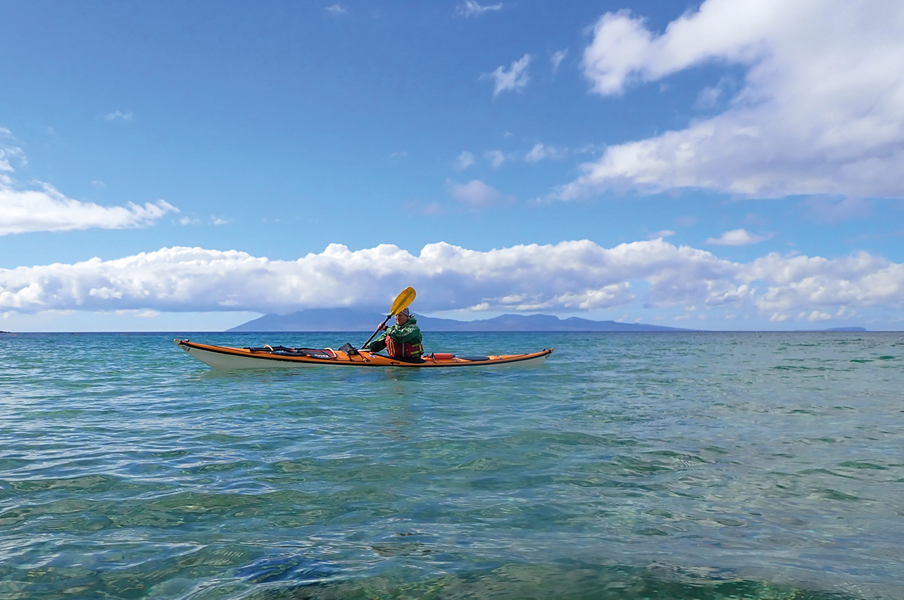
Visitors then visit the Quirang, the Coral Beach of Dunvegan, Talisker Bay and Neist Point Lighthouse. Some attractions, such as the Kilt Rock Waterfall, can be best visited by kayak. Perhaps though, the south of Skye is the diamond amongst the island’s little-known gems. The Sleat peninsula, which looks out onto the mountainous mainland, is only known to the most savvy and adventurous visitors; it is a quieter place but offers no fewer opportunities and attractions – especially for sea kayakers.
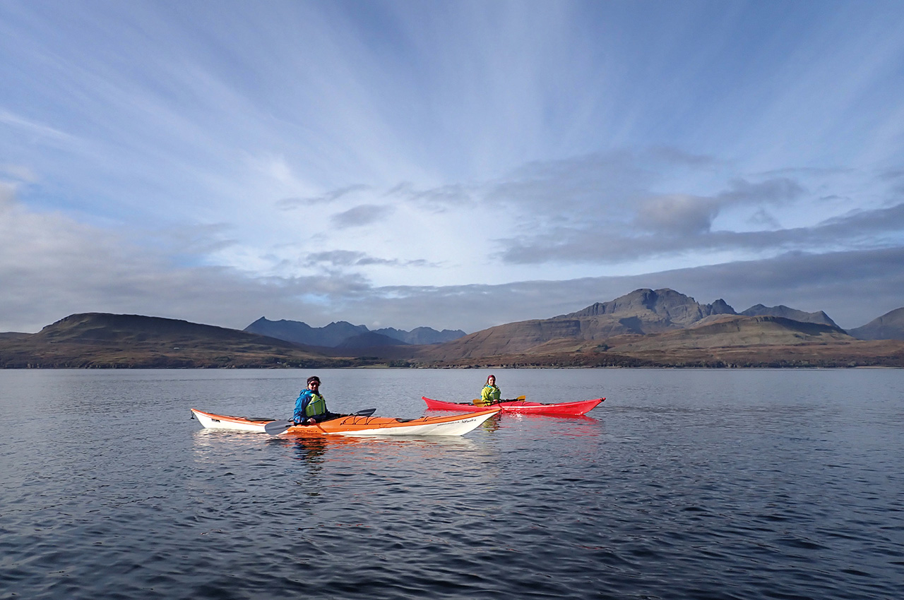
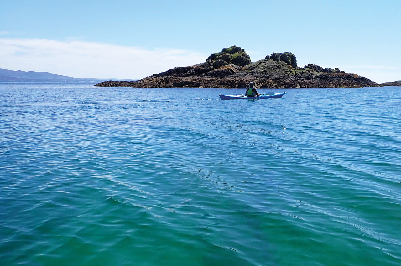
Its proximity to the mainland gives it easy access by ferry and bridge and ample accommodation options, rich fauna, ancient forests, beautiful views to Knoydart on the Mainland, and white sandy beaches. The Sound of Sleat is often calmer than the rest of the island’s coastline and offers stunning views and relaxed kayaking. In the evenings, kayakers can enjoy the rich cultural scene the south offers with concerts, music sessions and ceilidhs. Gaelic is still a part of daily life on Skye, especially in the very north and south where the Gaelic College of Scotland, Sabhal Mòr Ostaig, is situated.
The paddling options on Skye are innumerable. They can be travelled in one long circumnavigation – which Kate Duffus achieved in three days but can also be appreciated leisurely over ten days while exploring the coastline. Depending on how deep you paddle into each sea loch, this is a 150 – 300km long journey. If time permits, you can watch the weather and choose your trip accordingly to explore the coastline in depth. Here are some of the best kayaking trips on Skye:
The Point of Sleat
The southernmost tip of Skye overlooks the Small Isles, Mallaig, Knoydart and the Cuillin Ridge. Park in Armadale and launch from the beach. Go around the ferry terminal and head southwest along the coast. You’ll pass a few skerries, Eilean Maol (the bald island), Eilean Sgorach (the notchy island), and the village of Ardvasar.
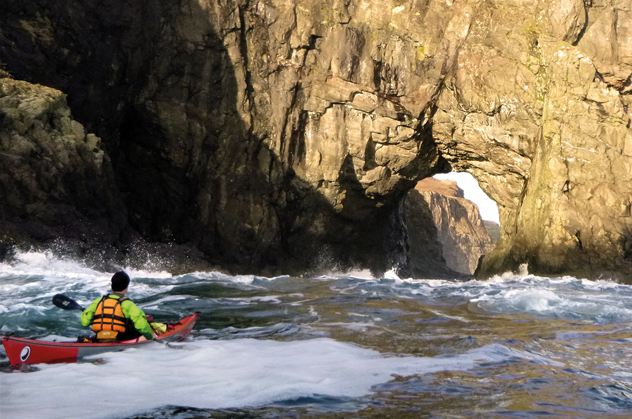
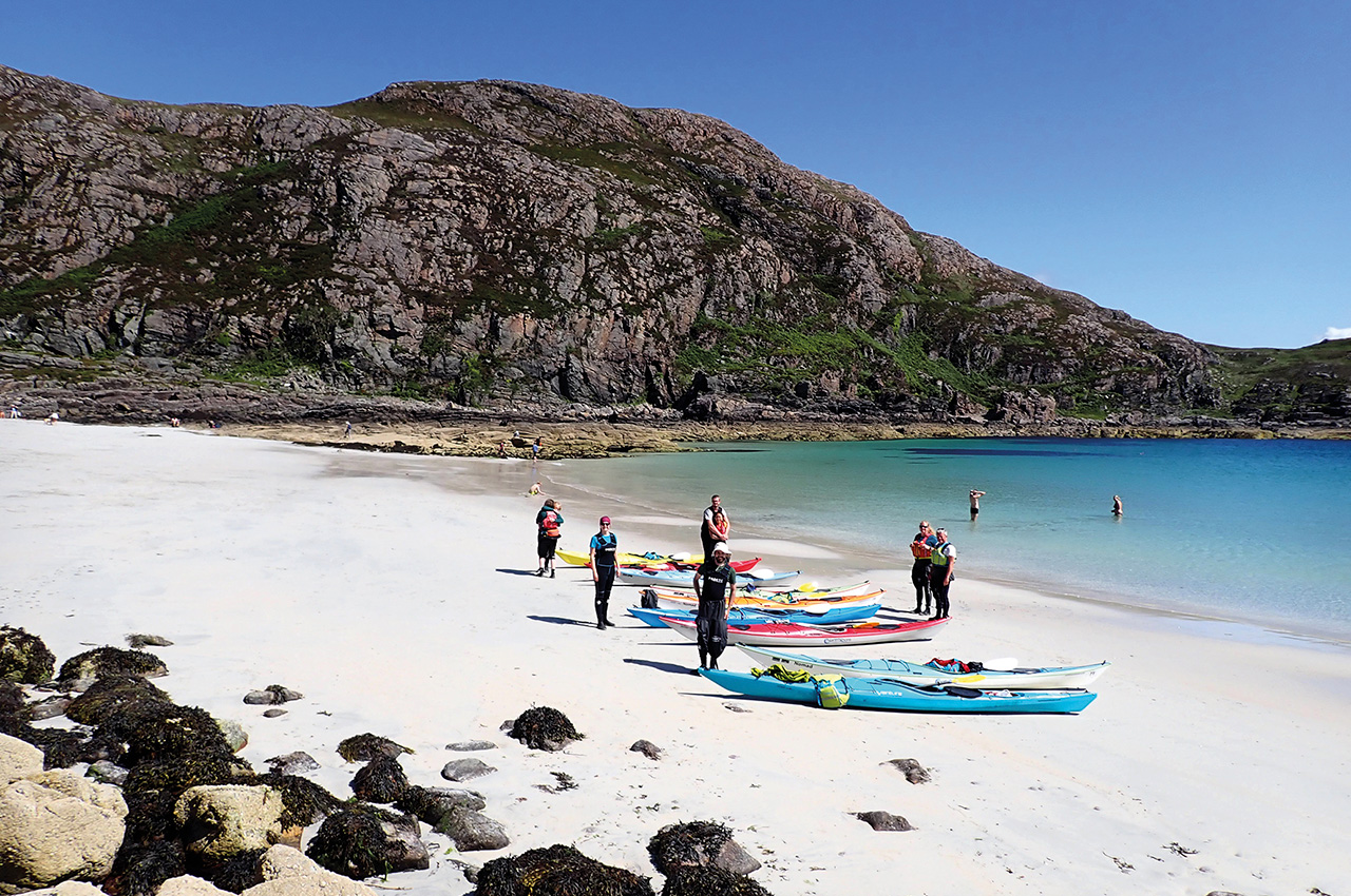
On the way south, visit the rock arch just before Tormore and enjoy the view changing from Knoydart to Mallaig, to Eigg and then to Rum. It can be a bit choppy near Tormore, where the headland reaches into the sea and around Aird, but Port a’ Chùil (the back port) gives excellent shelter for a snack stop before you head on to the Point. Don’t miss the big sandy beach of Camas Daraich (the bay of the oak) for a lunch spot with white sand and Hebridean colours. The lighthouse at the Point is not picturesque, but Orcas and dolphins have been spotted here.
As you turn the corner, a beautiful view unfolds to the Cuillin, which you can enjoy to the landing point. The west side of Sleat is more rugged, and the waters can be rougher as it is more open to the incoming swell off the Atlantic. Stop again at Dalavil, one of the many villages deserted during the Highland Clearances in the 19th century and where you can enjoy beautiful white sandy beaches, turquoise waters and complete remoteness, all with stunning views into the Cuillin. The last stretch provides excellent opportunities for rock hopping until you finally pass the beach of Achnacloich (landing/launch spot at high water, but a long walk at low water) and finish either at Tokavaig or Ord. (29km)


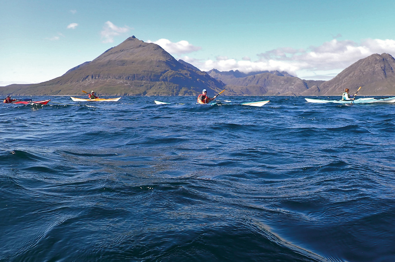
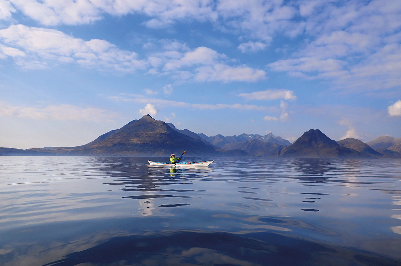
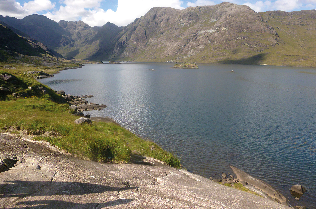
Soay and Loch Coruisk from Elgol
Loch Scavaig is the best place for spotting dolphins and minke whales and offers options for trips of different lengths. Elgol is a busy place in the summer months for boat trips, so unload your kayaks at the pier and always drive back to the top of the hill to keep the lower car park free for less able visitors. From Elgol, the views into the Cuillin are outstanding, and many people come here to see them.
After launching, head north towards Camasunary (Camas Fhionnairigh – the bay of the white shieling), which is an excellent snack stop. There are three buildings here. The one on the left is the old bothy which was taken over by the estate in 2015 and replaced by the new bothy, which is the building on the right. Unfortunately, the latter has no fireplace and is quite damp. The house in the middle is a private house owned by the estate owner Alan Johnson.
After your break, head west past Sgùrr na Strì (the pointy mountain of struggle) and paddle past the notorious Bad Step – an angled gabbro slab walkers must cross to reach Loch Coruisk (the loch of the freshwater corrie). You will soon reach Loch nan Leac (the loch of the slabs), and if you walk NW for 10 minutes, you will not be disappointed by the stunning view of Loch Coruisk. Many visitors are taken here by boat during the summer, but in the winter or shoulder season, you are likely to be on your own. Head back to Elgol (20km) from the beach or take the detour via Soay. This island is famous because Gavin Maxwell attempted to make lamp oil from basking shark livers in the 1940s and is still populated by a few people today. Soay has beautiful caves and an interesting harbour where the remains of the shark oil factory can still be seen. (33km)
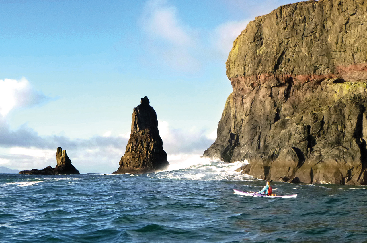
Loch Bracadale and MacLeod’s Maidens
Skye is well-known for its myths, legends and clan warfare, and this trip will place you right in the heart of that tradition. The north was long ruled by the Clan MacLeod, which traces its roots back to the Vikings and still resides here. Legend has it that the three sea stacks called MacLeod’s Maidens are the drowned wife and daughters of the 14th-century MacLeod clan chief. Many islands in Loch Bracadale (Norse for Juniper Valley) have impressive cliffs and caves. Harlosh Island, Tarner and Wiay all make a great day trip from Camus Bàn (the white bay) near Harlosh or Struan (the little stream).
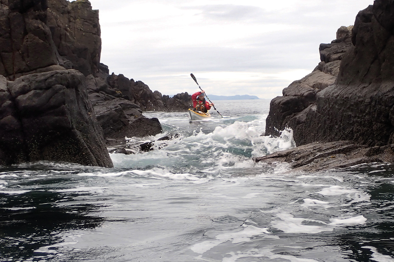
Alternatively, the coast between Loch Bharcasaig and Idrigill Point has many caves and tunnels to play, rock hop and explore your way to the majestic MacLeod’s Maidens. After launching, cross over and head south along the coast but don’t miss the tunnel cave at Meall Greepa (Gaelic: gnìoba – rounded hill of the steep sea cliff). Take your time along this stunning piece of coastline. Visit the caves in high water for the best experience, and beware that they can be like washing machines when the swell comes in. There are minimal lunch options here, so take the opportunity for stops at Brandarsaig Bay and Ard Beag (the little height). Enjoy the views to Canna, Uist and Barra. Turn the corner at Idrigill Point and make for the Maidens. It can be rough around the stacks in southerly and westerly winds, so a calm day is ideal for this trip. On the way back, enjoy the following sea and surf into the beach. (20km)
Rubha Hunish, Eilean Trodaigh and Fladda Chuain
The very north of Skye is famous for the Trotternish Ridge, home to three of the most visited places on Skye. Though the roads can be busy, the sea is not. Be aware that, as well as having a strong tidal flow that requires careful planning, the water here is often rough and open to the elements. Possible launch points are Kilmaluag and Dun Tulm, and you’ll have to plan your day according to the tides flowing around Rubha Hunish. It was common for places in Skye to be named by both the Gaels and the Vikings, which is where you get doublings like Rubha Hunish, which is named ‘headland’ twice. Rubha, a word you will often come across on the Scottish coast, is Gaelic for headland and pronounced roo-a with the bh silent. The suffix -nish is the old Norse equivalent and means nose.
Whichever way you go around it, do not miss out on Eilean Trodaigh, where incredible caves and beautiful cliffs await you. It’s also worth doing the 5km crossing to Fladda Chuain, where you can see extraordinary birdlife and experience fast tidal flow whizzing past as you come out of the caves. You get stunning views of the Outer Hebrides and Torridon, Raasay and Rona from here. It’s worth heading south from Kilmaluag to see the sea stacks of Bàgh nan Gunnaichean (Bay of the guns). 15km incl. Trodaigh, 28km incl Fladda Chuain. While you are up in Trotternish, why not walk through the Quirang or up to the Old Man of Storr?

camping
All the sights mentioned can be explored on separate day trips, but many can also be combined into a longer camping expedition. Although Skye can be a busy place on land, many remote beaches are only accessible by sea, where you can wild camp and be entirely on your own.
If camping does not appeal to you, Skye has a wide range of accommodation options; from pods to high-end hotels, there is plenty of choice. However, in the summer, early booking is advised. There is plenty to do on Skye to keep yourself occupied for a week or two, especially as an outdoor enthusiast.


