Words and photos:
Priscilla Schlottman
In December 2018, along with eight potential paddlers, I received an email from Sean Morley. Matt Krizan, Bert Vergara and I had completed our Farallon Islands Paddle two months prior. I assumed it was that fact, which landed us on this rather elite mailing list. Sean requested we save the date for April 20th, 2019 and presented a 7-Bridge Challenge in his email. Ultimately, only the three of us accepted the challenge.
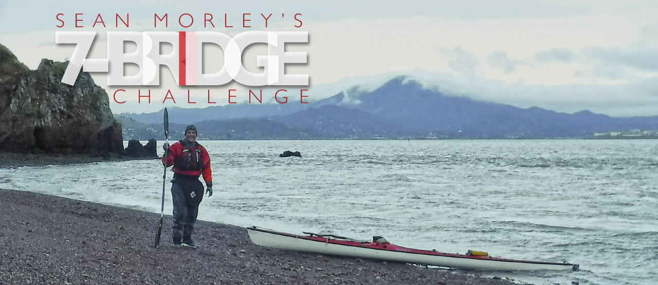
Sean Morley’s 7 bridge challenge
Two weeks before the paddle, Sean dropped out but encouraged us to move ahead with our plans. Sean conceptualized this as, “A challenge that could be done at any time, and you just share your track and time and see if anyone can beat it… you need to pass fully under each bridge, including the Golden Gate Bridge before turning around.”
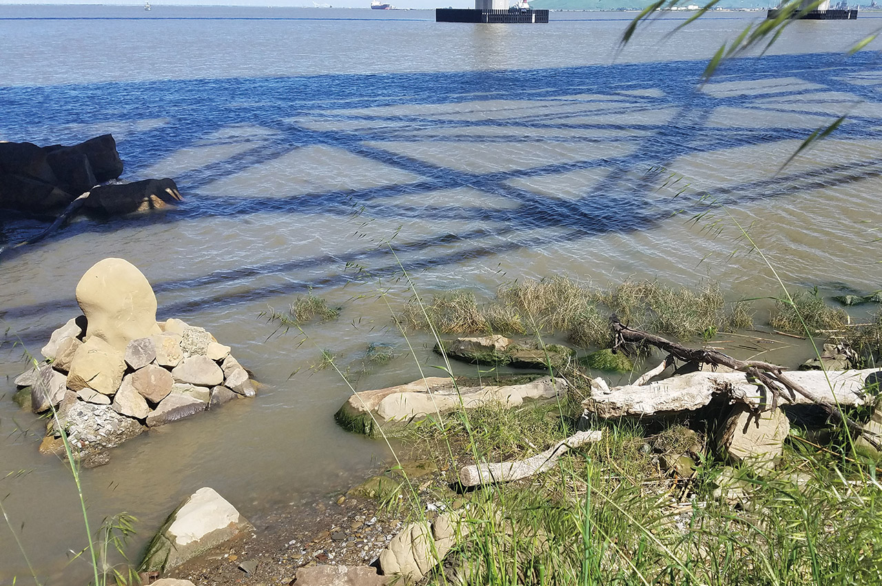
The entire flow of current in the San Francisco Bay is controlled by the Golden Gate. At ebb tide, the water rushes out of the Gate, and at flood it rushes into the Gate. Breathing like that twice a day, every day. The crux of the 7 Bridge Challenge is to start in the North Bay at the Benicia Bridge at slack-to-ebb, follow the current as it’s sucked to its source at the Golden Gate Bridge, turn tail at the Golden Gate Bridge as the tide changes, and ride the flood to the South Bay. Timing is crucial because paddling with this ebb/flood cycle is the key to success. Poor timing results in a battle against the current, and will decrease the chance of making it to the Dumbarton Bridge while there is still enough water to land. A football field sized mudflat appears at the west end of the Dumbarton Bridge when the tide drops below 4.5 feet.
Below is the route:
- Launch: Benicia-Martinez Bridge
- Carquinez Bridge 6 miles total 6 miles
- Richmond-San Raphael Bridge 16.4 miles total 22.4 miles
- Golden Gate Bridge 7.9 miles total 30.3 miles
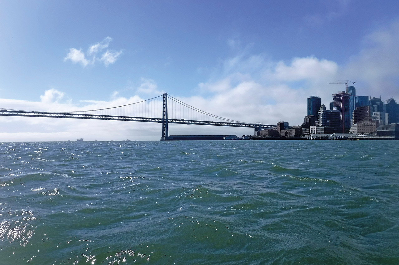
- Bay Bridge 6.1 miles total 36.4 miles
- San Mateo Bridge 16.2 miles total 52.6 miles
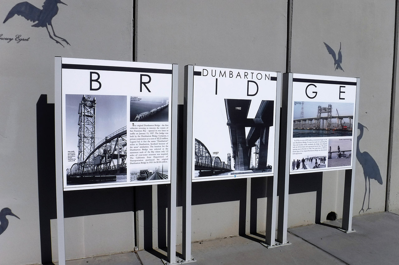
- Land: Dumbarton Bridge 8.9 miles
total 61.5 miles
April 19th, 2019
Launch is in 17 hours. The wind prediction is troubling. I’m starting to think we’re crazy to do this. The base winds look ok – 10 knots but with headwinds predicted to gust up to 20 knots at launch. Ouch! A gift at the Golden Gate – 15-knot base (up to 24-knot gust) tail winds from the Golden Gate Bridge to Pier 39. Add that to our budding flood and that small hand full of miles will be turbo charged. And the last stretch? Well, at least it’s not a headwind. Cross winds over our right shoulder, base over 20 knots (gusts up to 36 knots) now predicted for the final 25 miles.
Bert is afraid the wind will slow us and we won’t be able to land. Mudflats will take over the landing zone, and the later we are, the more mud. During a training paddle a few weeks prior, I had hoped to launch from the west end of the Dumbarton Bridge. When I arrived there the tide was at about one foot. The whole place was a stinking mudflat. We would need at least 4.5 feet of water to land.
That fact stole my breath as I considered what it would be like to paddle over 60 miles only to be unable to land, unable to exit my boat without sinking knee deep in sludge, unable to reach solid ground. I remember wondering why Sean chose such a desolate and disgusting landing zone.
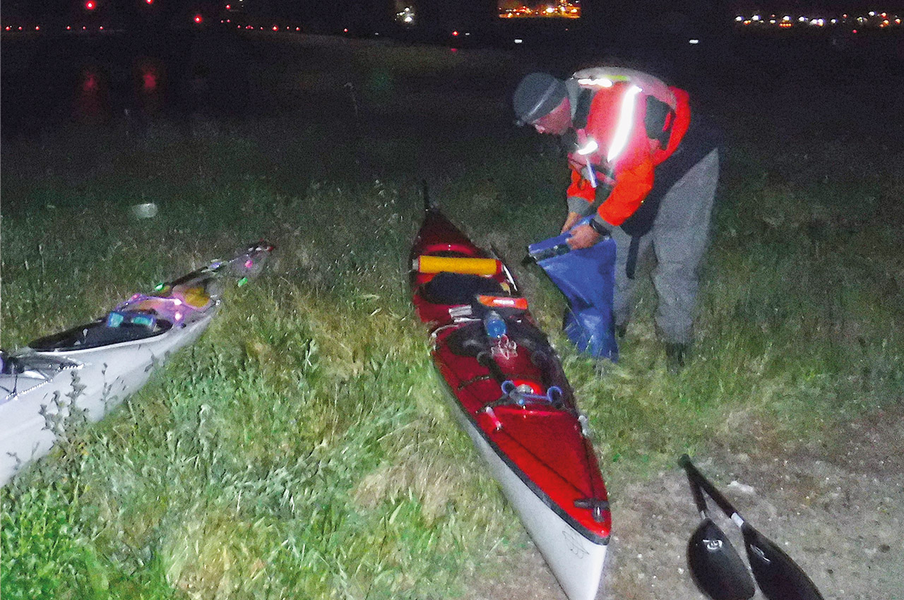
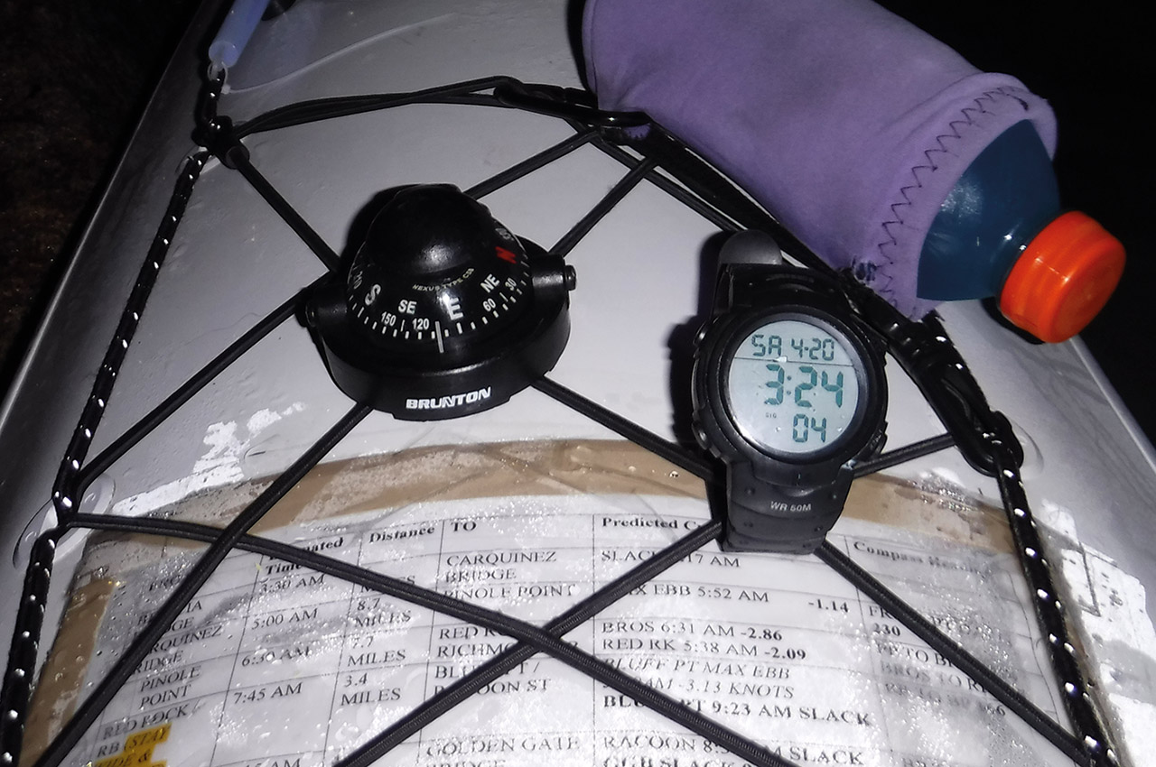
We’re all on edge. Matt has decided to launch at midnight to improve his chances of current assisting the last half of the paddle and to avoid the mudflat problem at the Dumbarton Bridge. To attain those benefits, he has to sacrifice the benefit of launching with the budding ebb. Instead, he’ll launch into opposing current. I’m unwilling to make that sacrifice. I agree to launch at 3:30 AM, against the last remnants of flood in Benicia. Bert and I plan to launch together, though we know we’ll be separated at some point.
April 20, 2019
The alarm sounds at 02:10 and Bert and I drag ourselves out of bed. A text from Matt confirms he launched at midnight into the flood. We’re in Benicia at the home of a friend who kindly drives us to the base of the Benicia-Martinez Bridge at 03:00. There are train tracks and some rocks to contend with at the launch site, both worth it to save us paddling 1.2 miles in the wrong direction at the outset of the paddle. Sean’s rules state we need to paddle beneath each of the seven bridges.
Launching from the Martinez Marina as Matt has means starting a 60+ mile adventure by paddling over a mile in the wrong direction. Just the psychology of that is enough to make me happy to dodge trains and wade over rocks into polluted water to avoid it. Upon arrival we find an actual train and no beach to launch from. The tide has risen just enough to pull the water over the small beach we saw upon scouting. The wind is howling.
03:30-04:33:
Benicia-Martinez Bridge to Carquinez Bridge (six miles)
Surges of adrenaline at launch propel us forward into the 15-20 knot winds. We launch about 30 minutes before slack into and against the remaining flood. I stay close to Benicia, having observed a wide eddy there at dinner the night before. Bert moves out toward the middle of the channel. Our glow sticks do not help maintain visibility at that distance and I lose sight of him before reaching the Carquinez Bridge. I predicted I would reach the bridge at 05:00 but am there 27 minutes ahead of schedule.
04:33-07:30:
Carquinez Bridge to Richmond Bridge/Red Rock (16.4 mile segment/22.5 miles total)
The wind is strong and it remains very dark. The full moon provides some ambient light but not enough to read my compass. The current in this spot is odd and it takes me longer to travel the short distance to Davis Point than I had hoped. Rounding Davis Point at 04:58, I realize that I can’t see Pinole Point – my next landmark. Earlier, at launch, I had hastily decided I did not need my waterproof flashlight on my deck and stashed it in the day hatch. Now, I desperately need it to see the compass. Unfortunately, the water is choppy, the wind and dark make it even more difficult to access my day hatch.
More and more water floods in as I feel around blindly in the hatch with one hand for the flashlight. I abort that idea and try to use my camera flash to read the chart on my deck. No good, flash does not stay on long enough. I strain my eyes toward the horizon and make out a black-on-gray blob that I think might be Point Pinole and head for that. I’m hoping day will start to break and confirm my guess. Paddling off in the wrong direction at this point might be a deal breaker.
The six-mile stretch between Davis Point and Pinole Point in San Pablo Bay is demanding. Waves swamp my deck in the dark, compromise stability and have the potential to slow my progress. At 05.00, navigating swells that remain invisible until they’re a foot in front of my bow takes all of my concentration.
Dawn reveals that my directional guess is correct. I come a bit wide around Pinole Point and falter. My next destination is The Brothers, two little islands off the tip of Point San Pablo, but I’ve never paddled this section before. During practice, I came toward The Brothers from the direction of Angel Island. I have no idea what they look like from this direction. My head tells me stay far left; my gut tells me to veer right. I decide to rely on my compass heading. I take a moment to move lines and gear aside to read the heading I gave myself from Pinole Point to The Brothers.
My compass points me toward three trees on a tiny island about five miles away. But I know The Brothers are a set of two islands, and I hope my compass is right and that the other island is just hidden from view. Choppy, messy, muddy water. No sign of Bert as I scan all around me. It occurs to me that despite lots of night paddling, neither of us has ever paddled solo in the dark. I become increasingly concerned about him. I know he must be feeling the same way about me.
I know he’ll be worried that the Mysterioso top I have on (I also hastily decided I did not need a splash jacket or semi dry top) will not be warm enough to stave off hypothermia. I know he will worry because my radio is in my day hatch and not my PFD. If I come out of my boat and separated from it in this wind, I have no hope of rescue and will succumb to hypothermia before anyone realizes I’m missing. Bert at least has on a drysuit and has his radio in his PFD. I reassure myself with those two facts.
A sense of relief blossoms as the three trees present themselves as the larger of The Brother Islands. The distance between The Brothers and Red Rock is only about 2.5 miles. The Richmond Bridge lies between the two. I decide I’ll land on Red Rock and text our safety coordinator Jess to let her know both my location and that we launched on time. I also plan to mention that I have lost sight of Bert.
My relief at identifying The Brothers is short-lived. The water around The Brothers is boiling. It is max ebb here (-2.86 knots) and the water is chaos. I had planned to stay wide and outside of both islands, but that does not happen. I cut the corner too close around the point and am sucked violently through the narrow between Point San Pablo and the first island. I fight it for a few minutes. My struggle results in my nearly being hurled into a red buoy. I decide to go with the water, after all it’s trying to take me in the direction I need to travel; it just seems to have its own thoughts about the line I should take.
Once I let the water take the lead, my balance improves and my speed increases. Things calm down enough right before the Richmond Bridge that I’m able to balance and take a photo. Then I fly under the bridge and into Red Rock – literally! My plan was to touch down on the west side of Red Rock, but the current flings me straight onto the rockiest part of the north shore. I stumble out, having completed the first third of the journey. Twenty-two miles down, another 40 to go.
It’s then that I see Bert heading toward me, much to my relief. It’s now 07:32. I look down and read a message that came in from Matt at 07:22 saying he’s in Richmond and has bailed on the paddle. It’s a rollercoaster of emotions. I limp over to Bert and throw my arms around him. He is as giddy as I am. We briefly share stories and commiserate about conditions. I tell him about Matt. He tells me to keep going. I jump back on the water and head around the east side of the island.
07:35-09:07 Richmond Bridge (Red Rock) to Golden Gate Bridge (eight-mile segment/30.4 miles total)
The weather shifts as I fly on the ebb toward Bluff Point and Raccoon Straights. I stay in deep water and let the remains of the ebb sweep me along. The wind is barely noticeable here and the sun is out. Bert and I are both ahead of schedule. It feels like the worst is over. Life is good. I round Bluff Point widely, closer to Angel Island than Tiburon, maximizing the last of the ebb.
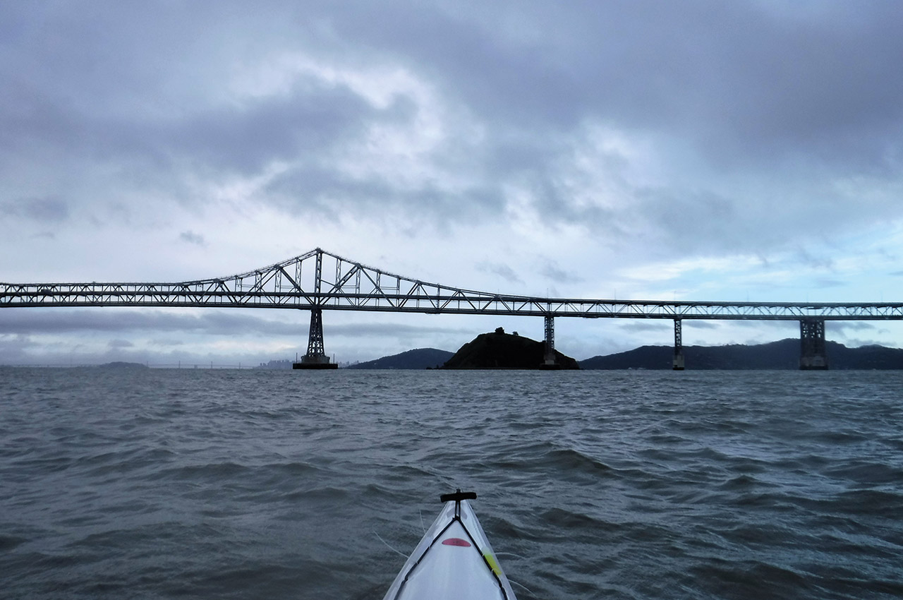
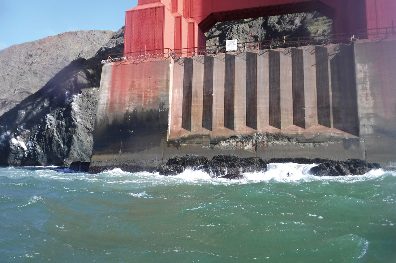
The Golden Gate Bridge is looming ahead of me, glowing in the sunlight. Behind it, a webby mess of fog obscures the ocean. I head straight for the Golden Gate Bridge, hedging my bets and hoping to beat the onset of the flood. Slack (to flood) at the Golden Gate is predicted for 09:03. I have almost an hour to span that 4.5-mile stretch before the water will turn against me and staunch my progress. I go for it.
The flood starts a little early, slowing me around Yellow Bluff. A mile of slog later I come under the Golden Gate Bridge. It’s 09:07. I’m almost 30 minutes ahead of my predicted schedule and I have set myself up perfectly to ride the flood all the way to the South Bay. The wind is alive beneath the Gate and blowing straight toward my next destination (just outside Pier 39), about four miles in the distance.
09:07-10:04:
Golden Gate Bridge to Bay Bridge (six-mile segment/36.4 miles total)
With a 25-knot wind, following seas and the growing flood (max flood of 3.93 knots 0.8 miles east of GGB at 12:03 PM) all in my favour, I fly through the shipping channel toward Pier 39, maintaining a straight line and staying well offshore. I come under the Bay Bridge at 10:04. It’s taken less than an hour to travel that six miles and it’s been exhilarating. I’m now almost an hour ahead of schedule.
I haven’t seen Bert since Red Rock. The wind is wailing here, a steadily increasing crosswind smashing into my right ear. I cross under the Bay Bridge, take photos and look into the distance. There is no sign of the San Mateo Bridge, just foggy white backdrop and huge ships. I check my compass. The line I set for myself cuts straight through a field of (hopefully) anchored freighters. I double-check. The San Mateo Bridge is 16.2 miles from the Bay Bridge, the longest unbroken straight line in this paddle. I triple-check – and yes, my line goes straight through the freighters.
10:04-12:33:
Bay Bridge to San Mateo Bridge (16.2 mile segment/52.6 miles total)
I set off, aiming just to the right of the freighters, too frightened to run straight through them. This is not easy going. The crosswind is creating huge wind waves that break with frothy white hands that keep trying to shove me over. I grow chilly from water swamping my deck, flooding my lap, and pouring down the front of my top. I fight hard with sore muscles to stay upright, to make each stroke not only a strong movement forward but a well-placed brace.
I try to use the crosswind to my advantage, try to pick up a tiny thread of surf wave from the flood. Try-try-fail-correct direction. Fail-fail-try-succeed-surf. Try-try-fail-correct direction. On and on and on like that for 16 miles. The wind now topping 30 knots is treacherous and keeps me constantly alert, constantly working. My body hurts. My back aches. I stop once to check what’s between my hand and my paddle. Blisters, my own skin feels foreign to me. I again worry about Bert. I worry about me. At least I know Matt is safe on dry land, potentially stranded without a car, but safe.
12:33-14:10
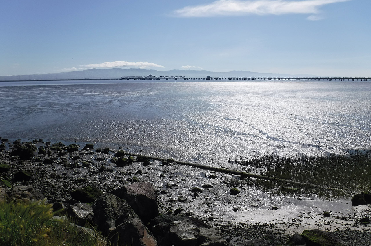
San Mateo Bridge to Dumbarton Bridge (8.8 mile segment/total 61.5 miles)
I want to come into this last segment under the highest point of the San Mateo Bridge. The westerly wind has another idea and blows me much closer to the east side of the bridge than I planned. No photo opportunity here. Wind waves topping four feet slosh at me from what seems like six different directions as the narrow under the bridge erupts chaotically.
Suddenly, I’m under and out the other side. Only one bridge left! It’s 12:33 PM, nearly two hours ahead of schedule with 8.9 miles to go. I have the advantage of the flood (max flood San Mateo Bridge 11:48, 2.18 knots), a gift I hadn’t counted on in planning. My highest hope had been for slack. I’m too tired and too worried about Bert to feel the elation that should come with that fact. There will be no mudflat to worry about, there will be no ebb to contend with. I register those facts and keep moving.
The final bridge, the Dumbarton, is in the distance. My landing spot is the west end of the bridge where the road leaves the water. The wind is blowing around 30 knots from the west and although the line is better than it was to the San Mateo Bridge, I still need to be careful that I’m not blown off course. The last thing I want is to be wide of my landing zone, torn beneath the bridge by the current and wind, and then, after over 60 miles of paddling, have to fight my way back to land.
I catch some nice downwind waves on my way to the Dumbarton. I’m sad that when Bert arrives here, his experience will be drastically different. The wind steadily grows as time marches on. I have the benefit of the flood. The current will be turning against Bert and the wind waves will be breaking dangerously. I sail in under the Dumbarton Bridge at 14:10. I’m two hours and 20 minutes ahead of schedule. I have almost eight feet of water over the mudflats (high tide 14:44, eight feet, Dumbarton Bridge). I still have a strong flood. I text to let the others know I reached the Dumbarton Bridge.
Finished
Then I realize that the cold little beach I’m sitting on beneath the bridge on the north side where I’ve landed is fenced in. This spot under the bridge is a small dark cave, weeds and water to the north and a large fence to the south. The wind is freezing me. I wonder if I can get my boat through a small hole in the fence. Nope. I struggle hard to launch off into the flood so I can paddle around the fence to the south side of the bridge.
Three failed attempts to launch into the current later, I finally make it, paddle several yards around the fence to the south side and am instantly grateful. The bridge is blocking the wind. There’s sun here and a tiny warm beach perfect to land on. I take everything out of my boat. I lay all of my gear on the rocks to dry. Matt texts back that he is reunited with his car and boat, about an hour away, heading to me.
I’m grateful for the isolation, the sun, the fact that I’m done paddling for the day. My hatches are swamped. My boat is full of water. My dry bag has done its job and my warm clothes feel wonderful. I text my mom and sister to tell them I landed. I move everything up the slope to a series of cement steps as I wait for Matt. I go around the base of the bridge to the north side multiple times to look for Bert.
Each time the water is whiter, wind waves are breaking in sets at this point. I worry. A lot. I try to radio Bert. I know he will not be able to answer, cannot take his hands off his paddle in that mess without risking falling over. Matt arrives just as I haul the last of my gear to the cement steps.
He tells me the story of why he decided to call it quits. We carry my gear to his car. It’s getting late. Past slack. The ebb is starting. No sign of Bert. We sit on a cement block and search the white and mud coloured water for him. We wish he had a spot or an inReach with him. We begin to ponder how to proceed and then at 15:36 a text comes in from him. He has landed just south of the San Mateo Bridge. We load my boat and drive to retrieve him.
Bert relays his story of being hit hard and broadside by a wind wave, capsizing just north of the San Mateo Bridge. Thankfully he rolled up. He continued under the San Mateo Bridge but needed to stop to empty his boat and try to notify us of his status. Thus far, I’m the only one to have completed Sean Morley’s 7 Bridge Challenge. My time is 10 hours and 40 minutes. Approximately 61.5 miles. Strong westerly winds for the duration.