
By Pete Marshall
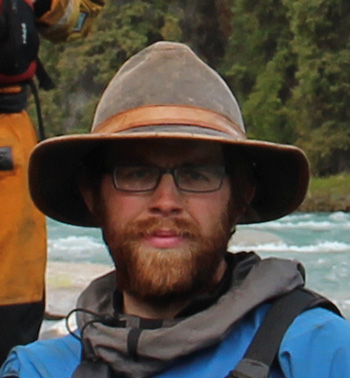
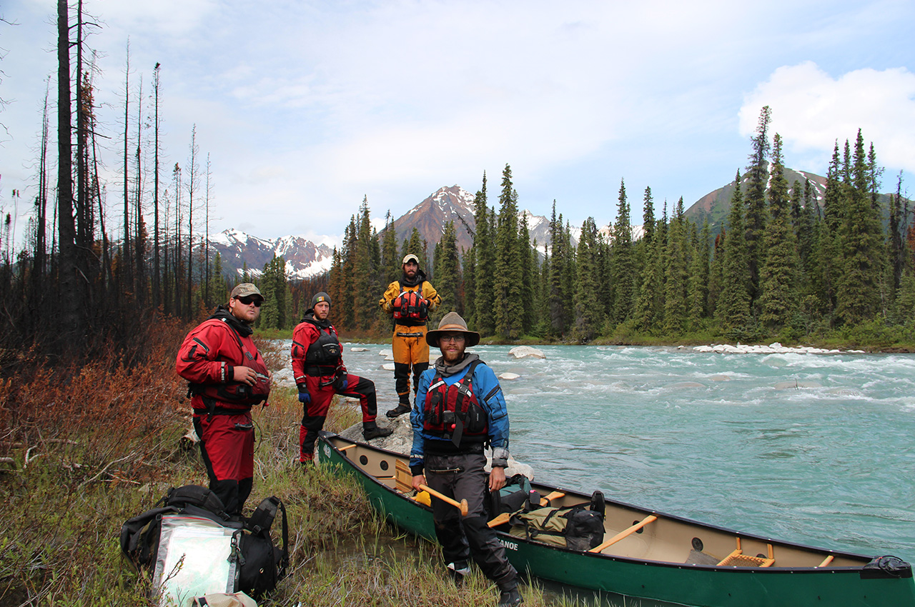
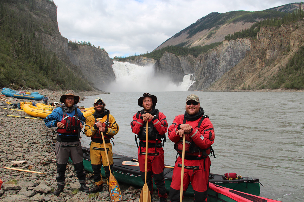
Paddlers: Winchell Delano, Steve Keaveny, Matt Harren, and Pete Marshall.
Story from issues 7 & 8 – April & May 2013
They had paddled rivers in the Arctic and to Hudson Bay. Together they had thousands of miles of combined experience. But when they got off the ferry at Skagway, Alaska, they knew that nothing they had gone through would be like the next few months.
From sea to sea
A mari usque ad mare
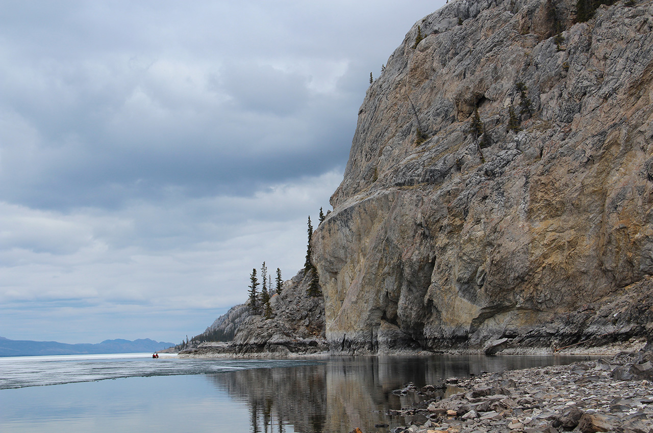
Two mountain ranges, three heights of land, and 2600 miles of some of the most remote and wild country left in the world lay before them. On paper, it was an ambitious route. Peter had severe doubts about crossing the Rocky Mountains in a canoe and reaching the end of the trip before the winter storms began. In many ways, he knew better than to set out on this expedition. But when you have big dreams and big goals, willful ignorance is a powerful thing.
Two mountain ranges, three heights of land, and 2600 miles of some of the most remote and wild country left in the world lay before us. On paper, it was an ambitious route. Most people who knew better told me so. I knew it was ambitious, and to be honest, I had serious doubts about crossing the Rocky Mountains in a canoe and reaching the end of the trip before the winter storms began. In many ways, I knew better than to set out on this expedition. But when you have big dreams and big goals, willful ignorance is a powerful thing.
The expedition was conceived with imagination and from there took form. An afternoon spent with maps and trip reports led to a drunken conversation at the bar that was followed by a hung over phone call that then resulted in a plan that involved many more phone calls, coordinating resupply points along the route, raising money, booking tickets on a ferry, and ultimately to the point where we were now at.
The beginning of the expedition
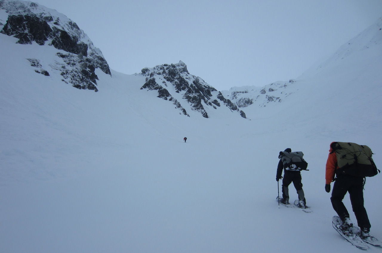
The first part of the trip didn’t even involve canoeing. It was a hike through the Coastal Mountains of Alaska, via the famous Chilkoot Pass. We had our canoes and paddling gear picked up by an outfitter on the other side of the Pass, on the headwaters of the Yukon River, where we would pick them after hiking through the pass.
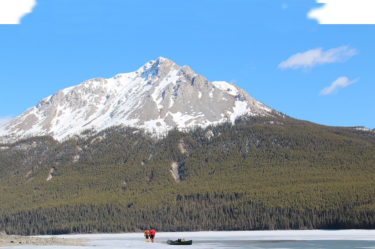
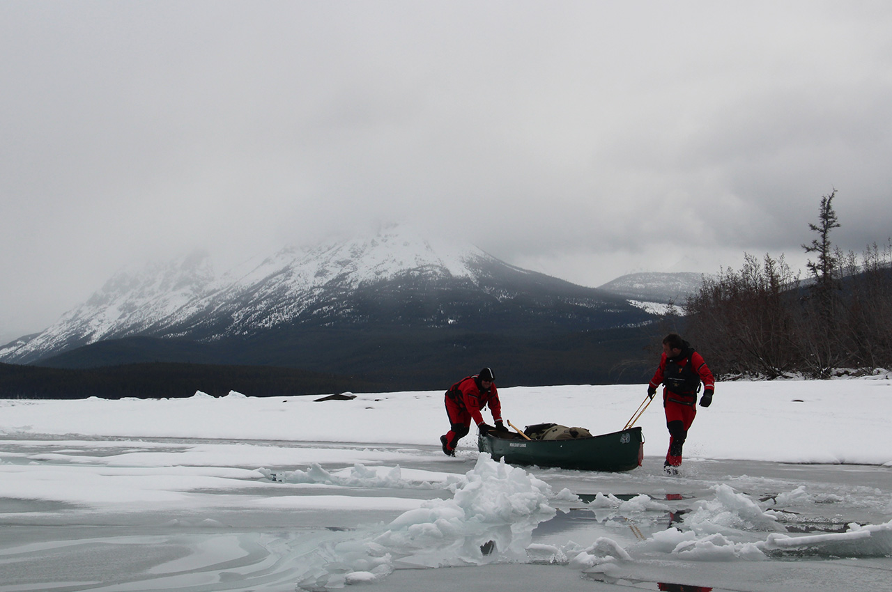
By our second day, we learned that winter had not begun to leave the mountains. This was a risk we had to chance form the outset. There only had a brief window, between ice-out and freeze up, in which we could do the trip. It was better to start too early, rather than too late. It was early May and the thirty-feet of snow and fifty-mile per-hour wind that blew on us for three days was a clear indication that spring was a long way off. We hiked over avalanche paths, passed snowed in shelters, wowed by the beauty, and when we reached out canoes, we were eager to begin paddling.
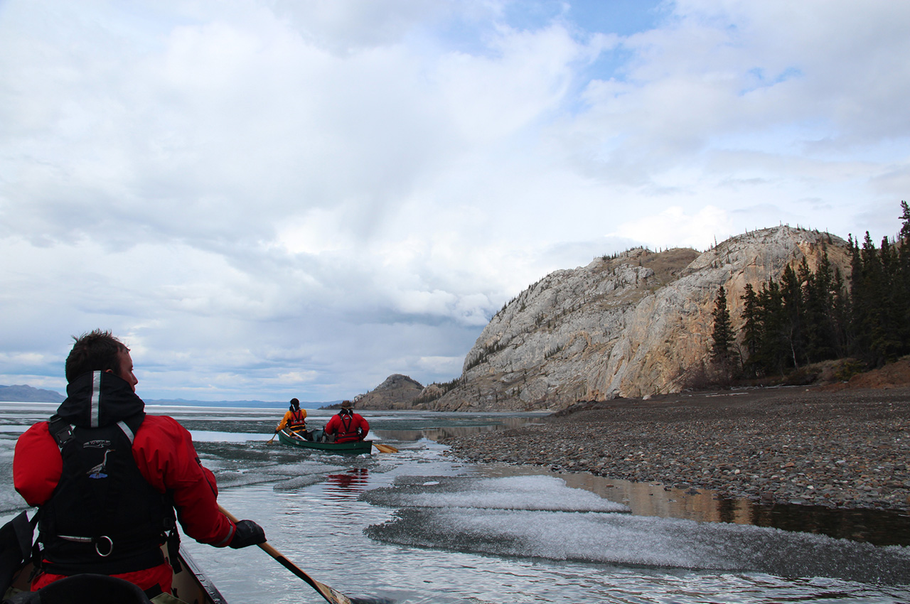
However, the lakes we hoped to paddle were choked with rotting ice. They were impossible to walk on and impossible to paddle through. Mile after mile of ice.
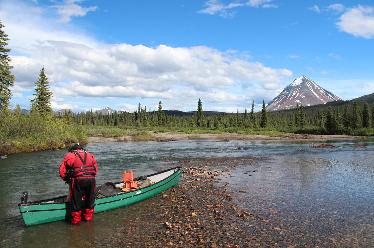
We were able to travel, but only because we were equipped with Kokatat Expedition Drysuits. These fully waterproof and fully enclosed bodysuits kept us safe from hypothermia and the freezing water.
We broke leads and pushed the canoes over unstable ice. It was slow work. We fell in many times, and like a seal crawling out of a breathing hole, had to pull ourselves out of the ice. Rather than being a life-threatening incident, with the drysuits on, we laughed, took photographs, and continued with the day.
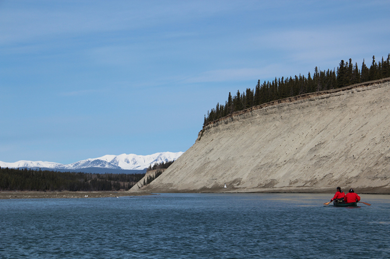
This went on for a week until after 40-miles of breaking through and pushing across Lake LaBerge, we came to the open waters of the Yukon River. For three days we enjoyed the ice free current, happy for the rest, for the sunshine and the easy paddling down stream. The river was low. The snow that covered the surrounding mountains had not began to melt. This would happen in the coming weeks. And when it did melt, the river would swell, the current would double, but we would not enjoy these benefits. We would be going the opposite direction, against the flooded current.
Pelly and Ross Rivers
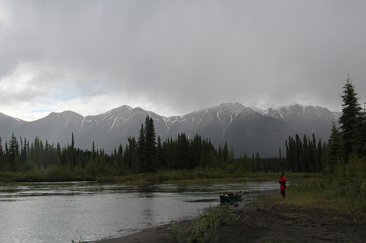
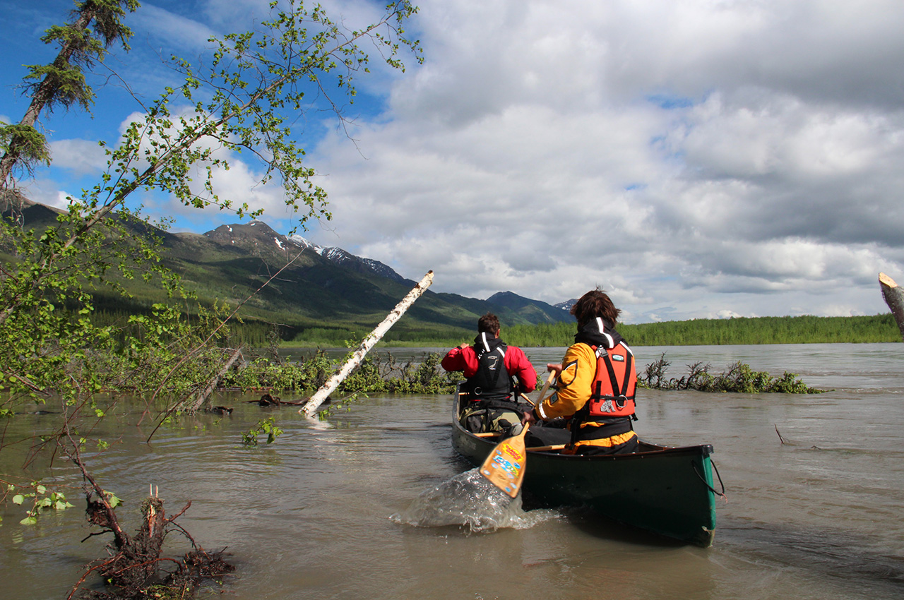
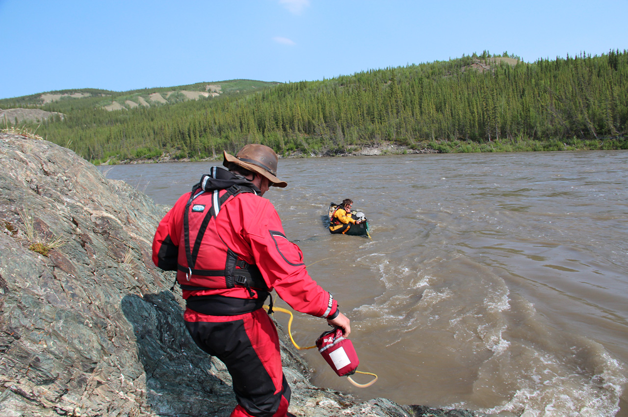
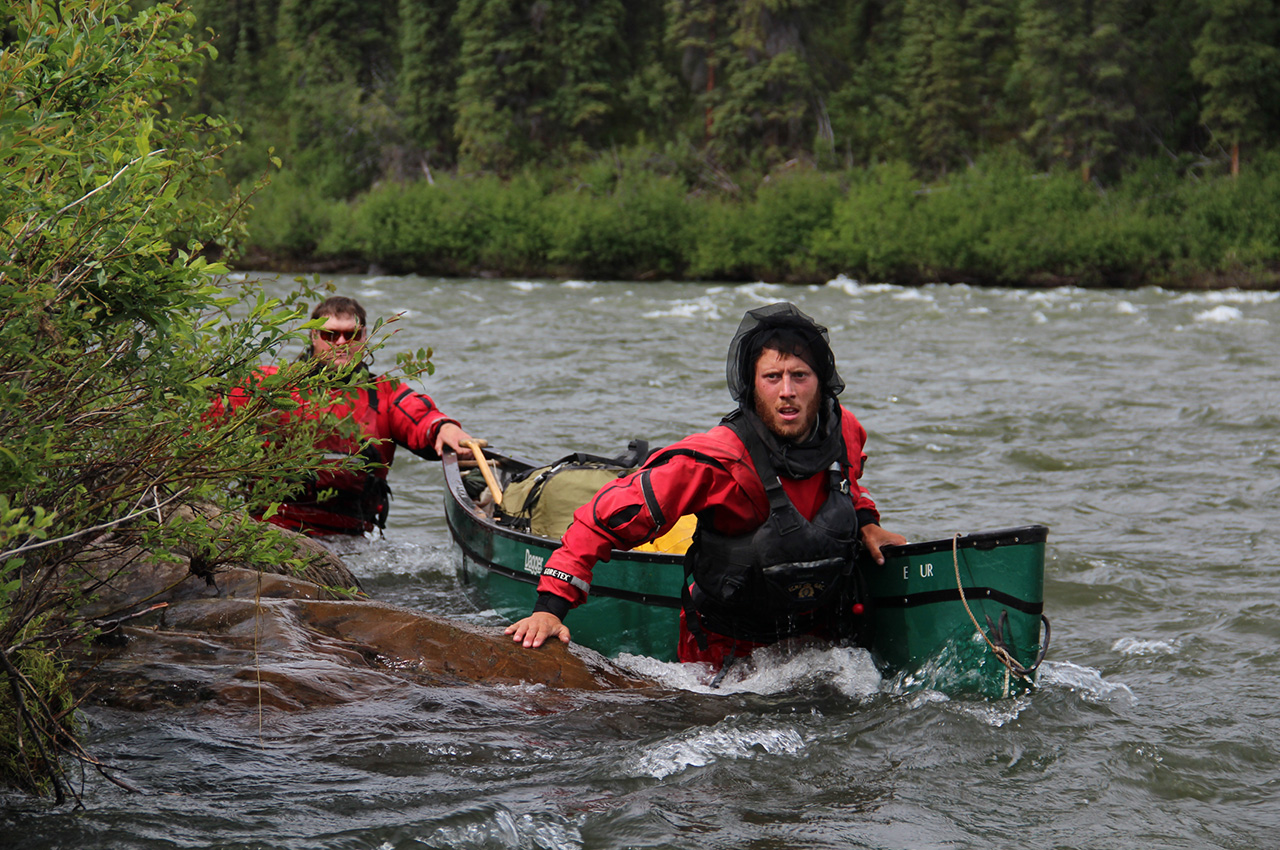
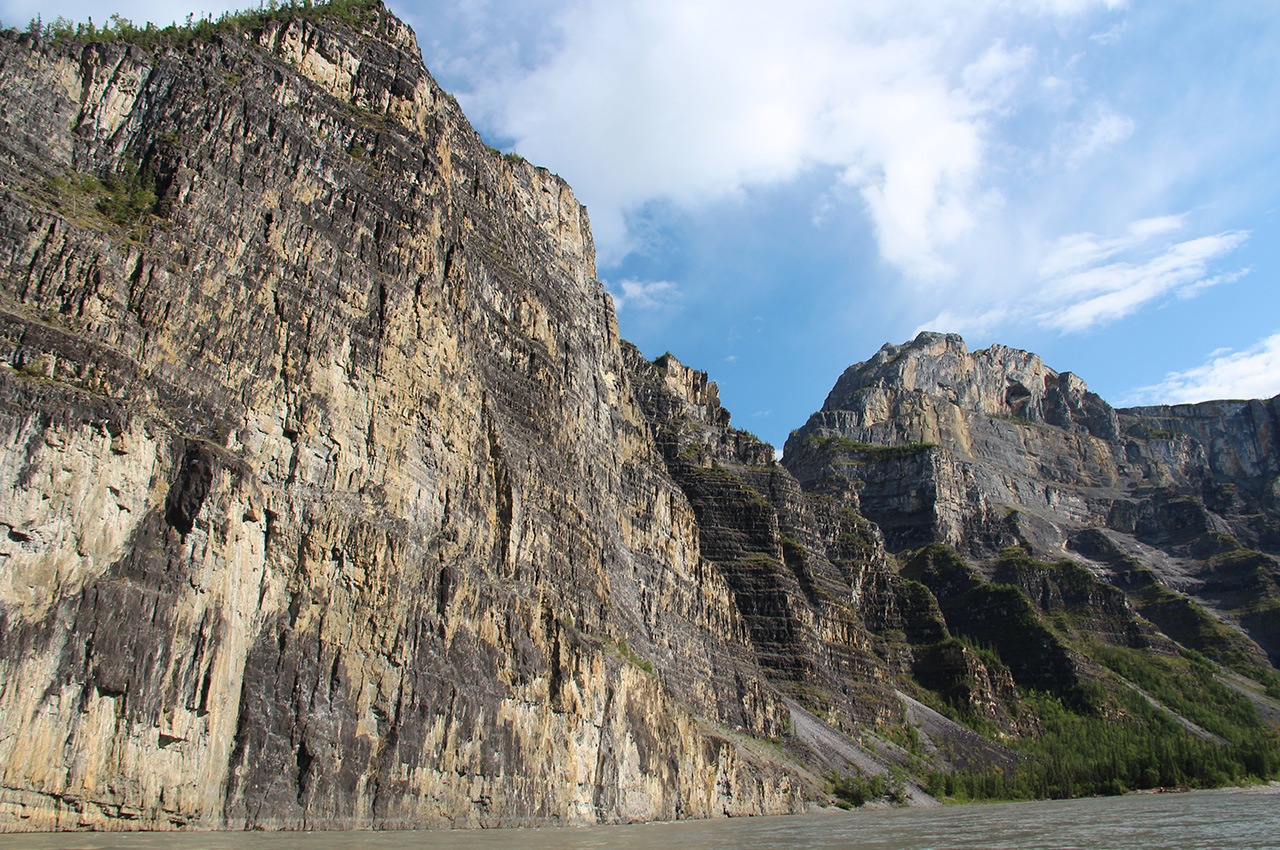
We turned our bows east and began to ascend the Pelly and Ross Rivers, on route to the Continental Divide. This was the major challenge of the trip, in many ways, its defining feature. I had little knowledge of what lay ahead, mostly because everyone who had paddled these rivers told me that going up them would be next to impossible. The last person to ascend the Pelly was a prospector almost one-hundred years ago, and he had made the trip in autumn, during low water. We would have to see the river for ourselves. None of us had any idea how difficult it would be.
At first it was interesting, even fun. We walked and pulled the canoes, paddle hard and made little distance. But we experienced something of a minor thrill as we threw ourselves into this challenge. By the third day, that novelty had worn off. The snow that made the mountains so beautiful in the distance was melting. Each day the river rose and swelled. The shoreline disappeared. We traveled beside submerged trees, entire forests looked like they were growing out of the flooded river.
We ferried back and forth across the rive, chasing the small stretch of slack water on the inside bend. Everyday we woke and hoped for a bit of relief, for a point in the river that the current would slow and give us a break. But the Pelly flowed like a continual, and exhausting treadmill.
We took a well earned break when we reached our first resupply point, 41 days into the journey. This was the first of three resupply points we had set up along the route, every 35 to 40 days of travel. For 36 hours we rested and didn’t paddle, but like all vacations, it came to an end too soon. With a packs full of replenished food food and equipment, we left the hospitality of our host, the kind couple who held our packages, and returned to the river.
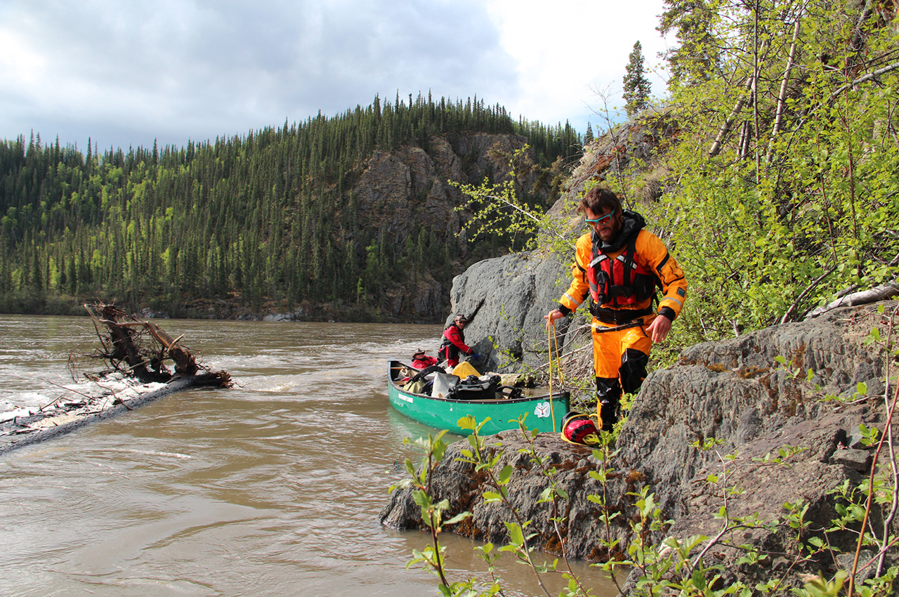
In three days we left the Pelly River and turned north onto the Ross River. The Ross was a smaller tributary of the Pelly. We had unrealistic hopes that less water would mean easier travel. But as the Ross ascended deeper into the mountains, things only became more difficult. The river was more violent. Mile after mile of steep drops. We walked more than we paddled. Most days were spent plunged waist deep in water that 20 hours before was part of a glacier or a snowfield.
As travel became more difficult, the weather deteriorated. We woke to rain and went to sleep in rain. Snow fell on the surrounding peaks and moral slackened.
This was the point that we all began to question the trip. How is it that we thought this trip was possible? There was no answer. We kept moving and continued the desperate struggle. The further we went the thinner the river became. The mountains were closer. And while moving against continual stretches of almost 20-feet per mile drops, we came closer to the point where we would finally be able to go down stream. It was a prospect and a reward that was hard to imagine.
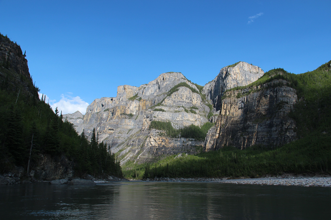
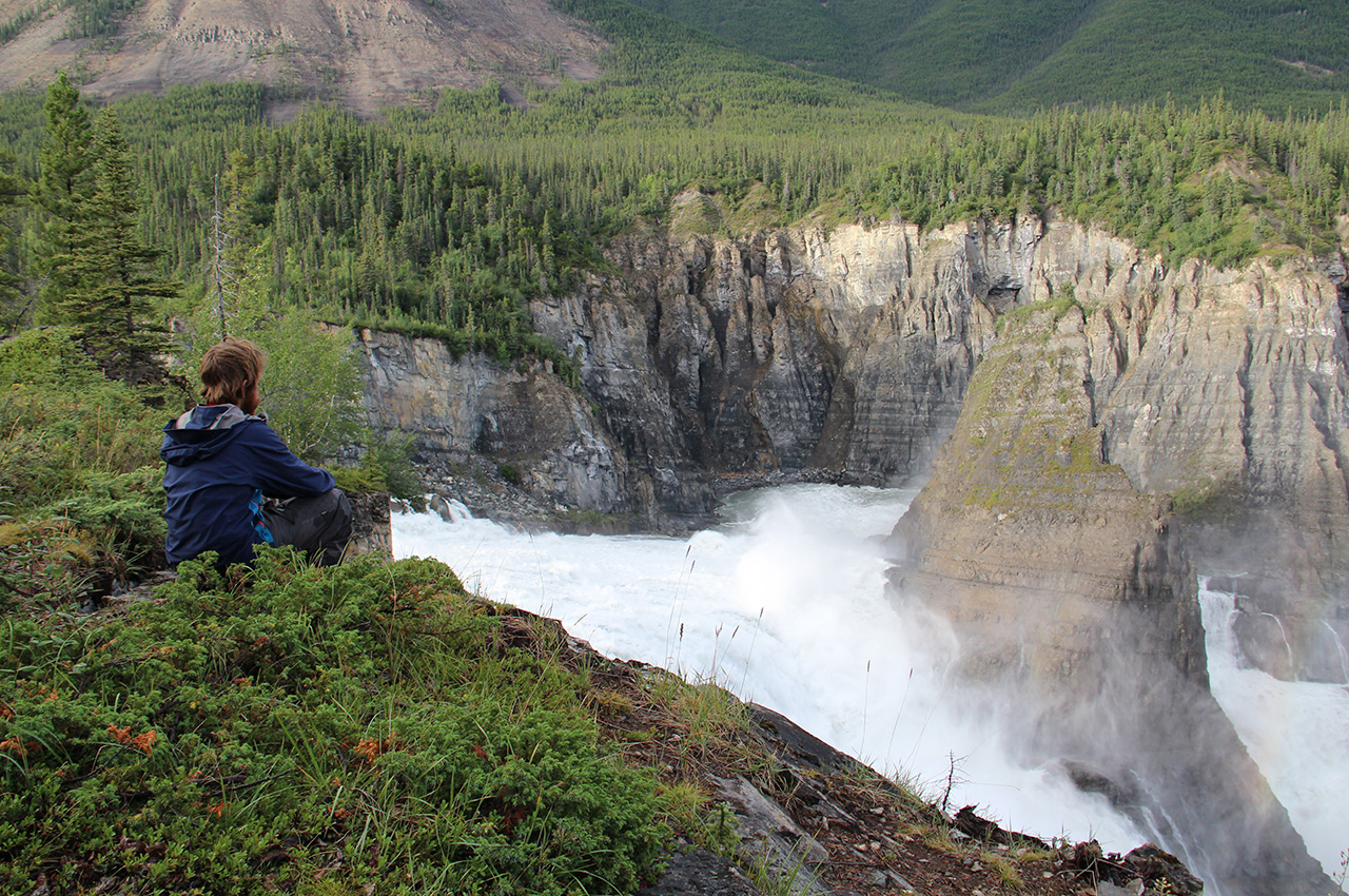
And then it happened. On a cold and rainy afternoon, 64 days after we began our journey, we were portaging through a series of ragged moose trails that would bring us over the Continental Divide. The reward for our effort was before us: the justly famous, South Nahanni River.


Sixty-four days after beginning our journey, we came to the Continental Divide and the reward for our efforts was before us: the justly famous, South Nahanni River.
We broke camp on a bitterly cold morning and paddled onto the quiet headwaters of the South Nahanni in the second and final account of our 2600 over 60 Trans Canada Expedition.
The South Nahanni
It began as a narrow stream flowing through swamplands nestled between mountains that had received a fresh coat of snow the night before. Gradually the river grew, it gained speed and force, turning into a blur of continual whitewater. These were by far the most challenging rapids any of us had ever ran in a canoe and they were continual, one after another, barely any space to breath. For weeks we had been dreaming about what it would be like to actually go downstream, and now we were experiencing every possible thrill of that dream.
After three days the section of continual whitewater, known as the Rock Gardens, let up. We found ourselves on a wide river coursing through a deep mountain valley. All we had to do was float and enjoy the ease of travel and the spectacular surroundings.
The South Nahanni is one of the crown jewels of Northern Rivers. And for good reasons. What can one say about it? Thousand foot canyons, a 300 foot waterfall, amazing whitewater and a stiff current – nothing can come close to describing how spectacular the river is. It was our reward for those many long days spent battling up the Ross and the Pelly Rivers and a much needed moral boost. We paddled the length of the river quickly, too quickly, but on a trip like this, you are always behind schedule.
The end of the Nahanni marked the end of the mountains. We had gone up the Continental Divide, through deep canyons to arrive at the flat, undistinguished plains of the boreal forest. Where once we paddled beside mountains rising thousands of feet from the river bed, now we passed by muddy banks and spruce trees three to four feet from the water. This was the part of the trip I was least excited about.
After only a week and a half of going downstream, we came to the mile-wide Mackenzie River, and once again had to travel upstream and put our paddles against the current, but this time it was a far gentler current and the effort we put into making twenty to 25 miles a day wasn’t even close to the work we had to put in to make ten miles up the rivers in the Yukon mountains. Travel was easier and as far as weather was concerned, we were finally experiencing something like summer.
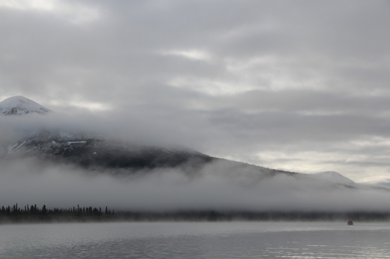
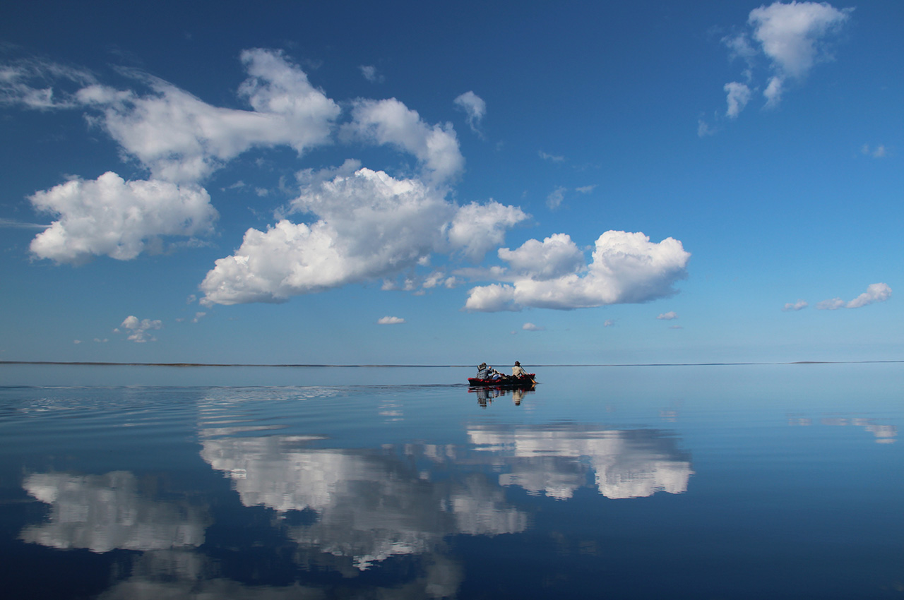
The Mackenzie River led into the Great Slave Lake. A huge inland sea, storms and wind would rise without warning. Several times we were pushed ashore by crashing waves and wind carried over hundreds of miles of open water. If weather permitted, we would paddle 14 hours a day, racking up miles and in this way we made it to the East Arm of Great Slave.
Here massive rock formations rise out of deep, cold water; cliffs rise over 500 feet and water levels plunge past 2,000 feet deep. This has always been one of my favourite places to canoe and indeed, it is one of the most beautiful places on earth.
At this point in the trip, the brief summer we enjoyed was retreating. The tell tale signs of autumn, yellowing leaves and orange speckled willows, appeared along the shore. Temperatures dropped, the days shortened, and nights grew darker. If we started our trip too early then we were ending it too late. Plenty of people had warned us that being out in the eastern Arctic past middle of August was gambling with the weather. As the temperature dropped, the wind would increase, storms could last for a week, pinning us to shore. Sleet could be expected and it would probably snow by the time we reached the Bay. Time was not on our side and we knew we were in a race against winter.
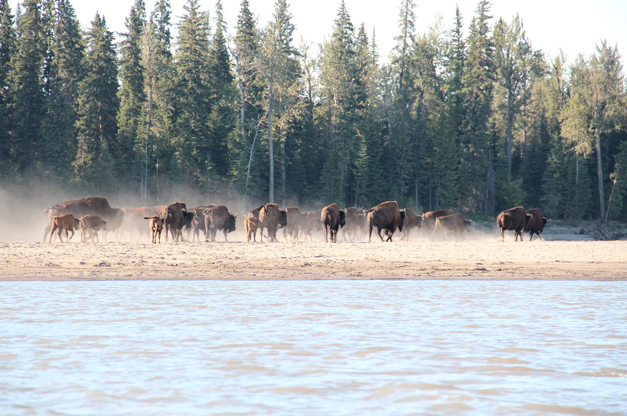
Near the end of August we portaged into the barren lands. Late in the season, this wilderness that was usually filled with vast numbers of caribou, muskoxen and a variety of other animals, was empty. Everyday we were passed by large flocks of geese headed south, a sign that we too should be getting out. Our days began as the first light of the sun began to burn off the frost that had settled over night. We paddled until sunset, often against strong winds, because even if we could only go one mile per hour, and had to work and strain ourselves for that mile, it was one mile closer to our goal.
For a week the weather held, and we paddled long hours over enormous lakes and down the Thelon River, eventually arriving at the community of Baker Lake. Here is where most groups end their tip down the Thelon or Kazan Rivers, but we still had two-hundred miles to paddle before we reached the Hudson Bay.

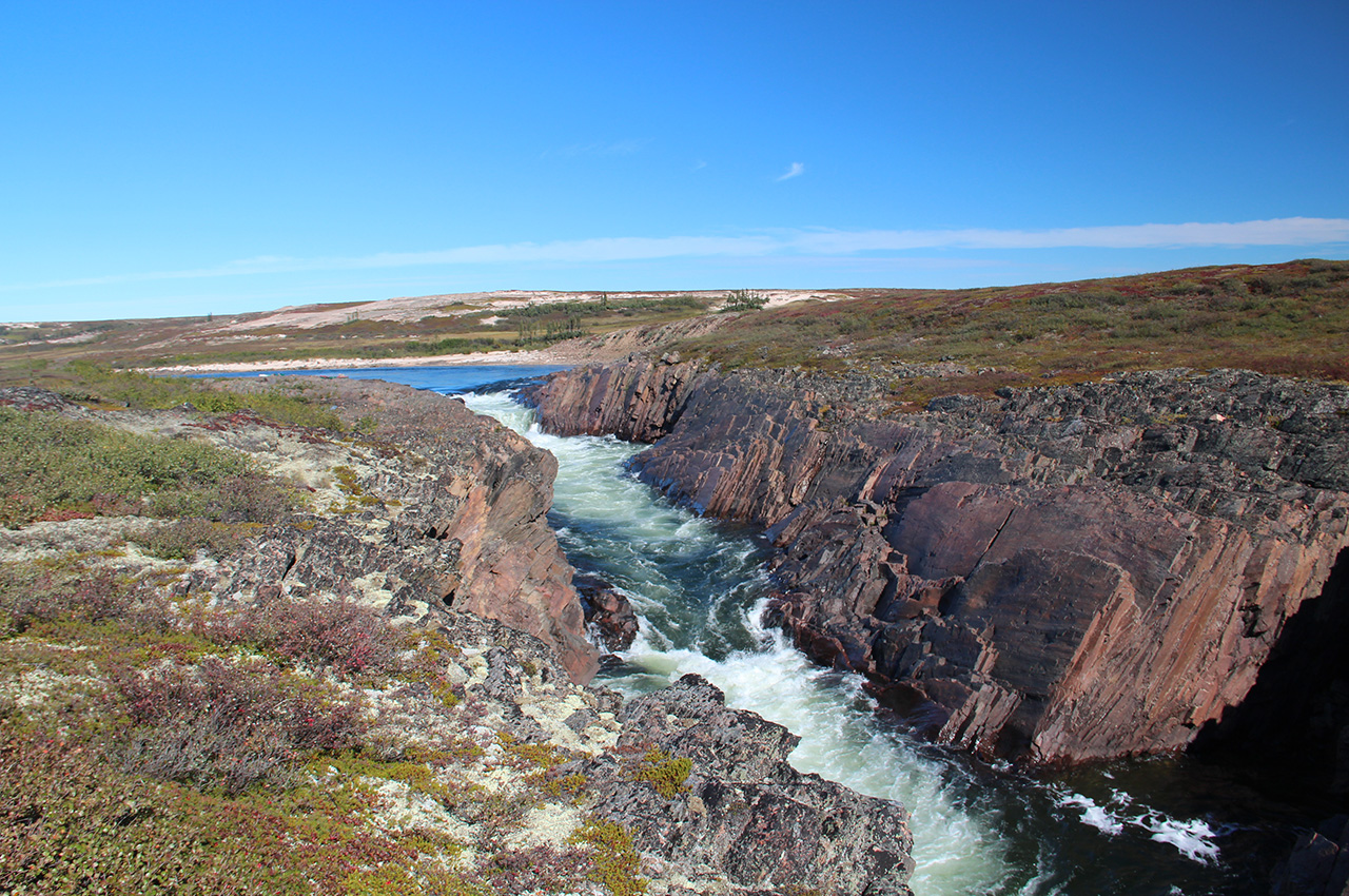
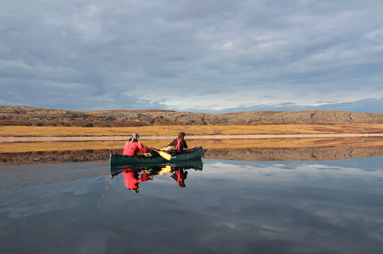
And it was an amazing finale to an amazing trip. The north shore of Baker Lake, which leads into the Chesterfield Inlet, is starkly beautiful. The land is made up of jagged, inhospitable rocks. Scarcely anything grows. It is an elemental land, made up of rock and water. Again, fortune smiled on us. The temperature dropped but wind remained calm. Bundled in several layers of polypro, scared of the polar bears that roam the area and hoping to paddle beside Beluga wales, we rode the tides towards the bay, encountering no wildlife.
On September 14th, we left camp just as the sun rose and the tide was going out. For several hours we paddled east into the brilliant glare of the sun and towards the endless expanse of water. Small buildings appeared, then telephone wires. This was the small hamlet of Chesterfield Inlet. We turned into a harbour and for the last time, stepped out of the canoes.
130 days after setting out, we had reached our goal.