
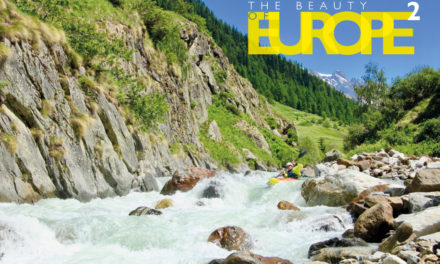
A Scandinavian canoe expedition
By Mal Grey
Mal Grey bio
Mal has paddled open canoes extensively throughout the UK, as well as on numerous trips to France and Scandinavia. He seems to be developing a strange love for trips that include portaging across hillsides, but is equally happy to find himself drifting on the quiet rural rivers of Surrey. As well as having written a number of articles for the Paddler magazine, Mal has his own blog, photo galleries and website at
www.wildernessisa
stateofmind.co.uk
Rogen to Roros
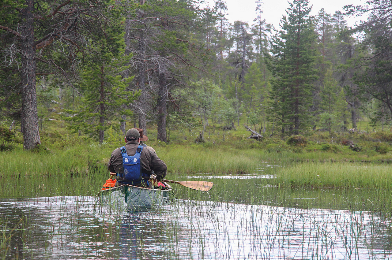
As the low-loader left the remote gravel car park with our only vehicle on its back, we were committed. Properly committed, as our only means of transport now were our canoes and our feet, and the nearest water was still 800 metres away. Ahead of us lay 100 kilometres or so of wilderness, a landscape of lakes, time-weathered hills, tumbling rivers and, above all, rocks.
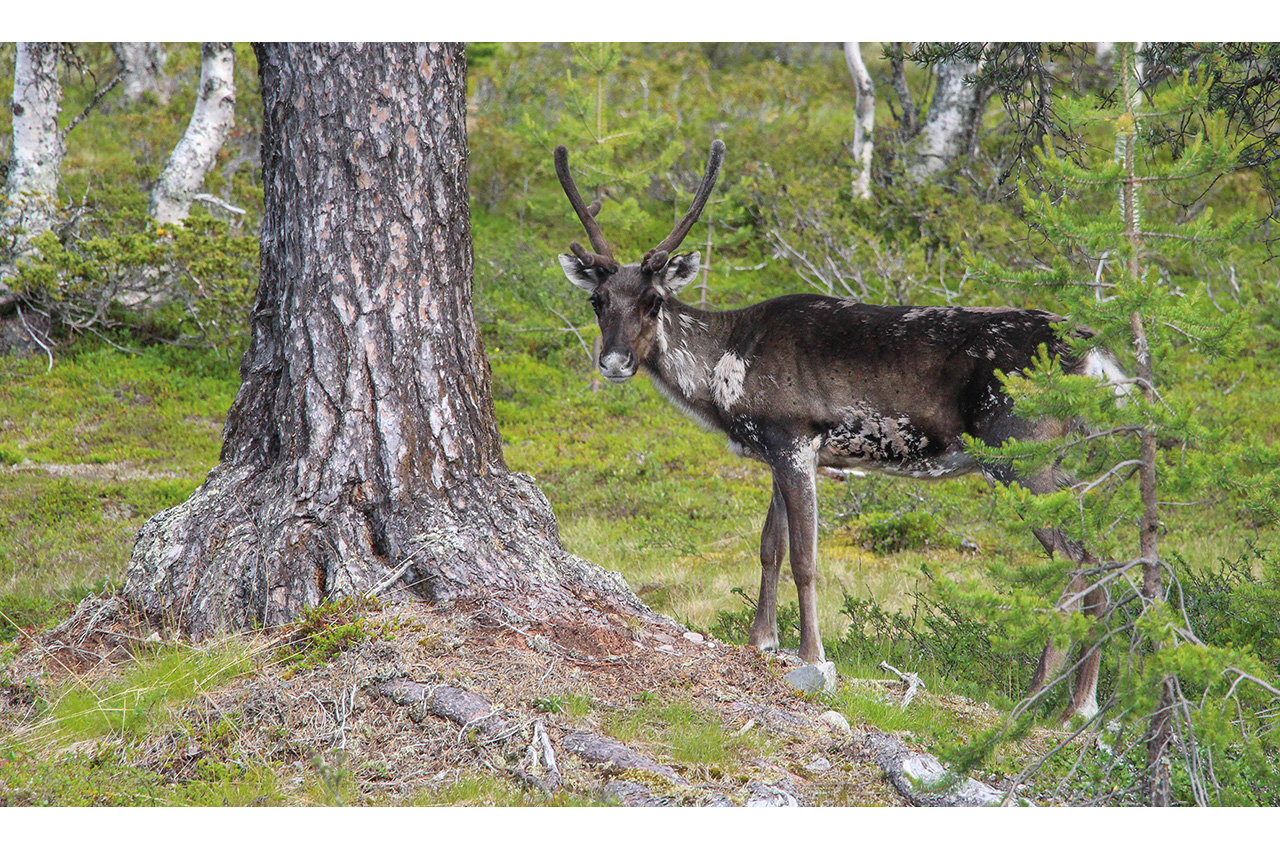
Our trip had been months in the planning, and it had taken us three long days to drive here from the UK with canoes on the van. Rogen is a beautiful nature reserve in Sweden, bumping up against the Norwegian border at 62 degrees north, sitting on a plateau at around 700 metres and thus almost arctic in its appearance. A forest of pines and birch covers most of the region, growing on the thin layer of earth that clings to the rocky land.
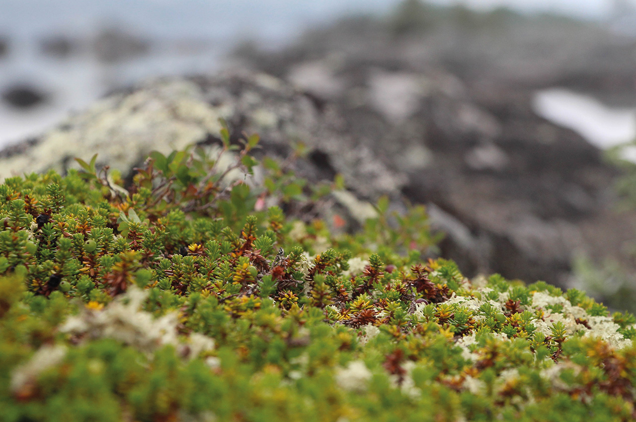
Above the woodlands, bare mountains are clad merely in a variety of mosses, one of the few things able to live here through the harsh winters. A series of lakes, including the eponymous centrepiece of the reserve, can be linked together to form a circular tour or, as we intended, extended into the Roa river system that takes one across the border via the enormous Lake Femunden, before a final section of river leads to the former mining town and World Heritage site of Røros.
We expected this to take us nearly two weeks, allowing time for a few side excursions and with a few spare days to allow for being wind-bound on the lakes. Our journey would include big lakes, little lakes, moderate white water, gentle meandering rivers and, unfortunately, many portages where the rivers were too difficult to run or too shallow to paddle. We started as a group of six; for the first few days, Fred and Rob would join the core team of Mark, Dris, Paul and myself, before they circled back to the start, unable to get enough time off to finish the whole trip.
Into the wilds
Now we stood on the edge of the silent wilderness, as our van was taken away to be looked at, for it had been sounding a little sickly, in the hope that it would be returned to the end of this gravel road before we returned for it. It certainly put into perspective how reliant we would now be on our own ability to travel through this landscape. After a night camped by the car park, our first portage, and first test, began. This one wasn’t too bad, with boardwalks and an obvious track, just a few roots and stones keeping us alert. This became typical of the portages during the first part of our trip, down and into the Rogen reserve itself.
Finally, with a sense of relief, we were afloat on our first lake, Öster-Vingarna, and we paddled happily around its islands and bays before swinging south towards our first proper camp, having planned an easy day to start the trip with. That night was spent in a lovely camp, with one of the ‘wind shelters’ so typical of Scandinavia forming a centrepiece where we could light a fire and enjoy the first of our excellent meals. Food is a key part of any wilderness trip, and we were determined to eat well. Mark is now a veteran of several Sweden trips, and having his own dehydrator and vac-packer, as well as a high level of culinary skill, he had prepared the majority of our food, supplemented by my own efforts for the first three nights when fresh food could be used.
Another 700 metres portage in the morning brought us to our next lake. Today we were making for Rogen lake itself, via a small lake and river system, about which we knew little. First we paddled another island-dotted lake, Stor-Tandsjön, complex enough that a compass bearing helped find our exit. Would it be a paddleable stream? No, it was a rock-filled trickle, more stone than water. A 100-metre portage took us down into a beautiful, sheltered lake, where once more we took to the clear waters.
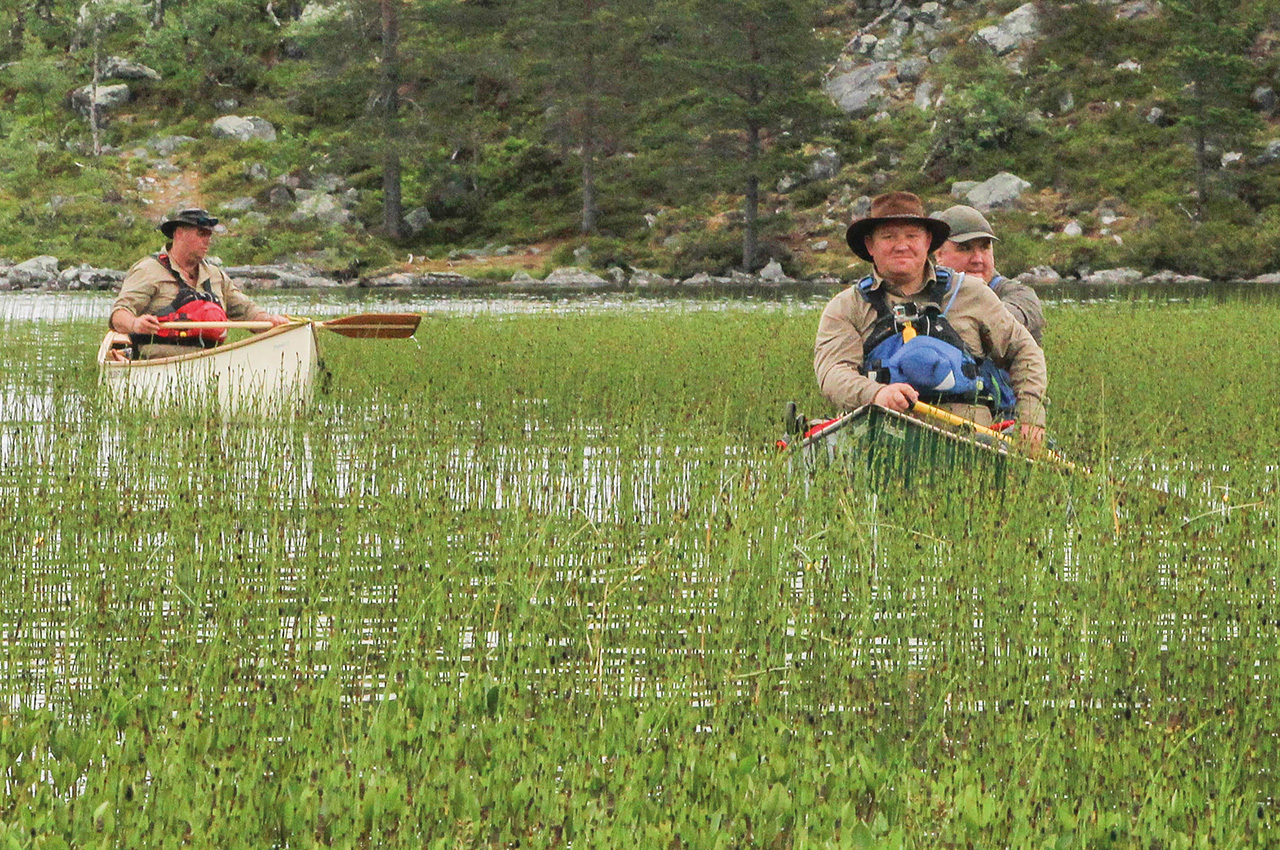
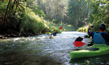
The day progressed, short portage followed by short paddle, followed by more lugging. We now finally felt we had left behind the trappings of the modern world, enjoying a simpler life where all we had to worry about was the route ahead. We entered a stunning, reed-lined lake, where an old, uninhabited beaver lodge hinted at the wildlife around us. Exiting this into a larger stream, we were glad to see that all we needed to do was dodge a few rocks in the gently flowing water, and our way onwards towards Rogen was clear.
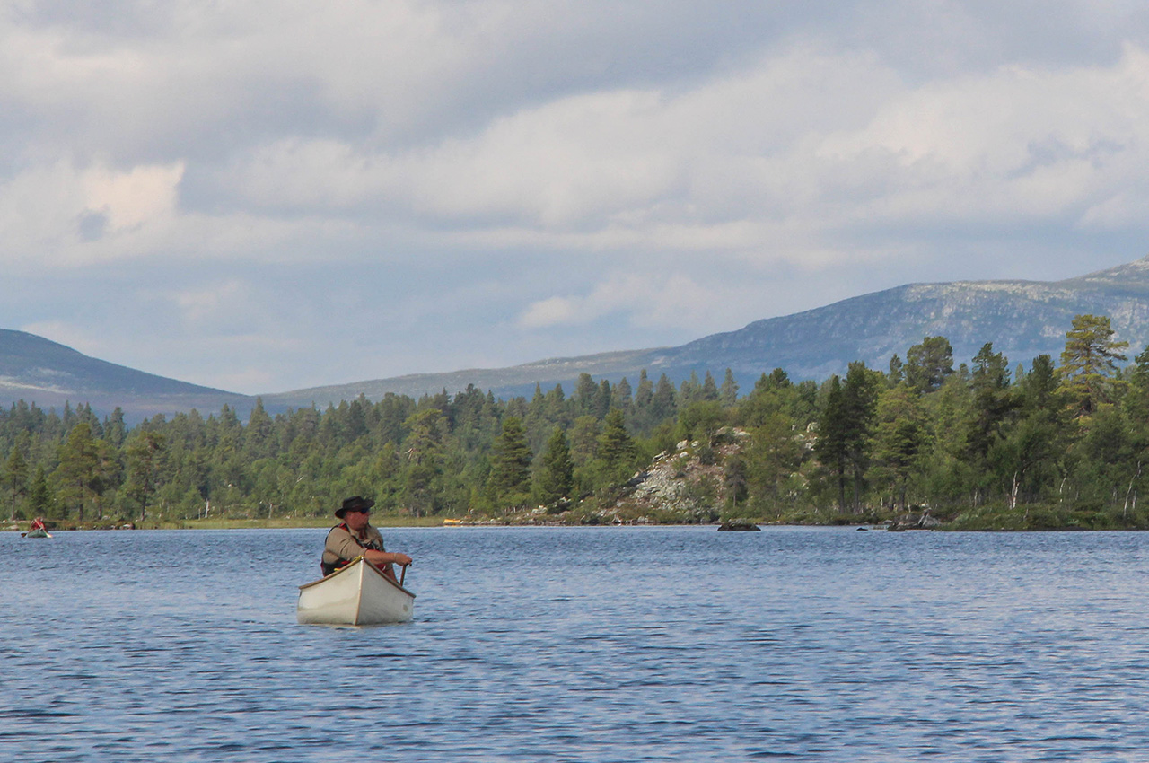
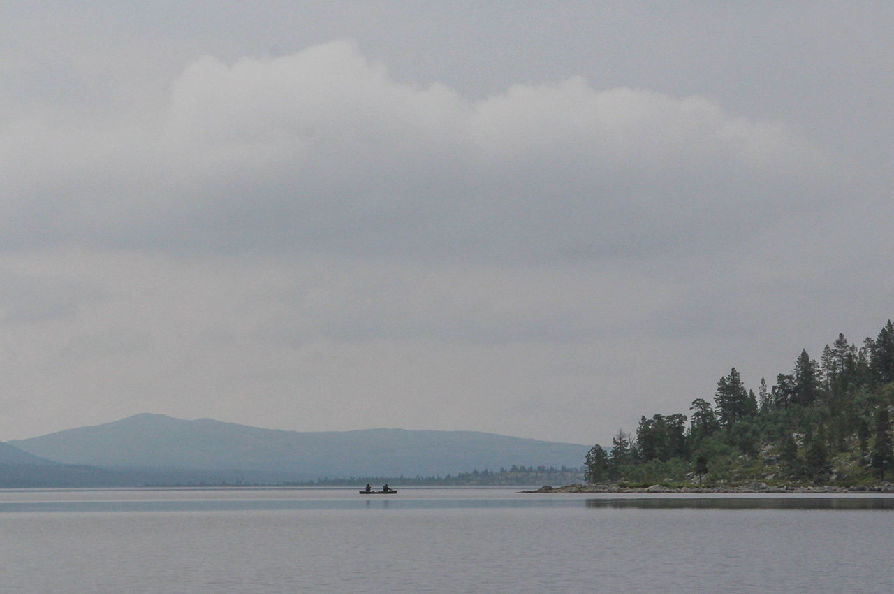
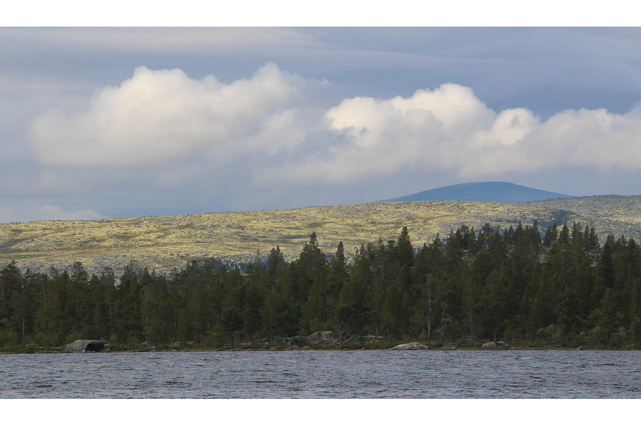
After the enclosed feel of the river and its small lakes, where views were short, it was a bit of a shock to come out onto Rogen itself. This is a big lake, 18km long, sat high on the plateau at over 750 metres, and today it was looking rather grey and bleak. Around the lake, the bare hills were tinged with a strange pale green colour, the moss which is one of the few things that can live there. This shallow lake has a bit of a reputation, and waves can rise quickly, but we were favoured with only a modest breeze.
Our plan was to head for Rödviken, an arm of the lake on its northern shore, where we would hopefully find a sheltered camp, before heading north into a maze of lakes where we would spend the next couple of days exploring.
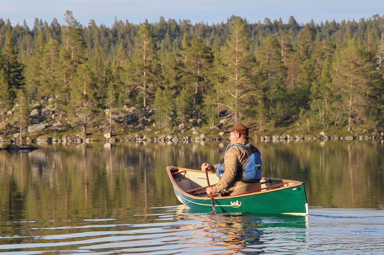
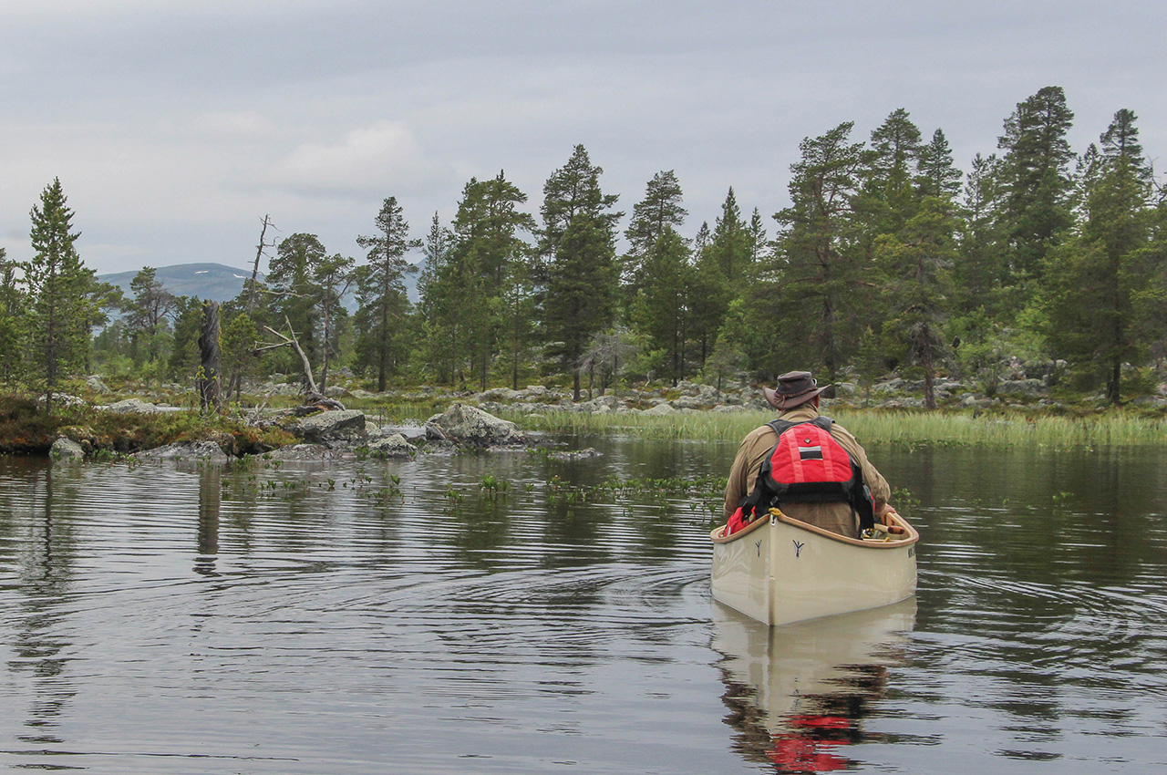
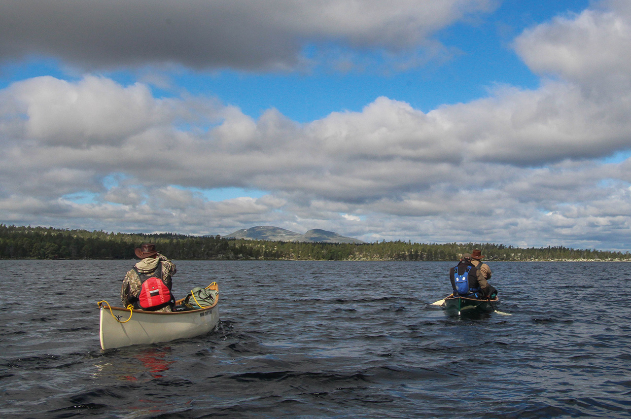
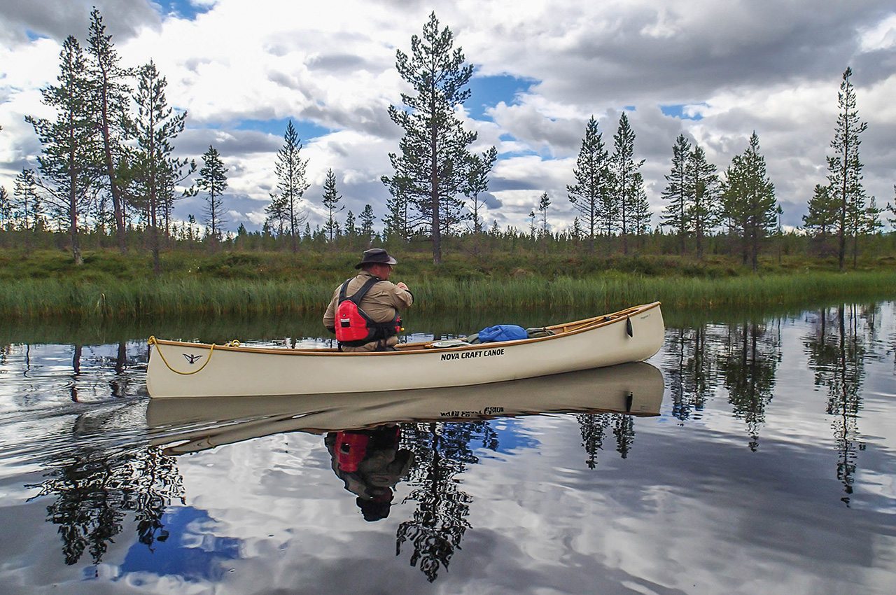
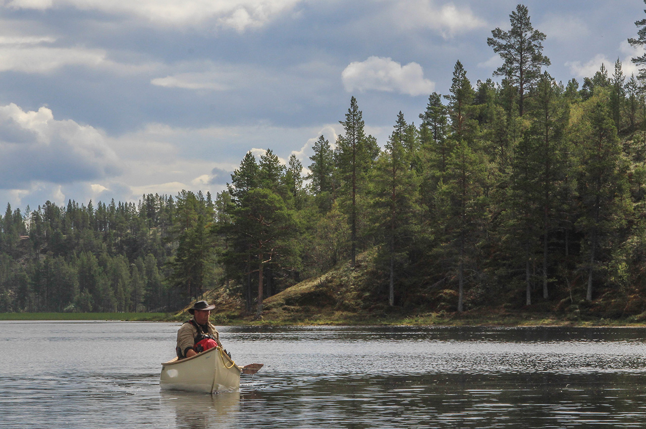
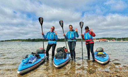
This was our first paddle of the trip on open water, and it was a useful exercise to get the hang of our boats in the slight chop. Dris and Paul were tandem in a long Swift Temagami, and quickly pulled ahead, following Rob and Fred who’d set off earlier, thanks to their more rushed schedule. Mark and I, each stubbornly paddling solo by preference, were a little slower. I had brought my Ally 15DR folding canoe, and so far, it had proven an excellent choice for this terrain. Now I was paddling it on open water, its least happy medium, but it was fine, a little slow but very sea-worthy.
Every now and then, the cold, dark waters would reveal a huge boulder below us, even when hundreds of metres off shore, such is the nature of this large shallow scrape in the Scandinavian hills. A couple of hours later and we were entering the bay at Rödviken, where another wind shelter made for a comfortable, if slightly cramped, campsite. Tonight was the last of the fresh food, so I treated us to steak, onions, mushrooms and potatoes, washed down with a little red wine, known to us as ‘ballast’.
The thousand lakes
The next couple of days would be spent exploring the remarkable area we refer to as the ‘Thousand Lakes’, one of the most notable features of Rogen. This amazing landscape, under the shadow of the hills, is basically a glacial moraine, a mix of small scraped-out lakes separated by hills, peninsulars and islands. First, though, our toughest portage so far, an uphill climb on a path littered with rocks and roots, before levelling off as it approached the biggest of the lakes, Öster Rödsjön. An hour or so later, we were on the lake, and heading for our next camp to make a base for a couple of nights and give us time to explore without our heavy loads.
The maze of islands confused us slightly, and it took back bearings on mountain summits to confirm our position and help us to find our camp. Here an old Sami Lavvu and fire pit marked a spot used for generations, and we quickly set up camp. This was a stunning spot, on a long, thin, peninsula, between the lakes of Väster and Oster Rödsjön. The views across this landscape of water and stone, to the snow-speckled mountains beyond, were magical.
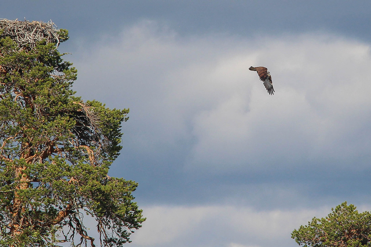
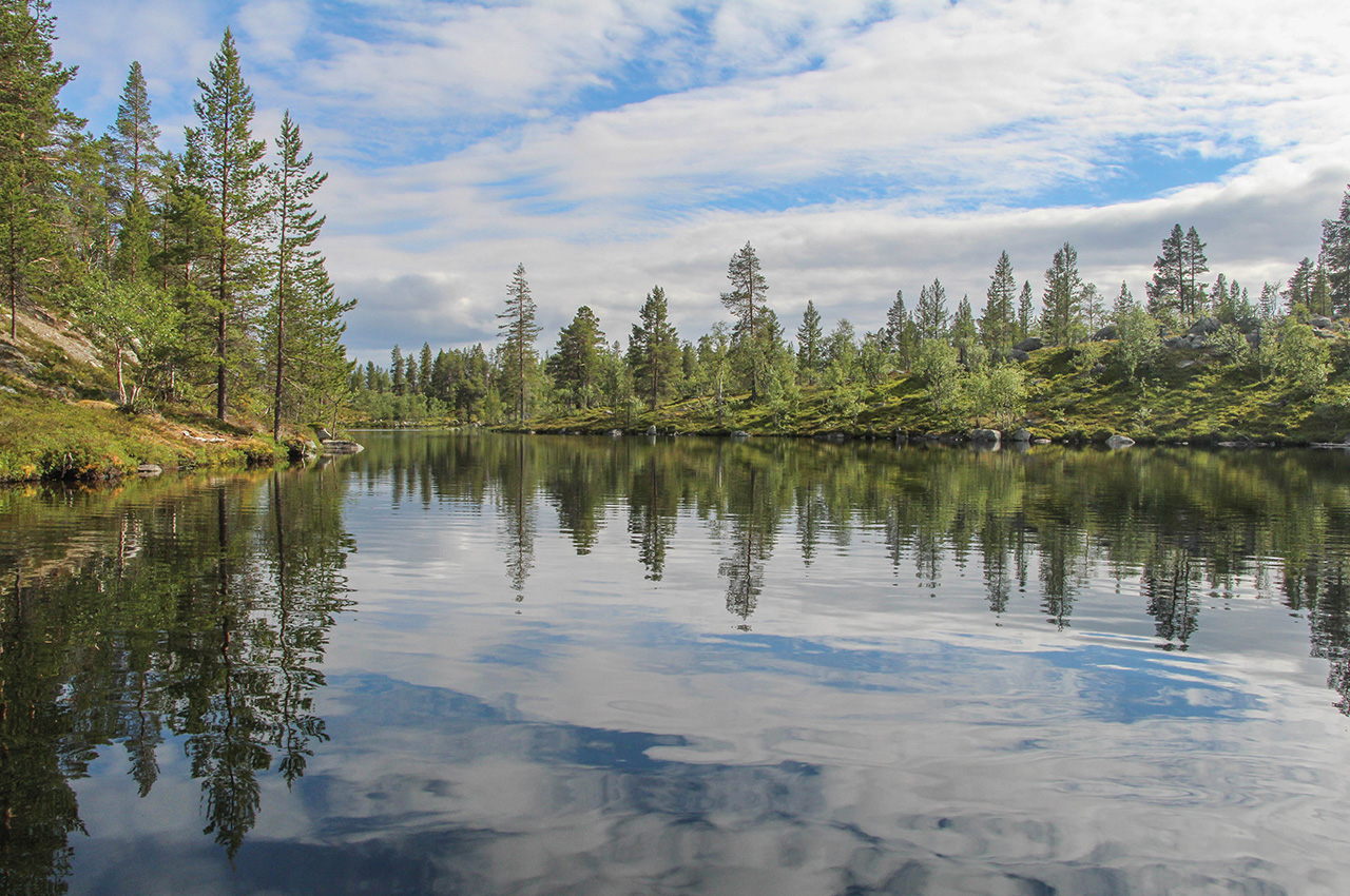
We spent the rest of the day resting, doing chores, or going for short paddles. On one solo exploration, I suddenly had the feeling of being watched, and looked up to find an osprey perched in a tree eyeing me suspiciously. Another appeared, and they circled, watching me. I suddenly realised I was near their nest, and moved further away. One returned to the nest, and then I realised there were three birds, one a juvenile that had fledged. Glad I hadn’t spooked them too much, I headed off to explore more of the lakes and inlets, a spellbinding landscape where the trees cling precariously to the rocky mounds.
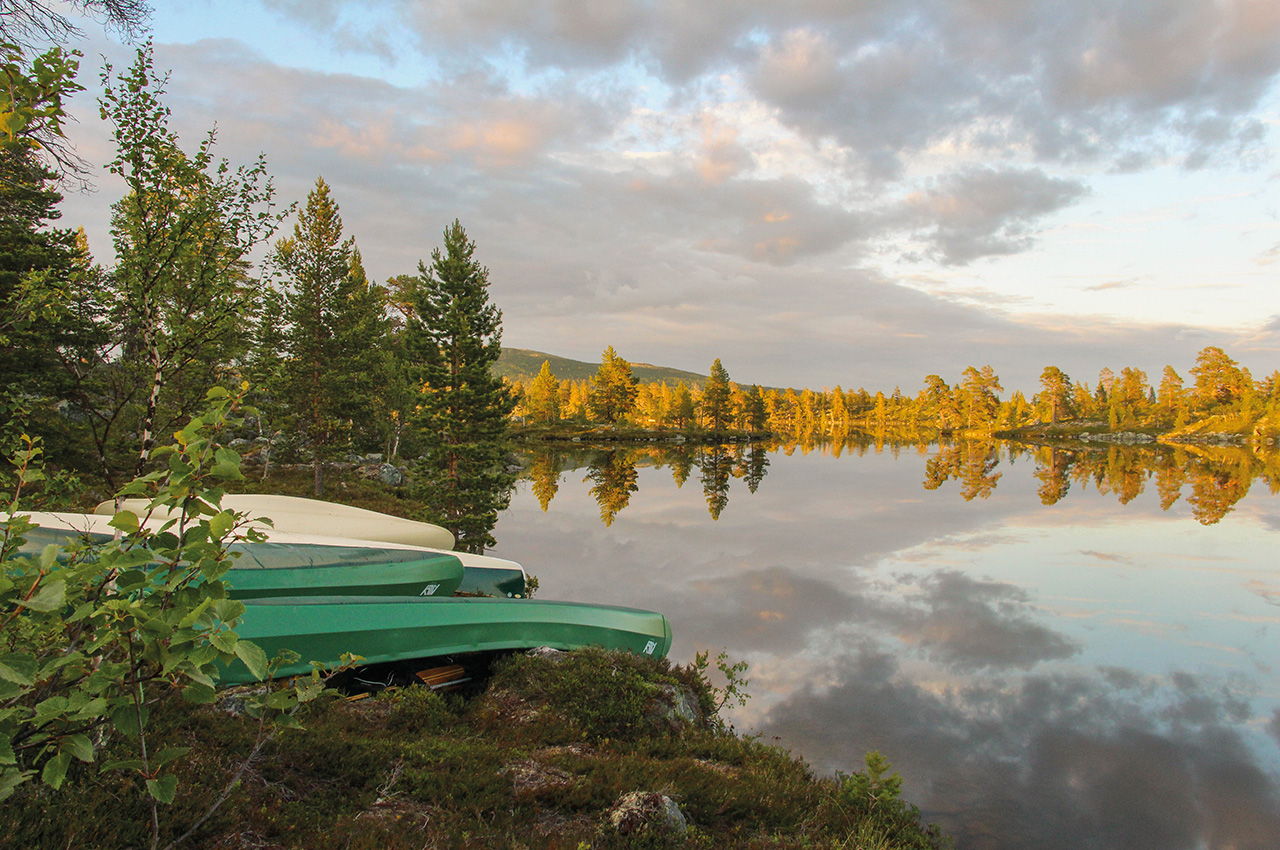
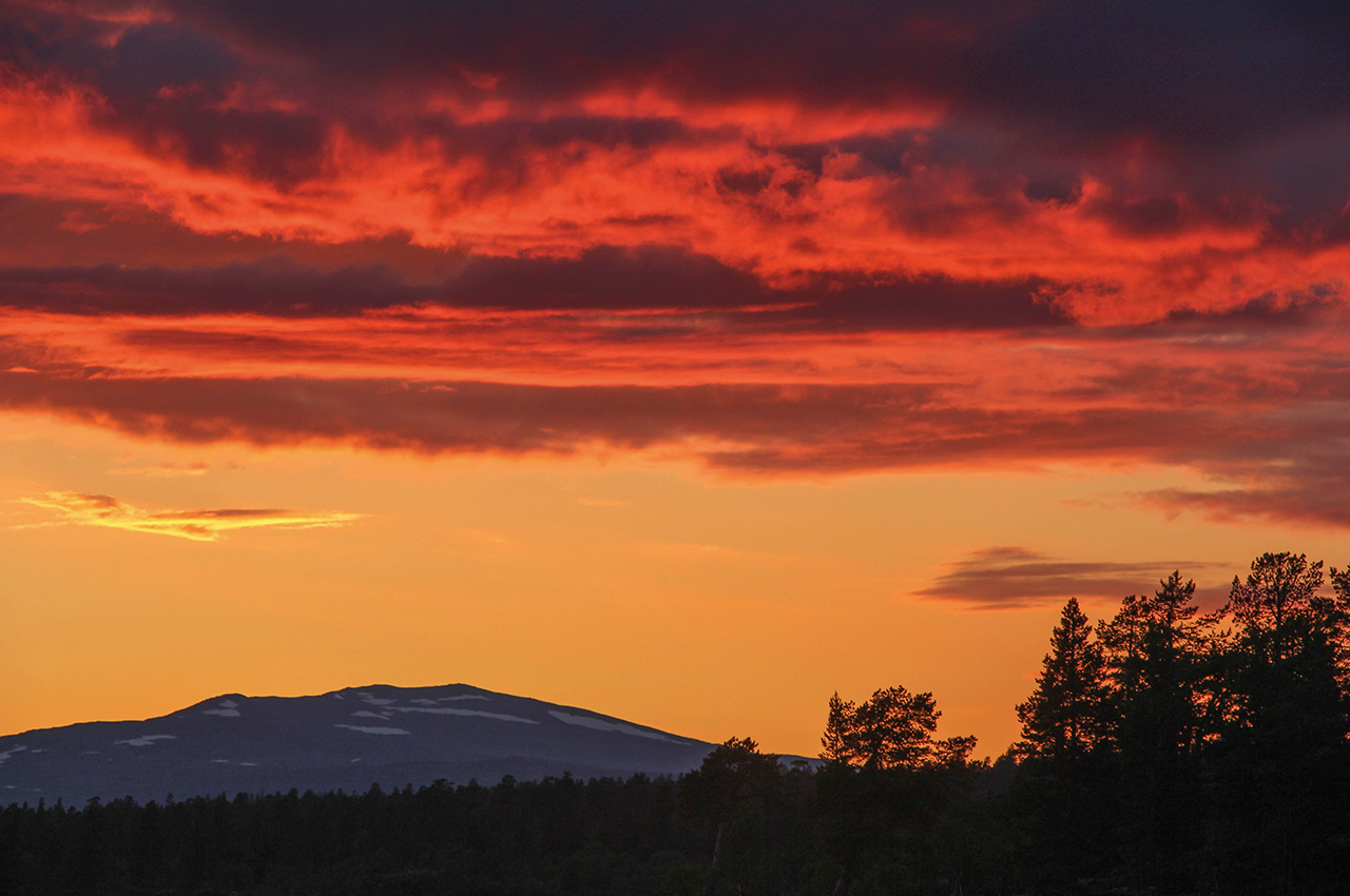
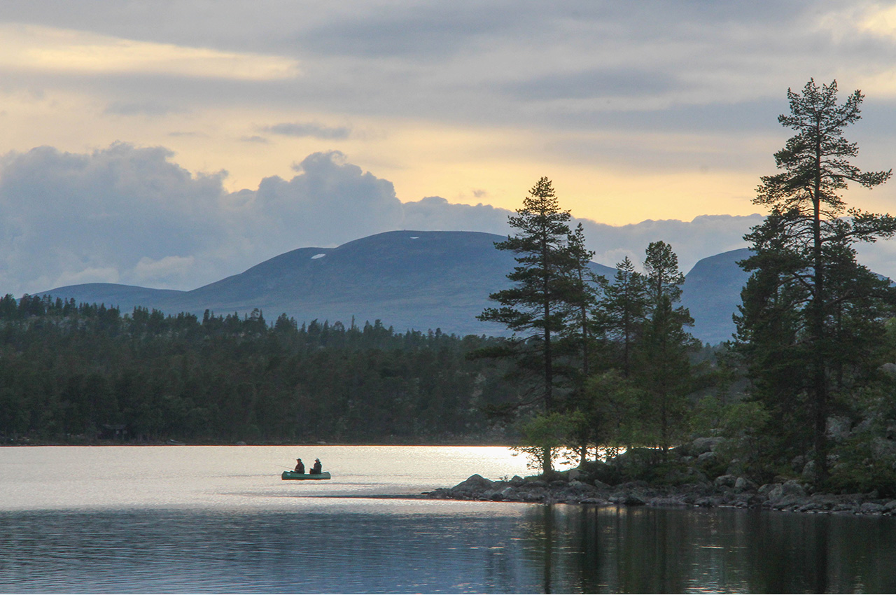
Returning to camp, we were treated to the most amazing evening, the clear light of the arctic sun softening towards dusk, too much of a temptation for us not to have a stunning evening paddle on the mirror-like water. Before bed, the Norse gods offered us one last display of their power, the most amazing sunset outlined against the hills, and reflected in the mercury-like water of Rogen.
A rest day followed, where we simply explored and lived in this wonderful landscape, before we brought our side-excursion to the Thousand Lakes to an end by heading back towards Lake Rogen. This required an early start, as we needed to hit the big lake before the wind rose, as was typical each afternoon. Repeating our rough portage to Rödviken, we were pleased to find the waters were flat and calm, and paddled out onto the vast lake before rounding a headland and heading west.
Our destination tonight was the west end of the lake, where the Norwegian border lies, and our jumping off point for the next stage of the journey. Paddling on this huge expanse of water in flat-calm conditions was an unforgettable experience, enhanced even further when the black-throated divers started their eerie calls as we rounded the point. Here we stopped for lunch on a pile of rocks sticking right out into the lake, a special place.
The breeze found us in the afternoon, and the last couple of kilometres were a little harder work, but soon enough we were at a large, popular camping area with a small hut and a shelter. Popular, in that we saw another person walk though, and some kayak fishermen off-shore.
I’d wanted to get up high and see a view of the landscape from above, so spent the rest of the afternoon climbing a nearby hill, Bustvålen. This felt properly remote, and I was conscious to take extra care, alone in this wild landscape on trackless, rock-strewn terrain, but I was rewarded with an amazing panorama of lake, rock, forest, mountains and sky. Looking ahead, I could just about trace our onward journey towards the huge Lake Femunden, a truly massive 60km long lake that would make our next target. First, though, we had the Roa river system to descend, 20km of unknown travel on lakes, on rivers, and no doubt, on foot. This 20km would take us four days.
Rough times on the Roa
The map showed us the route ahead, and early in the day we crossed into Norway. The customs process was not difficult, what with this happening 200 metres off the shore on our final Rogen paddle. Now we were entering Femundsmarka National Park, and after a short portage out of the big lake, we found ourselves at the start of what we expected to be the most challenging part of the trip.
The Roa River links Rogen and Femunden, the two huge lakes that dominate the region. Dropping only a 100 metres or so, it’s a string of small lakes and short river sections in its first part, followed by a couple of bigger lakes. The last part is all river, and we knew this would include some impassable rapids, for it has the largest proportion of the overall drop within a few short kilometres.
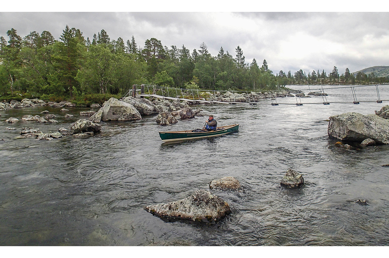
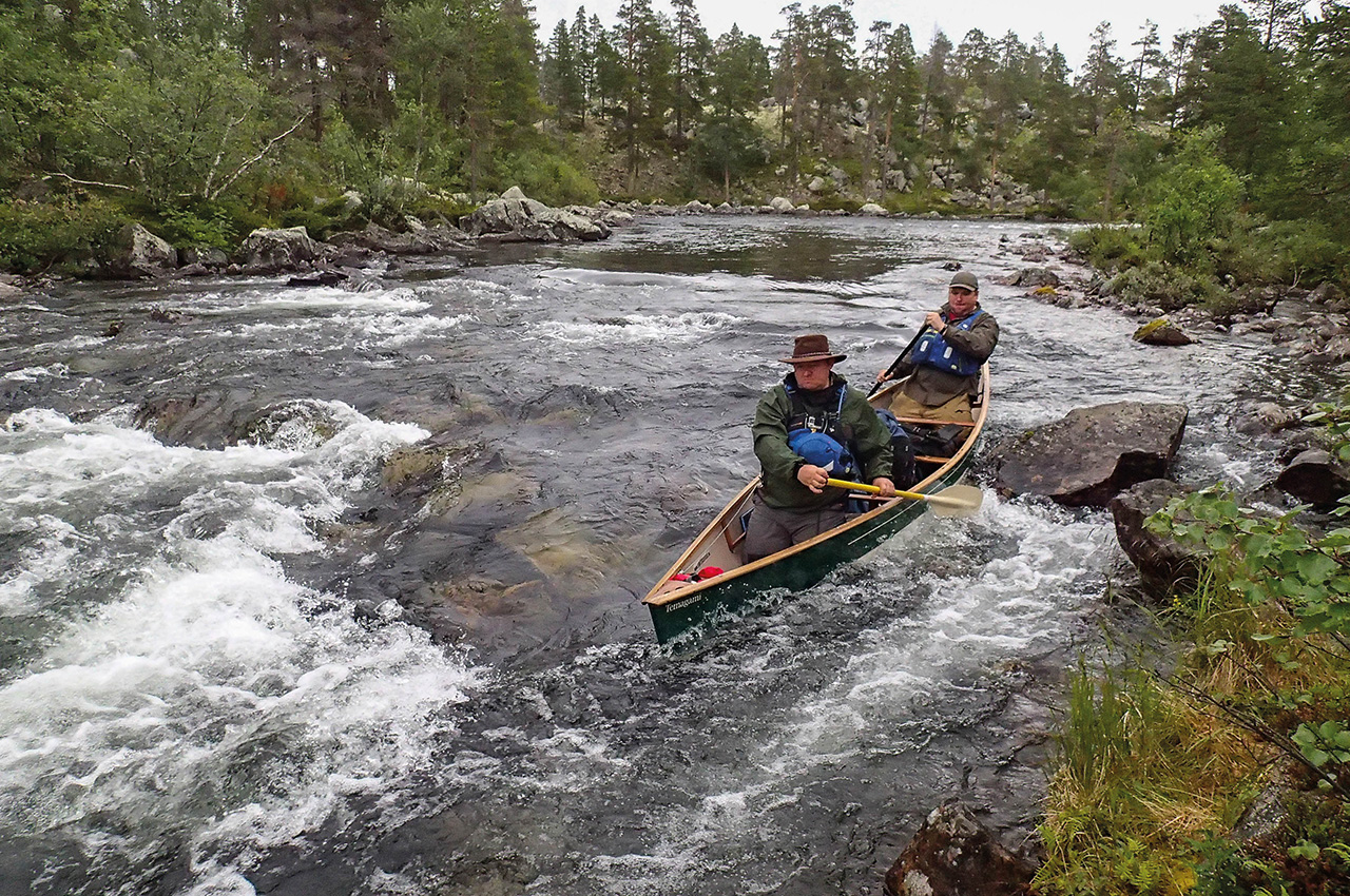
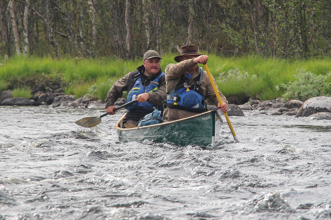
Our first rapid was marked by one of the trademark wooden suspension footbridges of Scandinavia, and formed a grade 2 rapid of about 50 metres in length. We ran it in turn, Paul going solo as Dris gave safety cover below, it being our first proper rapid of the trip. This was followed by a wonderful series of lakes linked by similar short modest rapids.
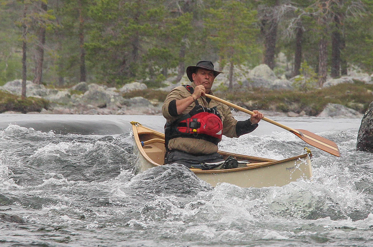
We were really enjoying ourselves now, reading and running the rapids, or whoever was leading hopping out for a quick inspection as required. This was one of the highlights of the trip for me, proper expedition travelling, not knowing what was coming next, but finding amenable grade water, all the time surrounded by this most amazing landscape of trees, moss and lichen-clad rocks.
The next rapid was longer, the drop on the map greater, and it was time for a proper inspection. Walking, with difficulty, along the banks, it was clear it was a step up in difficulty, and too much for us to run in laden open canoes. A continuous grade 3 at least, with more than a few rocks to dodge. Time for a portage. By now we were getting quite slick, each of us taking a trip with personal bags first, and returning for the canoes and communal food bags on the second leg. This portage was only about 150 metres, and followed a small path between the boulders.
It was on the second leg that it happened, just a few metres from the end. Carrying my canoe on my shoulders, I came across Dris’s load abandoned by the trail; clearly something had occurred. Reaching the put-in, we found Dris sat on a rock in clear pain.
Carrying the big food bag, he’d slipped on a relatively simple bit of path, and turned his ankle. Badly. It was unclear if he’d be able to continue. Being lunchtime, we stopped for an hour to give him chance to recover a little. Everybody was a little quiet, each of us pondering the consequences of the injury, and whether Dris would be able to move at all. We even wondered if he’d broken it, and if so, that was likely to be the end of the trip, other than finding a way to extricate ourselves, call for help, or deploy the ‘SPOT’ emergency device that we carry.

Fortunately, Dris reckoned it was only a bad sprain, but he could only just hobble about. I helped him bind his ankle, deployed some ibuprofen, and took stock. We were on the shores of a kilometre-long lake, it was mid-afternoon, and at the other end of the lake we knew there was a hut marked on the map. We decided to head for that, and have an early finish, giving Dris time to recover a little before we made any further decisions in the morning.
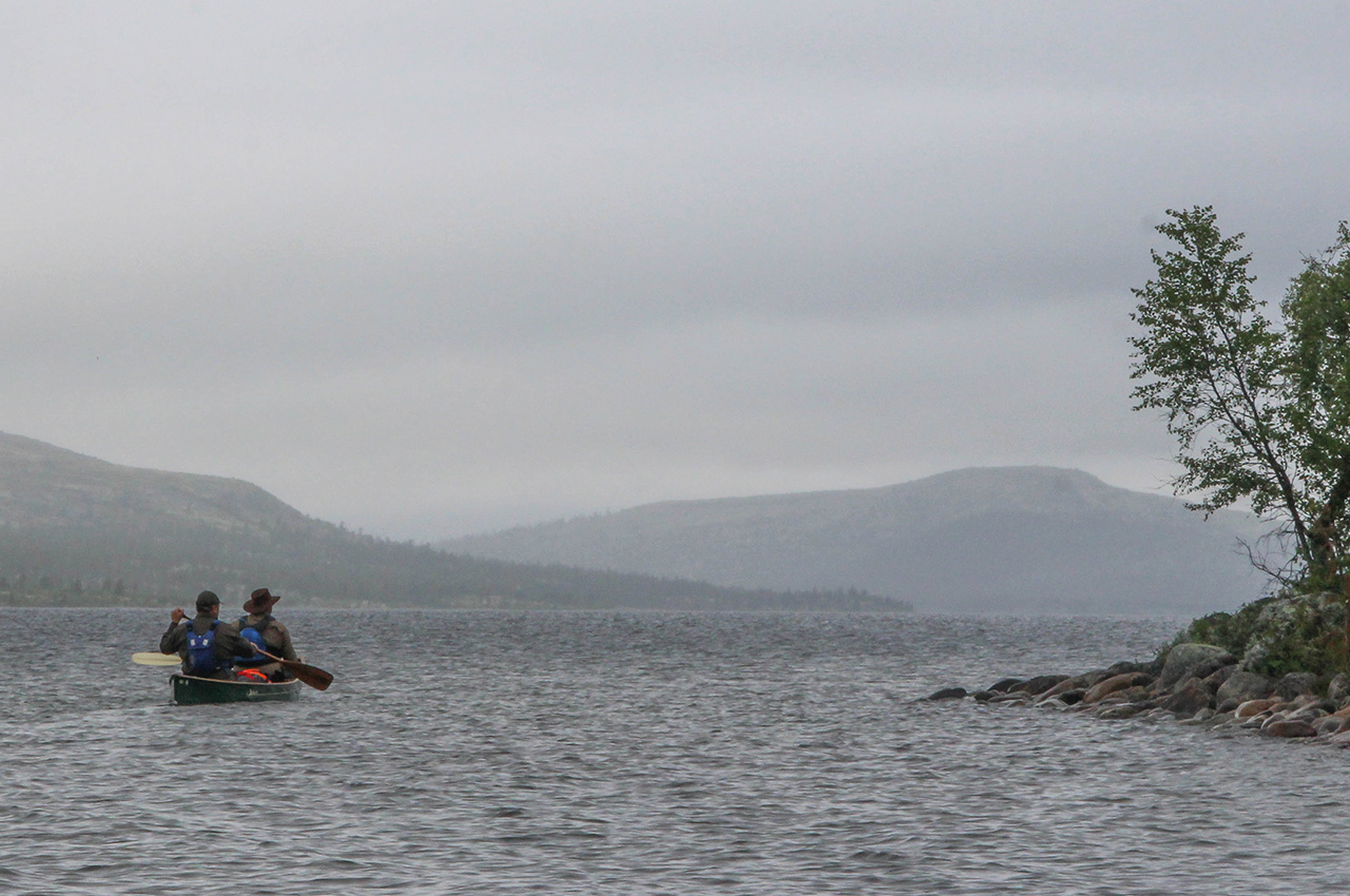
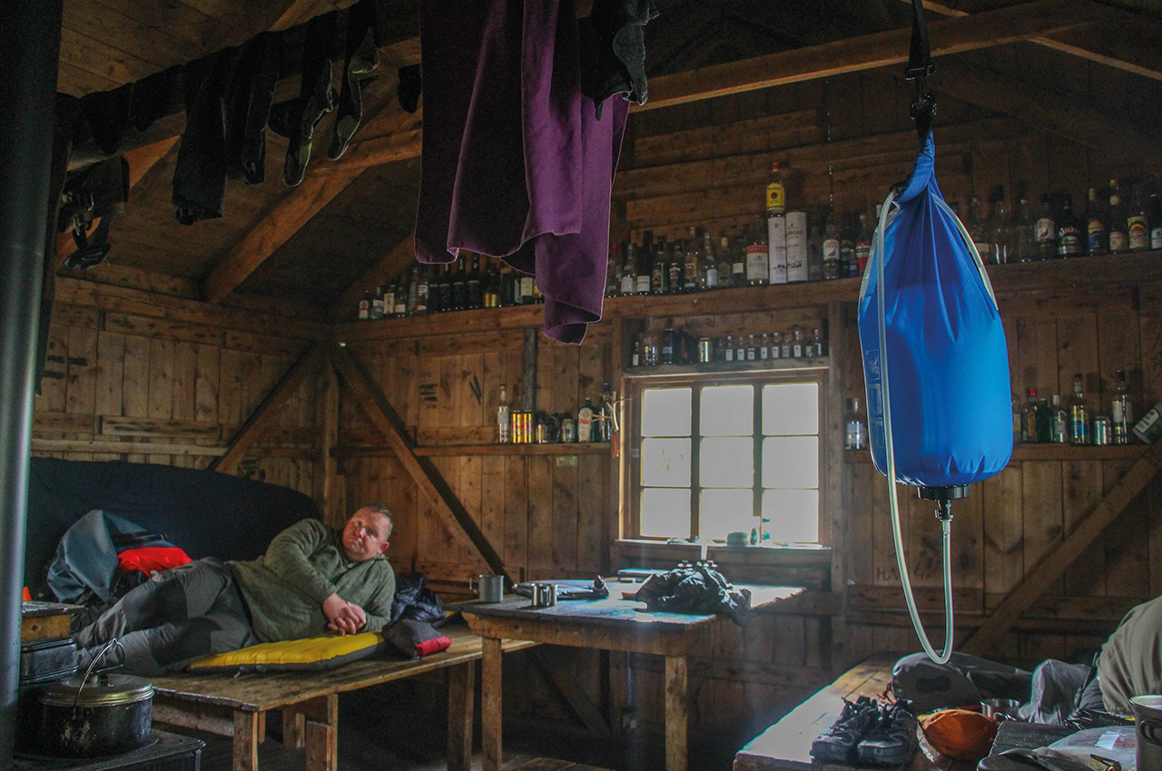
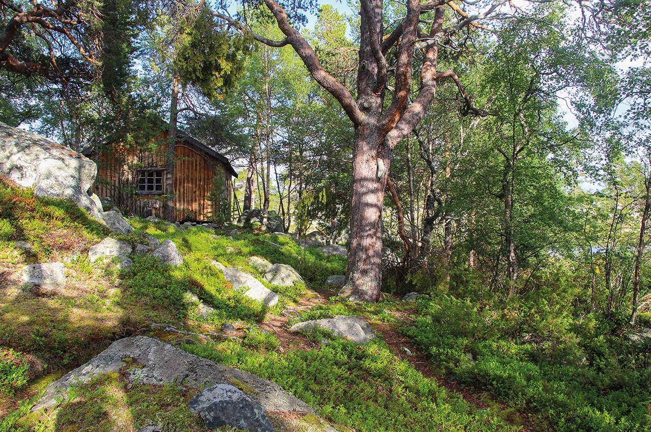
Rain clouds approached, matching our unsettled mood, as we paddled the lake, the hut a clear target in the distance, a real haven in the wilderness. Kløfthåbua was its name, one of the Norwegian State huts that have welcomed many a weary traveller before us, and it stood at the start of the next portage, the perfect place for us to spend the night.
As heavy rain arrived, we made ourselves at home. The feeling of being in sheltered comfort, with a fantastic wood stove and piles of logs to hand, was a major relief and allowed us to take time to relax and take stock. Dris was in slightly less pain now, things were hopefully looking up. We would see what the morning brought; either we would continue with our journey, sharing the load amongst the remaining fit members of the group; or we would have to work out our easiest escape, not an easy option as we were pretty much at the furthest point on our trip from any road.
After a luxurious night in our wood cabin, dawn brought new optimism. Once it had warmed up a little, Dris’s ankle would take his weight, though it was still painful. He would not be able to carry a load, but we hoped he’d be able to hobble the portages we needed to do today, for the route ahead looked as if there’d be as much carrying as paddling today, before we reached the larger lakes that marked the half-way point for the Roa River system. We would take it at an easy pace.
Immediately, we had our first portage, just a hundred metres or so from the hut to a slow, deep section of the river that was almost lake-like. Once on this, we had the joy of a few short easy rapids, before we reached what we expected to be our longest portage of the day. Here, the river curved and dropped significantly. Now to find the best portage route, but it wasn’t obvious, as there was a large overgrown boulder field across to get around. Soon it became clear that rather than finding a way around this boulder field, the route went across it, marked by worn sections between some of the rocks.
This would soon become known as the ‘Portage from Hell’, 500 metres across these tumbled piles of rock, a climb over the shoulder of a hill, and a steep, slippery drop down to the lake below. With Dris no longer able to carry, Paul and I would take up an extra load each from now on. Carrying the canoes over the boulders was frankly, verging on the ridiculous, so one of us would carry a boat whilst the other followed closely behind with a bag, to help if needed. It took a couple of hours in total to complete this passage, and by then it was lunchtime.
The afternoon was easier, but the paddling sections were disappointingly short compared with the time spent with canoes on our heads. Even so, I was revelling in the experience. It was tough, but this was what wilderness travel was all about, rising to the challenge brought by the landscape. Gruelling it may be, but I’d take this over a four-kilometre trolley push portage anytime! It was slow going though. After another woodland portage, this one over wet roots, we dropped onto a sheltered lake, the last one before we reached the bigger waters of Øvre Roasten where the Roastbua hut lay, reached by a part-portage, part empty canoe run. Reaching the hut, we found it occupied, and surprisingly it was an English couple Mat and Lotty who welcomed us in with an offer of hot water for a drink. The evening here was most pleasant, as the sun came out and the wind dropped, allowing us time to soak in the magical feel of this remote corner of Scandinavia.
Day eight
Day eight started with a 5km paddle along the two Roasten lakes, to the outlet into the river once more. This marked the start of the longest river section of the Roa system, something we knew would not be runnable all the way. The excellent Norwegian map marks a portage path on river left, and a walking trail on river right. After a bit of a scout about, neither looked particularly easy, but the walking trail was marked, was bigger, and took us past a hut.
However, it was five kilometres to the next place that it met the river. The supposed portage path was tiny, uncertain and not at all tempting. We decided to take the bags along the bigger trail, despite another truly mad boulder field, whilst it followed the river, then bring the canoes down the first rapids empty and solo, before making a decision about the next part.
Paul and I successfully ran a couple of grade 2 rapids, after portaging the first one, but the next one was steep and curving, with a massive stopper halfway down, and clearly not a good option in the middle of nowhere. Given the difficulty of progressing along the banks, we concluded that our best way onwards now was to abandon the river entirely as it curved away from the trail, and to follow the walking route towards Femunden. The next landmark was a manned ‘DNT’ hut, Røvallen. We started the carry. It was a tough one, further than we’d estimated at a full kilometre, and some of us had attempted heavier loads to save on one trip.
I learned from that mistake! By the time we had the gear and ourselves at the hut, we were exhausted, and the map didn’t show anywhere better to stop for the night in the next few kilometres. The lady warden turned a blind eye to allowing us to camp on the actual grounds of the hut, something that technically wasn’t allowed. This at least allowed us some comfort, and we were so tired we were all asleep by 21.00 that night.
Taking our canoes for a walk
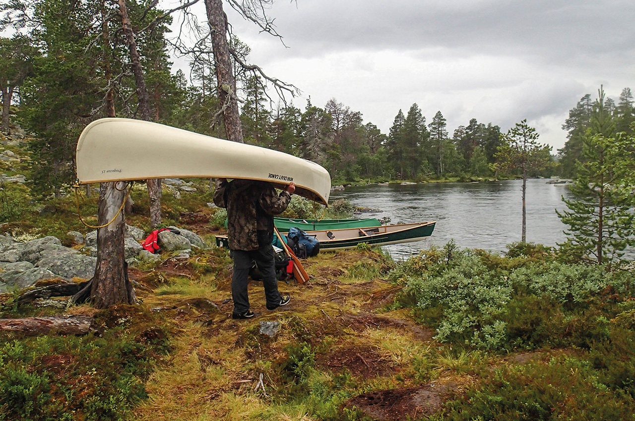
The morning brought sunshine, as we woke up in the middle of a forest with canoes, miles from the next bit of paddle-able water. Today, the fourth on this short 20 kilometres river, we would be beasts of burden. Our system was improving, though Dris was still unable to carry a load. Instead he took charge of snack and lunch duty, keeping the Sherpas fed and fuelled. Paul and I took three loads each, though it’s only fair to note that he carried the heaviest loads. Mark carried two loads, old injuries hampering his speed but not his spirit.
We were passing through some lovely woodlands, and the trail was much easier than some of our most difficult carries, though before this trip we would probably have described it as rough! Splitting the distance into five legs of around 700 metres each, we took it one stage at a time, and steadily crept towards our goal, a footbridge about a kilometre from Lake Femunden, from which we hoped to be able to paddle the final part. We were all aching, but I still enjoyed walking through these delightful pine glades, with the smell of the forest around us. Somehow the ridiculousness of being in the middle of nowhere, miles from water with your canoe on your head, helps. Having started at 09.30, it was nearly 5pm when we reached the bridge, pretty much worn out.
Unfortunately, instead of relief, we found the rapids below the bridge to be too hard. Fresh, we might have tried them, they were probably only grade 2+, but we were in no state to take risks. Another 200 metres portage got us around them, and two short easy rapids were all that separated us from the huge lake that marked our destination for the day, and where we hoped to camp. Finally, relieved to be afloat at long last, we slipped out onto the lake in a gentle, soft rain shower, to find the immense 60 kilometres of Femunden flat calm.
As we looked for the best campsite, and there was plenty of choice, it was slowly dawning on us that we had an opportunity in front of us; to paddle the seven kilometres to the end of the lake whilst the weather was calm. Yes, we’d already been on the go for 10 hours, were knackered and hungry, but we knew that the chances were, we would not have such calm conditions again. We would paddle tonight. First, though, we’d refuel, and we pulled up on a lovely beach and cooked one of Mark’s excellent chillies on a poor beach fire. By the time this was done, there was a breeze rising, but we decided that it was the right decision to at least get further down the lake tonight, and off we set, the sun already dipping towards the horizon.
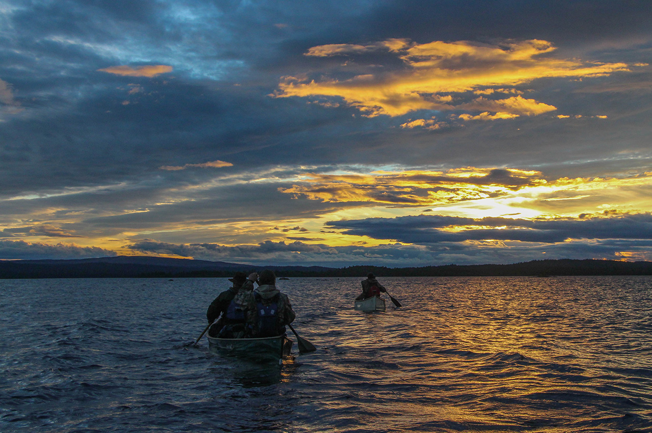
Ten minutes later, I wasn’t sure it was the right decision at all. The wind was rising, and coming out of the shelter of our bay it was getting choppy, the fetch being over 50km long! Fortunately, it was blowing from behind us and helping push our pace. A headland on the east shore formed a focal point for the waves, and battling round it we were getting a little worried about continuing. Beyond, the waters calmed a little, and we pressed on, committed now, making really good time. The tandem lads were ahead, waiting for us at key points along the shore where they could get shelter, whilst Mark and I stuck close to each other at the back. It was now nearly 22.00, but only a last large bay separated us from a headland that marked the entry to the sheltered north-east arm of Femunden, Nordvika.
With all the shorelines just dark outlines, a compass bearing took us straight into the setting sun, and we headed off on a one-kilometre open water crossing. This felt a little crazy, but it never really gets dark here at this time of year, and the wind and waves had dropped enough to feel we were not in danger of swamping. I will never forget this last section, as we passed into the relative shelter of some low islands, the sun now gone, but with an immense blanket of pink and orange clouds marking its departure with a glorious sunset. Rounding the headland, we were safe, and here, as hoped, we found a perfect little campsite where the point met the land. We’d been on the go for 13 hours, effectively walked something like 17 kilometres, many with canoes on our heads, and paddled on the biggest lake we had ever seen at dusk. As the moon rose over the hills, we sipped on a well-deserved dram of Laphroaig, before retiring to sleep deeply. A day I will never forget.
Following history to Feragen
We rose late, for we had the luxury of a short day ahead of us, having caught up some time yesterday, and with the dangerous open water crossings behind us now. Looking out to whitecaps on the huge lake we had paddled the night before, we were mightily relieved to have continued when we did. A half day’s travel from Femunden would follow an old logging route, linking another series of lakes together, and we would be mostly sheltered from the wind.
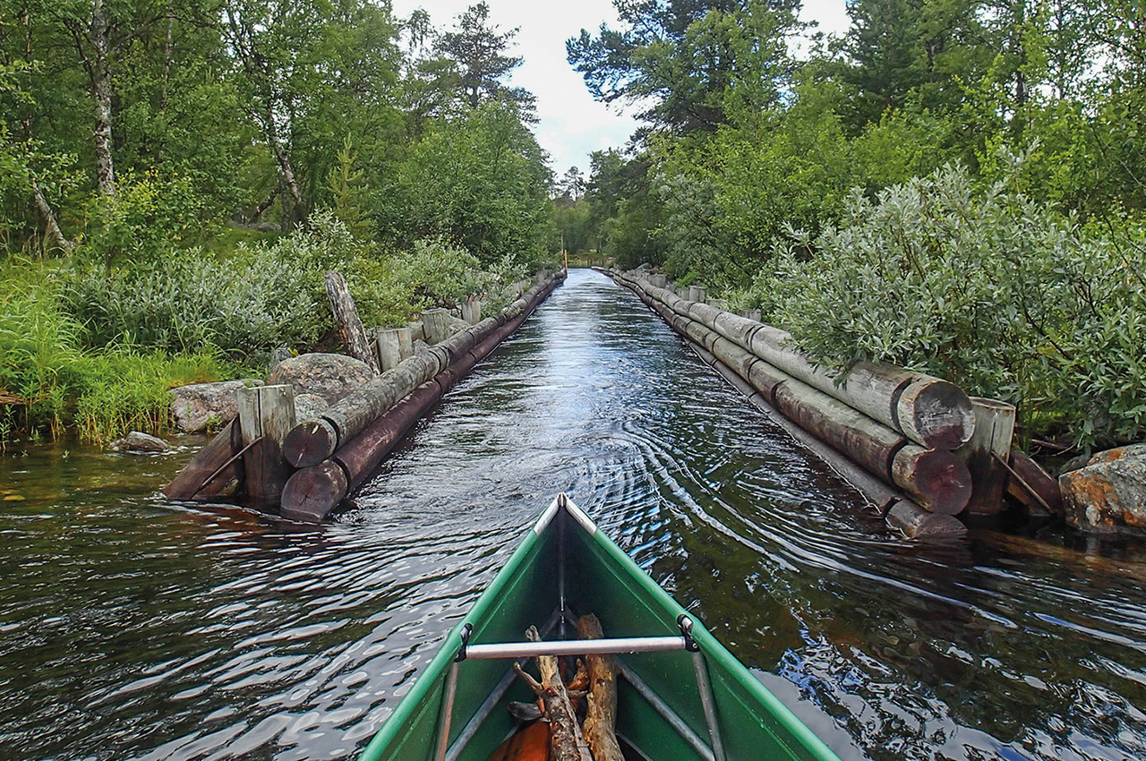
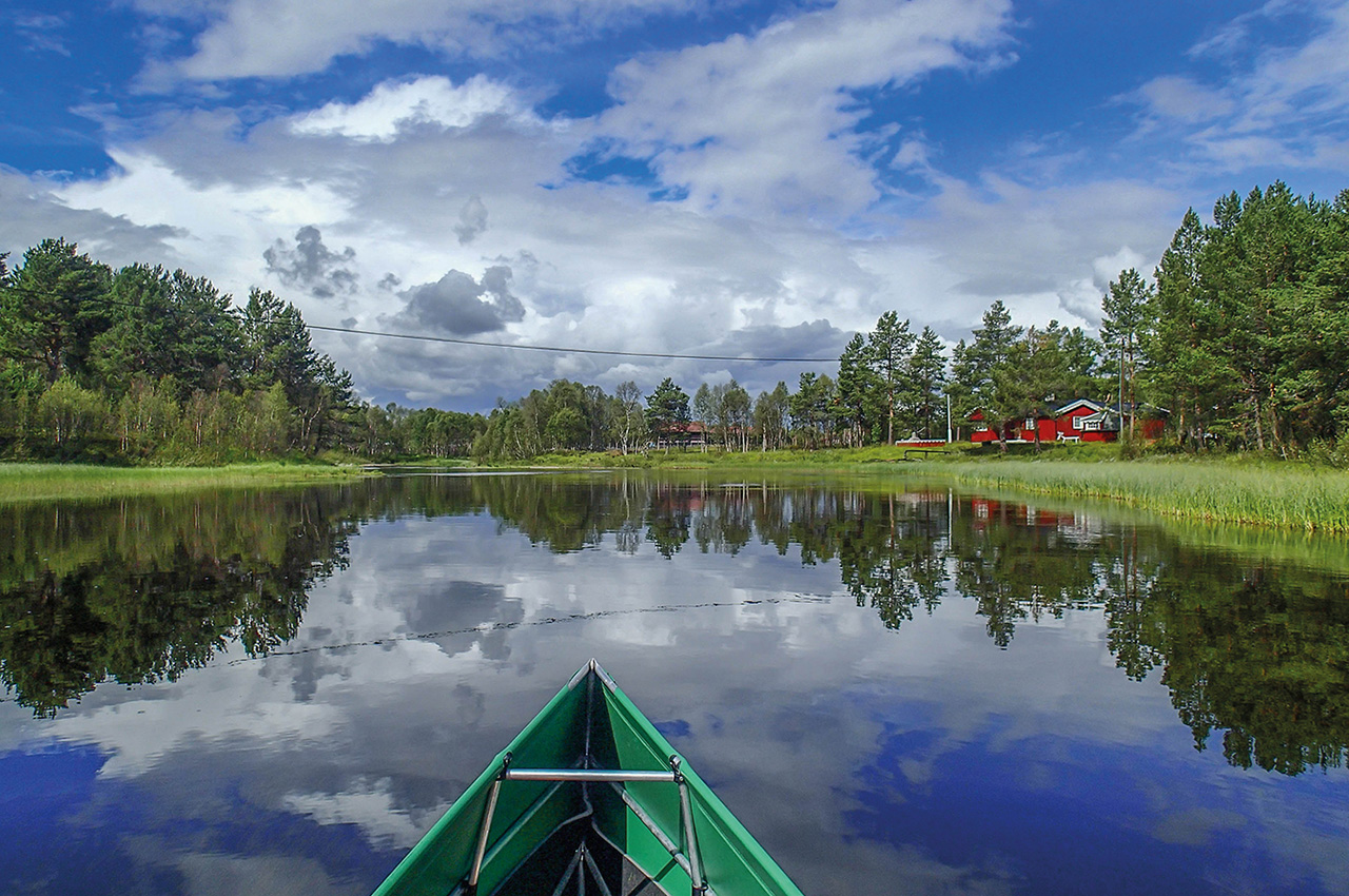
Heading along the sheltered inlet of Nordvika, we were starting to see the first signs that we were leaving the real wilderness, and small huddles of summer houses were appearing. Some of these no doubt marked the original location of logging camps, for this was a major source of wood to feed the furnaces at Røros, where mineral ore dug from the ground in this old mining town would be processed. At the head of the lake, we were happy to find a gentle ‘log flume’ would take us down into the next small lake, a short but simple way to avoid a portage, and this one was plenty wide enough for a couple of canoes. The next flume was narrow, and more reminiscent of an Alton Towers ride, curving away out of sight. Whilst a canoe might just fit, it was too tight to risk, and though the lads tried to persuade me to give it a go, in the end we all portaged. I wasn’t getting a folding canoe jammed between the narrow walls of this slide just for their amusement.
Another still and calm lake took us to another portage round an impassably narrow flume, and we were now on our last lake of the day, Langtjønna. An hour later and we were approaching another hut, perched on the neck of land that separated us from the next big lake, Feragen, a sheltered corner of which we would cross the next day.
That evening, we pored over the maps trying to glean as much information about our final few days as possible. From Feragen, a river, the continuation of the Roa effectively, heads west and north towards Røros. Indeed, that name means ‘confluence of the Roa river’, though the map names this part as the Håelva and Feragselva. We had one mystery to solve.
The first part of the river meandered for five kilometres or so, but a portage was marked along a large gravel track. We couldn’t understand the reason for this as all information we had gleaned from others we met along the way spoke of no hard rapids or falls, and we’d even managed to get a Google satellite view of the section. We would simply have to go and find out for ourselves. If it proved impassable, we had the option of heading north on Feragen for an alternative finish, but I know most of us were pretty determined to get to Røros now.
Running rivers to Røros
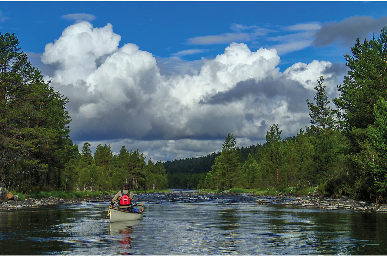
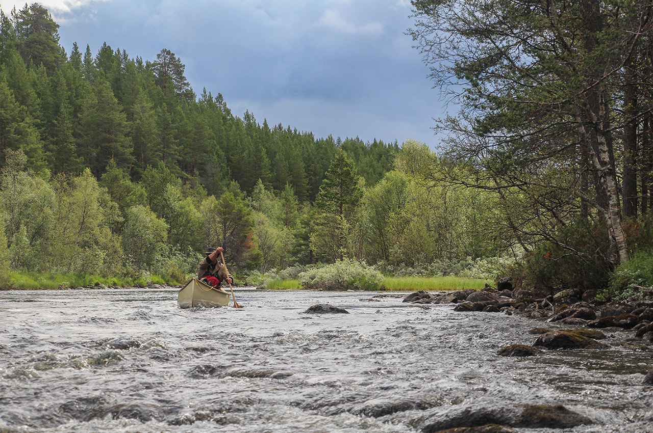
In the morning, we made our way to the lake by portage and a lovely small stream. Soon enough, we were together and heading up a sheltered arm of Feragen to the outlet into the Feragselva. Here was a proper bridge, a gravel road, and a lone mountain biker. We grilled this friendly chap for information on the river ahead, and he confirmed he didn’t think there were any difficulties, so our decision was made. We headed under the bridge and entered a wonderful section of shallow grade 1 river, winding its way noticeably downwards. The other two canoes were having a little difficulty finding deep enough water, but I was having great fun in the Ally folding canoe, joyously surprised to find it a brilliant little moving water boat. Slower sections followed, where steep sandy banks were clad with more diverse woodland than we’d been used to, and plenty of signs of beaver, as we made our way towards the next lake, Håsjøen.
Håsjøen turned out to be a bit of a battle, for the wind had swung to the west and Mark and I worked quite hard to cross the lake and use the far shore for shelter whilst the tandem boys paddled more easily straight across. Another short river took us onto another long, thin lake, Rambergssjøen, and near the end of this we made our final camp in a slightly scruffy patch of woodland. Here Dris and I discovered that we’d barely touched Mark’s supply of Ardbeg whisky, and proceeded to make amends.
Our last day and as usual, I had mixed feelings. By now, we were pretty shattered, smelly, and despite the wonderful meals we’d been enjoying, longing for those little fresh extras that make life in civilization a little easier. Like cold beer. However, at the same time, we were now completely at home in the wilds, and the occasional noise of a car on the gravel road across the lake felt like an intrusion, so a large part of me wanted to turn back around and head straight back out. After that cold beer.
Ahead of us was yet another day of lake and river, and we hoped to be able to paddle almost all of it. At the exit of the lake, we now knew there was a weir, leading into a six kilometres river section. This river dropped 20 metres along that distance, so we expected some rapids, but assumed a lot of the drop might be the weir. In the end, the weir was barely a metre in height. After the shortest portage of the trip, we entered a slow section of river through our first settlement, a small hamlet.
Leaving the trees behind, the river was obviously pooling up behind some rapids, but when they came, it was no raging torrent or steep drop, just a lovely gentle slope of shallow grade 1 water. I’d been half expecting this final few days to be a bit of an anti-climax after the wilder areas through which we’d passed, but this was wonderful. The next hour found us paddling a series of fun easy rapids, the only difficulty being that of finding enough water, especially for the two other canoes.
I was revelling in the feeling of paddling the Ally in this water, once again my fragile-looking folding canoe was proving to be not only capable, but also great fun to paddle. I would have loved this part to go on for ever, but all too soon a rickety footbridge marked the approach of the last lake, where we stopped for a final break. All that lay ahead of us was a last meandering section of easy river, now dotted with lovely rustic properties, as we approached Røros.
Suddenly, it was over
Turning up a canalised tributary towards town, we paddled until the water was too shallow, and that was it. Climbing the bank, we found our finish was in the less-than-salubrious location of an industrial estate on the edge of this World Heritage Site historic mining town. A few hours later and we were celebrating our achievement with a few rather pricey beers and an excellent meal. We even found the next day, that the van had been delivered back in its place as requested after our hire car shuttle run, and confirmed as roadworthy for the return drive.
This had been an unforgettable trip, perhaps tougher than we’d expected, thanks to the roughness of the portages, but equally much more rewarding than you could ever hope for. I loved this part of Scandinavia, wild but beautiful, and the thin blue line, linking such amazing lakes, was wonderful to travel. I think the abiding memory, though, is of one thing: rocks!