
By Graham Warren
Bio
Graham Warren runs the websites www.mooseheadcanoes.co.uk and www.scottishcanoeroutes.info. Details of ten more ‘off the beaten track’ canoe routes are found in his new book Explore Scotland’s Wilderness Waterways by Canoe, together with a wealth of tips and techniques and a detailed history of canoe tripping in Scotland.
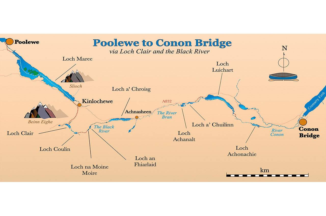
A closer look at the map – Poolewe to Conon Bridge
Here warm limestone cliffs tower up to 600m above the river but, perhaps surprisingly, the river itself is amenable and almost all paddleable at a modest grade. I’ve been fortunate to paddle here several times, but my most memorable trip was probably in summer 2016 when a group of us paddled the four days from Florac to Le Rozier as a continuous journey, and this is mostly the tale of that trip, with a few photos and observations from other trips thrown in for good measure.
The 2005 Scottish Canoe Touring guide somewhat inadvertently elevated the Poolewe-to-Conon Bridge route to the stuff of legend. The guide told of how paddlers got wind of the route via an obscure note on the wall of a bothy. Some seem to have doubted the route’s existence. How exciting. The route seems to be rarely paddled, presumably because people are put off by the thought of rolling a trolley seven miles up the steep, narrow and busy A832.
The seeds for our version of this route were sown high on the slopes of Beinn Eighe. My wife and I aborted our April trip to Inverpolly due to persistent high winds, so we instead climbed the mountain as a consolation prize. From our elevated viewpoint, we caught sight of a beautiful, partially hidden loch, sitting pretty amidst stands of ancient Scots pines. It seemed beckoning; what a great place to pass through in our canoe. Back at home, hunched over my maps, I tried every which way to engineer this loch, which turned out to be Loch Clair, into a long-distance canoe route. It links through to Loch Coulin, but I was thinking southwards from there on, and the route seemed to peter out. What a shame.
It doesn’t pay to be too blinkered by the route descriptions in the canoeing guidebooks. The blue lines on the map tell of altogether broader horizons. By studying the maps, we had pieced together a much-improved version of the standard Inverkirkaig to Bonar Bridge route and found excellent circuits in under-developed regions like Knapdale and Galloway. When the subject of the Poolewe to Conon Bridge route was mooted, we wondered what a closer look at the map might reveal about possible alternatives to the nasty road section.
At this point, our earlier thoughts about Loch Clair and Loch Coulin fell into place. There was a way onwards from Loch Clair – eastwards! After reaching Loch Clair from Loch Maree via a shorter and much quieter road section than the A832, and heading upriver to Loch Coulin, there is a feasible-looking one-and-a-half mile portage up to Loch Na Moine Moire. This loch is connected to Loch an Fhiarlaid by a channel, and from there, there is a stream, Abhainn Dubh – The Black River – leading down to Loch a’ Chroisg and so back onto the original route along the River Bran. The Black River would be the critical link to this variation. We plotted the stream’s height profile and saw that there would be some challenging sections. How much could be lined and how much would need to be portaged would only become apparent when we got there.
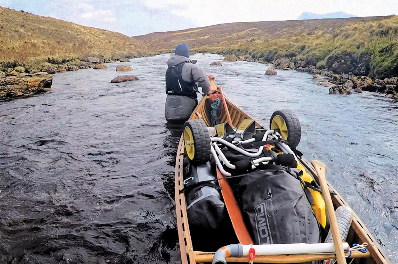
We had often passed the River Bran whilst driving along the A832, harbouring fantasies of linking it into a canoe adventure, revelling in its Barrens-like wildness, following its snaking, gravelly way across the moors. The water level would govern our fate in this section, and low water might mean ten miles with the canoe on the lines, a significant test of our shallow river technique.
Swollen and angry
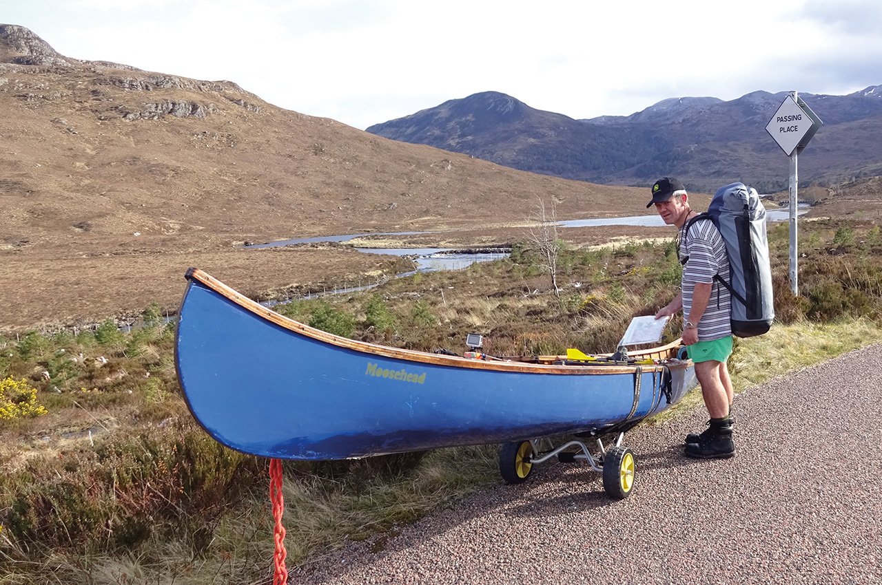
With this plan in mind, Andrew and I motored into Poolewe in early May with a cross-Scotland gleam in our eyes. The signs were good: it wasn’t raining, the sky, although sporting heavy clouds showed some blue, and the wind was light. However, we did have one disappointment, the prospect of intricate and absorbing upstream travel was denied us because the river flowing down into Poolewe was very swollen and angry. So we trolleyed up to Tollie Bay to begin our paddling there.
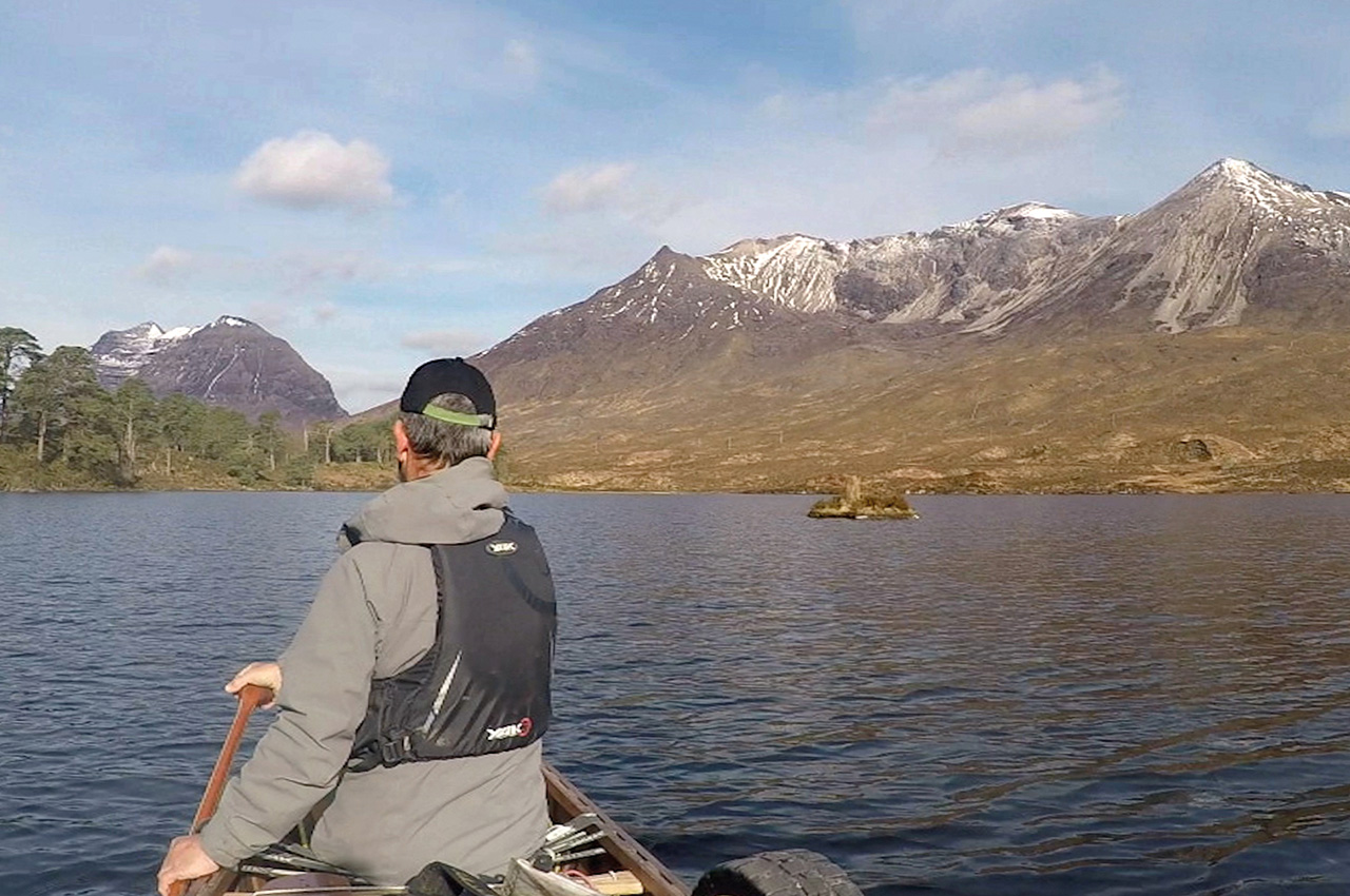
Loch Maree looked at its most inviting, with the sun starting to come out, Scots pines glowing green and orange, and snow on the peaks, bleached whiter than white in the sunshine. The spread of islands across the water seemed somehow to perfectly counter-balance the bulk of Slioch above. This trip had the feel of something big, and we were at the threshold of an adventure. Once on the loch, we soon got our rhythm going; our paddle strokes synchronised not only with each other but also with this beautiful place’s upbeat mood. We had lunch on the island next to Isle Maree. The last time I was at that Isle’s burial ground, I found an almost perfectly heart-shaped pebble. Folklore warns you not to remove anything from this island, so I laid the polished stone by the grave of a little girl.
At the top of the loch, again, the river was spated and unpleasant, so we continued by trolley up to Kinlochewe, passing the Allt na Still waterfall. Last night when we camped here after the drive up, water was pouring over like a slim Niagara. The top of the waterfall was lost in the cloud, making it look like water was gushing straight out of the sky. Today, the flow was dramatically reduced; things were drying up fast after the recent wet spell. We began to think that we should get a move on to reach the Bran while it still had some water in it. This feeling of urgency reminded me of reading about a party hastening down the Porcupine River in the Yukon, trying to outrun winter as the waters froze behind them.
At Kinlochewe, we branched off from the guidebook route to proceed up the quiet A896, which seemed much easier, safer and shorter than the A832 had looked.


Loch Clair
Loch Clair finally came into view, below us and to the left, looking just as pretty as I had remembered it. We paddled across to a handsome stand of Scots pines rising from a flat area on the opposite shore and found it to be a near-perfect campsite, with a great view of the snowy peaks of Beinn Eighe and Liathach. After a meal, we took a walk to see what lay between Loch Coulin and us. We found a splendid little gorge down which water was pouring at a fair rate. We would be ascending this tomorrow, and the prospect was exciting.
The next morning we paddled up into our exit gorge until stopped by the river’s flow, just before a bridge. We jumped out. I love upstream travel, wading next to the canoe, reading the river, and edging into eddies to re-board for deeper sections. The gushing of the water and the glint of sunlight through the heavy tree cover gave the place a special intimate atmosphere.
The current slackened off as we emerged into full daylight and entered a weedy pool with a fine view over to a Big House—Coulin Lodge.
Loch Coulin
Loch Coulin, hidden from the outside world in its secret valley, backed by snowy peaks and bursting with plant life, has to be a contender for the prettiest spot on Earth. But it was clear that the easy life was coming to an end, for the really wild country now reared up in front of us.
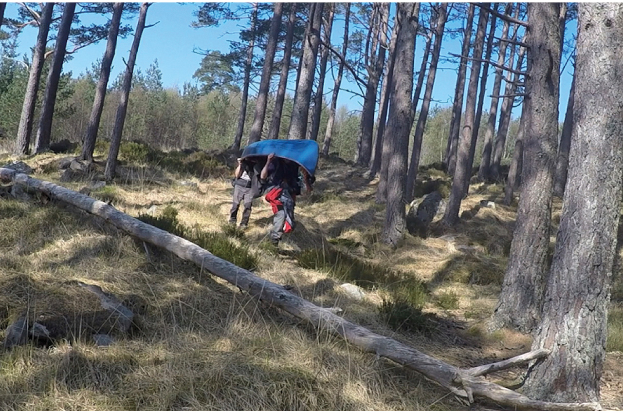
The way ahead was sunlit, attractively wooded, but uphill and a significant portage. On their 1898 expedition to explore the Barren Lands in Canada, the Tyrrell brothers chose some team members specifically because they were good at portaging rather than primarily for their paddling skills. Andrew would undoubtedly have qualified, for he delights in carrying. I feel it my duty to plan portages, like this one, that I know Andrew will enjoy.
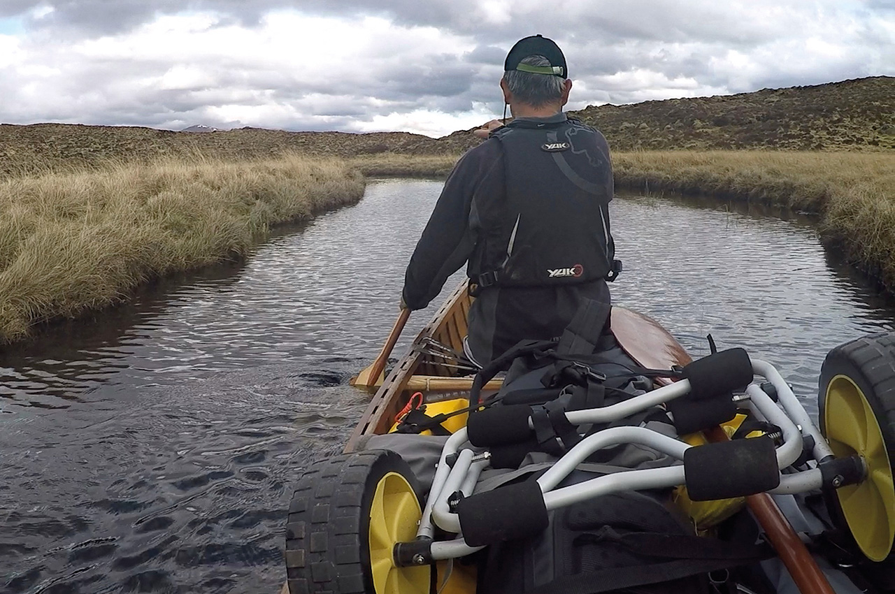
We relayed the gear almost to the top of the hill, stopping for lunch at a classy little waterfall. Beyond this point, the trees ended, and the moor began. The faint path weaved this way and that through the heather as far as Loch na Moine Moire and then abruptly stopped. This was the trail’s end; the easiest way onwards was now by canoe. Ahead was a sheet of water perched atop a broad sweep of heather and peat, dotted with unfamiliar and reclusive little plants that seemed to thrive in solitude.
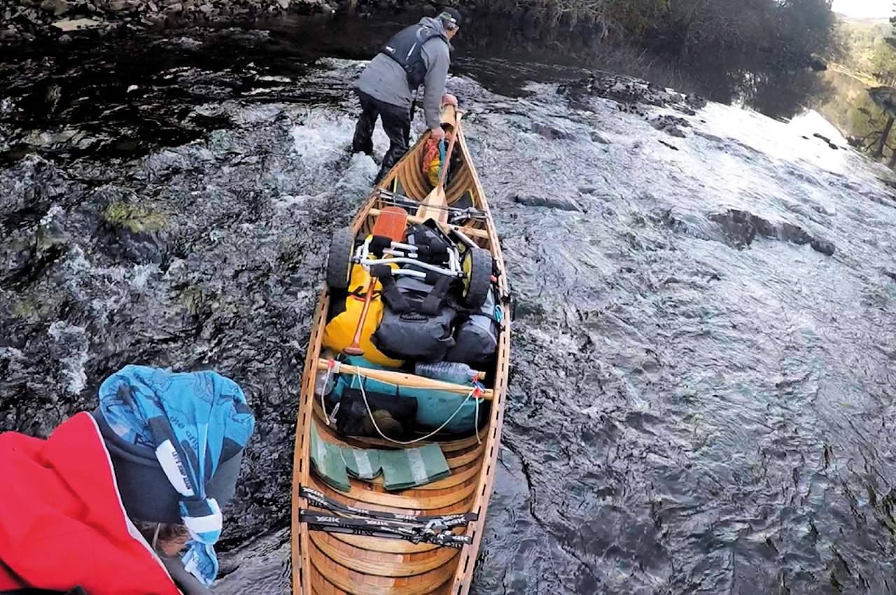
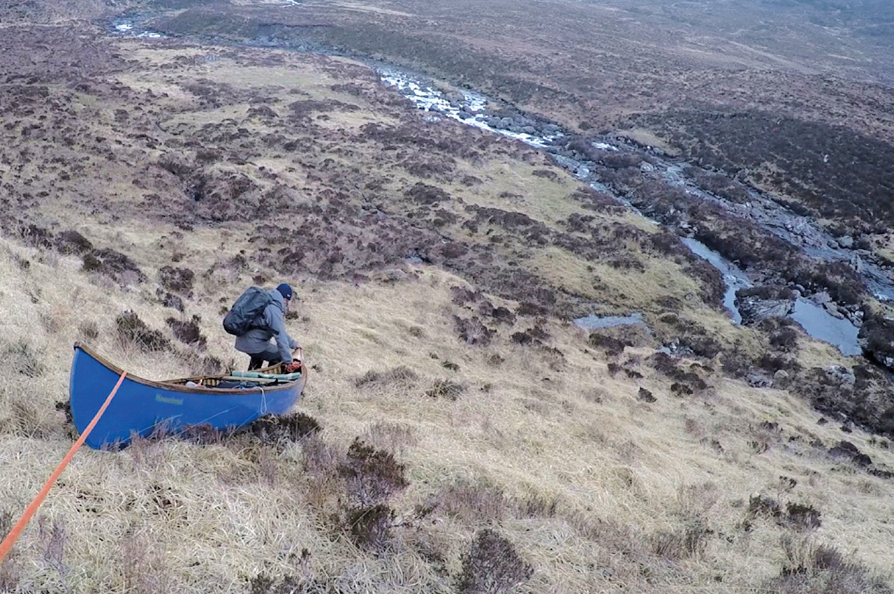
This was the height of land, the summit plateau, the Great Divide between west and east. Here, the water pooled in suspended animation, uncertain which way to flow. Paddling across this huge mirror set amidst the mountaintops was an otherworldly experience. Somewhat more appealing than trolleying up the main road, we thought. A canal-like channel brought us to another loch and the point where the land began to drop away, and waters picked up speed towards the North Sea. Now was the moment of truth; would our essential connection, the Black River, be benevolent or malign? First, we paddled, then waded, then flipped the canoe onto our shoulders where the river’s gradient increased, and its teeth came out.
The steeper section of the river gave quite a complex portage. The best route through the hillocks and outcrops and the most favourable river crossing points were not obvious. We looked out for stream crossings where we wouldn’t have to do too much balancing on boulders. We didn’t want a broken ankle here.
A large expanse of nothingness
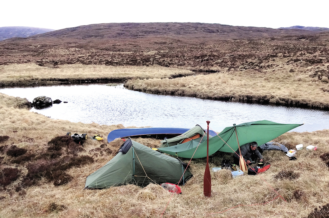
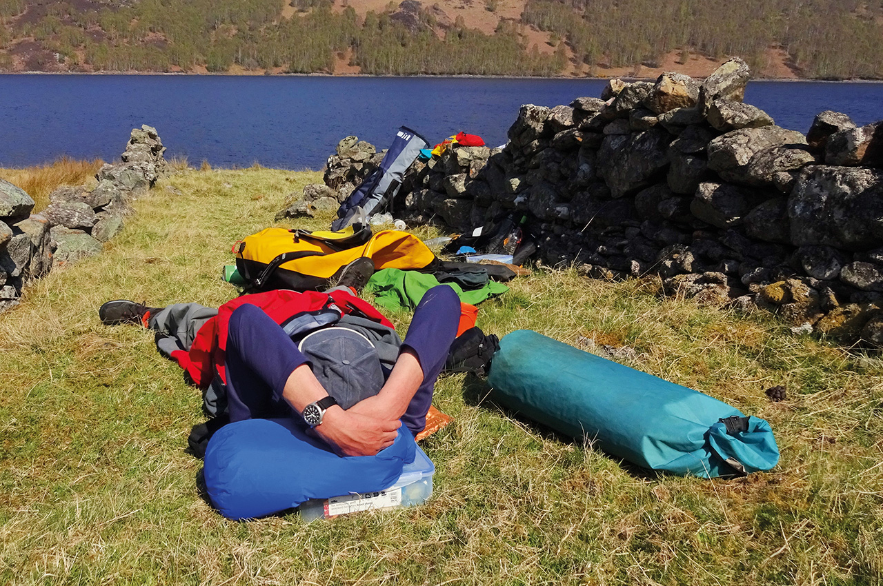
We continued until our cut-off camping time of 18:00 hours. It was going to be a night out on the open moor, so we began the search for a flat area for the tents amidst the tussocks and bogs. Tussocks are the bane of the wild camper, but I try to lessen their malignant aura by thinking of them by their pretty Canadian indigenous name – ladies’ heads. The best we could do was a rather marginal situation, but things seemed more cheerful once the camp was set up; at least we had our little oasis of comfort in this rather large expanse of nothingness. The night was dark and starless; the only sound was the chatter of the stream and the whisper of the wind. The tarp almost seemed to be breathing as it gracefully billowed, straining gently on the paddles staked out in front. The very ground seemed to radiate a deep sense of being far from the beaten track, in uncharted territory, a delicious feeling not found on every canoe route.
The next day, we continued portaging, wading and paddling through this stripped-down world of just two components: stream and moor. One thing I like about these trips is the feeling that the route isn’t going to yield without a certain amount of effort and ingenuity on our part. The way ahead is a bit like a puzzle that needs solving. An awkward drop was overcome by lowering the canoe down a steep bank on a line.
We kept working for several hours until a final carry around an excessively rocky section of the river brought us to a widening just before the start of Loch a’ Chroisg proper. Our first glimpse of the loch gave a psychological high – we had successfully negotiated the Black River, but it was at the same time sobering because the wind had risen to make the scene one of waves and whiteness. Canoe tripping in Scotland is full of these ups and downs, both psychological and geographical.
It wasn’t that late in the day, but we opted for an early meal to give the water time to subside, assuming the wind would follow its usual pattern and slacken off towards evening. Shelter was at a premium; we managed to get out of the wind behind a small hummock and propped up the canoe for a windbreak. We explored a little in the vicinity of our temporary camp and found that it was exceptionally well supplied with infrastructure, in fact almost international in flavour. You could get here by canoe and by the valley’s road and railway, but unbelievably we even had our own airstrip (yes, really).
We decided to go for it at around 19:30, sensing a bit of a lull in the wind. But we hadn’t got far before the whitecaps were back. That seems to be the way with lulls. But at least a bout of stiff paddling was a change from lining and portaging. Racing the coming darkness, we landed around 21:00 to camp on a beach we had spotted at the far end of the loch. After waiting for us to struggle to get the tents up in the deepening twilight, flapping all the while, the wind died away completely.
The River Bran
The next morning, the loch was reasonably calm, so we had no hesitation following the golden rule of getting off whilst the going was good. We planned to paddle for a mile or two and then pull in for breakfast. Before long, the loch shores converged, the water gathered itself together into a river, and off it sped down a little gorge. This was the River Bran at last. We experienced an abrupt change from carefree paddling to maximum rock alert. We emerged under a bridge at a more significant rapid that had us reaching again for the lines, then pulled out for breakfast behind a sheltering screen of gorse bushes bedecked in magnificent yellow.
The water level in the Bran turned out to be not particularly generous, and we were convinced it was visibly falling. The sections of uninterrupted paddling in the first part of the river were short. We constantly climbed out of the canoe to drag over a gravel bar or manoeuvre the boat fully laden in short coordinated lifts over rocky sections. During ‘in-river’ travel, time dissolves as you become absorbed by the task. My senses became mesmerised by the physicality of making progress, the rush of the currents in my ears, the glint of the sun on the water and the sight of ravens wheeling overhead.
The river became progressively rockier as we neared its steepest section. The rock density increased to the point where it was quicker to portage, so we flipped the canoe up top for a half-mile section. The way ahead did not look immediately promising. Whenever we feel that things are getting tough, we like to remind ourselves that we are only really playing at this compared to the ‘Real Thing’. A case in point is a couple who dragged, lined and portaged their canoe for 11 days to reach the Coppermine river system in Canada’s Northwest Territories. And this itself is relatively modest compared with feats recounted in the old explorers’ journals.
The notable lack of landmarks and our preoccupation with the immediate task left us with no clear idea about how we were progressing down the river. About halfway? Three-quarters? Therefore, it came as a surprise when the water began to back up, giving us a section of carefree, deep-water paddling and signalling that Loch Achanalt may not be too far away. We had considerably underestimated our rate of progress.
Loch Achanalt
Our wild moorland river experience came abruptly to an end when, kneeling high to give my ankles a rest, I was surprised to see a big sheet of water over the right bank of the river, then an equally big sheet over the left bank. We appeared to be on a river within a loch. This paradox was resolved when we got out the map and looked more closely at the unusual geography of Loch Achanalt, presumably a partially drowned section of the valley resulting from the dam up ahead.
The exit from Loch Achanalt was tough to spot. After paddling to a couple of dead-ends, we finally located the way out, which looked to all the world like a solid hillside from 200 yards away. We continued to Loch a’Chuilinn and docked at a promising-looking wooded bank on the left, giving us an excellent little campsite.
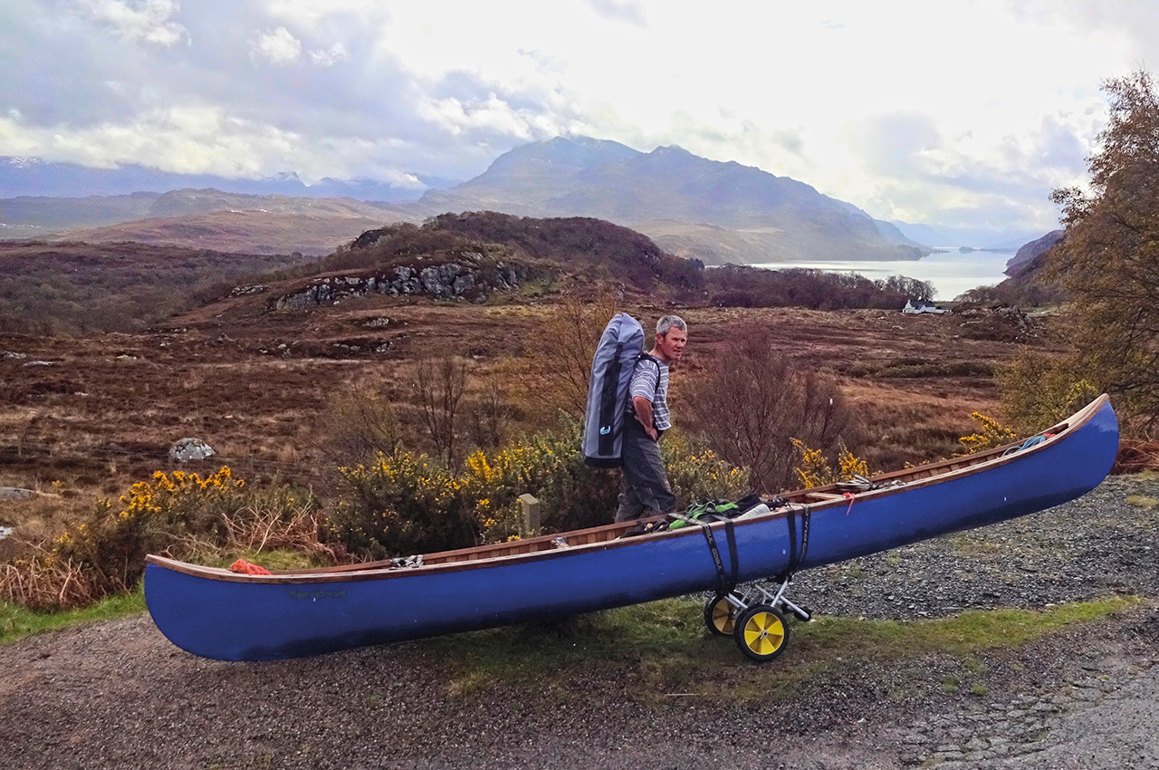
There was a bar or two of phone signal at the top of the hill, so I could report our position to my friend Jim who had kindly offered to meet us at Conon Bridge and take me back across to Poolewe for the van. The next day we finished off Loch a’ Chuilinn and pulled the canoe out under the shadow of the dismal grey concrete dam. We set off down the road for the 2km trolley mentioned in the guide book, to a pleasant carry, through a fine stand of Scots pines, down to a bay just before the railway bridge that marks the start of Loch Luichart.

Loch Luichart
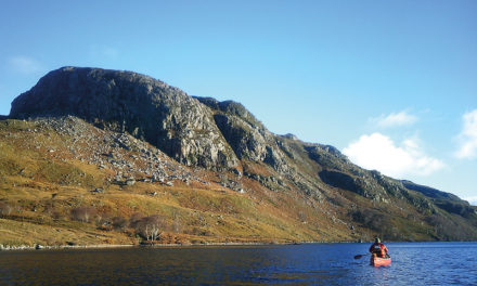
The easterly wind was still against us. Loch Luichart was a much wilder place than I had imagined, especially on the righthand side where we paddled. A cliff dropped straight into the water for a long section in the central part, making escape tricky. After the rocky section ended, we came to a ruined croft and some ancient field walls, which we recognised instantly as the ideal sheltered spot for lunch.
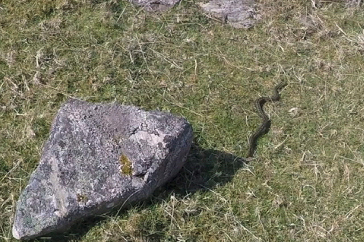
Together with the shelter from the wind, the sunshine encouraged a snooze. I had just started to doze off when Andrew announced that he had come face-to-face with an adder. This I had to see. The snake proceeded to lunge aggressively at both of us whilst I was trying to take a photo, then slithered off to sulk under a rock. I settled back down to finish my nap, but it was too late—the snake had got inside my head. I couldn’t relax again.
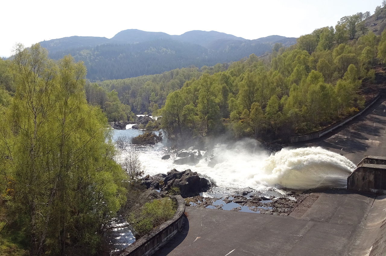
Beyond the dam at the southern end of the loch, a huge jet of water arced out into a spectacular rocky gorge. Portage time.
The landscape was now changing rapidly as the route continued to unfold. A road led down the more pastoral valley past some houses to an easy entry to the Conon River just after the power station. By this time, it was quite a big river, with the odd large rock breaking the surface to keep us concentrating. We pulled into a pleasant camping spot on the river bank after a mile or so, more-or-less opposite where the River Meig joins on the other side. The sound of the rapids drifting up the valley created an atmosphere of excitement around camp that night. Downriver we could see some fishing weirs with a significant amount of water funnelling through. More fun tomorrow, then.
Splintering cedar
We shot some of the weirs the next day and lifted over others. Mostly our judgement was good, but we got a few bangs and scrapes. Because the weirs here are mainly piles of rounded river rocks, relatively minor damage was done to the canvas of my canoe. One weir, however, stands out in memory. It looked like all the others; it seemed to have just enough water going over, beckoning us on. We decided to go for it. Too late, we saw that it was constructed of wire gabions filled with split granite pieces. We hit one with the sound of splintering cedar and, as we found out shortly afterwards, a significant slit in the canvas. A duct tape repair was effected in a few minutes on the riverbank.
There was still another dam and a few more weirs to keep us on our toes, but the river widened and deepened. The route was slowly releasing its grip, and we began to feel the first glimmerings of the glow of success. There is something extra-special about completing a cross-Scotland trip. You have gone all the way, taken things as far as they go. There is such a contrast between the wildness of the west and the tameness of the east. It was a thrill to have ridden the same water from its source in those distant, silent pools, close to 800 ft above us up in the hills, becoming a party to all its secrets and subject to all its moods.
Finally, it became clear that all difficulties were behind us, so we relaxed and watched the scenery drift by. The last few miles of easy lowland river brought us to the bridge at Conon, and the most welcome of sights – Jim was waiting for us!
It was a perfect sunlit afternoon as Jim drove me back to Poolewe. The route unfolded in reverse, allowing me to relive our adventures. The lochs and rivers were reflecting the intense blue of the sky. The Bran looked much rockier now than when we were on it; had the water level dropped that fast? It would be even harder going now. Back at Loch Maree, the Alt na Still waterfall had almost dried out.

Vast and magnificent
It had taken a couple of hours to rewind the trip across Scotland. Seeing it as a whole, running through a landscape viewed at its very best in the sunshine, the route seemed vast and magnificent; altogether an extraordinarily varied and rewarding route.