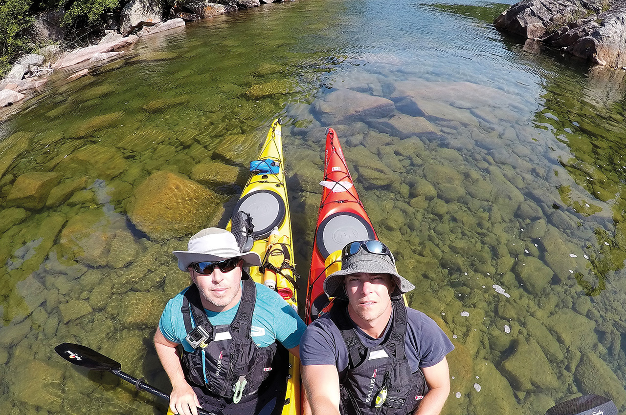
By Josh Spina
This wild and remote stretch of Lake Superior coastline had been on our paddling destination bucket list for some time. We had considered exploring this section of the lake in the past but weren’t quite able to work out the logistics. We wouldn’t have adequate time to properly paddle the whole coast (180+kms) from its northern border (Hattie Cove) to southern (Pukaskwa River) leaving the park turning east along crown land (Superior Highlands) to the mouth of the Michipicoten River (Wawa, Ontario).
Josh Spina
Josh is a high school design/drafting teacher, husband and father to two beautiful children out of Windsor, Ontario, Canada. He has always had a love for the outdoors and a passion for being on the water. He took up sea kayaking later in life as a hobby and a means of exploring beautiful camping locations along the Great lakes. Feel free to follow his adventures on the facebook page ‘@canyak family adventures blog’ as well as the instagram account ‘canoe_kayak_family_adventures’. He also runs the very popular canoeing facebook group ‘view FROM my canoe’.
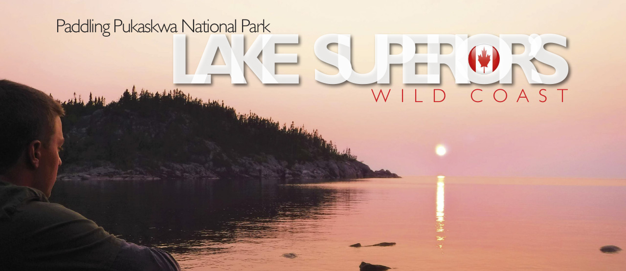
Paddling Pukaskwa National Park: Lake Superior’s wild coast
There simply wasn’t enough time to do it all in one trip and the issue of effectively shuttling our vehicle 196kms from Hattie to Wawa. We also weren’t satisfied with the idea of just paddling out of Hattie Cove for three days and then turning back. Many paddlers have raced through the full route but we wanted to hug the land exploring as much of the coast as possible. We came to the conclusion that the route would be split in half. With that being said the trip has sat idle for the past couple years.
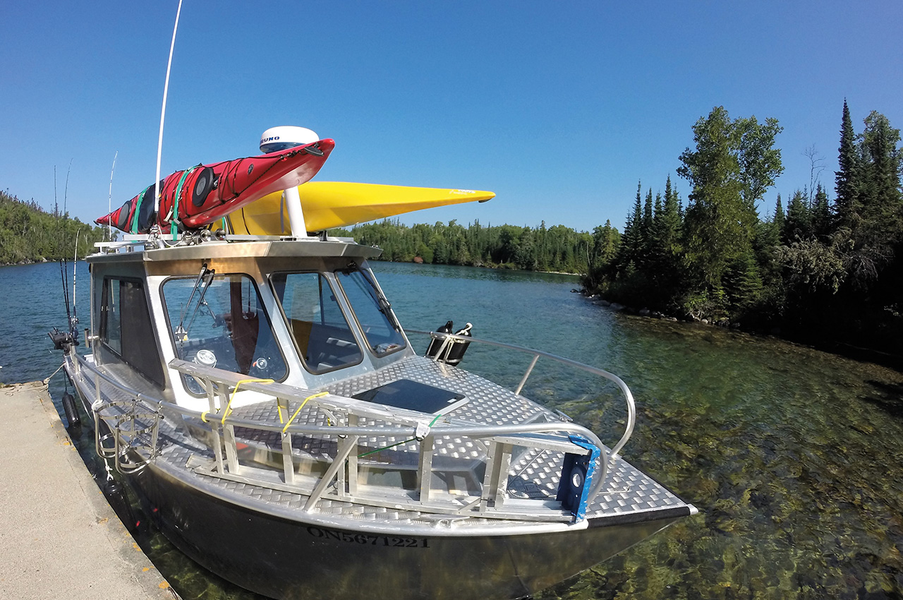
Over the winter I stumbled upon Taylor Angers of True North Charters (out of Marathon, Ontario). We chatted online, and he answered all the questions I could toss at him. We worked on a rough plan, and sat on it over the next couple winter months. In the spring we touched base once again and decided that he would provide us a water taxi from Marathon, Ontario to the Park’s Southern border allowing us to utilize our full seven day’s vacation.
The route from Windsor, Ontario to Marathon, Ontario is easily a ten-hour plus drive cutting through Michigan at Detroit, and crossing back at Sault St. Marie, Ontario. The road trip is quite beautiful, but personally it was a little overwhelming. I had just completed the same route two days earlier with my wife and kids (trailer in tow) as we camped at Neys Provincial Park, Pukaskwa NP and Pancake Bay PP along Superior’s North Shore. As tiring as the thought of hitting the road again so soon weighed on me, we set off and I was quickly filled with the energy of the open road and the upcoming adventure.
We left at noon with blue skies and little to no traffic. The ride was relaxing and uneventful until arriving in Wawa. We ran into David Wells (owner of Naturally Superior Adventures) while filling up at a gas station, which we thought might be a sign of good luck. He had personally shuttled our car two years earlier when paddling the coast of Lake Superior Provincial Park. The light started to fade as we headed towards White River, and that’s when the sky started to flash with impressive streaks of lightning. We both looked at each other and laughed as the rain began to come down hard.
Our laughter quickly turned to swearing, and three hours of white knuckle driving. Torrential downpours, semi-trucks, thick fog, ponding water, hills/curves, and kilometres of (moose) night danger signs made for an interesting end to our night. Taylor told us we could sleep at the campground in Marathon, but at this point we decided we’d just grab a motel in town. We pulled into Marathon around midnight. All the motels along the highway were full, likely due to the intense storm, so we thought we were lucky to find a room at the Zero-100 Motor Inn. Now that’s a funny story for another time.
We ended up with maybe two hours of sleep before setting off to meet Taylor at 08.00 to load the boats. Taylor was incredibly friendly, knowledgeable, professional and genuinely excited for us to head off on our adventure. With the boats and gear loaded we set off to meet with Park staff for a mandatory trip meeting.
DAY ONE
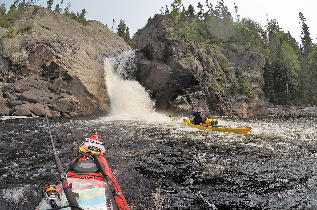
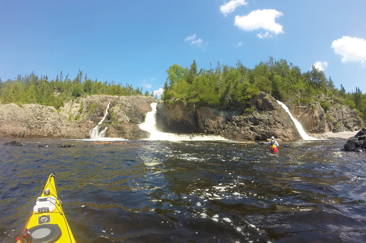
We set off by boat shuttle to the southern edge of the park, making a stop at ‘Old Daves Harbour’ on Otter Island. There we hiked to the Otter Island Light House and checked out the old lighthouse keeper’s buildings. Even at two kilometres away, we could hear the rumbling sound of Cascade Falls. The falls would be our first night’s camp and a spectacular one at that.
The paddle towards the falls was simply surreal. Seeing the water pour into Lake Superior was awesome and deafening. The falls really do roar and I wondered if sleeping next to them would be soothing or annoying.
We set up camp on the large cobble stone beach, seeking out a small patch of sand. Taylor mentioned we could hike to the top of the falls for an impressive view, and was it ever! We enjoyed swimming beneath the falls and attempts at catching a few fish. Turns out the falls were soothing to fall asleep to after all.
DAY TWO
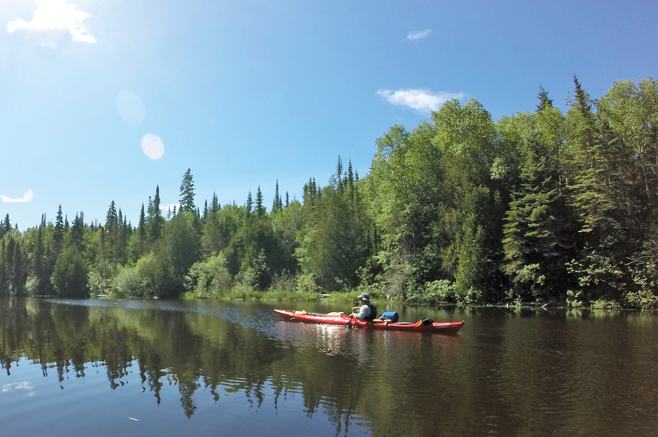
We were up for an early start, as we decided to be packing by 06.00 each day and on the water before the winds could pick up. We continued north towards our first river mouth.
We were really looking forward to paddling up each river we crossed in hopes of seeing wildlife, good fishing, and maybe a waterfall or two (cautionary note: many rivers along the coast can swell during spring melt or during heavy rains causing dangerous currents where they meet the lake. Always cross with caution).
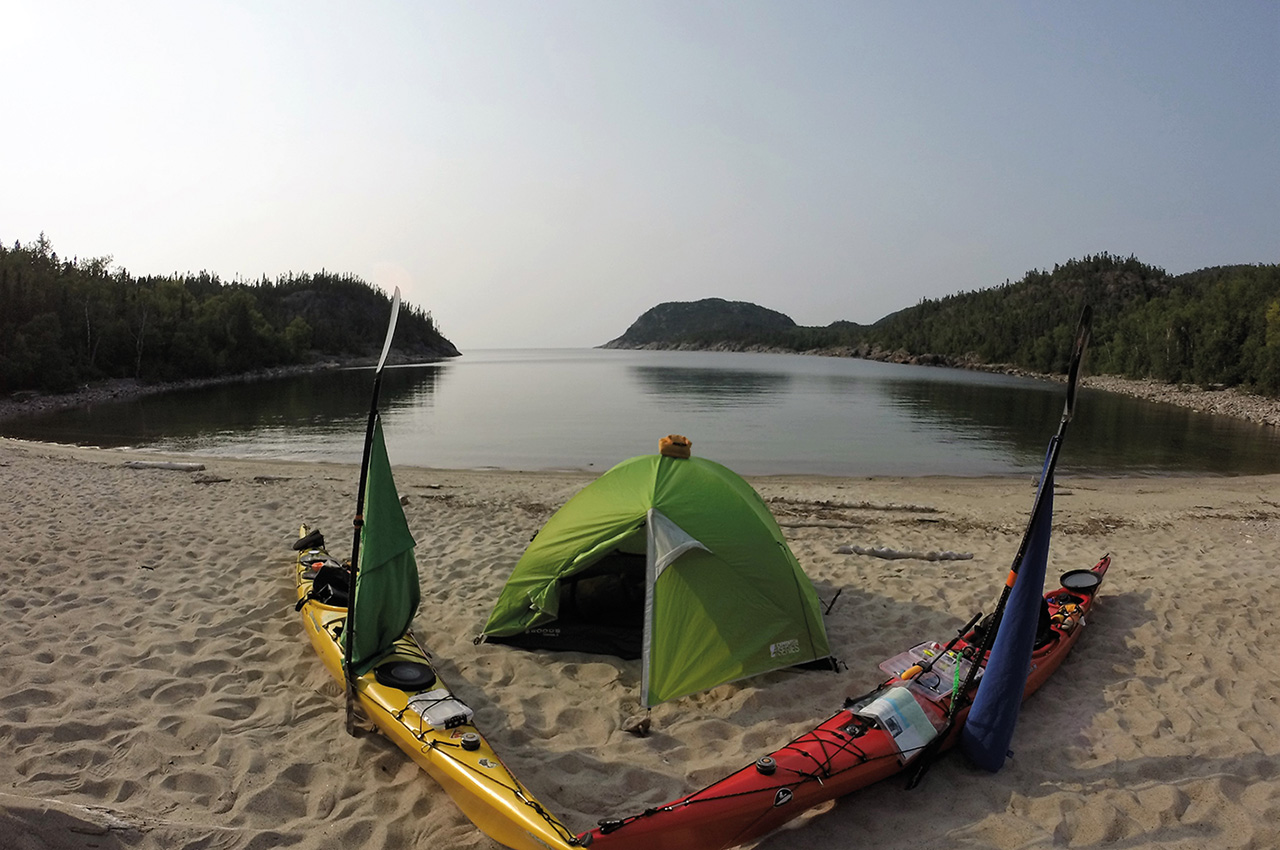
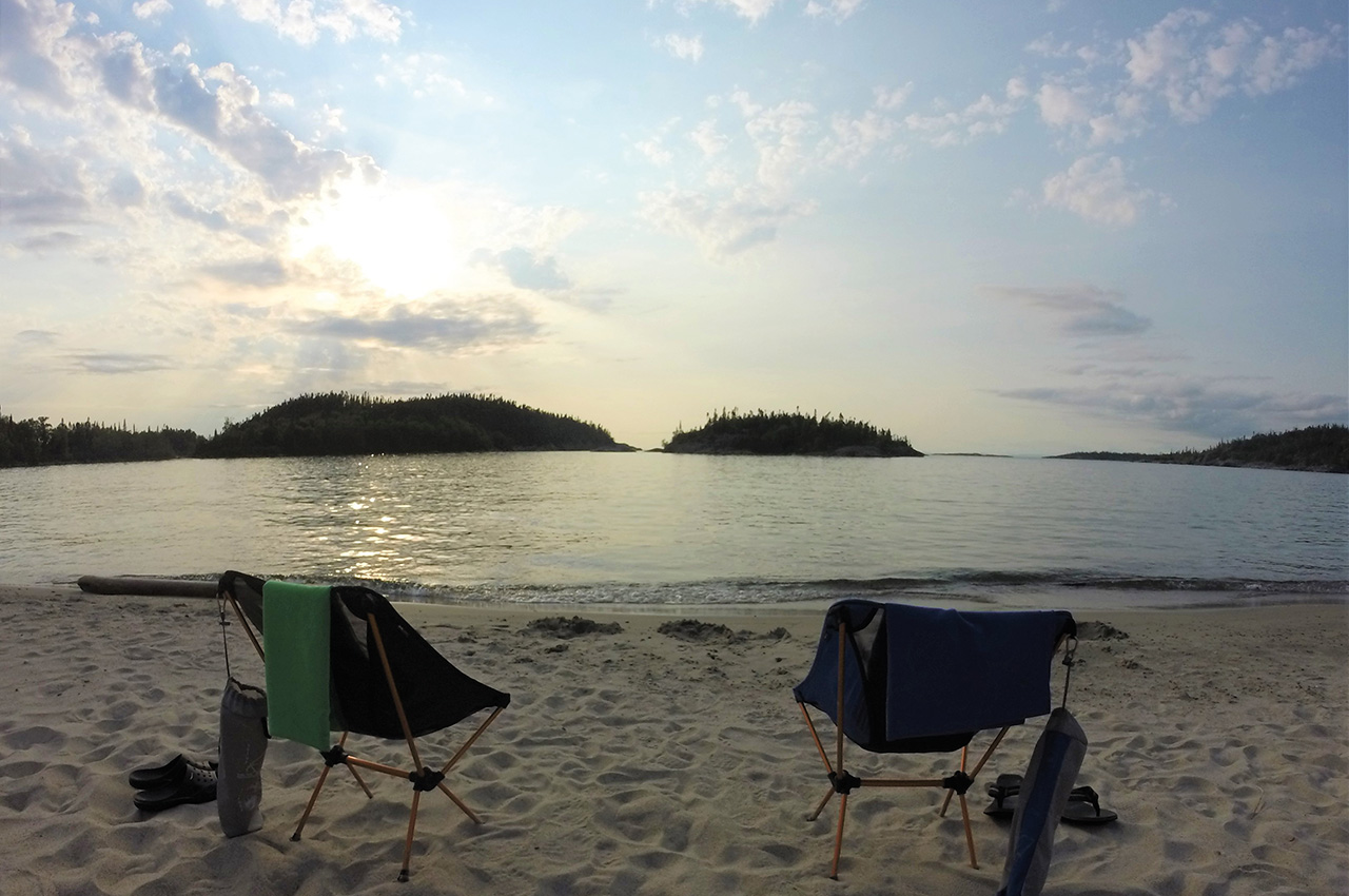
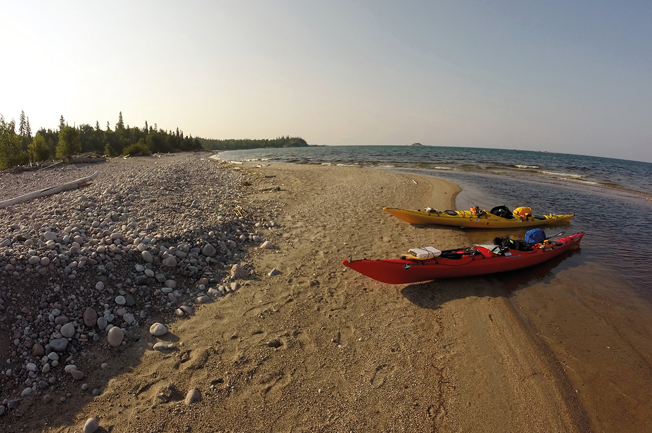
Swallow River did not disappoint as Swallow Falls was absolutely gorgeous. Our day two camp wasn’t too far from the river mouth at North Swallow Harbour. This would be one of many picturesque white sandy beaches along the paddling route. We set up camp on the beach and enjoyed the bay all to ourselves until near sun set.
That’s when we heard the faint sound of a motor boat. Turns out this harbour is the start of the park’s coastal hiking trail. A shuttle boat pulled ashore with two hikers sporting looks of sheer disappointment on their faces. I guess they were as happy to see us as we were to see them! It was very busy with hikers, and as the trip progressed we’d see backpackers at almost all of our camps. Generally something we try to avoid.
My only negative comment about the park. With route timing changes due to weather, we (along with other paddlers/hikers) would end up being knocked off our scheduled reservations. This ended up causing campsite reservation conflicts for the majority of our trip. One day a group of hikers were nice enough to share a site with us, but another time we saw hikers push a kayaking group from a site. There are definitely positives to crown land use or unreserved first-come first-serve campsites (ex: Lake Superior PP). Pukaskwa NP coastal campsites are reservable, so keeping to your dates can be tough.
DAY THREE
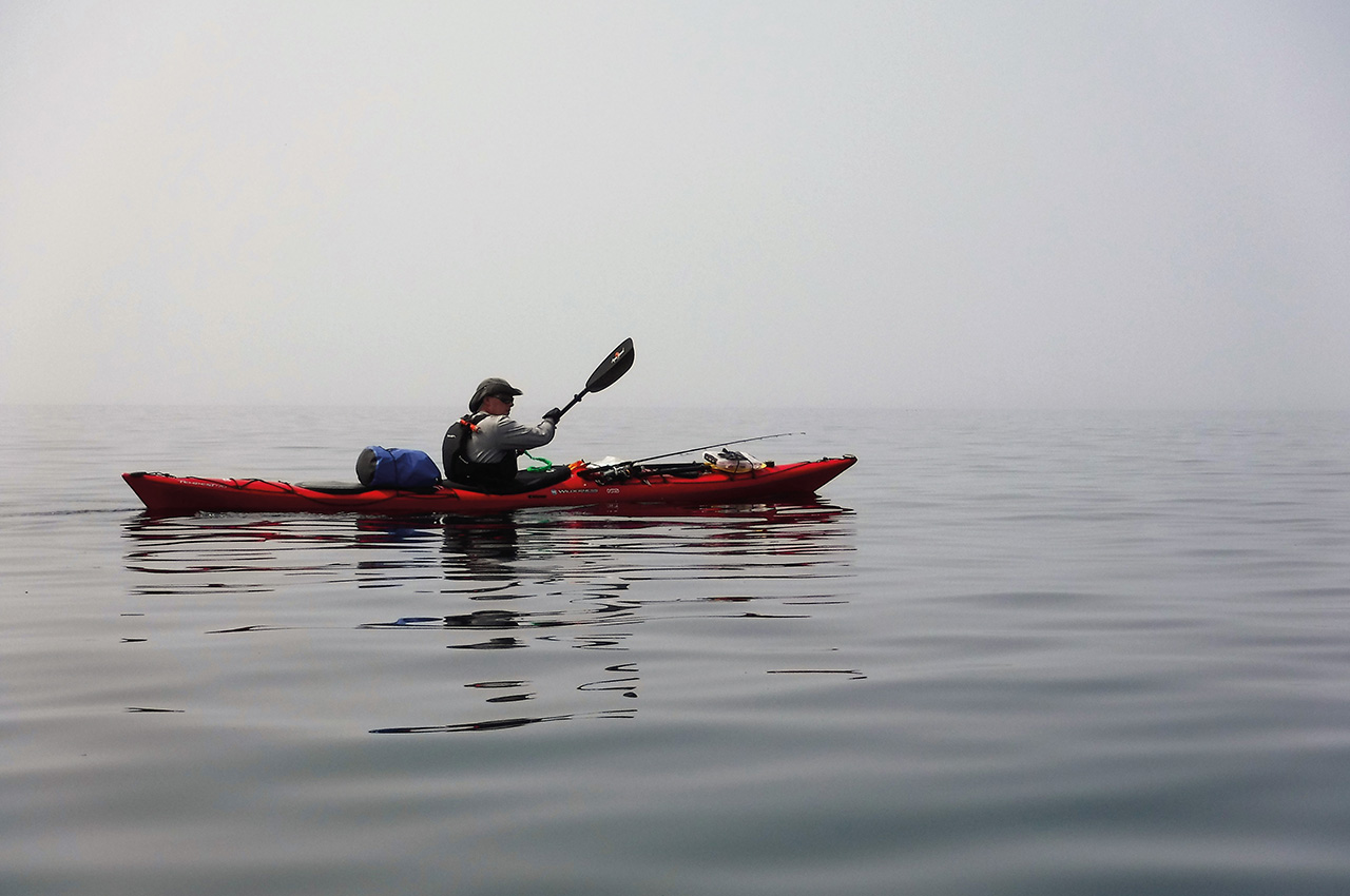
We lucked out with minimal wind in the morning for our passing of the Ramparts (reflection wave danger zone). This would be the day our itinerary was blown off schedule. The afternoon winds picked up from the south and we made the decision to ride the waves beyond our day three campsite at White Spruce Harbour. For most of this trip we hugged the coast and rarely skipped the chance to explore each bay.
We made the choice to blow past our site because we’ve had enough experience with Superior to know to take the wind at our backs when we can, as she might just as easily turn on us the following day. We decided to attempt to make camp at our day four site if it was empty (Nicols Cove) but unfortunately we couldn’t locate the site. This was my mistake as my map was a couple years old and some of the marked sites had been moved. At this point we had no choice but to continue forward to nearby Oiseau Bay.
We found this massive bay completely empty. The white sand on this beach was the finest we’d encounter on the entire trip. It was like baby powder and as it would turn out later in the night as winds picked up it also would easily blow into our tent coating everything. A lone hiker would stroll into the bay near sunset once again, but stuck to one of the wooded sites. While hiking we stumbled across an old cabin that looked to be actively used and we wondered what the story was behind it.
DAY FOUR
Started with an almost embarrassingly short paddle to our next site. We were literally a day ahead of schedule so we took this to be a rest day. We investigated the cave within Cave Harbour and then continued to Fish Harbour. This site was suggested to us by a local paddling legend (Steve Lutsch). He told us it was his favourite site and we soon found out why.
As we paddled in, a large group of kayakers were just packing up. We chatted with them for a bit before setting up camp in the woods. Once again we enjoyed the bay all to ourselves until backpackers started to stroll in. The two remaining sites filled up, and we enjoyed a laugh as one of the groups decided to walk around on the beach in the nude doing odd exercises/stretches for close to an hour. Unfortunately it wasn’t a pretty sight.
Soon another group of four hikers approached and I realized that we were likely set up on their campsite. We might have reserved it but we were a day off schedule. They were super friendly and understanding about the situation and decided to share the site with us (we offered to move to the beach but they insisted we stay). We sat around the campfire exchanging stories with our new camping friends while watching an amazing sunset over the lake.
DAY FIVE
We paddled out again with the wind blowing in our favour. We spent some time exploring the Willow River until we reached a massive log jam and had to turn around. This was supposed to be our day five campsite but once again we thought we’d just go with the winds. We took our time fishing along the river and when we left the mouth the winds had picked up considerably. This would be our biggest wave action day, and we felt we sort of deserved it (the punishment) as we had stuck around the Willow River too late in the day knowing this might happen.
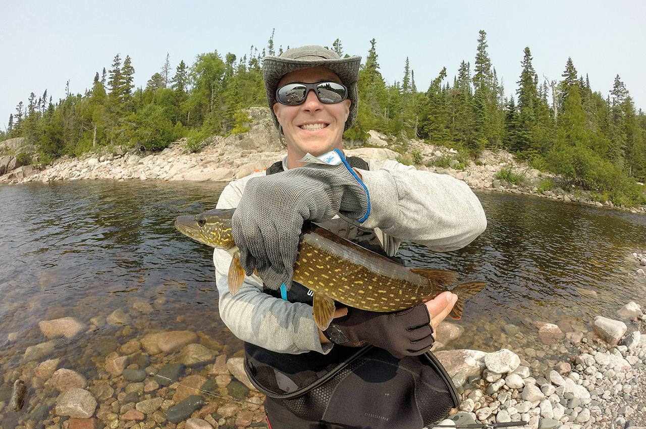
After some abuse from Superior we pushed on towards the White River. My brother had hoped this would be THE PLACE to catch some serious fish. Exhausted from the afternoon’s waves, we pushed our way up the warm waters of the river to the base of Chigamiwinigum Falls where we set up camp for the night. The campsite was perched atop a large rock face with gorgeous 360 degree views of the lower falls, rapids and river. My brother continued to luck out with hooking a couple descent Pike and Trout. Before leaving we hiked up to the suspension bridge to see the upper falls. The sight was definitely as impressive as people had described it.
DAY SIX
Would be our last campsite before heading back to Hattie Cove the following morning. We paddled down river and out to Picture Rock Harbour. The water in this area was almost tropical in appearance. Once again my outdated map caused us some minor campsite grief. The paddle only access sites on our map now had a new extension of the coastal hiking trail leading to them and with that, more backpackers.
When we showed up, we had the bay to ourselves. The three sites sat open, and now knowing better we decided to see if we could pick up cellphone data at this point to verify if the sites were actually reserved that night. Turns out only one was, so we chose another. A few minutes later the large group of kayakers we met previously, sailed in and set up on the booked site. We assumed it was their camp until later in the day a couple hikers came in and claimed it as theirs. The whole thing quickly became tense, awkward and annoying, with the large group pushed to the beach right next to our camp.
When one of them started playing a flute, we decided to pack up and head to another less scenic (but quieter) site across the bay.
DAY SEVEN
Was an early start as forecasts were calling for rain and a high wind advisory. The weather, up until this point, had been superb. All week there was nothing but blue skies and relatively light winds/waves. Actually the past three trips to Superior had been very much the same in regards to weather (unseasonably warm air and water… we lucked out).
We made it safely past the rugged Campbell Point before the lake had time to deliver us reflection waves and paddled into Hattie Cove, loaded up the gear into the car before heading towards our hotel in the Sault St. Marie. We took our time checking out the tug boat in Marathon Ontario, and some of the rivers along the Trans Canada highway.
Overall we’d had an amazing week-long backcountry paddling experience. Next year we might give Superior a rest, and return to Georgian Bay, but who knows. That’s what we’ve said the past two years. All photos by Josh & his brother Gilles Spina.
Information
Link to full photo album: https://preview.tinyurl.com/pukaskwa
Link to full youtube video: https://youtu.be/-GSxbRFe59U
Pukaskwa National Park:
www.pc.gc.ca/en/pn-np/on/pukaskwa
True North Charters:
truenorthcharters@outlook.com
1-807-228-0038
www.facebook.com/True-North-Charters-269642397083366/
Naturally Superior Adventures (Outfitter):
www.naturallysuperior.com/